• MAIN PAGE
  • LATEST NEWS
    • Lost Cities
    • Archaeology's Greatest Finds
    • Underwater Discoveries
    • Greatest Inventions
    • Studies
    • Blog
  • PHILOSOPHY
  • HISTORY
  • RELIGIONS
    • Africa
    • Anatolia
    • Arabian Peninsula
    • Balkan Region
    • China - East Asia
    • Europe
    • Eurasian Steppe
    • Levant
    • Mesopotamia
    • Oceania - SE Asia
    • Pre-Columbian Civilizations of America
    • Iranian Plateau - Central Asia
    • Indus Valley - South Asia
    • Japan
    • The Archaeologist Editor Group
    • Scientific Studies
    • Aegean Prehistory
    • Historical Period
    • Byzantine Middle Ages
    • Predynastic Period
    • Dynastic Period
    • Greco-Roman Egypt
  • Rome
  • PALEONTOLOGY
  • About us
Menu

The Archaeologist

  • MAIN PAGE
  • LATEST NEWS
  • DISCOVERIES
    • Lost Cities
    • Archaeology's Greatest Finds
    • Underwater Discoveries
    • Greatest Inventions
    • Studies
    • Blog
  • PHILOSOPHY
  • HISTORY
  • RELIGIONS
  • World Civilizations
    • Africa
    • Anatolia
    • Arabian Peninsula
    • Balkan Region
    • China - East Asia
    • Europe
    • Eurasian Steppe
    • Levant
    • Mesopotamia
    • Oceania - SE Asia
    • Pre-Columbian Civilizations of America
    • Iranian Plateau - Central Asia
    • Indus Valley - South Asia
    • Japan
    • The Archaeologist Editor Group
    • Scientific Studies
  • GREECE
    • Aegean Prehistory
    • Historical Period
    • Byzantine Middle Ages
  • Egypt
    • Predynastic Period
    • Dynastic Period
    • Greco-Roman Egypt
  • Rome
  • PALEONTOLOGY
  • About us
No results found

Ancient Dentistry: Drill Marks and Fillings from 9,000 Years Ago

April 30, 2026

The history of dentistry is far older than many realize, moving back long before the invention of anesthesia or modern metals. Archaeological finds from across the globe prove that as early as the Neolithic period, humans were performing complex dental surgery with a level of precision that suggests a deep understanding of anatomy and tool use.

1. The Mehrgarh Discovery: The World’s Oldest Drills

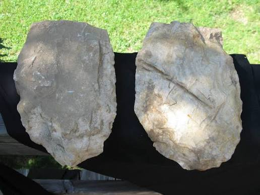
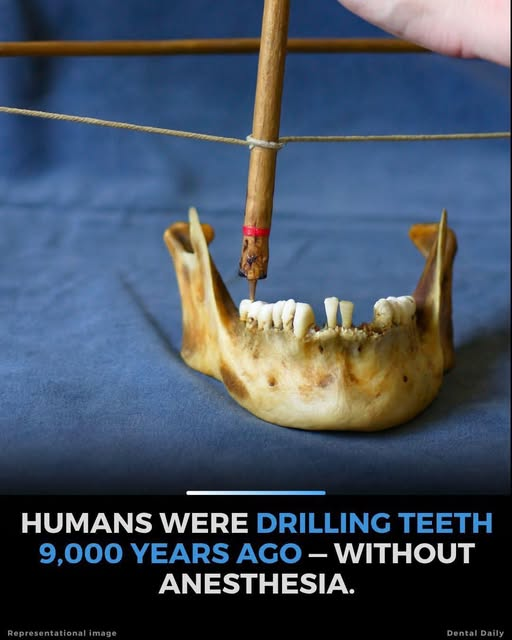
The most stunning evidence of early dentistry comes from Mehrgarh in modern-day Pakistan. In 2006, archaeologists discovered a Neolithic graveyard dating back 9,000 to 7,500 years ago containing teeth that had been intentionally drilled.

  • The Technology: Flint "micro-drills" were used to bore holes into the molars of living patients. These drills were likely powered by a bow-drill—the same technology used to start fires or drill beads for jewelry.

  • Precision: The holes are remarkably uniform, some only 1 to 3 millimeters in diameter. Most were located on the biting surfaces of the teeth, suggesting they were drilled to remove decayed material.

  • Healing: Analysis shows that the teeth continued to wear down after the drilling occurred, proving that the patients survived the procedure and continued to use their teeth for years.

2. The First Fillings: Beeswax and Bitumen

Once a tooth was drilled or a cavity formed naturally, ancient people had to find a way to seal it to prevent infection and alleviate pain.

  • The Slovenian Beeswax: A 6,500-year-old human jawbone found in Slovenia contains a canine tooth with a vertical crack. The crack was filled with beeswax. This is the oldest known example of a therapeutic dental filling, likely applied to reduce sensitivity and keep food out of the crack.

  • The Italian "Composite": In a 13,000-year-old site in Tuscany, researchers found a tooth filled with a mixture of bitumen (a natural tar), plant fibers, and hair. This served as an antiseptic and physical plug, functioning much like a modern resin filling.

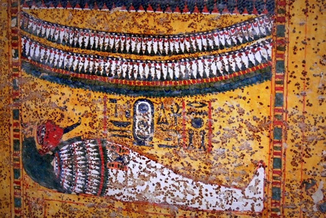
3. Ancient Egyptian Dental Surgery

While the Egyptians are famous for their medicine, their dentistry was equally advanced. They are credited with the first known "named" dentist in history: Hesy-Ra, who served Pharaoh Djoser around 2600 BCE.

  • Bridges and Wire: Archaeologists have found Egyptian teeth bound together with fine gold or silver wire. These "bridges" were used to stabilize loose teeth or re-attach teeth that had fallen out.

  • The "Toothworm": Like many ancient cultures, Egyptians believed toothaches were caused by a "toothworm" eating the inside of the tooth. Treatments included a mixture of cumin, incense, and honey applied directly to the site.

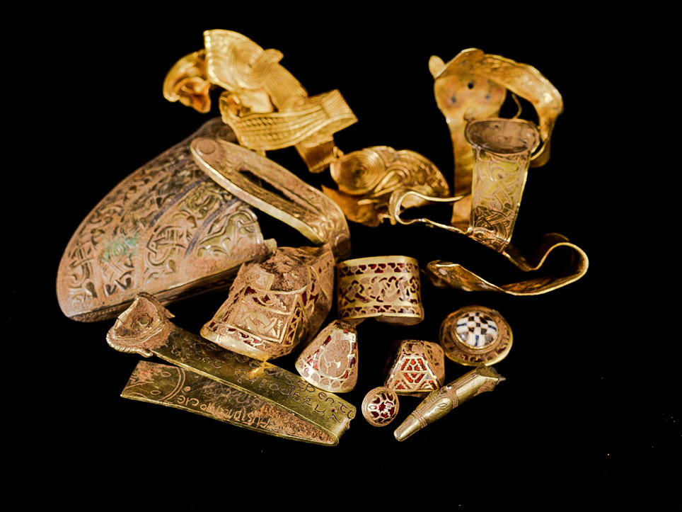
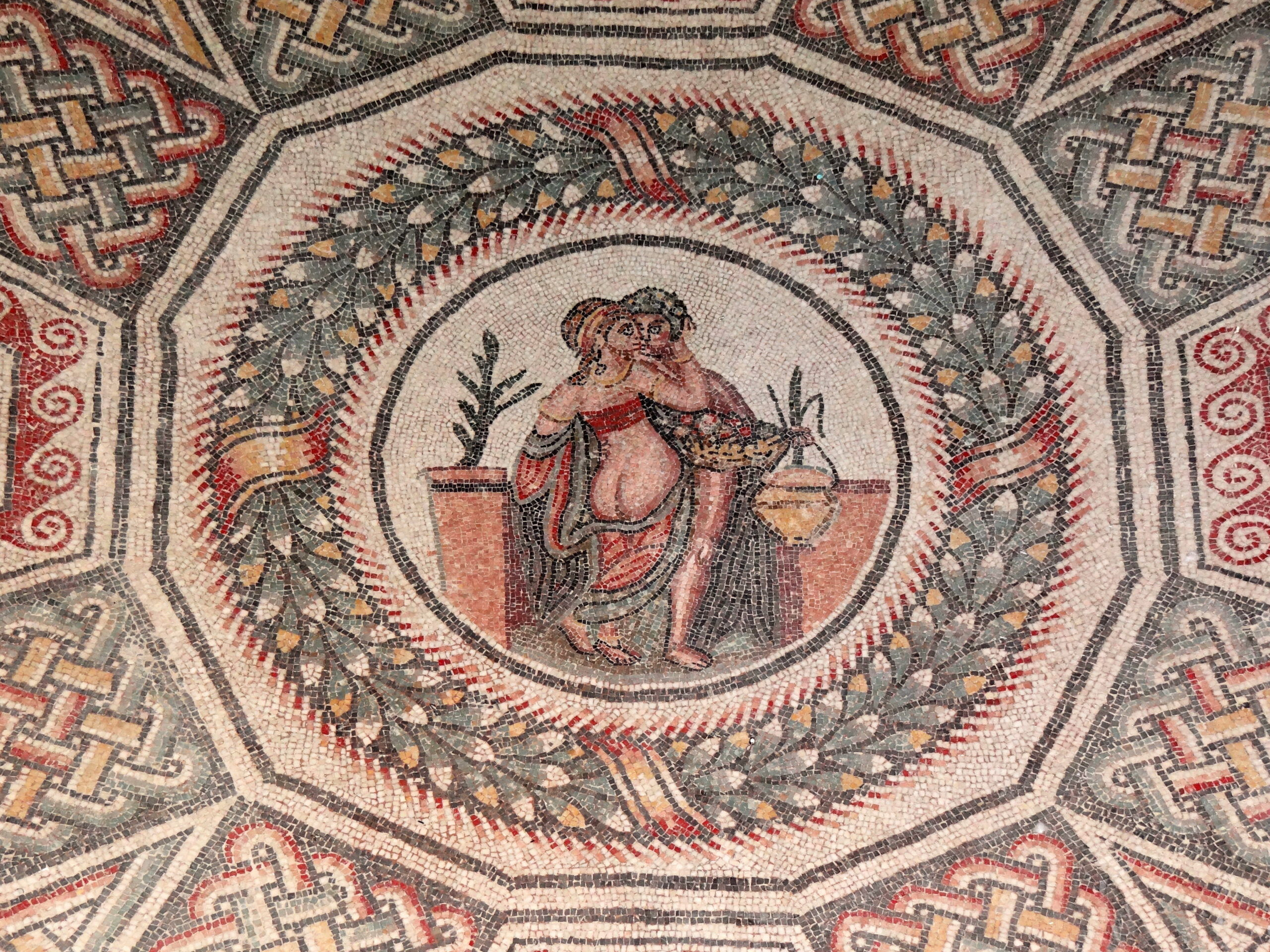
4. The Etruscan Gold Standard

The Etruscans (in modern-day Italy) were the master goldsmiths of the ancient world between 700 and 200 BCE, and they applied these skills to the mouth.

  • Dental Bands: They created sophisticated gold bands that wrapped around healthy teeth to support a false tooth—often carved from the ivory of a hippopotamus or another human's tooth.

  • Status Symbols: These gold prosthetics were often found in the graves of wealthy women, suggesting that early dentistry was as much about cosmetic status as it was about functional health.

5. The Mayan Bling: Gemstone Inlays

In Mesoamerica, the Maya took dental modification to a decorative extreme. Around 2,500 years ago, they were drilling holes into perfectly healthy front teeth to insert precious stones.

  • Inlays: Scribes and nobles would have their teeth inlaid with jade, hematite, or turquoise.

  • Adhesives: To keep the stones in place, they developed a powerful natural cement made of plant resins and crushed bone. These adhesives were so effective that many of the stones are still firmly attached to the teeth found in burials today.

  • The Surgeon’s Skill: To drill into the tooth without shattering it or hitting the sensitive pulp (which would cause a massive infection) required an incredible knowledge of tooth structure.

6. The Pain Barrier: Ancient Anesthetics

The biggest question in ancient dentistry is always: "How did they stand the pain?" Without modern Novocaine, ancient dentists relied on the pharmacy of the earth.

  • Herbal Remedies: Opium poppies, coca leaves, and henbane were frequently used to dull the senses.

  • Clove Oil: Used for thousands of years, clove oil contains eugenol, a natural anesthetic and antiseptic that is still a component in some modern dental materials today.

Ancient dentistry reminds us that the human desire to fix what is broken—and to look good doing it—is nearly as old as civilization itself.

The Palace of Sargon: Exploring the Grandeur of the Neo-Assyrian Empire

April 30, 2026

The Palace of Sargon II, located at Dur-Sharrukin (modern-day Khorsabad, Iraq), was the crowning achievement of the Neo-Assyrian Empire. Built between 717 and 706 BCE, it was a city-palace designed to project the absolute power of a king who styled himself "King of the World."

The site is a masterpiece of ancient urban planning, combining massive defensive fortifications with some of the most sophisticated stone reliefs and sculptures ever recovered from the ancient Near East.

1. Dur-Sharrukin: The "Fortress of Sargon"

Unlike many ancient cities that grew organically over centuries, Dur-Sharrukin was a "planned" capital. Sargon II ordered the city built from scratch on virgin soil to represent a fresh start for his dynasty.

  • The Layout: The city was a near-perfect square, surrounded by a massive wall with seven gates.

  • The Citadel: The royal palace was built on a giant artificial terrace, raised 15 meters above the city level to literally look down upon the subjects and protect the king from potential floods or uprisings.

  • The Scale: The palace complex itself contained over 200 courtyards and rooms, covering nearly 25 acres of the citadel.

2. The Lamassu: Celestial Guardians

The most iconic archaeological finds from Sargon’s palace are the Lamassu—colossal guardian figures that stood at the gateways of the palace.

  • Design: These statues possessed the head of a human (representing intelligence), the body of a bull or lion (strength), and the wings of an eagle (divinity/speed).

  • The Five-Legged Illusion: If you look at a Lamassu from the front, it appears to be standing still; from the side, it appears to be walking. To achieve this, Assyrian sculptors gave the creatures five legs, an early example of using perspective in monumental art to create a sense of motion.

  • Purpose: They were intended to "magically" protect the king and intimidate visiting dignitaries before they even entered the throne room.

3. The Throne Room and Propaganda in Stone

The heart of the palace was the royal throne room, which was accessed through a series of increasingly grand courtyards.

  • The Narrative Reliefs: The walls were lined with gypsum slabs carved in low relief. These weren't just art; they were state propaganda. They depicted Sargon’s military victories, the brutal treatment of captives, and the king hunting lions.

  • Psychological Warfare: By the time a foreign ambassador reached the King, they had walked past hundreds of meters of imagery showing exactly what happened to those who rebelled against Assyria.

  • Polychromy: While we see the stone as grey or white today, archaeology has found traces of vibrant pigments—blues, reds, and yellows—proving the palace was once a riot of color.

4. The Ziggurat: Reaching for the Heavens

Attached to the palace was a religious complex featuring a Ziggurat, a stepped pyramid common in Mesopotamian architecture.

  • The Spiral Ascent: Sargon’s ziggurat was unique because it featured a continuous spiral ramp winding around the exterior to the summit, rather than the traditional staircases.

  • Symbolism: Each level was likely painted a different color to represent various celestial bodies or deities, serving as a physical link between the King’s palace and the gods of the Assyrian pantheon.

5. Archaeology and the Tragedy of 1853

Much of what we know about the palace comes from early French excavations led by Paul-Émile Botta and Victor Place.

  • The Sinking of the Rafts: In 1853, a massive collection of artifacts, including hundreds of relief slabs and several Lamassu, was being transported down the Tigris River to the Persian Gulf. Arab tribes attacked the convoy, and the heavy rafts (called keleks) capsized.

  • Lost Treasures: Over 200 crates of Sargon's treasures sank to the bottom of the river. They have never been recovered and remain buried in the silt of the Tigris, while the pieces that survived are now the centerpieces of the Louvre and the British Museum.

6. The Short Life of a Capital

The grandeur of Dur-Sharrukin was remarkably short-lived. Sargon II died in battle in 705 BCE, just one year after the palace was completed.

  • The Abandonment: His son, Sennacherib, viewed his father’s death on the battlefield as a bad omen. He immediately abandoned Dur-Sharrukin and moved the capital to Nineveh.

  • Preservation through Neglect: Because the city was abandoned so quickly and never re-inhabited, the layout of the palace remained largely undisturbed by later civilizations, providing archaeologists with a "frozen" snapshot of Neo-Assyrian life at its peak.

Ancient Petroglyphs: Reading the Stone Art of the American Southwest

April 30, 2026

The American Southwest—spanning Utah, Arizona, New Mexico, and Colorado—is home to one of the world’s most dense concentrations of petroglyphs. Unlike pictographs, which are painted onto the stone, petroglyphs are pecked, carved, or abraded into the "desert varnish" (a dark patina of manganese and iron oxides) to reveal the lighter rock beneath.

These images were created by various cultures, including the Ancestral Puebloans, Fremont, and Hohokam, spanning thousands of years from the Archaic period to the arrival of the Spanish.

1. The Mechanics: How Stone Records Art

The longevity of petroglyphs is due to the chemical interaction between the artist and the cliff face.

  • Desert Varnish: Over millennia, bacteria and wind-blown dust create a dark, shiny coating on sandstone.

  • The Tools: Artists used "indirect percussion," where a hammerstone struck a stone chisel to chip away the varnish.

  • Patination: After a petroglyph is carved, it begins to "re-patinate." Archaeologists use the darkness of the carving relative to the surrounding rock to estimate age; the darker the image, the older it likely is.

2. Classifying the Styles

Petroglyphs are categorized by specific cultural "signatures" that reflect the worldview of the people who carved them.

  • Barrier Canyon Style: Characterized by tall, tapered, "ghost-like" figures that often lack arms or legs. These are some of the oldest (dating back 4,000+ years) and most haunting images in the Southwest.

  • Fremont Style: Known for "trapezoidal" human figures with elaborate headdresses, jewelry, and shields. They are often found in the Great Basin and northern Utah.

  • Ancestral Puebloan (Anasazi): These feature more recognizable animals (zoomorphs), flute players (Kokopelli), and intricate geometric spirals.

3. The Spiral: The "Calendar" Hypothesis

One of the most common symbols in the Southwest is the spiral. While it has many meanings, archaeology has proven that some were used as sophisticated solar observatories.

  • The Sun Dagger: At Fajada Butte in Chaco Canyon, a spiral was carved behind three stone slabs. On the summer solstice, a "dagger" of light pierces the exact center of the spiral.

  • Agriculture: These carvings weren't just art; they were agricultural tools that told farmers exactly when to plant maize based on the position of the sun during the equinoxes.

4. Iconography: Reading the Symbols

While we cannot "read" petroglyphs like a book, researchers and modern Indigenous descendants provide insight into the recurring motifs:

  • Bighorn Sheep: Often represent a successful hunt or perhaps a spiritual guide for rain-making.

  • Anthropomorphs: Figures with horns or feathers often represent shamans or deities (Kachinas).

  • Handprints: A universal sign of "I was here" or a symbol of a person’s connection to the earth and the sacred site.

  • Migration Lines: Long, undulating lines connecting different figures are often interpreted as "maps" of tribal migrations across the desert.

5. The "Rock Art" vs. "Writing" Debate

Archaeologists are careful to distinguish petroglyphs from a formal writing system like Cuneiform or Maya glyphs.

  • Ideograms: Most petroglyphs are ideograms—symbols that represent an idea or a story rather than a specific sound or word.

  • Cultural Context: To the Hopi, Zuni, and Diné (Navajo) people, these are not "dead" art. They are living records of ancestral history, clan migrations, and spiritual covenants that continue to hold power today.

6. Preservation and Ethics

Petroglyphs are incredibly fragile. The oils from human skin can damage the desert varnish and introduce bacteria that "eat" the image.

  • Vandalism: Tragically, many sites have been marred by graffiti or "chalking" (outlining images in chalk to make them pop for photos).

  • Tribal Sovereignty: Modern archaeology now works closely with Indigenous tribes to ensure that sites are managed with spiritual respect, often leaving some locations undisclosed to the public to prevent desecration.

The petroglyphs of the Southwest are a "library in the landscape." They remind us that for thousands of years, the desert was not an empty space, but a deeply mapped and storied home.

The Search for Nefertiti: New Scans in the Valley of the Kings

April 30, 2026

The search for the final resting place of Queen Nefertiti remains one of the most tantalizing quests in Egyptology. Despite her status as one of the most powerful women in history, her tomb has never been definitively identified. However, recent technological leaps in the Valley of the Kings have sparked a modern-day detective story involving hidden chambers, disputed scans, and the "heretic" history of the Amarna Period.

1. The Nicholas Reeves Hypothesis

In 2015, British Egyptologist Nicholas Reeves published a groundbreaking theory that sent shockwaves through the archaeological community.

  • The Hidden Doorways: While examining high-resolution 3D laser scans of Tutankhamun’s tomb (KV62), Reeves noticed faint linear traces beneath the painted plaster of the north and west walls.

  • The Theory: He proposed that KV62 was originally a "corridor tomb" designed for Nefertiti, and that Tutankhamun was buried in the outer chambers as an emergency measure after his early death. He suggests Nefertiti lies undisturbed in a hidden room directly behind the boy king’s burial chamber.

2. Ground-Penetrating Radar (GPR): The Great Debate

Since 2015, multiple teams have entered the tomb with sophisticated GPR equipment to "see" through the walls without damaging the priceless murals.

  • The "Yes" Scans: The initial radar survey by Hirokatsu Watanabe claimed a 90% certainty of "voids" and even metal or organic materials behind the walls.

  • The "No" Scans: A subsequent, more extensive survey by the National Geographic Society was inconclusive.

  • The Politecnico di Torino Survey (2018): This was the most rigorous scan to date. Using three different radar systems, the team concluded that there are no hidden chambers adjacent to the tomb, dealing a blow to the Reeves hypothesis.

3. The Search Moves Beyond KV62

While the "tomb-within-a-tomb" theory has lost momentum, the search for Nefertiti has shifted to other locations in the Valley of the Kings.

  • The West Valley (KV21 and KV23): Some archaeologists, including former Antiquities Minister Zahi Hawass, believe Nefertiti might be hidden in the West Valley, an area less explored than the main cluster of royal tombs.

  • The DNA Connection: Hawass has been leading a massive project to analyze the DNA of "unidentified" mummies found in the Valley. Two female mummies found in KV21 are currently under intense scrutiny to see if they are Nefertiti or her daughter, Ankhesenamun.

4. Why is she so hard to find?

Nefertiti’s disappearance from the record is tied to the Amarna Period, a time of religious revolution when she and her husband, Akhenaten, replaced the traditional gods with the worship of the sun disk, the Aten.

  • Damnatio Memoriae: After the Amarna Period ended, later pharaohs attempted to erase Akhenaten and Nefertiti from history. Their names were hacked off monuments, and their city was leveled.

  • A Hidden Pharaoh? A growing theory suggests Nefertiti didn't just disappear; she may have ruled as a solo pharaoh under the name Neferneferuaten after her husband died. If she was buried as a king, she might be hidden in a tomb designed for a male ruler, further confusing archaeologists.

5. The "Younger Lady" Mystery

One of the most famous unidentified mummies is the "Younger Lady," found in a cache in KV35.

  • The Discovery: DNA testing confirmed this mummy is the biological mother of Tutankhamun.

  • The Identity Debate: While some believe this is Nefertiti, many Egyptologists argue the DNA suggests she was a sister of Akhenaten, whereas Nefertiti is traditionally thought to have been a non-royal noblewoman. The search continues for a mummy that matches Nefertiti's specific historical profile.

The hunt for Nefertiti represents the "New Age" of archaeology—one where shovels are replaced by muon tomography and DNA sequencing. Whether she is hidden behind a wall in Tutankhamun's tomb or lying in an unmarked pit in the West Valley, her discovery would be the greatest archaeological find of the 21st century.

The Staffordshire Hoard: The Largest Find of Anglo-Saxon Gold

April 29, 2026

The Staffordshire Hoard is the most significant collection of Anglo-Saxon gold and silver ever discovered. Found in a field near Lichfield in 2009 by a metal detectorist, it consists of over 3,500 items, totaling roughly 5 kilograms of gold and 1.5 kilograms of silver.

What makes this hoard truly unique is not just its value, but its contents: it is almost entirely composed of martial (military) items, with almost no jewelry or domestic objects found in the mix.

1. The Nature of the Find: A Warrior’s Treasure

Unlike other hoards that include coins or tableware, the Staffordshire Hoard is a collection of "warrior bling."

  • Weapon Fittings: The vast majority of the items are hilt plates, pommel caps, and sword-hilt fittings.

  • The Absence of Blades: Curiously, the iron blades themselves were missing. It appears the gold and silver fittings were stripped from the weapons and gathered together, possibly as trophies or "spoils of war."

  • Gold and Garnet: Many pieces feature the cloisonné technique, where thin slices of Almandine garnets are set into gold cells, creating a shimmering, blood-red effect that was a hallmark of high-status Anglo-Saxon craftsmanship.

2. The Mystery of its Burial

The hoard dates to the 7th or 8th century, a time when the Kingdom of Mercia was frequently at war with its neighbors, Northumbria and Wessex.

  • A Ritual Deposit? Some archaeologists suggest the hoard was a religious offering to a pagan god or a Christian "thank you" for a victory.

  • Emergency Hiding: Others believe it was the treasury of a defeated army, hidden in haste during a retreat and never recovered.

  • Intentional Damage: Many of the items were bent or broken before being buried. This "ritual killing" of objects was a common practice in prehistoric and early medieval Europe to ensure the items remained in the spirit world.

3. The Biblical Inscription

One of the few non-martial items in the hoard is a folded gold strip inscribed with a Latin verse from the Old Testament (Numbers 10:35).

  • The Text: "Surge domine et dissipentur inimici tui et fugiant qui oderunt te a facie tua" (Rise up, Lord, may your enemies be scattered and those who hate you flee from your face).

  • Spiritual Warfare: This inscription highlights the intersection of Christian belief and warrior culture, suggesting that for the Anglo-Saxons, battles were fought with both physical weapons and divine protection.

4. Masterful Craftsmanship: Filigree and Zoomorphism

The level of detail on these items, some of which are smaller than a fingernail, is staggering for the period.

  • Filigree: Master goldsmiths used tiny "beads" and wires of gold to create intricate patterns.

  • Zoomorphic Art: The designs are filled with "Style II" animal art, where the bodies of birds, snakes, and beasts are elongated and intertwined into complex, symmetrical knots. You often have to look closely to see where one animal ends and another begins.

5. Historical Impact

Before this discovery, historians viewed the 7th-century Mercian kingdom as somewhat of a "backwater" compared to the artistic heights of the Sutton Hoo burial in East Anglia.

  • The Mercian Powerhouse: The hoard proves that the Mercian court was incredibly wealthy and had access to the finest craftsmen in Europe.

  • Garnet Trade: Chemical analysis of the garnets shows they originated from as far away as India and the Czech Republic, revealing the vast trade networks that survived even after the fall of the Roman Empire.

The Staffordshire Hoard remains a puzzle. It is a collection of beautiful, broken things—the gold of a hundred swords stripped and buried in a lonely field.

Since the hoard is almost entirely military and seems to have been stripped from weapons with some items "ritually broken," do you think it represents a tribute to a king, or is it more likely the "recycling bin" of a battlefield scavenger who never made it back to his forge?

Roman Lead Pipes: Did Plumbing Lead to the Fall of the Empire?

April 29, 2026

Certainly! Focusing on the archaeology and the biological impact of the metal, here is the breakdown of the Roman lead debate using that specific numbered layout.

1. The Protective Barrier: Rome’s Hard Water

The most effective defense against lead poisoning was a happy accident of Roman geology. Most of the water sourced from the Apennine Mountains was "hard," meaning it was heavily saturated with calcium carbonate.

  • The Limescale Shield: As this water flowed through the fistulae (lead pipes), it naturally deposited a thick layer of limescale along the interior walls.

  • Insulation: This mineral buildup acted as a physical insulator, preventing the water from ever actually touching the lead.

  • Constant Motion: Because the water was in constant motion—flowing perpetually from aqueducts to fountains—it rarely sat stagnant long enough to absorb significant concentrations of the metal.

2. The Culinary Culprit: Sapa and Defrutum

Archaeologists believe the real danger was in the Roman kitchen rather than the plumbing. The elite had a taste for defrutum and sapa, which were grape juices boiled down into thick, sweet syrups.

  • Lead Acetate: Because these syrups were traditionally boiled in lead-lined copper pots, the acidity of the grapes leached high concentrations of lead into the mixture.

  • "Sugar of Lead": This created lead acetate, an incredibly toxic but sweet substance. Since these syrups were added to everything from expensive wines to fish sauces, the aristocracy was essentially micro-dosing themselves with a neurotoxin at every feast.

3. The Anatomy of a Disease

Because lead exposure was tied to luxury goods—private plumbing and expensive sweeteners—it was primarily a disease of the upper class rather than a universal epidemic.

  • Documented Symptoms: Roman physicians like Galen frequently described symptoms consistent with chronic lead poisoning, such as saturnine gout, abdominal "colics," and infertility.

  • Class Divide: While this likely caused health problems among the ruling class, it did not affect the millions of common citizens, soldiers, and farmers who did not have private lead plumbing or access to expensive sweetened wines.

4. Vitruvius’s Warning

Interestingly, the Romans weren't entirely ignorant of the danger. The architect Vitruvius, writing in the 1st century BCE, explicitly warned against lead pipes.

  • The Observation: He noted that laborers in lead works were pale and sickly, and he advocated for the use of earthenware (clay) pipes instead.

  • Convenience vs. Health: Despite his warning, lead was simply too convenient. It was easy to mine, easy to cast, and incredibly flexible, making it the "standard" for Roman hydraulic engineering for centuries.

5. Isotopic Evidence

In recent years, scientists have used lead isotope analysis to track how much lead actually made it into the Roman water supply.

  • Tiber Sediments: By studying core samples from the sediments of the Tiber River, researchers found a clear "chemical signature" of Roman plumbing.

  • The Verdict: While lead levels in Roman tap water were significantly higher than modern spring water, they were generally below the threshold required to cause a catastrophic, empire-wide collapse.

The "Lead Theory" remains a fascinating lesson in unintended consequences, showing how a civilization's greatest technological achievements can carry hidden costs, even if they aren't the primary reason for that civilization's end.

Prehistoric Migration: The Peopling of the Americas via the Bering Land Bridge

April 29, 2026

The story of how humans first reached the Americas is one of the most debated and rapidly evolving chapters in archaeology. For decades, the "Clovis First" model dominated the field, suggesting a single wave of hunters crossing a land bridge around 13,000 years ago. However, recent discoveries of older sites and genetic mapping have revealed a far more complex, multi-layered migration.

1. Beringia: The "Lost Continent"

During the Last Glacial Maximum (roughly 26,000 to 19,000 years ago), so much of the Earth's water was locked in massive ice sheets that sea levels dropped by as much as 120 meters (400 feet).

  • The Land Bridge: This exposed a vast landmass known as Beringia, connecting Siberia to Alaska.

  • Not a "Bridge," but a Homeland: Beringia wasn't just a narrow strip of land for crossing; it was a thousand-mile-wide tundra ecosystem. Genetic evidence suggests that ancestral Native Americans lived in "Beringian Standstill" for thousands of years, becoming genetically distinct from their Siberian cousins before moving further south.

2. The "Ice-Free Corridor" Theory

As the climate began to warm, two massive ice sheets—the Laurentide and the Cordilleran—began to retreat.

  • The Path: Archaeologists long believed that a narrow gap opened between these ice sheets through modern-day Alberta, Canada.

  • The Timeline: Humans were thought to have followed big game (like mammoths and bison) through this corridor, eventually emerging into the Great Plains. These people were identified by their distinct "Clovis" fluted spear points.

3. The Kelp Highway: The Coastal Route

The "Ice-Free Corridor" theory faced a major problem: humans were showing up in South America (at sites like Monte Verde, Chile) at least 14,500 years ago—before the inland corridor was actually habitable.

  • Maritime Migration: This led to the "Kelp Highway" hypothesis. Instead of walking through a frozen interior, humans likely used boats to move along the Pacific coast.

  • Resource Rich: The coastline offered a stable environment of kelp forests, shellfish, and sea mammals. Because these people moved by water, they could travel much faster than those on foot, explaining the rapid "peopling" of the entire western hemisphere.

4. Breakthrough Evidence: White Sands Footprints

In 2021, archaeology was rocked by the discovery of fossilized human footprints in White Sands National Park, New Mexico.

  • The Date: Using radiocarbon dating on seeds embedded in the prints, scientists dated them to between 21,000 and 23,000 years ago.

  • The Impact: This proves that humans were in the heart of North America during the height of the Ice Age, long before the ice-free corridor existed. It suggests that humans may have entered the Americas in an even earlier pulse of migration that we are only just beginning to detect.

5. The "Solutrean" and "Australasian" Controversies

While the Beringian route is the primary consensus, two other theories have sparked intense debate:

  • The Solutrean Hypothesis: The idea that stone-tool makers from Ice Age Europe crossed the North Atlantic ice rim. This is largely dismissed by genetic evidence, which shows no direct link between ancient Europeans and early Native Americans.

  • The Australasian Signal: Geneticists have found a mysterious "Population Y" signal in some Amazonian tribes that shares DNA with indigenous groups in Australia and Melanesia. It is currently unknown how or when this genetic signature arrived in South America.

6. Archaeology's Submerged Frontier

One reason the coastal route is hard to prove is that the original campsites are now underwater. When the ice melted and sea levels rose, the ancient coastlines were flooded.

  • Underwater Archaeology: Scientists are now using sonar and divers to search for submerged shell middens and stone tools off the coasts of British Columbia and California to find the "smoking gun" of the maritime migration.

The peopling of the Americas wasn't a single "event," but a process involving multiple waves of people with different technologies and strategies. Whether they were mammoth hunters or seafaring foragers, these first Americans adapted to a completely new world with incredible speed.

The Temple of Artemis: Excavating One of the Seven Wonders

April 29, 2026

The Temple of Artemis (the Artemision) at Ephesus was not just a building; it was an architectural statement of scale and grandeur that earned its place as one of the Seven Wonders of the Ancient World. Built of solid marble, it was the largest building in the Greek world, four times the size of the Parthenon in Athens.

The story of its excavation is as dramatic as its destruction, involving a British railway engineer, a massive swamp, and the rediscovery of a lost "Hellenistic masterpiece."

1. A Tale of Three Temples

Archaeologists have discovered that the "Temple" was actually a series of structures built on the same sacred site over centuries.

  • The D-Phase (Archaic): Built around 550 BCE, funded largely by the legendary King Croesus of Lydia. It was the first Greek temple to be made entirely of marble.

  • The Herostratic Fire: In 356 BCE, a man named Herostratus burned the temple to the ground solely because he wanted his name to be remembered in history. Legend says it burned on the same night Alexander the Great was born.

  • The E-Phase (Hellenistic): The final, grandest version, rebuilt after the fire. This is the version described by ancient travelers as "overwhelming the sun."

2. Architectural Innovation: The Dipteral Forest

The temple was a "dipteral" design, meaning it had a double row of columns surrounding the central chamber (cella).

  • The Columns: It featured 127 columns, each standing 60 feet (18 meters) tall.

  • The Sculpted Bases (Columnae Caelatae): In a unique twist for Greek architecture, the lowest sections of 36 columns were decorated with life-sized relief carvings of gods and myths.

  • The Amazon Connection: According to legend, the temple was founded by the Amazons. Sculptures found at the site depict these warrior women, reinforcing the temple's identity as a sanctuary for the feminine divine.

3. The "Lost" Wonder: John Turtle Wood’s Search

By the 19th century, the temple had vanished. It had been dismantled for its marble or sunk into the silt of the Cayster River.

  • The Obsession: In 1863, British engineer John Turtle Wood began a obsessive six-year search. Because Ephesus had become a swamp, he had to dig through 20 feet (6 meters) of mud and water.

  • The Discovery: On New Year’s Eve, 1869, his team struck the pavement of the temple. Wood had found the "ghost" of the structure—the massive foundation blocks and fragments of the sculpted column bases.

4. The Ephesian Artemis: The Lady of the Animals

Excavations within the cella revealed that the statue of Artemis worshipped here was unlike the "huntress" seen in mainland Greece.

  • The Multi-Breasted Statue: The "Ephesian Artemis" was covered in oval-shaped protrusions. While often interpreted as breasts (symbolizing fertility), many archaeologists now believe they represent bull testicles (sacrificial offerings) or amber gourds (protective amulets).

  • The Wildlife: Her garment was adorned with carvings of lions, stags, and bees, representing her role as Potnia Theron (Mistress of the Animals).

5. The "Croesus" Hoard

Underneath the foundations of the earlier Archaic temple, archaeologists discovered a spectacular "foundation deposit."

  • The Treasure: Hundreds of items were found, including ivory statuettes, gold jewelry, and some of the world's earliest coins (made of electrum, a natural gold-silver alloy).

  • The Lydian Influence: These finds proved the temple was a hub of international finance and trade, acting as a "bank" for the wealthy kings of Lydia and the merchants of the Ionian coast.

6. The Temple Today: A Single Column

If you visit the site in modern-day Selçuk, Turkey, you will see a solitary, reconstructed column standing in a marshy field.

  • The Plunder: Much of the temple’s marble was reused to build the Hagia Sophia in Istanbul and local Byzantine structures.

  • The Storks: Today, the top of the single remaining column is often the nesting site for storks—a quiet, natural irony for a temple once dedicated to the protector of all living things.

The Temple of Artemis reminds us that even the most "permanent" monuments of human achievement can be reclaimed by the earth. It took a railway engineer’s grit and a decade of digging through muck to prove that the legends of its size weren't just ancient exaggerations.

Ancient Persian Engineering: The Qanats That Conquered the Desert

April 29, 2026

To build an empire in the arid plateau of ancient Iran, the Persians had to solve a fundamental problem: how to move massive amounts of water across burning deserts without it evaporating. Their solution was the Qanat, a feat of hydraulic engineering so sophisticated that thousands of them are still in use today, 3,000 years later.

The Qanat system allowed the Achaemenid Empire to transform "dead" deserts into lush paradises (pairidaeza), laying the agricultural foundation for one of history’s greatest civilizations.

1. The Anatomy of a Qanat

A Qanat is essentially a long, underground tunnel that taps into a mountain water table (aquifer) and uses gravity to move the water miles away to lower-lying plains.

  • The Mother Well: Engineers would first dig a "Mother Well" deep into a mountain slope to reach the groundwater.

  • The Tunnel (Channel): A gently sloping tunnel was then excavated. The gradient had to be perfect: too steep, and the water would erode the tunnel; too shallow, and the water would stagnate.

  • Vertical Shafts: These are the most visible signs of a Qanat from above. Looking like a line of "termite mounds" across the desert, these shafts provided ventilation for the workers and a way to haul out excavated dirt.

2. Engineering Precision without Modern Tools

The Achaemenid "water masters" (muqannis) achieved incredible precision using only simple levels, strings, and oil lamps.

  • The Slope: Most Qanats maintain a gradient of less than 1:1000 (a 1-meter drop every 1 kilometer). This ensured a steady, non-destructive flow over distances that sometimes exceeded 70 kilometers.

  • Evaporation Control: By keeping the water underground, the Persians protected it from the searing desert heat and the wind, ensuring that almost 100% of the water reached its destination—unlike open-aqueduct systems used by the Romans or Greeks in similar climates.

3. The Yakhchal: Ancient Desert Refrigeration

The Qanat system didn't just provide drinking water; it enabled the Persians to have ice in the middle of summer. They built massive conical structures called Yakhchals.

  • How it worked: Cold water from the Qanat was channeled into shallow pools at the base of the Yakhchal. On winter nights, the water would freeze.

  • Storage: The ice was then moved into a deep, insulated underground pit. The thick, heat-resistant walls (made of a special mortar called sarooj) kept the interior so cold that ice survived all through the summer, allowing the elite to enjoy chilled wine and frozen desserts (faloodeh).

4. The Social Engineering of Water

The Qanat was more than a pipe; it was a legal and social framework.

  • Water Shares: Since a Qanat was expensive to build, they were often communal investments. Water was distributed based on a strict time-allotment system using "water clocks" (bowls with tiny holes in the bottom).

  • The "Desert Bloom": The Achaemenid kings offered a special incentive: anyone who brought water to a barren land via a Qanat was granted the right to the land and its profits for five generations. This sparked an engineering "gold rush" that turned the Iranian plateau green.

5. Archaeology and the "Kariz" Legacy

Archaeologists have mapped tens of thousands of these structures across Iran, North Africa, and even into Spain (brought there later by the Moors).

  • Longevity: Many Qanats have been in continuous operation for over 2,500 years.

  • UNESCO Status: The Persian Qanat is now a UNESCO World Heritage site, recognized as a sustainable technology that works with the environment rather than depleting it, as modern deep-well pumping often does.

The Qanat proves that the Persians didn't just conquer people; they conquered the landscape. By mastering the "hidden" waters of the earth, they created a civilization that could thrive in one of the harshest environments on the planet.

The Maya Calendar: Understanding the Sophisticated Math of Time

April 29, 2026

To the ancient Maya, time was not a straight line moving from the past into the future; it was a series of interlocking cycles, some short and some spanning millions of years. Their ability to track these cycles required a mathematical system far more advanced than what was being used in Europe at the same time.

By combining a vigesimal (base-20) system with the concept of zero, the Maya created a calendar so accurate that it could predict solar eclipses and the movements of Venus with a precision of only a few seconds' error over centuries.

1. The Three Interlocking Gears

The Maya didn't use just one calendar; they used three distinct systems that worked together like the gears of a mechanical clock.

The Tzolk’in (The Divine Calendar)

  • Duration: 260 days.

  • Structure: It combined a cycle of 13 numbers with a cycle of 20 named days.

  • Purpose: This was used for religious rituals, naming children, and divination. It roughly corresponds to the human gestation period or the agricultural cycle of maize.

The Haab’ (The Civil Calendar)

  • Duration: 365 days.

  • Structure: 18 months of 20 days each, plus a 5-day "unlucky" month at the end called the Wayeb’.

  • Purpose: This tracked the solar year and the seasons, essential for large-scale farming.

The Calendar Round

When the Tzolk’in and Haab’ were combined, they created a larger cycle called the Calendar Round. A specific date (e.g., "4 Ahau 8 Cumku") would only repeat once every 52 years, which the Maya considered a full "century" or a complete life cycle.

2. The Long Count: Tracking Deep Time

While the 52-year cycle was fine for a human life, it wasn't enough for recording history. For that, the Maya developed the Long Count, which allowed them to date events from a fixed starting point: August 11, 3114 BCE.

The units were based on their base-20 math:

  • K'in: 1 day.

  • Uinal: 20 days.

  • Tun: 360 days (18 Uinals—adjusted to stay close to the solar year).

  • K'atun: ~20 years.

  • Bak'tun: ~394 years.

The "Great Cycle" consists of 13 Bak'tuns (roughly 5,125 years). It was the completion of this cycle on December 21, 2012, that sparked the famous (and misunderstood) "end of the world" prophecies—though to the Maya, it was simply the "odometer" rolling over to a new era.

3. Base-20 Math and the Zero

The Maya were one of only a handful of civilizations globally to independently discover the concept of zero. This was a mathematical breakthrough that allowed for "place-value" notation.

  • Vigesimal System: While we use base-10 (0-9), the Maya used base-20 (0-19).

  • The Notation: They used a simple, elegant system of dots (value 1), bars (value 5), and a shell (value 0).

  • Vertical Positional Value: Numbers were written vertically. The bottom row represented 1s, the next row 20s, the third row 400s ($20 \times 20$), and so on.

4. Astronomy: The Sky as a Laboratory

The Maya were master astronomers without telescopes. By building temples like El Caracol at Chichén Itzá as observatories, they aligned their architecture with celestial events.

  • The Venus Table: In the Dresden Codex, the Maya tracked the synodic period of Venus (584 days). Their calculations were accurate to within two hours over a 500-year span.

  • Solar Eclipses: They developed tables to predict when the moon would cross the sun’s path, allowing priests to "predict" the darkening of the sun to maintain social control.

5. Archaeology: The Stelae of Time

We know so much about their calendar because the Maya were obsessed with recording dates on Stelae—massive stone slabs.

Archaeologists use these dates to reconstruct the rise and fall of dynasties. Every time a new king took the throne or a K'atun (20-year period) ended, they would commission a "time monument" to lock that moment into the cosmic record forever.

For the Maya, understanding time was the ultimate form of power. If you knew the cycles of the past, you could anticipate the future.

Viking Ship Burials: The Oseberg and Gokstad Discoveries

April 29, 2026

Viking Ship Burials: The Oseberg and Gokstad Discoveries

For the Vikings, a ship was not merely a tool for trade or war; it was a vessel for the soul's final journey. The discovery of the Oseberg and Gokstad ships in the late 19th and early 20th centuries transformed our understanding of the Viking Age, revealing a culture of immense wealth, sophisticated engineering, and a deep obsession with the afterlife.

These ships weren't replicas or models—they were actual seaworthy vessels that were dragged ashore to serve as the eternal homes for the Viking elite.

1. The Oseberg Ship: A Queen’s Masterpiece (834 CE)

Discovered in a large burial mound at the Oseberg farm in Norway, this is widely considered one of the most beautiful artifacts to survive from antiquity.

  • The Passengers: The burial contained two women—one elderly (likely a powerful queen or priestess) and one younger. DNA and isotopic analysis suggest they were of high status, though their exact identities remain a mystery.

  • The "Oseberg Style": The ship is famous for its intricate wood carvings. The "Serpent's Head" prow and the "Carolingian" style animal motifs represent a peak of Viking artistry.

  • The Grave Goods: The ship was packed with everything a noblewoman would need in the afterlife: four elaborately carved sledges, a working loom with exquisite textiles, a wooden cart, and even the remains of 15 horses and several dogs.

2. The Gokstad Ship: The Warrior’s Vessel (c. 890 CE)

Found in 1880, the Gokstad ship offers a more "functional" look at Viking naval power. It was built during the height of the Viking expansion.

  • The Warrior King: The burial belonged to a tall, powerful man in his 50s. His bones show clear signs of battle trauma, including deep sword cuts to his legs, suggesting he died in combat.

  • Seaworthiness: Unlike the more decorative Oseberg ship, the Gokstad is a robust, ocean-going vessel made of oak. In 1893, a replica called the Viking sailed across the Atlantic to prove that such a ship could easily reach North America.

  • The Shields: Along the sides of the ship, archaeologists found 64 yellow and black painted shields, alternating in color to create a striking visual pattern that would have been visible as the ship moved through the water.

3. The Clinker Technique: The Secret of Viking Success

The archaeology of these ships reveals the "Clinker" (or lapstrake) construction method that allowed Vikings to dominate the seas.

  • Overlapping Planks: Instead of fitting planks side-by-side, they overlapped them and fastened them with iron rivets. This made the hull incredibly flexible, allowing the ship to "bend" with the waves rather than breaking against them.

  • The Keel: Both ships feature a heavy, solid oak keel. This acted like a spine, allowing for a large sail and providing the stability needed to cross open oceans while maintaining a shallow enough draft to navigate rivers and land on beaches.

4. The Ritual of the Burial Mound

The process of burying a ship was a massive community undertaking that served both a religious and political purpose.

  • Dragging the Ship: The ships, weighing several tons, had to be hauled from the sea to the burial site, often over significant distances.

  • The Burial Chamber: A wooden tent-like structure was built on the deck of the ship to house the deceased and their most precious belongings.

  • The Blue Clay Seal: One reason these ships survived so well is that they were buried in blue clay. This dense, anaerobic (oxygen-free) soil prevented the wood from rotting, effectively "pickling" the ships for over a thousand years.

5. New Technology: The Gjellestad Discovery

Ship burial archaeology isn't a dead science. In 2018, using Ground Penetrating Radar (GPR), archaeologists in Norway discovered the Gjellestad ship, the first new ship burial found in over a century.

  • The Invisible Ship: Because the wood is in poor condition, archaeologists are using 3D scanning and chemical analysis to reconstruct the ship's "ghost" in the soil, proving that there are likely many more of these "soul-ships" hidden beneath the Norwegian countryside.

The Oseberg and Gokstad ships are more than just graves; they are the ultimate symbols of a culture that refused to be anchored by the horizon. They show us that for a Viking, the end of life was simply the beginning of a new voyage.

The Venus Figurines: Symbols of Fertility or Artistic Expression?

April 29, 2026

The Venus figurines are among the most captivating and debated objects in human history. These small, portable sculptures of the female form date primarily to the Gravettian period (c. 26,000–21,000 years ago) of the Upper Paleolithic.

Found across a vast geographic range—from France to the Ural Mountains in Russia—they share a striking "shorthand" for the female body: exaggerated breasts, bellies, and thighs, often with minimal attention paid to faces, hands, or feet.

1. The "Big Three": Iconic Examples

While hundreds of fragments exist, three specific figurines have defined our understanding of Paleolithic art:

  • Venus of Hohle Fels (c. 35,000 BCE): Found in Germany, this is the oldest known depiction of a human female. It was carved from a mammoth tusk and features a small loop instead of a head, suggesting it was worn as a pendant.

  • Venus of Willendorf (c. 25,000 BCE): Discovered in Austria, she is the "superstar" of the genre. Carved from oolitic limestone and originally tinted with red ochre, her detailed braided hairstyle (or cap) is one of the few features beyond her physique.

  • Venus of Brassempouy (c. 25,000 BCE): Found in France, this ivory fragment is unique because it focuses on the face. It is one of the earliest realistic representations of human facial features, complete with hair and eyes.

2. Theory 1: Symbols of Fertility and Survival

For decades, the dominant theory was that these were "Mother Goddesses" or fertility fetuses.

  • The Survival Mechanism: In a world of extreme ice-age scarcity, fat was a sign of health and the ability to survive a pregnancy. Exaggerated sexual characteristics may have been "sympathetic magic"—objects designed to ensure a successful birth.

  • The Steatopygia Debate: Some early researchers argued they were realistic portraits of women with steatopygia (a natural accumulation of fat in the hips and buttocks), though most modern scholars see the forms as highly stylized rather than literal.

3. Theory 2: Self-Portraits and the "Female Gaze"

In recent years, archaeologists like Catherine McCoid and LeRoy McDermott have proposed a revolutionary idea: these were made by women, for women.

  • The Perspective Argument: If a woman looks down at her own body, her breasts and belly appear larger and her feet seem small and distant. This perspective matches the proportions of the figurines perfectly.

  • Obstetrical Records: Some scholars suggest the figurines were used as educational tools for women to track the changes in their own bodies during different stages of pregnancy, acting as a "Paleolithic gynecological manual."

4. Theory 3: Social Glue and Diplomatic Tokens

Archaeologist Clive Gamble suggested that the figurines weren't about religion or sex, but about communication.

  • The Shared Language: Despite being thousands of miles apart, groups across Europe made figurines that looked nearly identical. This suggests they were "social signatures."

  • Climate Stress: During the coldest parts of the Ice Age, human groups needed to stay connected to survive. Carrying or trading these figurines might have been a way to signal "I am part of your culture" when encountering strangers in distant lands.

5. Artistic Expression: Aesthetics Beyond Function

We often try to find a "reason" for ancient art, but it’s possible the Paleolithic people simply valued artistic virtuosity.

  • Material Mastery: Carving mammoth ivory or hard stone required immense skill and hours of labor. The fine details on the "Venus of Dolní Věstonice"—the oldest known ceramic piece in the world—prove that Ice Age humans were experimenting with chemistry and kilns to achieve an aesthetic result.

  • Diverse Representations: Not all figurines are "voluptuous." Some are thin, some appear elderly, and some are highly abstract. This diversity suggests they weren't a "one-size-fits-all" religious icon.

6. The Naming Controversy

The term "Venus" was coined in the 19th century by the Marquis de Vibraye, who found a figurine and mockingly called it Vénus impudique (immodest Venus).

  • The Irony: By naming them after the Roman goddess of beauty, Victorian archaeologists imposed their own sexualized views on a culture that existed 20,000 years before Rome. Today, many archaeologists prefer the term "Anthropomorphic Figurines" to avoid these modern biases.

The Venus figurines remind us that the "human condition"—the desire to create, to understand the body, and to connect with others—has remained remarkably consistent for over 30,000 years.

Ancient Roman Wine: Recreating the Flavors of Antiquity

April 29, 2026

To the ancient Romans, wine was not a luxury—it was a necessity of life, consumed by everyone from the Emperor to the enslaved. However, if you were to taste a glass of authentic Roman vinum today, you might not even recognize it as wine. It was a thick, pungent, and highly alcoholic substance that was almost never drunk "neat."

Archaeology and ancient texts like those by Pliny the Elder and Columella have allowed modern researchers to recreate the complex viticulture of the Roman Empire.

1. The Terroir: Smoked and Salted

The Romans were the first to classify "grand cru" vineyards. The most famous was Falernian, grown on the slopes of Mount Falernus. It was said to be so strong it could be set on fire.

  • The Sea Water Secret: In areas like Kos and Rhodes, Romans added sea water to the must (unfermented grape juice). This acted as a preservative and, according to ancient tasters, "sharpened" the sweetness of the grapes.

  • The Fumarium: To accelerate the aging process, Romans would place wine jars in a heated chamber called a fumarium. This gave the wine a smoky, charred flavor that was highly prized.

2. Fermentation in Clay: The Dolium

Unlike the oak barrels used in modern winemaking, the Romans fermented their wine in massive clay jars called Dolia.

  • The Burial Method: These jars were often buried up to their necks in the ground (dolia defossa) to maintain a constant, cool temperature during the long fermentation process.

  • The Lining: To make the porous clay waterproof, the interiors were coated with pitch (resin). This imparted a strong, pine-like flavor similar to modern Greek Retsina.

3. The Art of the Blend: Mulsum and Conditum

Because Roman wine was often harsh, the real "flavoring" happened at the table. Drinking wine undiluted (merum) was considered a sign of "barbarism" or chronic alcoholism.

  • Mulsum: A popular aperitif made by mixing four parts wine with one part honey. It was served at the start of a banquet to stimulate the appetite.

  • Conditum Paradoxum: A "spiced wine" that included honey, pepper, mastic, laurel, saffron, and even date pits. This created a complex, syrupy drink that masked any bitterness from the pitch-lined jars.

4. The Flora: Lead and Preservatives

Archaeological analysis of Roman wine dregs has revealed a darker side to their chemistry.

  • Defrutum and Sapa: To sweeten and preserve wine, Romans boiled down unfermented grape juice in lead vessels to create a thick syrup. This created lead acetate, also known as "sugar of lead." While it made the wine taste delicious and prevented it from turning to vinegar, it likely contributed to chronic lead poisoning among the elite.

  • Herbal Infusions: They also added preservatives like wormwood, myrrh, and iris to prevent the wine from spoiling during long-distance shipping across the Empire.

5. Recreating the "Dregs": The Pompeii Experiment

Archaeologists at Pompeii have used "experimental archaeology" to bring Roman wine back to life. By studying the root casts found in the ash, they replanted the exact ancient grape varieties—such as Piedirosso and Scythe—using the same spacing and trellising methods used 2,000 years ago.

  • The Result: Modern recreations like Villa dei Misteri show that Roman wine was likely heavy, floral, and deeply amber in color, rather than the clear reds and whites we prefer today.

6. Posca: The Soldier's Drink

While the elite drank honeyed Falernian, the Roman legions conquered the world on Posca. This was a mixture of sour wine (or vinegar) and water, sometimes flavored with herbs.

  • The Utility: It wasn't for the taste; the acidity of the vinegar killed bacteria in the water, making it safe for soldiers to drink from local streams. It was the "Gatorade" of the ancient world—providing hydration, Vitamin C, and a safe energy boost.

Roman wine was a sensory experience that combined the sweetness of honey, the heat of pepper, the smokiness of the fumarium, and the resinous tang of pitch. It was a drink designed to last, to travel, and to reflect the status of the person holding the silver cup.

The Olmec Cascajal Block: Is This the Oldest Writing in the Americas?

April 29, 2026

The Cascajal Block is one of the most controversial and exciting discoveries in Mesoamerican archaeology. Found in the late 1990s in a gravel pit in Veracruz, Mexico—the heartland of the Olmec civilization—it potentially pushes the dawn of writing in the Americas back to approximately 900 BCE.

If authentic, it suggests the Olmecs, often called the "Mother Culture" of Mesoamerica, were the first in the Western Hemisphere to develop a true system of writing, centuries before the Zapotecs or the Maya.

1. Discovery and Context

The block was discovered by road builders in the village of Cascajal. Because it wasn't found in a controlled stratigraphic excavation by archaeologists, its exact age has been a point of fierce debate.

  • Material: It is a tablet of serpentine, a greenish metamorphic rock highly prized by the Olmecs for its spiritual and aesthetic value.

  • Dating: Based on ceramic shards found in the same debris, researchers like Stephen Houston and Maria del Carmen Rodríguez Martínez dated the block to the San Lorenzo phase (c. 1200–900 BCE).

2. The Script: Decoding the Symbols

The block contains 62 symbols (glyphs), some of which repeat up to four times. Unlike later Mayan writing, which is usually arranged in vertical columns, the Cascajal Block appears to be read horizontally.

  • The Imagery: The glyphs are highly iconic. They include recognizable Olmec motifs:

    • Nature: Corn (maize), insects, and fish.

    • Objects: Throne-like chairs and what appear to be ritual tools.

  • The "Syntax": Because certain symbols repeat in specific patterns, linguists are confident this isn't just random art. It shows the hallmark of syntax—the arrangement of signs to create meaning, similar to a sentence.

3. Is It "True" Writing?

Archaeologists distinguish between iconography (pictures that represent things) and writing (symbols that represent language).

  • The Case for Writing: The sequences on the block are non-linear and seemingly follow grammatical rules. It doesn't look like a narrative scene (like a mural); it looks like a list or a ledger.

  • The "Isolate" Problem: The biggest challenge is that no other examples of this specific script have been found. True writing systems usually leave an evolutionary trail. Because the Cascajal script seems to have appeared and disappeared in a vacuum, some scholars remain skeptical.

4. The Controversy: Genuine or Fake?

The Cascajal Block has faced rigorous scrutiny. Critics point to several "red flags":

  1. The "Horizontal" Problem: Almost every other known Mesoamerican script is written vertically.

  2. The Surface: Some geologists noted that the weathering on the engraved lines looked remarkably crisp compared to the rest of the stone.

  3. The Context: Because it wasn't found in situ (in its original place) by scientists, its "provenance" is considered weak by strict archaeological standards.

The Rebuttal: Proponents argue that the symbols are too perfectly aligned with known Olmec iconography from the San Lorenzo period to be a modern hoax. A forger would have had to be a master of Olmec art history to include the specific "maize" and "throne" symbols so accurately.

5. What Was Its Purpose?

Since we have no "Olmec Rosetta Stone," we can only guess based on the context of other Mesoamerican cultures.

  • Ritual Ledger: It could be a list of offerings or a calendar of religious festivals.

  • Erasability: Interestingly, the surface of the block is slightly concave. This suggests it may have been scraped and reused multiple times—a prehistoric "whiteboard" for a scribe.

6. The Olmec Legacy

Whether the Cascajal Block is the "First Script" or a unique ritual object, it reinforces the idea that the Olmecs were the intellectual architects of the Mesoamerican world, laying the groundwork for the complex calendars and writing systems of the Maya and Aztecs.

The Cascajal Block stands as a silent witness to a lost language. If we ever find a second block with similar symbols, it would officially rewrite the history of human literacy in the Western Hemisphere.

Since the Olmecs are famous for their "Colossal Heads" and massive stone altars, do you think they reserved writing for small, portable objects like this block for privacy, or were the large monuments originally covered in painted texts that have simply washed away over the millennia?

The Battle of Marathon: Finding the Burial Mound of the Athenians

April 29, 2026

The Battle of Marathon (490 BCE) was a pivotal moment in Western history, where a heavily outnumbered Athenian force defeated the first Persian invasion of Greece. While the tactics of the battle are legendary, the physical proof of the conflict lies in a massive, 9-meter-high earthwork known as the Soros, or the Burial Mound of the Athenians.

The mound is one of the few archaeological sites that directly links a specific historical event described by ancient writers, like Herodotus, to a tangible physical location.

1. The Significance of the Soros

In ancient Greece, it was standard practice to return the bodies of the fallen to their home city for burial in the public cemetery (the Kerameikos). Marathon was a rare exception.

  • Special Honors: Because of their extraordinary bravery in saving Athens from the Persians, the 192 Athenians who died were buried exactly where they fell on the battlefield.

  • The Structure: The mound was originally surrounded by marble slabs (stelae) inscribed with the names of the dead, organized by their tribes.

  • The "Plataean" Mound: A second, smaller mound was discovered nearby at Vrana, which archaeologists believe holds the remains of the Plataeans, the only other Greeks who came to Athens' aid during the battle.

2. Excavation: Proving the Legend

For centuries, the mound was just a prominent hill on the plain. It wasn't until the late 19th century that archaeology confirmed its identity.

  • Schliemann's Failure: Heinrich Schliemann (famous for Troy) dug into the mound in 1884 but found nothing, leading him to believe it was a prehistoric structure.

  • Staïs's Success: In 1890-1891, Greek archaeologist Valerios Staïs excavated deeper and found a layer of cremated human bones, charcoal, and funeral vases (lekythoi) dating precisely to the early 5th century BCE.

  • The Evidence of Battle: Mixed with the remains were obsidian and flint arrowheads. While these seem primitive for the Iron Age, they match Herodotus’s description of the Persian army's Ethiopian archers, who used stone-tipped arrows.

3. Tactical Insight: Where the Fighting Was Heaviest

The location of the mound provides a "GPS coordinate" for the climax of the battle.

  • The Thin Center: Miltiades, the Athenian general, intentionally thinned his center to strengthen his wings. When the Persians broke through the middle, the Athenian wings closed in like a trap (a double envelopment).

  • The Killing Ground: The mound is located in the area where the center of the Greek line took the brunt of the Persian assault. This suggests the 192 fallen were likely those who held the line against the Persian elite while the wings secured the victory.

4. The Trophy of Marathon

Near the Great Marsh at the edge of the plain stands a reconstruction of the Trophy of Marathon.

  • The Original: After the battle, the Athenians erected a monument consisting of captured Persian armor and weapons hung on a wooden post.

  • The Marble Successor: Later, this was replaced with a permanent white marble column topped by a Nike (Victory) statue. Fragments of this column were found built into a nearby medieval tower, allowing archaeologists to relocate the site where the Persians finally broke and fled toward their ships.

5. The "Tomb of the Persians" Mystery

If 192 Athenians were buried in a great mound, where are the 6,400 Persians who Herodotus claims died?

  • Mass Graves: Archaeologists have never found a "Great Mound of the Persians." It is likely they were buried in simple, unmarked mass pits that have since been covered by the shifting silt of the Charadros River.

  • The Great Marsh: Many Persians were driven into the marsh during their retreat. This swampy ground likely swallowed many of the remains, making them nearly impossible to recover through traditional excavation.

6. Ritual and Memory

The mound was not just a grave; it was a site of active worship. Every year, Athenian youths (ephebes) would travel to the plain to offer sacrifices and lay wreaths at the mound.

  • Votive Offerings: Excavations revealed hundreds of small ceramic vessels and food remains, showing that for centuries after the battle, the "Marathon-fighters" (Marathonomachoi) were treated as semi-divine heroes, much like the figures from Homeric myths.

The Burial Mound of the Athenians serves as a permanent anchor for the legend of the "Marathon Run." It reminds us that behind the myth of Pheidippides and the 26-mile race, there was a visceral, bloody struggle that was meticulously documented and honored by the survivors.

Viking Mercenaries in Byzantium: The Story of the Varangian Guard

April 29, 2026

The Varangian Guard was one of the most elite and feared military units in history. Serving as the personal bodyguards to the Byzantine Emperors in Constantinople (the "Queen of Cities"), these Northmen traded the cold fjords of Scandinavia for the golden palaces of the East.

Their story is a fascinating blend of archaeology, Norse sagas, and Byzantine court records, detailing how "barbarians" from the north became the most trusted protectors of the Roman successors.

1. The Birth of the Guard: The 6,000-Man Gift

The Guard was officially formed in 988 CE during the reign of Emperor Basil II (the "Bulgar-Slayer").

  • The Deal: Facing a massive rebellion, Basil turned to the Kievan Rus’ prince, Vladimir the Great. In exchange for the hand of the Emperor's sister, Anna, in marriage, Vladimir sent 6,000 Viking warriors to Constantinople.

  • Why Vikings? Basil II distrusted his own Greek subjects, who were prone to political intrigue and coups. The Northmen, however, were famously loyal to the man who paid them and were largely indifferent to local Byzantine politics.

2. The Weapon of Choice: The Dane Axe

The Varangians were known to the Byzantines as the Pelekyphoroi—the "Axe-bearers." * The Great Axe: Their primary weapon was the two-handed Dane Axe, which could be up to 1.5 meters long. It was capable of cleaving through a horse’s head or a man's shield with a single blow.

  • Psychological Warfare: Clad in heavy mail and carrying their massive axes, the sight of a wall of Varangians was often enough to break the morale of enemy forces before the fighting even began.

3. Life in Miklagard: "The Great City"

The Vikings called Constantinople Miklagard. For a warrior from a small village in Norway or Sweden, the city was a sensory overload of marble, gold, and silk.

  • The Guard’s Perks: They were paid astronomical sums of gold. Beyond their salary, they had the "Right of the Palace"—the privilege of plundering the Emperor’s treasury for as much gold as they could carry in their hands upon the death of a ruler.

  • The "Wine-Bags": Byzantine writers often looked down on the Varangians' heavy drinking and boisterous behavior, but they never questioned their ferocity in battle.

4. The Graffiti of Hagia Sophia

Archaeology has provided "first-hand" evidence of the Varangians' presence in the heart of the city.

  • The Runic Inscriptions: High in the gallery of the Hagia Sophia, the great cathedral of Constantinople, scholars discovered 9th-century runic graffiti.

  • "Halfdan was here": One inscription, worn down by centuries of hands, simply reads "Halfdan..." It is a poignant reminder that these elite guards were often bored soldiers, passing the time during long church services by carving their names into the marble.

5. Famous Members: Harald Hardrada

Perhaps the most famous Varangian was Harald Sigurdsson, later known as Harald Hardrada ("The Hard Ruler").

  • The Mercenary General: Harald fled Norway and served in the Guard for a decade (c. 1034–1043). He fought in Sicily, North Africa, and Jerusalem, accumulating a hoard of gold so large that it took several ships to transport it back to Scandinavia.

  • From Guard to King: Using his Byzantine wealth, Harald eventually became King of Norway. His death at the Battle of Stamford Bridge in 1066 is often cited as the official end of the Viking Age.

6. The English Transition

After the Norman Conquest of England in 1066, the composition of the Guard changed dramatically.

  • The Anglo-Saxon Influx: Thousands of displaced Anglo-Saxons fled England to avoid Norman rule. Because they shared a similar Germanic culture and axe-wielding tradition with the Northmen, they were recruited into the Varangian Guard in massive numbers.

  • New England: By the late 11th century, the Guard was increasingly "English," even founding a settlement on the Black Sea coast which they allegedly named "Nova Anglia" (New England).

7. The End of the Guard

The Varangian Guard served the Empire for over 400 years, but their power waned as the Byzantine Empire’s treasury emptied.

  • 1204 CE: During the Fourth Crusade, the Varangians were among the few defenders who stayed at their posts to fight the Latin crusaders who breached the walls of Constantinople.

  • Disappearance: They were mentioned sporadically until the late 14th century, but by then, they were a ceremonial relic of a once-unstoppable force.

The Varangian Guard represents the ultimate Viking success story: men who traveled thousands of miles to find fortune, leaving their marks on the walls of the world's most beautiful cathedral and serving as the iron shield of a dying Empire.

Roman Mosaics: The Digital Reconstruction of the Villa Romana del Casale

April 29, 2026

The Villa Romana del Casale in Sicily contains the most extensive and well-preserved collection of Roman mosaics in the world. Dating to the early 4th century CE, this palatial estate features over 3,500 square meters of intricate floor art.

While the physical site remains a UNESCO World Heritage marvel, digital reconstruction has become the primary tool for archaeologists to understand the villa’s original architectural splendor and the "visual narrative" intended by its mysterious owner.

1. The Scope of the Art: A World in Stone

The mosaics were not mere decorations; they were a display of immense wealth and political connections. The stones used (tesserae) were sourced from across the Empire to provide a vast palette of natural colors.

  • The Great Hunt: A 60-meter-long mosaic depicting the capture and transport of exotic animals—elephants, tigers, and rhinoceroses—from Africa and India to the Colosseum in Rome.

  • The "Bikini Girls": Formally known as the Coronation of the Victress, this mosaic depicts young women engaged in weightlifting, discus throwing, and ball games, wearing two-piece athletic outfits that look remarkably modern.

  • Mythological Scenes: Elaborate depictions of Polyphemus, Hercules, and Arion riding a dolphin, used to showcase the owner’s high level of classical education (paideia).

2. The Challenge of Physical Preservation

For centuries, the villa was buried under a mudslide, which paradoxically "pickled" and protected the mosaics from weathering and looters. However, since their excavation in the 1950s, they have faced new threats.

  • Humidity and Micro-climates: The influx of tourists and the weight of modern protective structures created moisture traps that threatened to loosen the tesserae.

  • Restoration Fatigue: Early attempts to preserve the mosaics using cement and wax actually caused long-term damage by trapping salt and moisture beneath the surface.

3. Digital Reconstruction: The Virtual Restoration

Archaeologists and digital engineers are now using non-invasive technology to "rebuild" the villa in virtual space without touching a single stone.

  • Laser Scanning (LiDAR): Millions of data points are used to create a 3-dimensional map of the villa’s topography. This allows researchers to see how light would have hit the mosaics at different times of day.

  • Photogrammetry: Thousands of high-resolution overlapping photos are stitched together to create 3D models of individual mosaic rooms. This allows for "micro-analysis" of the artist's technique, such as the opus vermiculatum (worm-like work) used for fine details.

  • Color Correction: Using chemical analysis of the stone types, digital artists can "re-saturate" the mosaics in a virtual environment, showing the vibrant reds, deep blues, and shimmering golds as they appeared 1,700 years ago.

4. Augmented Reality (AR) on Site

One of the most exciting developments at the Villa Romana del Casale is the use of AR to bridge the gap between ruins and reality.

  • Virtual Overlays: Using tablets or AR glasses, visitors can stand in the Peristyle and see the missing walls, painted frescoes, and soaring timber-trussed roofs rise up around the existing mosaic floors.

  • Narrative Animation: Digital tools can "animate" the Great Hunt, showing the intended flow of the story as a guest would have walked through the corridor, transforming the floor from a static image into a cinematic experience.

5. Solving Archaeological Mysteries

Digital modeling has helped settle long-standing debates about who owned the villa.

  • The Imperial Theory: Some scholars believe it belonged to the Emperor Maximian. Digital reconstructions of the throne room and the "Great Hunt" suggest a scale of ceremony that only an Emperor or a high-ranking member of the Tetrarchy could maintain.

  • The Senatorial Theory: Others argue the iconography points to a wealthy Roman Senator involved in the trade of wild animals for the games. Digital mapping of the guest flow suggests a home designed for massive social receptions and political "networking."

The Villa Romana del Casale is a testament to the fact that archaeology is no longer just about the shovel; it is about the pixel. By digitally preserving these "stone carpets," we ensure that even if the physical stones eventually succumb to time, the stories they tell will remain accessible in high-definition.

The Walls of Benin: One of the Largest Earthworks Ever Built

April 29, 2026

Cuneiform is not a language, but a revolutionary writing system developed by the Sumerians in Mesopotamia (modern-day Iraq) around 3200 BCE. It began as simple pictures used for accounting and evolved into a complex script capable of recording the world’s first epic poetry, legal codes, and scientific observations.

Reading these tablets today is a painstaking process of "3D linguistics" that involves physical archaeology, computer imaging, and an intimate knowledge of dead languages.

1. The Mechanics of the Script: Wedges in Clay

The name "cuneiform" comes from the Latin cuneus, meaning "wedge." This describes the shape made by the writing tool.

  • The Stylus: Scribes used a sharpened reed with a triangular tip. By pressing it into damp clay, they could create a variety of wedge shapes.

  • The Orientation: Initially, the script was written in vertical columns from top to bottom, but it later rotated 90 degrees to be read from left to right in horizontal rows.

  • The Complexity: Cuneiform is polyvalent, meaning a single sign could represent a whole word (logogram), a syllable (phonetic value), or even act as a "determinative" (a silent sign that tells you the category of the following word, like "god" or "wooden object").

2. The "Rosetta Stone" of the East: The Behistun Inscription

Cuneiform was used for over 3,000 years, but by the time of the Roman Empire, it was completely forgotten. It wasn't until the 19th century that it was decoded.

  • The Inscription: High on a cliff in modern-day Iran, the Persian King Darius the Great carved a massive monument. It featured the same text in three different cuneiform languages: Old Persian, Elamite, and Babylonian.

  • The Breakthrough: Sir Henry Rawlinson scaled the cliff to copy the text. By first decoding the simpler Old Persian (which had fewer signs), he was able to "unlock" the much more complex Babylonian script, opening the door to the entire history of the Ancient Near East.

3. How Experts Read Tablets Today

Reading a 5,000-year-old tablet is nothing like reading a printed book. It requires a combination of physical and digital skills.

  • Lighting is Everything: Because the signs are three-dimensional impressions, the direction of light is critical. Epigraphists (people who study inscriptions) traditionally use a single light source from the top-left corner to cast the shadows necessary to see the wedges clearly.

  • Autography: Even with high-res photos, scholars often create a hand-drawn "facsimile" or "autograph" of the tablet. Drawing each wedge helps the reader understand the "ductus" (the hand movement) of the original scribe.

  • Joining the Fragments: Most tablets are found as broken shards. Scholars spend years looking through museum drawers to find "joins"—shards that physically fit together to complete a missing sentence or story.

4. Digital Archaeology: The 3D Revolution

The biggest leap in reading cuneiform today comes from computational imaging.

  • Reflectance Transformation Imaging (RTI): This technology takes dozens of photos of a tablet from different angles. It creates a digital file where the user can move a "virtual light source" across the surface of the tablet, revealing signs that are invisible to the naked eye.

  • AI and OCR: Machine learning is now being used to recognize patterns in the wedges. The Cuneiform Digital Library Initiative (CDLI) and various AI projects are working to create "Optical Character Recognition" for cuneiform to help catalog the hundreds of thousands of untranslated tablets currently in museum storage.

5. What the Tablets Tell Us

The vast majority of cuneiform tablets are not "The Epic of Gilgamesh"; they are the mundane records of everyday life.

  • The Mundane: Receipts for beer, lists of sheep, and complaints about poor-quality copper (such as the famous Complaint Tablet to Ea-nasir).

  • The Scientific: Detailed observations of the planet Venus, medical prescriptions involving beer and herbs, and complex mathematical tables using a base-60 system (which is why we still have 60 seconds in a minute).

  • The Personal: Letters between long-distance merchants and their wives, discussing business deals and family drama.

Reading cuneiform is the closest thing we have to a time machine. It allows us to hear the voices of individuals who lived 5,000 years ago, complaining about their bosses, praying to their gods, and recording the first chapters of human history.

Ancient Cuneiform: How 5,000-Year-Old Clay Tablets are Read Today

April 29, 2026

Cuneiform is not a language, but a revolutionary writing system developed by the Sumerians in Mesopotamia (modern-day Iraq) around 3200 BCE. It began as simple pictures used for accounting and evolved into a complex script capable of recording the world’s first epic poetry, legal codes, and scientific observations.

Reading these tablets today is a painstaking process of "3D linguistics" that involves physical archaeology, computer imaging, and an intimate knowledge of dead languages.

1. The Mechanics of the Script: Wedges in Clay

The name "cuneiform" comes from the Latin cuneus, meaning "wedge." This describes the shape made by the writing tool.

  • The Stylus: Scribes used a sharpened reed with a triangular tip. By pressing it into damp clay, they could create a variety of wedge shapes.

  • The Orientation: Initially, the script was written in vertical columns from top to bottom, but it later rotated 90 degrees to be read from left to right in horizontal rows.

  • The Complexity: Cuneiform is polyvalent, meaning a single sign could represent a whole word (logogram), a syllable (phonetic value), or even act as a "determinative" (a silent sign that tells you the category of the following word, like "god" or "wooden object").

2. The "Rosetta Stone" of the East: The Behistun Inscription

Cuneiform was used for over 3,000 years, but by the time of the Roman Empire, it was completely forgotten. It wasn't until the 19th century that it was decoded.

  • The Inscription: High on a cliff in modern-day Iran, the Persian King Darius the Great carved a massive monument. It featured the same text in three different cuneiform languages: Old Persian, Elamite, and Babylonian.

  • The Breakthrough: Sir Henry Rawlinson scaled the cliff to copy the text. By first decoding the simpler Old Persian (which had fewer signs), he was able to "unlock" the much more complex Babylonian script, opening the door to the entire history of the Ancient Near East.

3. How Experts Read Tablets Today

Reading a 5,000-year-old tablet is nothing like reading a printed book. It requires a combination of physical and digital skills.

  • Lighting is Everything: Because the signs are three-dimensional impressions, the direction of light is critical. Epigraphists (people who study inscriptions) traditionally use a single light source from the top-left corner to cast the shadows necessary to see the wedges clearly.

  • Autography: Even with high-res photos, scholars often create a hand-drawn "facsimile" or "autograph" of the tablet. Drawing each wedge helps the reader understand the "ductus" (the hand movement) of the original scribe.

  • Joining the Fragments: Most tablets are found as broken shards. Scholars spend years looking through museum drawers to find "joins"—shards that physically fit together to complete a missing sentence or story.

4. Digital Archaeology: The 3D Revolution

The biggest leap in reading cuneiform today comes from computational imaging.

  • Reflectance Transformation Imaging (RTI): This technology takes dozens of photos of a tablet from different angles. It creates a digital file where the user can move a "virtual light source" across the surface of the tablet, revealing signs that are invisible to the naked eye.

  • AI and OCR: Machine learning is now being used to recognize patterns in the wedges. The Cuneiform Digital Library Initiative (CDLI) and various AI projects are working to create "Optical Character Recognition" for cuneiform to help catalog the hundreds of thousands of untranslated tablets currently in museum storage.

5. What the Tablets Tell Us

The vast majority of cuneiform tablets are not "The Epic of Gilgamesh"; they are the mundane records of everyday life.

  • The Mundane: Receipts for beer, lists of sheep, and complaints about poor-quality copper (such as the famous Complaint Tablet to Ea-nasir).

  • The Scientific: Detailed observations of the planet Venus, medical prescriptions involving beer and herbs, and complex mathematical tables using a base-60 system (which is why we still have 60 seconds in a minute).

  • The Personal: Letters between long-distance merchants and their wives, discussing business deals and family drama.

Reading cuneiform is the closest thing we have to a time machine. It allows us to hear the voices of individuals who lived 5,000 years ago, complaining about their bosses, praying to their gods, and recording the first chapters of human history.

Roman London: Life and Commerce in the Outpost of Londinium

April 29, 2026

The Roman city of Londinium, founded around 43 CE in present-day London, became one of the most important centers in Roman Britain. It served as a hub of trade, governance, and daily life.

1. Strategic Location

Londinium was built for economic and military advantage.

  • River Thames: Provided easy transportation and trade routes.

  • Bridge Crossing: Connected major Roman roads.

  • Trade Hub: Linked Britain to the wider Roman Empire.

  • Rapid Growth: Quickly developed into a busy urban center.

Its location made it ideal for commerce and expansion.

2. Daily Life

Life in Londinium was active and diverse.

  • Multicultural Population: People from different parts of the empire lived there.

  • Housing: Ranged from simple homes to large villas.

  • Public Spaces: Included baths, forums, and temples.

  • Daily Activities: Trade, crafts, and social gatherings were common.

Artifacts such as writing tablets and tools provide insight into everyday life.

3. Commerce and Economy

Trade was the foundation of Londinium’s success.

  • Imports: Wine, olive oil, glassware, and pottery.

  • Exports: Wool, metals, and agricultural products.

  • Markets: Busy trading centers supported economic growth.

  • Currency Use: Roman coins facilitated transactions.

The city functioned as a major economic center in the region.

4. The Revolt of Boudica

A major turning point in Londinium’s history.

  • Boudica: Led a rebellion against Roman rule around 60 CE.

  • Destruction: Londinium was burned and many inhabitants were killed.

  • Roman Response: The rebellion was eventually suppressed.

  • Rebuilding: The city was reconstructed and became stronger.

This event showed both the vulnerability and resilience of the city.

5. Decline

Londinium declined after Roman control weakened.

  • Roman Withdrawal: Early 5th century CE.

  • Economic Decline: Trade networks collapsed.

  • Population Decrease: Many residents left the city.

  • Urban Decay: Buildings fell into ruin.

Despite this, its legacy continued.

6. Historical Significance

Londinium demonstrates how the Romans spread their culture, infrastructure, and economy across distant regions. It laid the foundation for modern London and shows how ancient cities influence present-day urban life.

Do you think modern cities still reflect Roman ideas in planning and infrastructure?

← Newer Posts Older Posts →
Featured
image_2026-05-12_233536697.png
May 13, 2026
Roman Shipwrecks: The Grand Congloué and Ancient Wine Trade
May 13, 2026
Read More →
May 13, 2026
image_2026-05-12_233507059.png
May 13, 2026
The Viking Sun Compass: Navigating the North Atlantic Without Stars
May 13, 2026
Read More →
May 13, 2026
image_2026-05-12_233424977.png
May 13, 2026
Ancient Phoenician Navigation: Did They Circumnavigate Africa?
May 13, 2026
Read More →
May 13, 2026
image_2026-05-12_233354765.png
May 13, 2026
The Anasazi Cliff Dwellings: The Architecture of Mesa Verde
May 13, 2026
Read More →
May 13, 2026
image_2026-05-12_233318188.png
May 13, 2026
Roman Baths in Bath: The Healing Waters of Sulis Minerva
May 13, 2026
Read More →
May 13, 2026
image_2026-05-12_233232674.png
May 13, 2026
The Walls of Babylon: The Ishtar Gate and the Processional Way
May 13, 2026
Read More →
May 13, 2026
read more

Powered by The archaeologist