• MAIN PAGE
  • LATEST NEWS
    • Lost Cities
    • Archaeology's Greatest Finds
    • Underwater Discoveries
    • Greatest Inventions
    • Studies
    • Blog
  • PHILOSOPHY
  • HISTORY
  • RELIGIONS
    • Africa
    • Anatolia
    • Arabian Peninsula
    • Balkan Region
    • China - East Asia
    • Europe
    • Eurasian Steppe
    • Levant
    • Mesopotamia
    • Oceania - SE Asia
    • Pre-Columbian Civilizations of America
    • Iranian Plateau - Central Asia
    • Indus Valley - South Asia
    • Japan
    • The Archaeologist Editor Group
    • Scientific Studies
    • Aegean Prehistory
    • Historical Period
    • Byzantine Middle Ages
    • Predynastic Period
    • Dynastic Period
    • Greco-Roman Egypt
  • Rome
  • PALEONTOLOGY
  • About us
Menu

The Archaeologist

  • MAIN PAGE
  • LATEST NEWS
  • DISCOVERIES
    • Lost Cities
    • Archaeology's Greatest Finds
    • Underwater Discoveries
    • Greatest Inventions
    • Studies
    • Blog
  • PHILOSOPHY
  • HISTORY
  • RELIGIONS
  • World Civilizations
    • Africa
    • Anatolia
    • Arabian Peninsula
    • Balkan Region
    • China - East Asia
    • Europe
    • Eurasian Steppe
    • Levant
    • Mesopotamia
    • Oceania - SE Asia
    • Pre-Columbian Civilizations of America
    • Iranian Plateau - Central Asia
    • Indus Valley - South Asia
    • Japan
    • The Archaeologist Editor Group
    • Scientific Studies
  • GREECE
    • Aegean Prehistory
    • Historical Period
    • Byzantine Middle Ages
  • Egypt
    • Predynastic Period
    • Dynastic Period
    • Greco-Roman Egypt
  • Rome
  • PALEONTOLOGY
  • About us
No results found

Ancient Greek Warfare: The Phalanx and the Hoplite Revolution

May 21, 2026

Introduction: The Birth of Citizen Soldiers

During the Archaic period of ancient Greece (c. 800–480 BCE), warfare underwent a profound structural transformation that reshaped the geopolitics and social hierarchy of the Mediterranean. Prior to this era, combat was dominated by wealthy aristocratic elites who engaged in individualized, champion-style duels, as famously romanticized in Homer’s Iliad.

This heroic style of warfare was shattered by the emergence of the hoplite—a heavily armored infantryman—and the deployment of the phalanx, a tightly packed, interlocking wall of shields and spears. This shift was not merely a tactical update; it was a socio-political upheaval known to historians as the Hoplite Revolution. Because victory now required absolute collective discipline rather than individual aristocratic heroism, military power shifted to the emerging middle class, directly paving the way for early democratic reforms and the rise of the classical Greek city-state (polis).

1. Tactical Anatomy: The Phalanx Formation

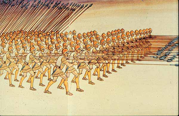
The phalanx was an infantry formation designed to maximize defensive mass and frontal offensive power. It turned a group of individual men into a singular, crushing machine.

  • The Grid Structure: Soldiers were drawn up in a dense block, typically eight ranks deep. The men stood shoulder-to-shoulder, with the files packed so tightly that individual movement was severely restricted.

  • The Interlocking Shield Wall: Each hoplite carried a large, round shield. In formation, a soldier tucked his shield into his left shoulder, overlapping the exposed right side of the man standing next to him. This meant that every man depended on the shield of the comrade to his right for protection.

  • The Shockwave (Othismos): Battles between two phalanxes often devolved into a literal shoving match known as the othismos. The front ranks would lock shields and thrust with their spears, while the ranks behind them used their physical weight to push forward, attempting to literally trample and break the enemy line.

  • The Vulnerabilities: While nearly impenetrable from the front, the phalanx was rigid and cumbersome. It required flat, open terrain to maintain cohesion. If an enemy managed to flank the formation or attack it from the rear, the lack of mobility meant the entire unit could be quickly butchered.

2. The Hoplite's Panoply: Heavy Metal Warfare

A hoplite was defined by his panoply—the complete set of armor and weapons. Unlike modern armies, ancient Greek city-states did not issue standardized gear; each soldier had to purchase his own equipment, which served as a direct indicator of his middle-class economic status.

  • The Hoplon (Shield): The absolute core of the kit, from which the hoplite drew his name. It was a large, circular shield roughly 3 feet (1 meter) in diameter, constructed of thick wood and faced with a thin sheet of bronze. It featured a revolutionary dual-handle system (the porpax and antilabe) that allowed the soldier to carry the heavy weight on his forearm rather than just his wrist.

  • The Dory (Spear): The primary offensive weapon. It was a wooden spear ranging from 7 to 9 feet (2 to 2.7 meters) in length, tipped with a sharp iron leaf-shaped blade. The butt of the spear featured a bronze spike called the sauroter ("lizard-killer"), which served as a backup weapon if the main shaft broke and allowed the spear to be planted upright in the ground.

  • The Corinthian Helmet: The iconic bronze helmet that fully enclosed the face, providing excellent protection but severely limiting the soldier's vision and hearing—a design choice that emphasized looking straight ahead and trusting the formation.

  • The Linothorax or Bronze Cuirass: Torso protection consisted either of a heavy, sculpted bronze breastplate or the more flexible linothorax, a vest made of multiple layers of laminated linen, sometimes reinforced with metal scales.

3. The Mechanics of the Clash

Hoplite warfare was brief, brutal, and highly ritualized. Because the soldiers were farmers, craftsmen, and citizens who needed to return to their livelihoods, campaigns were usually confined to the summer months and settled in a single afternoon.

  • The Paean: As the phalanx marched toward the enemy at a steady, rhythmic pace—often timed to the playing of double-reed pipes (auloi)—the men sang the paean, a solemn hymn to Apollo designed to steel their nerves and maintain marching cadence.

  • The Collision: The two lines crashed together with deafening violence. The first two ranks held their spears overhand, thrusting downward at the enemy's exposed throat, face, and pelvic areas, while the rear ranks kept their spears upright to deflect incoming missiles.

  • The Rout and the Trophy: Once a phalanx’s shield wall cracked and a line fractured, panic set in, and the battle quickly ended. The victors rarely pursued the fleeing enemy across long distances, as chasing broken infantry risked breaking their own vital formation. Instead, they remained on the field to collect the dead and erect a tropaion (trophy) made of captured armor to mark the spot of victory.

4. The Socio-Political Ripple Effect

The transition to the phalanx completely transformed the civic identity of the Greek polis.

When military success shifted from the aristocratic knight on a horse to the independent farmer standing in the mud, political leverage shifted with it.

Because the defense of the city-state now depended on the collective bravery of ordinary citizens who could afford a panoply—men known as the zeugitai in Athens—they began demanding a formal say in the laws and foreign policy they were risking their lives to defend. In cities like Athens, this direct link between military service and civic responsibility acted as a catalyst for democratic governance.

Even in oligarchic Sparta, the system produced a radically egalitarian warrior elite; Spartan citizens referred to themselves as the Homoioi ("Equals"), bound by a brutal, lifelong martial system (agoge) designed entirely to ensure that no single individual would ever place their own glory above the survival of the phalanx.
The Minoan Eruption of Thera: Impact on the Bronze Age World

May 21, 2026

Introduction: A Bronze Age Apocalypse

During the height of the Bronze Age, the Eastern Mediterranean was dominated by the Minoans, a highly advanced, seafaring civilization based on the island of Crete and its surrounding archipelago. They were masters of maritime trade, renowned for their palatial architecture, vibrant art, and sophisticated engineering. However, in the mid-second millennium BCE (around 1600–1500 BCE), this flourishing culture was dealt a catastrophic blow by one of the largest volcanic events in human history: the Minoan Eruption of Thera.

The eruption completely reshaped the island of Thera (modern-day Santorini), blowing the island's core into the sky and generating a series of cascading environmental disasters. While it did not instantly erase the Minoan civilization from the map, the resulting tsunamis, ash fallout, and economic disruption shattered their maritime hegemony—their dominance over the sea lanes—leaving them critically vulnerable to foreign conquest and triggering a permanent geopolitical shift across the ancient Aegean world.

1. The Cataclysm: Anatomy of a Super-Eruption

Geological analysis indicates that the Thera eruption was a Ultra-Plinian event—a volcanic eruption of maximum intensity—scoring a 6 or 7 on the Volcanic Explosivity Index. It was multiple times more powerful than the 79 CE eruption of Mount Vesuvius that buried Pompeii.

  • The Precursor Phase: The eruption was preceded by violent earthquakes. Unlike later historical disasters, these early warnings gave the inhabitants of Thera time to evacuate the island with their valuables, as evidenced by the lack of human remains in the ruins.

  • The Plinian Column: When the main vent ruptured, it blasted a column of ash, pumice, and toxic gases up to 24 miles (39 kilometers) into the stratosphere. Winds carried this toxic cloud east, blanketing parts of Anatolia, the Levant, and Egypt in darkness.

  • Pyroclastic Flows: As the eruption column collapsed, superheated avalanches of ash, rock, and gas rushed down the volcano's flanks at speeds exceeding 100 miles per hour, instantly vaporizing anything left on the coast.

  • Caldera Collapse: Empty of magma, the volcano’s massive underground chamber collapsed inward, dragging the center of the island down into the sea and creating the dramatic, water-filled caldera that characterizes Santorini today.

2. Akrotiri: The Aegean Pompeii

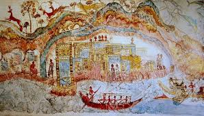
Just as Vesuvius preserved Pompeii, the thick layers of volcanic ash and pumice on Thera sealed a prosperous Minoan-influenced settlement known to modern archaeologists as Akrotiri. Excavations have revealed a remarkably sophisticated bronze-age urban landscape frozen in time.

  • Urban Infrastructure: Akrotiri featured multi-story stone buildings, paved streets, and an intricate, subterranean sewer and indoor plumbing system that wouldn't be matched in Europe for another two millennia.

  • The Frescoes: The ash preserved breathtaking wall paintings that offer a window into the Minoan worldview. Rather than glorifying war or monarchs, these colorful murals celebrate the natural world, depicting monkeys, marine life, boxers, and blooming landscapes.

3. The Tsunami and the Blow to Crete

While Thera itself was completely obliterated, the most devastating consequence for the core Minoan civilization on Crete, located roughly 85 miles (140 kilometers) to the south, came from the ocean.

  • The Giant Waves: The colossal collapse of the caldera displaced billions of tons of water, generating massive tsunamis. Computer models and marine deposits suggest these waves hit the northern coast of Crete with heights up to 30 to 50 feet (9 to 15 meters).

  • Destruction of the Fleets: The tsunamis instantly wiped out the Minoan naval fleets, shipyards, and coastal trading ports. For a civilization whose economy and defense depended entirely on naval supremacy (thalassocracy), this loss was structurally fatal.

  • Agricultural Collapse: The immediate physical damage was compounded by atmospheric fallout. Dense clouds of sulfur and ash blanketed Crete's fertile plains, acidifying the soil, ruining crops, and inducing widespread agricultural failure and famine.

4. Geopolitical Realignment: The Rise of Mycenae

The Minoans survived the immediate aftermath of the eruption, quickly working to rebuild their fractured settlements. However, the catastrophic loss of their navy and the internal chaos caused by famine left them fundamentally weakened.

With the Minoan naval shield shattered, the trade routes of the Aegean lay undefended, creating a power vacuum that a hungry new empire was eager to fill.

From the Greek mainland, the Mycenaeans—a highly militaristic, chariot-driving warrior culture—seized the opportunity. Within a few generations of the eruption, Mycenaean artifacts and their distinct Greek script (Linear B) began replacing Minoan cultural traits across Crete. By roughly 1450 BCE, the grand Minoan palace at Knossos was occupied by Mycenaean rulers. The center of Aegean political, economic, and cultural gravity had permanently shifted from Crete to the Greek mainland, setting the stage for the classical Greek world.

5. Myths and Echoes: The Origin of Atlantis?

The memory of a wealthy, advanced maritime civilization that vanished into the sea in a single cataclysmic day left an indelible mark on the collective consciousness of the ancient world. Many historians believe this event serves as the historical core behind one of humanity's most enduring legends.

Roughly 1,200 years after the eruption, the Greek philosopher Plato wrote the story of Atlantis—a powerful island empire characterized by concentric rings of water and land, advanced architecture, and red and black stone walls, which sank beneath the ocean waves in a single night of misfortune. The striking physical parallels between Plato's description and the geological reality of Thera suggest that the Minoan apocalypse may well be the true story behind the myth of the lost continent.

Roman Marble Trade: Identifying the Quarries of the Mediterranean

May 21, 2026

Introduction: The Stone of Empire

Augustus famously boasted that he found Rome a city of brick and left it a city of marble. To achieve this unprecedented architectural transformation, the Roman Empire developed a massive, highly organized logistical network, extracting millions of tons of decorative stone from across the Mediterranean basin.

Marble was not merely a building material; it was a potent symbol of imperial power, wealth, and the subjugation of distant provinces. Transporting monoliths from the remote deserts of Egypt to the center of Rome served as a constant, physical reminder of the empire's vast reach.

1. The Imperial Monopoly: Ratio Marmorum

During the Roman Republic, marble was largely imported by wealthy private individuals. However, as the Empire expanded, the state assumed direct control over the most valuable quarries through a centralized administrative department known as the ratio marmorum.

  • Imperial Properties: Quarries producing the most prestigious stones were designated as imperial property. This ensured a steady supply for state monuments and prevented private citizens from outshining the emperor with their domestic architecture.

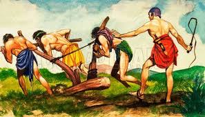
  • The Workforce: The brutal work of extracting stone was largely carried out by condemned criminals (damnati ad metalla), prisoners of war, and enslaved people. They were managed by military overseers and skilled engineers who lived in fortified, isolated quarry towns.

2. The Principal Mediterranean Quarries

Roman architects favored distinct colored marbles, and identifying these specific stones helps modern archaeologists map ancient trade routes and establish the wealth of specific buildings.

  • Luni (Carrara, Italy): The primary source of white marble (marmor Lunense). Because it was located on the Italian peninsula, it was significantly cheaper to transport to Rome than Greek equivalents and became the standard for imperial statues and temple cladding.

  • Mons Porphyrites (Egypt): Located deep in the Eastern Desert, this remote quarry was the sole source of Imperial Porphyry. Characterized by its deep purple color—the color of royalty—it was exclusively reserved for imperial use, particularly for sarcophagi and monolithic columns.

  • Chemtou (Tunisia): The source of Giallo Antico (Numidian marble), a highly prized yellow stone heavily veined with red or pink. It was frequently used for interior columns, pavements, and intricate veneer works in basilicas.

  • Carystus (Greece): Located on the island of Euboea, this quarry produced Cipollino (onion-stone), a distinctive white and pale green marble with heavy, wavy striations that resembled an onion's layers.

3. The Logistics of Extraction and Transport

Moving monoliths weighing hundreds of tons across the Mediterranean required engineering ingenuity that bordered on the miraculous.

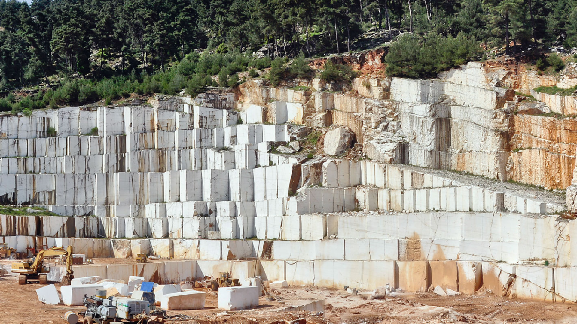
  • The Extraction Process: Stonemasons did not use explosives. Instead, they carved deep grooves into the bedrock and hammered in dry wooden wedges. They then soaked the wood with water; as the wood swelled, the sheer physical force would cleanly split the stone from the mountain.

  • The Stone Ships (Naves Lapidariae): Rome constructed massive, specialized cargo ships designed specifically to transport immense weights. Some of these vessels were large enough to carry Egyptian obelisks weighing over 300 tons across the open sea.

  • The Marmorata: Once the ships reached the port of Ostia, the stone was transferred to flat-bottomed river barges and towed up the Tiber by teams of oxen to the Marmorata, Rome's sprawling riverside marble yards. Here, blocks were cataloged, stamped with lead seals, and stored until needed.

4. Modern Archaeological Identification

For centuries, archaeologists relied on visual inspection to identify the origin of marble fragments, which was frequently inaccurate due to weathering and natural variations within a single quarry. Today, science provides definitive answers.

Key insight: The most definitive method for sourcing ancient marble is isotopic analysis. By measuring the specific ratios of carbon and oxygen isotopes within a stone sample, scientists can create a chemical "fingerprint" that uniquely matches the marble to its original bedrock quarry.

This scientific sourcing has revolutionized our understanding of the Roman economy, proving that even modest provincial towns successfully imported expensive, colored Mediterranean marbles to mimic the imperial grandeur of the capital.

The Viking Thing: The Early Origins of Parliamentary Democracy

May 21, 2026

Introduction: The Heart of Norse Justice

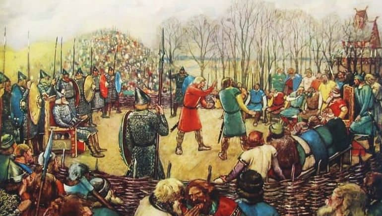
The popular perception of Vikings often centers on bloodthirsty raiders and lawless conquerors, but Norse society was actually underpinned by a highly sophisticated, communal legal system. At the center of this society was the Thing (Old Norse: þing), a governing assembly composed of free men who gathered to enact laws, elect leaders, and judge disputes.

The Thing was an essential balancing mechanism for a warrior culture deeply bound by honor and clan loyalties. By providing a structured arena for public debate, negotiation, and judicial arbitration, the Thing prevented endless cycles of blood feuds and laid the ideological groundwork for early parliamentary democracy in Northern Europe.

1. Societal Structure: The Tiers of Justice

The Viking legal framework was deeply decentralized and built upon a tiered, geographical hierarchy that mirrored the social structure of the Norse world.

  • The Local Thing: The lowest level of assembly handled immediate community issues, petty crimes, and local land disputes. It allowed ordinary free people a direct voice in the governance of their immediate surroundings.

  • The Regional Thing: A larger gathering that mediated conflicts between different clans or communities, pulling together representatives and chieftains from several local districts to handle broader political and legal matters.

  • The National Assembly: In certain established territories, an overarching assembly governed the entire realm. The most famous example is the Icelandic Althing, which convened the nation's 36 district leaders and served as the supreme legislative and judicial authority for the island.

2. The Mechanics of the Gathering

A Thing was not merely a court of law; it was a vibrant socio-economic festival that could last for days or weeks, pulling communities together across vast distances.

  • The Location: Things were typically held outdoors in highly accessible, natural amphitheaters, often near reliable water sources. Sites were chosen for their acoustics, allowing speakers to be heard by massive crowds, and their geographical neutrality.

  • The Truce (Thingfriðr): Violence at the assembly was strictly forbidden. Attendees were required to leave their weapons—swords, axes, and spears—outside the boundaries of the meeting site (often marked by hazel poles or ropes) to ensure peaceful deliberation.

  • The Festival Atmosphere: While the core purpose was judicial, the gatherings attracted merchants, brewmasters, and artisans. The assembly functioned as a bustling bazaar and was a primary venue for arranging marriages, forging political alliances, and conducting major trade.

3. The Lawspeaker: The Living Constitution

Because Viking society operated primarily through oral tradition before the widespread use of written law codes, the integrity of the legal system rested on a single, highly respected official.

  • The Memorization of Law: The Lawspeaker (lögsögumaður) was elected for a set term and was responsible for memorizing the entirety of the community's laws, acting as a human legal encyclopedia.

  • The Recitation: At national assemblies, the Lawspeaker would stand at a prominent geographic feature—such as the Lögberg (Law Rock) in Iceland—and recite a portion of the laws aloud to the attendees each year, ensuring everyone understood their rights and obligations.

  • The Neutral Arbiter: While chieftains (goðar) held political power and influenced outcomes, the Lawspeaker acted as an impartial legal expert who clarified precedents and guided the assembly toward lawful, consistent verdicts.

4. Resolving Disputes: Blood Feuds and Compensation

The Norse culture of honor meant that an injury to one person was an insult to their entire clan, frequently triggering violent retribution. The Thing was specifically designed to interrupt this cycle.

  • The Outlawry Sentence: The Thing had no police force to carry out punishments. Instead, severe crimes resulted in the perpetrator being declared an "outlaw." Stripped of all legal protection, an outlaw could be killed by anyone without consequence, effectively forcing them into permanent exile.

  • The Weregild (Man Price): To avoid continuous bloodshed, the Thing established a complex system of financial compensation called weregild. Every individual, from a lowly freeman to a chieftain, had a specific monetary value based on their social status, which had to be paid to the victim's family in the event of injury or death.

  • The Burden of Proof: Trials were conducted publicly, relying heavily on sworn oaths and character witnesses. If a man was accused of a crime, he could clear his name by gathering a specific number of respectable men to swear an oath confirming his innocence.

5. The Enduring Legacies: Althing and Tynwald

The physical and political legacy of these Viking assemblies outlasted the Viking Age itself, embedding democratic principles into the territories they settled.

  • The Icelandic Althing: Founded in 930 CE at Þingvellir, it is widely considered the oldest surviving national legislature in the world. It operated continuously as an open-air assembly until the late 18th century and remains Iceland's parliament today.

  • The Manx Tynwald: On the Isle of Man, the legacy of Norse settlers lives on in the Tynwald (derived from the Old Norse Þingvöllr, meaning "assembly field"). Established over a millennium ago, the Tynwald is the world's oldest continuously operating parliament.

Every year on July 5th, the Isle of Man still celebrates Tynwald Day, where the modern Manx parliament gathers on the ancient four-tiered, artificial earthen mound to proclaim the year's new laws in both English and Manx Gaelic.

Ancient Egyptian Music: Harps, Flutes, and the Sistrum

May 21, 2026

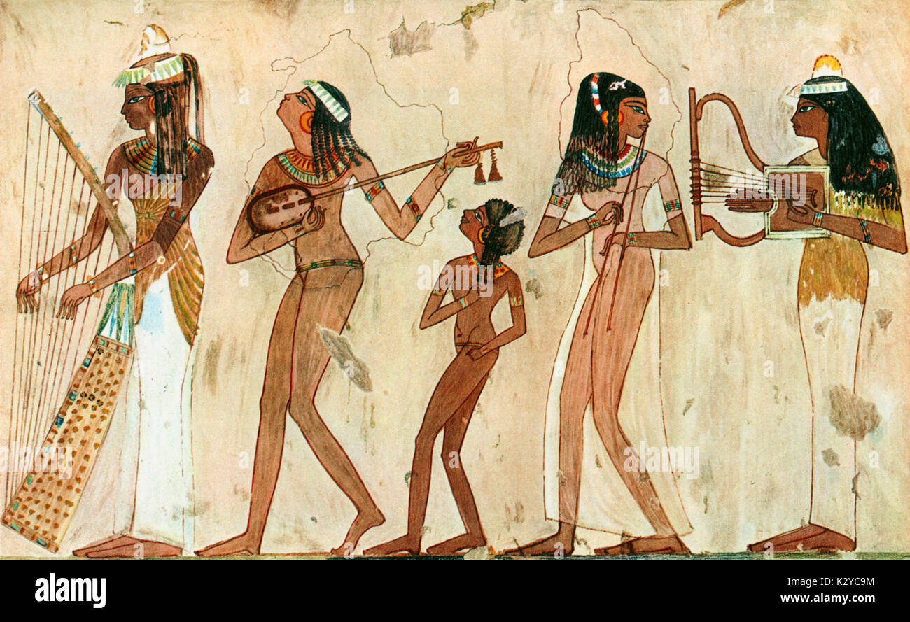
Music was deeply woven into the fabric of ancient Egyptian life, present in everything from royal banquets and military processions to temple rituals and the daily labor of farmers. Because the Egyptians did not have a system of musical notation, we cannot know exactly what their music sounded like. Instead, our understanding comes entirely from the archaeological record: surviving instruments, tomb paintings, and hieroglyphic texts.

Based on these artifacts, we know their ensembles relied heavily on three distinct families of instruments: strings, winds, and percussion.

The Harp: The Backbone of the Ensemble

The harp was the premier string instrument of ancient Egypt. The earliest versions, dating back to the Old Kingdom (c. 2686–2181 BCE), were "arched" or bow-shaped harps with relatively few strings. By the New Kingdom, contact with Mesopotamia introduced the larger, more complex "angular" harp, which had more strings and a wider tonal range.

One of the most famous motifs in Egyptian funerary art is the blind harpist. These musicians were frequently depicted in the tombs of royalty and nobles, entertaining banqueters while singing contemplative lyrics about death, the afterlife, and the fleeting nature of life. While it is unclear if these harpists were literally blind or if the depiction was a symbolic convention, they held an honored position in society.

End-Blown Flutes

Woodwinds were essential for carrying the melody, often playing in unison or slight variation (heterophony) with the singers. The most common wind instrument was the end-blown flute, made from river cane or wood.

Similar to the modern ney still played in traditional Egyptian and Middle Eastern music today, these flutes were held at an angle, with the player blowing directly across the open rim. Tomb reliefs frequently show flute players sitting alongside singers, using hand gestures (chironomy) to signal melodic changes or rhythmic beats. Over time, the Egyptians also incorporated double-reed pipes (similar to early oboes), but the simple cane flute remained a staple for thousands of years.

The Sistrum: The Sound of the Gods

While harps and flutes were used for both entertainment and religion, the sistrum was an exclusively sacred instrument. It was a type of handheld rattle made of bronze or brass, featuring a U-shaped frame with sliding metal crossbars that jingled when shaken.

The sistrum was the primary instrument of the priestesses of Hathor, the goddess of joy, music, and motherhood. The instrument's ancient Egyptian name, sesheshet, is actually an onomatopoeia mimicking the soft, rustling sound it makes—a sound the Egyptians associated with wind blowing through the papyrus reeds where Hathor was believed to dwell.

During temple rituals and open-air processions, priestesses and queens would shake sistrums in sharp, rhythmic pulses. The sound was believed to clear negative energy, appease the deities, and invoke blessings. The instrument's shape was deeply symbolic; many sistrums featured a handle shaped like the ankh (the symbol of life) or were topped with the cow-eared face of Hathor herself.

The Roman Forum: The Political Heart of the Republic

May 21, 2026

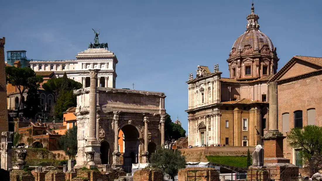
The Roman Forum (Forum Romanum) was the beating heart of the Roman Republic—a dense, chaotic, and vibrant space where politics, law, religion, and commerce collided. Originally a marshy valley between the Palatine and Capitoline Hills, it was transformed in the 6th century BC by the construction of the Cloaca Maxima, a massive drainage system that allowed the area to become the city's primary public gathering place.

Deep Dive: The Six Pillars

1. The Comitium: The Legislative Assembly

The Comitium was the original heart of political activity, a circular outdoor space where the Roman people met to vote and decide the future of the state. It was the "democratic" counterpart to the Senate, representing the Populus Romanus. Over time, as Rome grew, the Comitium became the focal point for the struggle between the patricians and the plebeians, serving as the setting where the most foundational laws, such as the Twelve Tables, were presented to the citizenry.

2. The Curia: The Senatorial Power

If the Comitium represented the people, the Curia represented the power of the aristocracy. As the official meeting place of the Senate, it was the site where the most influential men in Rome debated foreign policy, declared war, and controlled the state’s massive budget. The Curia was more than just a building; it was a symbol of continuity, and its frequent reconstructions after fires or civil riots tracked the turbulent evolution of Rome’s ruling class.

3. The Rostra: The Power of Political Oratory

The Rostra was the most volatile spot in the Forum, a raised platform adorned with the prows of captured enemy ships. This was the primary interface between the elite and the masses. In a society without mass media, the ability of a statesman to command the attention of the crowd from the Rostra was the most vital political skill. From here, Cicero defended the Republic against conspiracy, and here, too, the inflammatory speeches were given that ignited the populist movements of the late Republic.

4. The Basilicas: The Legal and Economic Hub

As Rome’s legal and commercial needs expanded, the open-air courts proved insufficient, leading to the development of the basilica. These long, roofed halls provided the necessary shelter for complex legal trials and intense commercial banking. By concentrating the city's financial and legal activities into these massive public structures, the Republic effectively institutionalized its judicial process and established the Forum as the permanent headquarters for Roman contract law and international trade.

5. The Temple of Saturn: The State Treasury

The Temple of Saturn served the critical function of the aerarium, or the public treasury of the Roman Republic. Located at the foot of the Capitoline Hill, it safeguarded the wealth that sustained Rome’s expansive military campaigns and civic projects. Its role as a bank turned it into a target during periods of political upheaval, as control over the treasury was synonymous with control over the state's ability to pay its legions and satisfy its creditors.

6. The Via Sacra: The Processional Spine

The Via Sacra, or "Sacred Way," was the central artery of the Forum. It functioned as the ritual spine of the city, serving as the final leg of the Roman Triumphs—the grand processions where victorious generals marched their captives, gold, and legions to the temple of Jupiter on the Capitoline. By forcing this route through the center of the Forum, the Republic ensured that every military victory was inextricably linked to the sacred and political identity of the city, transforming battlefield success into divine sanction.

Ancient Greek Slavery: The Invisible Workforce of Antiquity

May 21, 2026

Introduction: The Fabric of Ancient Greek Society

To understand the "Greek Miracle" is to recognize that it was not a sudden burst of genius, but the result of a highly specific, interconnected set of social, environmental, and structural conditions. The Greek world was a complex ecosystem where the sacred and the profane were inseparable, and where the loftiest philosophical inquiries were supported by a base of rigorous—and often exploitative—economic systems. By examining these six pillars, we uncover the true nature of a civilization that balanced intense internal rivalry with a shared cultural language, turning a rugged, fragmented landscape into the foundation of the Western tradition.

1. Sacred Topography: The Anchoring of Power

The Greek landscape was fundamentally shaped by the concept of sacred topography, where specific physical sites were consecrated to bridge the gap between the mortal and divine realms. Sanctuaries like Olympia were not just collections of temples; they were meticulously engineered environments designed to funnel the competitive energy of the Greek world into a singular space of religious and athletic observance. By integrating the stadium, the altar, and the administrative council house into one precinct, these sites ensured that every act of athletic achievement or political discourse was performed under the watchful eye of the gods, effectively grounding the disparate Greek city-states in a shared, visible religious reality.

2. Labor Systems: The Foundation of Citizen Leisure

The structure of Ancient Greek society was underpinned by an extensive and varied system of forced labor that acted as the invisible engine of the economy. In democratic Athens, this primarily took the form of chattel slavery, where people were treated as alienable property to be utilized in mines, workshops, and domestic settings, while in places like Sparta, state-controlled serfs known as helots provided the agricultural surplus necessary to sustain the warrior class. This widespread reliance on enslaved labor offloaded the essential work of subsistence, creating the "leisure" required for the citizen-body to focus on the civic duties of politics, warfare, and philosophical inquiry, thereby anchoring the Greek "miracle" in a reality of profound human exploitation.

3. Mycenaean Palaces: The Template for Bureaucratic Control

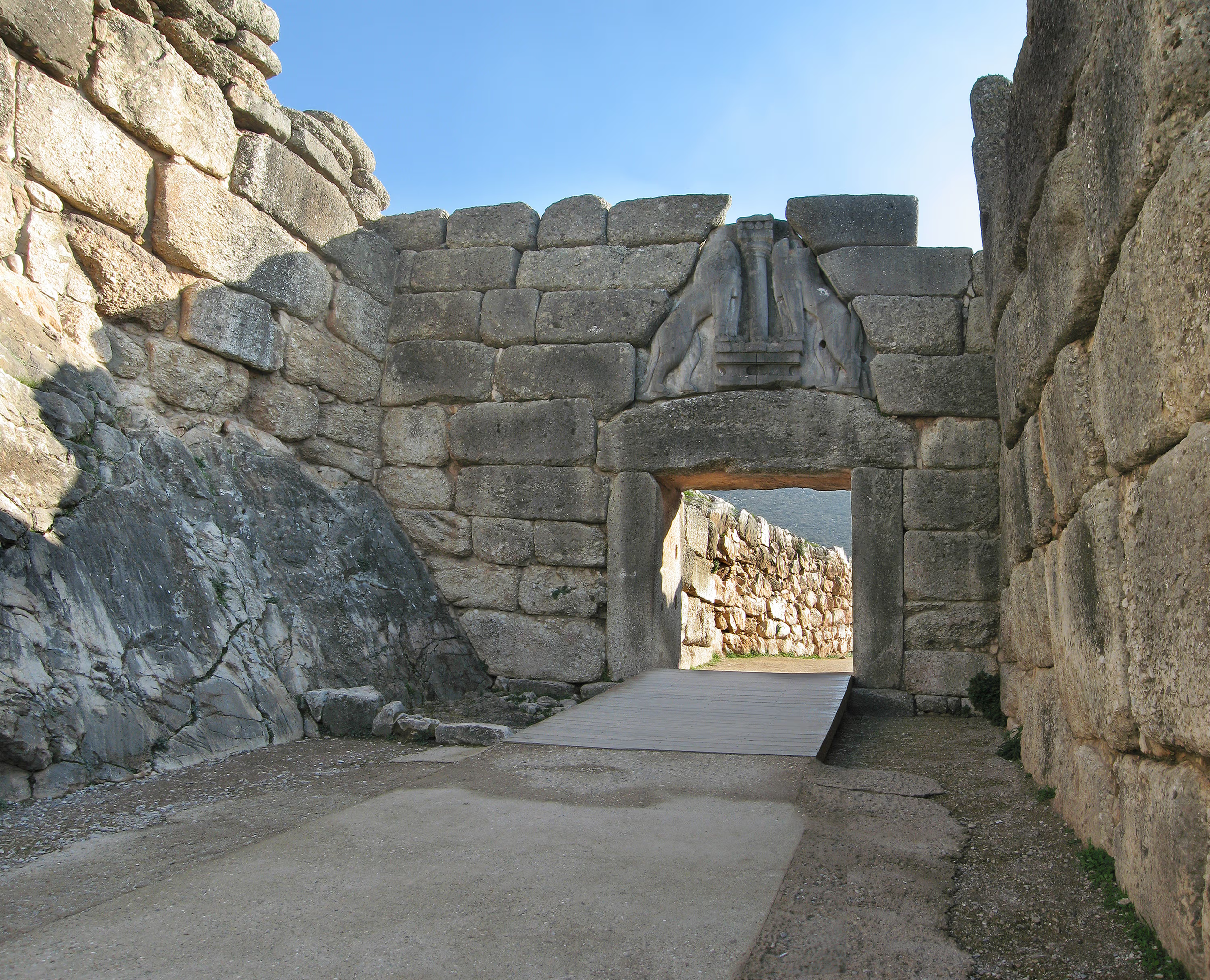
Long before the rise of the classical polis, the Mycenaean palaces of Tiryns and Pylos established the early blueprint for centralized administrative power in the Greek world. These monumental complexes were organized around the megaron, a central throne room that served as the focal point for ritual and political legitimacy, supported by a sophisticated bureaucracy that tracked agricultural yields and craft production through Linear B tablets. Although these palatial centers collapsed around 1100 BC, their massive "Cyclopean" architecture and the memory of their powerful kings became fossilized in the later Homeric tradition, serving as the legendary bedrock upon which subsequent generations of Greeks built their own identity.

4. The Symposium: The Intellectual Laboratory

While the public square served as the stage for political life, the symposium—a private, ritualized drinking party for men—acted as the true laboratory for Greek intellectual and cultural development. Governed by strict social protocols and led by a chosen master of ceremonies, these gatherings provided the secluded environment necessary for the performance of lyric poetry and the rigorous testing of political alliances. It was within the informal yet highly disciplined atmosphere of the symposium that many of the core philosophical debates, rhetorical strategies, and artistic innovations of antiquity were first developed and refined away from the scrutiny of the public gaze.

5. Thalassocracy: The Maritime Network

The meteoric rise of the Greek city-states was inextricably linked to their identity as a thalassocracy, or a power rooted in naval dominance. By treating the Mediterranean as a vast, navigable highway rather than a geographic barrier, maritime hubs like Athens and Corinth were able to project their influence far beyond their immediate borders. This maritime connectivity facilitated a rapid, networked exchange of goods, coinage, and civic institutions, turning the Greek world into a competitive ecosystem where the necessity of controlling vital trade routes drove constant innovation in naval architecture, colonial administration, and economic policy.

6. The Delphic Oracle: The Geopolitical Compass

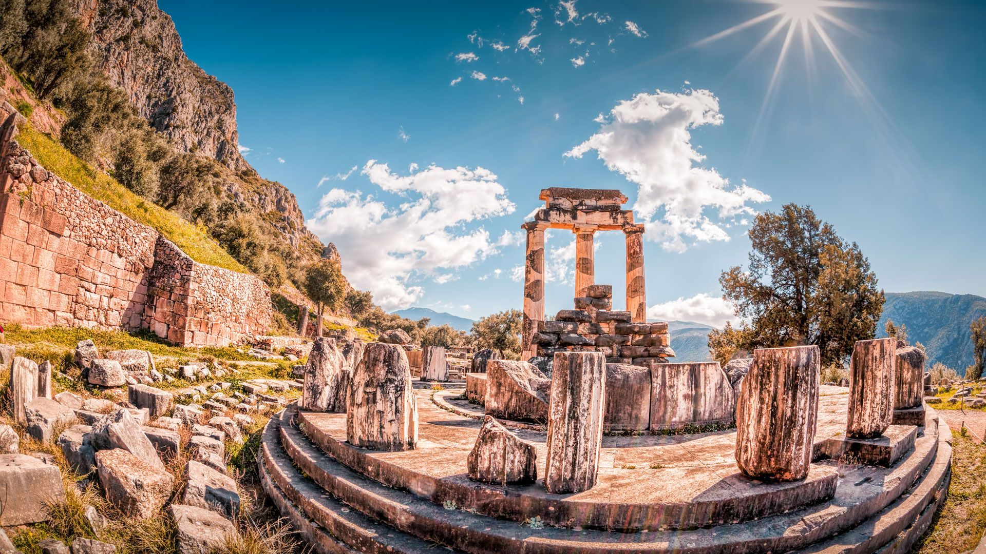
The Sanctuary of Apollo at Delphi functioned as the ultimate "soft power" authority of the ancient world, providing a centralized moral and political compass that transcended local rivalries. Because leaders from all over the Mediterranean sought the Oracle’s guidance on matters ranging from warfare to the founding of new colonies, the priests at Delphi became the most well-informed political consultants of antiquity. By curating their prophecies based on a vast reservoir of collected geopolitical intelligence, they managed to act as a stabilizing influence, subtly guiding the trajectory of Greek history through a system of interpretation that balanced divine mystery with pragmatic, real-world insight.

The Mycenaean Palaces: Tiryns, Pylos, and the Homeric Tradition

May 21, 2026

The Mycenaean palaces of Tiryns and Pylos represent the zenith of Bronze Age Greek engineering and administrative power. These sites were not merely royal residences; they were centralized hubs of a complex bureaucracy that managed agricultural production, craft specialization, and regional defense.

1. The Architectural Core: The Megaron

The defining feature of both palaces is the megaron, the ceremonial and administrative heart of the complex. While specific layouts vary, the megaron consistently followed a tripartite design:

  • Porch (Aithousa): A colonnaded entryway facing an open courtyard.

  • Vestibule (Prodomos): An anteroom leading to the main hall.

  • Throne Room (Domos): The central chamber, which featured a large, circular central hearth (eschara) surrounded by four columns supporting the roof. The royal throne was typically positioned against the right-hand wall.

This architectural template provided a dramatic setting for the wanax (the Mycenaean king) to preside over social, religious, and political life.

2. Palace Profiles

While sharing a common "palatial logic," Tiryns and Pylos served different strategic needs:

  • Tiryns ("Mighty-Walled"): Famous for its Cyclopean masonry—walls built from massive, multi-ton limestone boulders without mortar. It was designed as a formidable fortress. Its labyrinthine complex included casemates, galleries for storage within the walls, and sophisticated drainage systems. It served as a major power center in the Argolid, projecting military dominance.

  • Pylos (The Palace of Nestor): Located on the coast of Messenia, it is the best-preserved Mycenaean palace, largely because it was destroyed by fire rather than dismantled. Unlike the fortified citadels of Tiryns or Mycenae, Pylos was largely unfortified in its final phase. It is renowned for its wealth of archaeological evidence, including thousands of Linear B tablets that provide a direct window into the palace's economy—listing tribute, workshops, and land allotments.

3. The Homeric Connection

The relationship between these archaeological realities and Homeric tradition is complex:

  • "Fossilized" Memory: Homer wrote during the 8th century BC—hundreds of years after the Mycenaean collapse—yet he describes a world of "rich kingdoms," "majestic walls," and powerful kings that align remarkably well with the 13th-century BC archaeological record.

  • Poetic Anachronism: The palaces described in the Iliad and the Odyssey are likely an "amalgam" of memories. Homeric singers incorporated elements from the Bronze Age past alongside the social and material realities of their own Early Iron Age present.

  • The Power of Myth: Heinrich Schliemann’s 19th-century excavations were driven by a literal belief in Homer. While we now know the epics are not historical documentaries, they preserved the "fame" of these sites, transforming them into the legendary landscape of the Greek heroic age.

The Mycenaean palace system eventually collapsed around 1100 BC, but its legacy survived through the oral traditions that Homer later immortalized, grounding his poems in a physical reality that remained visible in the ruins of the Peloponnese long after the wanax had vanished.

Roman Domestic Life: The Layout of the House of the Vettii

May 21, 2026

The House of the Vettii in Pompeii is one of the most famous examples of a Roman domus, providing a rare and vivid glimpse into the domestic life of the 1st century AD. It is particularly significant because it was owned by two brothers, Aulus Vettius Conviva and Aulus Vettius Restitutus, who were freedmen (formerly enslaved people) who rose to great wealth, likely as wine merchants. Their home is a masterpiece of "nouveau riche" self-presentation, where architecture and art were used to assert social status and cultural literacy.

1. Architectural Layout: A "Performance" Space

Unlike more traditional aristocratic homes, the House of the Vettii was explicitly designed for hosting and impressing visitors.

  • The Entrance & Atrium: Visitors entered through the fauces (vestibule) into a large, impressive atrium. In a display of calculated status, the brothers placed two iron-bound strongboxes (arcae) in plain view here—a direct, visual signal of their liquid wealth to any client or guest who entered.

  • The Absence of a Tablinum: Traditionally, a tablinum (a formal office) sat between the atrium and the private areas. The House of the Vettii famously lacks this, choosing instead to open the space directly onto the garden, creating a continuous, airy vista that emphasized the scale of their property.

  • The Peristyle: The heart of the house is the large, colonnaded courtyard garden (peristyle). It was lavishly decorated with marble fountains, bronze statuary (including cherubs and cupids), and manicured plantings. This was the stage for the brothers' social entertainment and dinner parties.

  • Service vs. Private Zones: The house is divided into two distinct parts. The "public" areas (atrium, peristyle, reception rooms) were for prestige. A separate service area—centered around a smaller, secondary atrium—housed the kitchen, latrines, and the quarters for their staff, ensuring that the labor required to maintain such an opulent lifestyle remained out of sight.

2. Art as Social Climbing

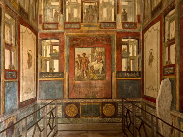
The house is a premier example of the Fourth Style of Pompeian wall painting, characterized by elaborate architectural perspectives, illusionistic scenes, and decorative flair.

  • Mythological "Galleries": The walls are covered in complex mythological scenes—such as the punishment of Ixion, the death of Pentheus, and the strangling of the serpents by infant Hercules. These were essentially "picture galleries" (pinacothecae) intended to show that the brothers were cultured, educated, and well-versed in high Greek mythology.

  • Apotropaic Symbolism: Near the entrance, a famous fresco of the god Priapus (a fertility deity) weighing his own phallus against a bag of gold served both as a symbol of prosperity and an apotropaic charm—meant to ward off the "Evil Eye" of envy from visitors who might resent the brothers' sudden climb in status.

  • The Room of the Cupids: One of the most famous spaces, the triclinium (dining room), features a vibrant frieze of cupids performing "human" tasks—selling wine, acting as goldsmiths, and charioteering. This playful imagery suggests a high degree of artistic sophistication and a desire to delight and entertain guests during banquets.

3. The Social Context

The layout of the House of the Vettii illustrates how Roman society managed social hierarchy. The brothers used their home as a tool to bridge the gap between their past (as enslaved people) and their present (as prominent, wealthy citizens). By mimicking the architectural and artistic language of the traditional elite, they effectively curated their own identity, turning their home into a museum of their own success.

The house reminds us that in Roman culture, the home was never truly "private." It was a stage for the patron-client system, where the design of a space was just as important as the wealth displayed within it.

The Viking Age Town of Birka: Sweden’s Gateway to the East

May 21, 2026

The Crucible of Northern Trade: Birka

Founded in the mid-8th century on the island of Björkö in Lake Mälaren, Birka was arguably the most important trading center in Viking Age Sweden. While many Viking settlements were agrarian, Birka was a dedicated urban hub—a "proto-city"—specifically engineered to facilitate the flow of goods between the Baltic Sea, the interior of Scandinavia, and the vast markets of the Abbasid Caliphate and the Byzantine Empire.

1. The Geometry of a Trading Hub

Birka was not a sprawling metropolis; it was a tightly organized, highly defensible center of commerce. Its layout was designed to maximize efficiency for traders who arrived by boat and stayed for months to conduct business.

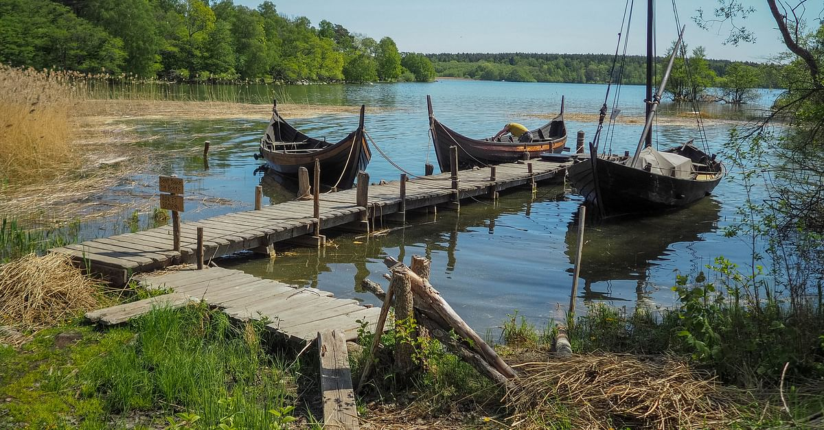
  • The Harbor and Waterfront: The town was built directly on the water, with rows of wooden piers and jetties extending into the lake. This allowed for the rapid unloading of heavy goods like furs, slaves, and walrus ivory, and the loading of luxury imports like silk, glass, and spices.

  • The Defensive Rampart: A massive semicircular earthen wall—the Kvarnbacken rampart—was built to enclose the town on the landward side. It served not only to protect the town’s residents but also to strictly control the flow of people and goods in and out, ensuring that traders paid their "market taxes" to the local chieftain.

2. The Eastern Connection: The "Silk Road" of the North

Birka’s importance rested entirely on its role as the western terminus of the Volga and Dnieper trade routes. Norse merchants, known in the East as the Rus, traveled deep into Russia, navigating rivers as far as the Caspian Sea and the Black Sea.

  • The Luxury Import Economy: Archaeologists have unearthed incredible quantities of non-Scandinavian goods at Birka:

    • Silk: Fragments of high-quality Chinese and Persian silk, often used as trim for everyday Viking clothing.

    • Dirhams: Thousands of silver dirhams—Arab coins minted in places like Baghdad and Samarkand—have been found in Birka’s graves and house floors. These were not just currency; they were the primary commodity the Norse brought back to be melted down into jewelry or used as status symbols.

    • Glass and Beads: Colored glass vessels and beads from the Rhineland and the Byzantine Empire provided the status-defining "bling" that allowed the Birka elite to distinguish themselves.

3. Social and Religious Pluralism

Because it was a commercial hub, Birka was far more cosmopolitan than the typical rural Norse settlement. It acted as a "melting pot" where the rigid social norms of the rural interior were often bypassed in favor of commerce.

  • The First Christian Mission: It was here, in the 830s, that the monk Ansgar made his first attempt to convert the Swedish Vikings to Christianity. The fact that he was allowed to establish a mission at all—despite the local pagan elite's resistance—shows that Birka was a site of religious negotiation and tolerance, largely driven by the practical need to accommodate foreign traders.

  • The "Black Earth": The town was built on a thick layer of dark, organic-rich soil known as the Svartjorden (Black Earth). This soil is packed with the refuse of centuries—broken pottery, animal bones, spindle whorls, and thousands of tiny metal scraps. It acts as an "archaeological time capsule," allowing modern researchers to reconstruct the daily lives of the craftspeople who lived in the town’s cramped, wooden row houses.

Birka was the physical embodiment of the Viking Age's transition from raiding to long-distance commerce. By 975 AD, Birka was abandoned—likely due to a combination of land elevation (the harbor became too shallow for larger ships) and the rise of a new, more strategically located town nearby: Sigtuna. However, for two centuries, it remained the essential gateway that tied the Scandinavian world to the economic engines of the Orient.

Ancient Egyptian Papyrus: The Manufacturing of the World’s First Paper

May 20, 2026

The Botanical Foundation: Cyperus papyrus

The invention of papyrus around 3000 BC transformed the administrative and cultural landscape of the ancient world. It provided a lightweight, durable, and portable medium that was vastly superior to clay tablets or animal skins. The process was not "paper-making" in the modern sense of pulping fibers; it was a refined technique of botanical layering and compression.

The raw material was the Cyperus papyrus sedge, a tall, aquatic plant that thrived in the nutrient-rich, marshy floodplains of the Nile Delta.

1. The Manufacturing Process

The production of a sheet of papyrus was a precise, labor-intensive craft that required standardized preparation to ensure the final product was smooth and absorbent.

  • Harvesting and Stripping: The green, triangular stalks were harvested and the outer, fibrous green rind was stripped away to reveal the white, spongy inner pith (the medulla).

  • Slicing: The pith was sliced into thin, vertical strips. These strips were then laid out side-by-side on a flat, hard surface, slightly overlapping to create a "sheet."

  • The Cross-Hatch Layering: A second layer of strips was laid horizontally across the first layer at a 90-degree angle. This cross-hatching was crucial; it gave the papyrus structural integrity and prevented it from splitting when dried or written upon.

  • The Compression: The two-layered mat was then beaten with a wooden mallet or pressed under heavy weights. This was the most important step: the sap within the plant's fibers acted as a natural adhesive, binding the two layers of strips together into a single, cohesive sheet.

  • Finishing: Once dried under pressure, the sheet was polished with a smooth stone or shell to remove any remaining bumps, creating a surface receptive to the carbon-based inks used by Egyptian scribes.

2. Physical and Chemical Properties

Papyrus was engineered for the environment of the Nile Valley, and its properties made it the gold standard for thousands of years.

  • Durability: When kept in the hyper-arid climate of Egypt, papyrus was remarkably stable. The cellulose fibers were resistant to decay, allowing administrative and religious texts to survive for millennia.

  • Ink Compatibility: The natural acidity and texture of the pressed pith were ideal for the lampblack (soot-based) inks used in antiquity. The ink was absorbed just enough to prevent smudging but not so much that it bled through the fibrous matrix.

  • Scroll Format: Because papyrus sheets were relatively small, they were joined together edge-to-edge to create long, continuous rolls (biblia). This allowed for the efficient storage of long texts, such as the Book of the Dead or administrative tax records, which could be rolled up and stored in jars or wooden boxes.

3. Economic and Societal Impact

Papyrus was a major state-controlled economic engine of Ancient Egypt. Its production and distribution were central to the pharaonic bureaucracy.

  • The Scribe Class: The availability of papyrus enabled the rise of the scribe, a powerful and highly respected caste of civil servants who managed everything from food distribution to the precise measurements of land boundaries following the annual Nile flood.

  • Diplomatic Currency: Papyrus was a highly sought-after luxury export. Its sale to neighboring cultures—including the Greeks, Romans, and Phoenicians—provided Egypt with a significant influx of foreign wealth. The very word "Bible" is derived from Byblos, the Phoenician city that served as the primary trading port for Egyptian papyrus.

The Roman Colosseum: The Logistics of Flooding the Arena

May 20, 2026

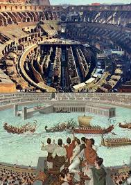
The naumachia—or mock naval battle—held inside the Flavian Amphitheatre (the Colosseum) remains one of the most debated and technically fascinating spectacles of Roman engineering. While ancient authors like Martial and Cassius Dio described elaborate naval battles taking place within the arena, modern archaeologists have long puzzled over the logistics, as the arena floor is honeycombed with the hypogeum, a complex subterranean network of tunnels, elevators, and animal cages.

1. The Hydraulic Challenge

To flood the arena, the Romans had to overcome the massive structural obstacle of the hypogeum. If the arena floor were simply filled with water, the wooden structures and mechanisms beneath it would have been destroyed, and the structural integrity of the Colosseum’s foundation would have been compromised by the immense weight of the water.

  • The Evidence for Flooding: Archaeologists have found large, lead-lined stone channels beneath the arena floor. These channels were connected to the massive Aqua Claudia and Anio Novus aqueducts that fed Rome. The logistical theory suggests that these channels functioned as a sophisticated drainage and filling system, allowing water to be pumped into the arena through high-pressure conduits.

2. The Timeline of the Naumachia

It is widely believed by modern scholars that the naumachia occurred primarily during the early phase of the Colosseum’s existence, specifically under the Emperor Titus in 80 AD.

  • Pre-Hypogeum Era: During the inauguration games in 80 AD, the hypogeum had not yet been fully constructed (or was at least not yet the permanent multi-story complex it would later become under Domitian). Before these subterranean levels were walled in with permanent masonry, the arena floor was likely a removable wooden platform.

  • The Logistical Process:

    1. Removal of the Floor: The wooden arena floor was dismantled, exposing the deeper pit beneath.

    2. Sealing the Drain: The main drainage channels (the cloaca) were plugged.

    3. Controlled Inundation: Water from the city’s primary aqueducts was diverted into the arena, filling the basin to a depth sufficient to float specialized, low-draft vessels.

3. The Structural Constraint: Water Weight and Displacement

Water is exceptionally heavy—approximately 1,000 kilograms per cubic meter. Filling the entire arena bowl of the Colosseum would have created an immense pressure load on the exterior walls and the foundation.

  • Limited Depth: The naumachia were likely not "deep water" battles. Instead, they utilized shallow-draft boats or flat-bottomed barges. This limited the volume of water required, reducing the hydrostatic pressure on the arena walls while still providing enough buoyancy for the ships to maneuver.

  • Rapid Drainage: The Romans were masters of civil engineering. Once the spectacle was finished, they utilized the gravity-fed sewer system (the Cloaca Maxima) to drain the arena rapidly, allowing the area to be reset for standard gladiatorial combat in a relatively short timeframe.

4. Why the Practice Ended

The "flooding" era of the Colosseum was short-lived. Following the reign of Titus, Emperor Domitian completed the permanent, multi-story hypogeum. This massive brick-and-stone subterranean complex essentially turned the area beneath the arena into a "backstage" factory for gladiatorial games, complete with lifts and pulley systems to bring lions and warriors up into the arena. Once this permanent structure was installed, flooding the arena became physically impossible without destroying the complex machinery that made the daily games possible.

The naumachia effectively moved from the Colosseum to purpose-built, dedicated basins elsewhere in Rome—such as the Naumachia Augusti—which were designed specifically for naval combat and did not have the complex sub-floor machinery of the Colosseum.

While the naumachia in the Colosseum represent a pinnacle of Roman showmanship, they were a fleeting technological experiment. The permanent installation of the hypogeum reflects the Roman shift toward the "industrialized" entertainment of the later Empire, where efficiency and complexity were prioritized over the short-term spectacle of flooding the arena.

Ancient Greek Sanctuaries: The Sacred Topography of Olympia

May 20, 2026

Ancient Greek Sanctuaries: The Sacred Topography of Olympia

The Sacred Topography of Olympia: A Convergence of Divinity and Athletics

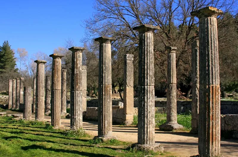
The sanctuary of Olympia was not merely a cluster of temples; it was a carefully curated sacred landscape that functioned as the pan-Hellenic nerve center of the Greek world. Located in the fertile valley of the Alpheios River in the Peloponnese, Olympia was designed to facilitate a profound sensory experience, where the boundary between the mortal realm of athletic achievement and the divine realm of Zeus was intentionally blurred.

1. The Altis: The Sacred Enclosure

At the heart of Olympia lay the Altis, the sacred grove dedicated to Zeus. Unlike the residential quarters of a city-state, the Altis was a strictly consecrated space, demarcated by a boundary wall (peribolos) that separated the mundane world from the divine.

  • Density of Devotion: Inside the Altis, space was intensely dense. It contained the oldest and most sacred sites, including the Pelopion (a mound dedicated to the hero Pelops) and the massive Temple of Zeus, which housed the gold-and-ivory statue of the god, one of the Seven Wonders of the Ancient World.

  • The Votive Forest: Over centuries, the Altis became crowded with thousands of bronze statues, tripods, and commemorative victory monuments dedicated by triumphant athletes and city-states. This "forest" of bronze served as a permanent, visible archive of Greek history, piety, and rivalry.

2. The Relationship Between Sanctuary and Stadium

A defining feature of Olympia’s topography was the integration of the athletic facilities directly into the sacred site. The Stadium was not separated from the religious core; rather, it was functionally and physically tied to it.

  • The Stoa of Echoes: Athletes and spectators entered the stadium through a vaulted entrance. Near the entrance sat the Stoa of Echoes, designed to reflect sound back toward the spectators, creating an acoustic environment that amplified the roar of the crowd.

  • The Ritual of Entry: Athletes entered the sacred precinct after taking an oath before the statue of Zeus Horkios (Zeus of the Oaths), swearing that they had trained for ten months and would not cheat. This ritual placement meant that the physical act of sprinting or wrestling was an extension of a religious promise made to the god of the sanctuary.

3. The Hydrography and Natural Features

Olympia’s location was chosen specifically for its natural features, which were integrated into the myths and cult practices of the site.

  • Mount Kronion: The northern boundary of the sanctuary was dominated by the hill of Kronos (Mount Kronion). In mythology, this hill was the site of a battle between the older generation of gods (the Titans) and the younger generation led by Zeus. By placing the sanctuary at the foot of this hill, the Greeks physically linked their ritual activities to the primordial victory of Zeus over chaos.

  • The Alpheios and Kladeos Rivers: The sanctuary was bordered by two rivers, the Alpheios and the Kladeos. These rivers provided the water for the sacred precinct’s elaborate hydraulic systems, including the public fountains and the drainage systems necessary to keep the stadium from flooding. Ritual washing—a prerequisite for entering a sanctuary—was performed at these water sources, purifying the athletes and pilgrims before they approached the altars.

4. The Administrative Infrastructure

While the Altis was for the gods, the periphery of Olympia was a sophisticated administrative machine designed to support the thousands of pilgrims, officials, and athletes who descended upon the site every four years.

  • The Bouleuterion: The council house where the Olympic officials (Hellanodikai) deliberated. It was here that the rigorous rules of the games were enforced and where athletes were disqualified if they failed to meet the standards of the sanctuary.

  • The Leonidaion: A massive guest house built to accommodate the dignitaries and wealthy delegates from distant city-states. Its presence highlights that Olympia was a diplomatic hub; during the Olympic Truce (Ekecheiria), warring Greek city-states were legally required to suspend hostilities, allowing safe passage for all who traveled to the sanctuary.

Olympia was effectively a "controlled environment." By funneling the competitive energy of the Greek world into this singular, sacred topography, the Greeks transformed individual athletic prowess into a communal religious experience, ensuring that the winner’s victory belonged as much to the gods as it did to the man who crossed the finish line first.

The Neolithic Site of Çatalhöyük: Life in the World’s First City

May 20, 2026

The Threshold of Urbanization

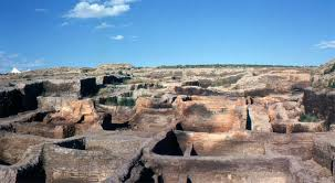
Çatalhöyük, located in modern-day Turkey and dating from approximately 7500 BC to 5700 BC, represents one of the most significant archaeological sites in human history. Often cited as the world's "first city," it challenged the long-held archaeological belief that large-scale, sedentary societies could only emerge after the invention of advanced state bureaucracies or specialized agriculture. Instead, Çatalhöyük suggests that the transition to urban life was a social and architectural evolution that predated the "civilizations" of Mesopotamia by millennia.

1. The Architecture of Density: Life Without Streets

The most striking feature of Çatalhöyük is its layout. The settlement was not a collection of individual detached homes, but a sprawling, cellular honeycomb of mud-brick dwellings packed so tightly together that there were no streets.

  • The Rooftop Economy: To move between houses, residents climbed ladders to their flat rooftops. The entire surface of the "city" functioned as a public plaza where daily activities—such as food processing, social interaction, and craft manufacturing—took place.

  • The Entrance System: Residents entered their homes through a hole in the roof, which also served as the primary ventilation point for the smoke from the central hearth. This design choice provided maximum security and insulation, though it necessitated a high degree of communal cooperation.

2. Social Equality in the Domestic Sphere

Archaeological analysis of the site reveals a society that remained remarkably egalitarian for several centuries.

  • Uniform Household Size: Excavations have found that almost every dwelling was roughly the same size and contained similar types of goods. There is no clear evidence of "palaces" or "elite quarters," suggesting that wealth and status were likely distributed broadly across the population rather than concentrated in a ruling class.

  • The "Domesticated" City: Every house was also a shrine. Beneath the floors of the dwellings, the inhabitants buried their dead, with the living and the ancestors living in direct proximity. This blurring of the boundary between the domestic space and the ritual space indicates that social order was maintained through familial and ancestral ties rather than centralized laws or police forces.

3. Symbolic Expression: The Art of the Walls

The interior walls of these mud-brick homes were frequently replastered and decorated with elaborate murals, suggesting a rich symbolic and religious life.

  • Representational Murals: Many of these paintings depict the dangerous, powerful animals of the local environment—bulls, leopards, and wild boar—often surrounded by human figures, suggesting that the residents viewed themselves as part of a complex ecological hierarchy.

  • The "Mother Goddess" Motif: The discovery of numerous clay figurines, including the famous "seated woman" flanked by leopards, sparked early theories about a matriarchal society. Modern scholarship is more cautious, suggesting these figurines likely functioned as tokens of fertility, power, or personal identity rather than evidence of institutionalized gender-based rule.

4. Economic Complexity: Sustaining a Proto-City

At its peak, Çatalhöyük may have housed between 5,000 and 8,000 people. Feeding such a large population required a sophisticated understanding of the surrounding environment.

  • The Wetland-Agro System: The residents were not exclusively grain-farmers. They practiced a mix of cultivation—wheat, barley, and peas—combined with the intensive harvesting of wild plants and the hunting of local fauna. This "mixed economy" provided a safety net; if a crop failed, the community could rely on the abundant resources of the nearby marshlands.

  • Obsidian Trade: The city was a major hub for the extraction and processing of obsidian, a volcanic glass highly valued for its sharp cutting edge. Çatalhöyük controlled access to the nearby volcanic deposits, trading this material across the region and bringing in exotic goods like sea shells, flint, and copper.

\

Roman Military Uniforms: The Evolution of the Lorica Segmentata

May 20, 2026

The Evolution of the Roman Cuirass: From Chain to Segmented Plate

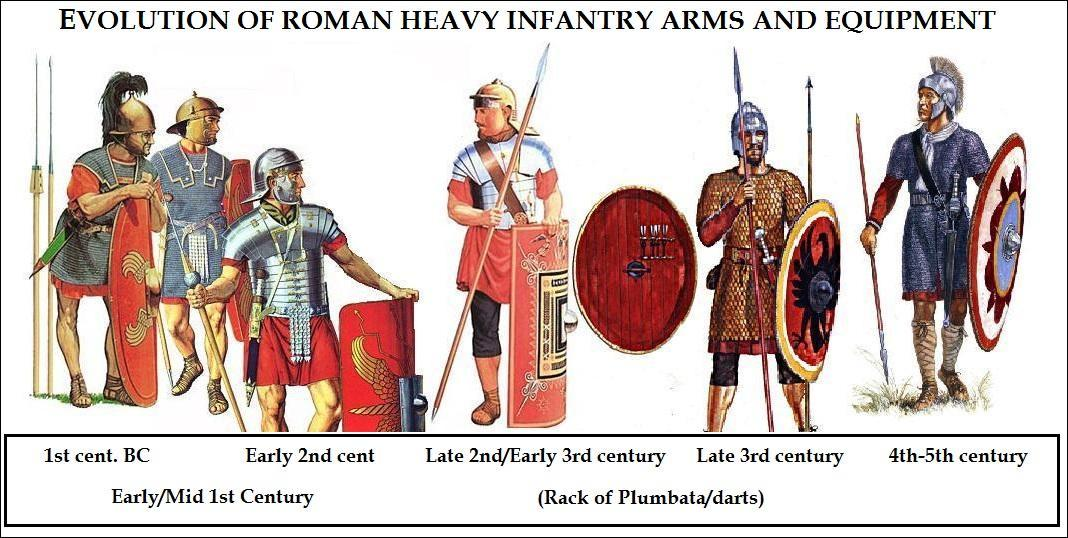
The image of the Roman legionary is almost universally associated with the Lorica Segmentata—the iconic, gleaming plate armor composed of horizontal metal strips. However, this armor was neither the beginning nor the end of Roman military protection. It represents a specific, highly engineered middle period in the evolution of Roman defensive equipment, born from the unique requirements of the early Imperial army.

1. The Predecessor: Lorica Hamata (Chainmail)

For the majority of the Roman Republic, the standard protection was the Lorica Hamata—a chainmail shirt.

  • Design: Composed of thousands of interlocked iron rings, it was flexible, relatively easy to repair in the field, and effective at stopping glancing sword cuts.

  • Limitations: It was heavy, and because it lacked structural rigidity, it offered poor protection against heavy crushing blows (like maces or heavy polearms) and could easily be pierced by high-velocity thrusts.

2. The Innovation: The Lorica Segmentata

By the early 1st century AD, as Rome expanded into the hostile frontiers of Britannia and Germania, the army encountered enemies using long, heavy swords and spears that necessitated superior impact protection. The Lorica Segmentata was the technological answer.

  • Design: It consisted of broad, overlapping iron or steel plates (segmenta) arranged in horizontal bands around the torso and shoulders, secured by internal leather straps, brass hooks, and split pins.

  • Strategic Advantages:

    • Impact Distribution: Unlike chainmail, the rigid plates acted as a shell, spreading the kinetic energy of a blow across a larger surface area, drastically reducing blunt-force trauma to the ribs and internal organs.

    • Thrust Deflection: The curved shape of the plates was designed to deflect thrusts from spears and swords, causing them to slide off rather than bite into the metal.

    • Portability: Perhaps its most brilliant logistical feature was that it could be unbuckled into four main sections (the two shoulder guards and the two torso halves), allowing it to be stored compactly in a leather bag during long marches.

3. The Structural Mechanics

The Lorica Segmentata was an engineering masterpiece, but it relied on a delicate balance of parts.

  • The Internal Skeleton: The plates were held together by leather straps riveted to the inside of the metal. This allowed for a surprising degree of movement, letting the soldier breathe and swing his sword while keeping the torso fully encased.

  • The Vulnerability: The reliance on leather straps was its greatest weakness. In the humid, muddy, or marshy environments of the northern frontiers, the leather would rot, rust, or harden. This made the armor notoriously high-maintenance; legionaries required constant access to oil and replacement straps to keep their gear functional.

4. The Transition: Why the Plate Disappeared

Despite its superior protective qualities, the Lorica Segmentata was largely phased out by the end of the 3rd century AD. The Roman military underwent a strategic shift—prioritizing mobility, lower manufacturing costs, and ease of maintenance in a decentralized, crumbling empire.

  • Logistical Simplification: The production of the Segmentata was a labor-intensive, specialized craft that required skilled blacksmiths. By contrast, the older Lorica Hamata and the simpler Lorica Squamata (scale armor) were much faster and cheaper to mass-produce for the vast, mobile frontier armies.

  • Field Durability: Soldiers on long-term garrison duty in remote outposts found chainmail more reliable because it didn't require the complex, fragile strap-and-buckle system of the plate armor. The Roman military returned to a design philosophy that favored durability over specialized protection.

The Viking Discovery of Greenland: Erik the Red’s Settlement

May 20, 2026

The Norse Expansion into the North Atlantic

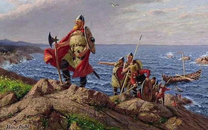
The Viking settlement of Greenland in the late 10th century stands as one of the most audacious maritime achievements of the Middle Ages. Driven by land hunger, social volatility in Iceland, and an innate seafaring culture, Norse explorers pushed beyond the known boundaries of the North Atlantic. The discovery and colonization of Greenland was not a haphazard event, but a carefully orchestrated effort led by one of the era’s most notorious figures: Erik the Red.

1. The Exile of Erik the Red

Erik Thorvaldsson, known as "Erik the Red" for his flaming hair and beard, was a man of violent temper even by the harsh standards of the Norse frontier. Born in Norway, he was forced into exile in Iceland following a series of feuds and homicides committed by his family.

In Iceland, history repeated itself; after killing neighbors in a fresh dispute, he was sentenced to a three-year period of outlawry (exile). Prevented from returning to any settled community, Erik chose to sail into the unknown western seas, searching for lands reported by earlier, lost explorers like Gunnbjörn Ulfsson.

2. Finding the "Green" Land

Around 982 AD, Erik reached the southeastern coast of Greenland. Finding the terrain there mountainous and covered in glacial ice, he sailed south around the island's tip and settled in the southwestern fjords—a region that offered microclimates surprisingly hospitable to pastoral farming.

  • Marketing the Settlement: When his period of outlawry ended, Erik returned to Iceland with a stroke of brilliant psychological marketing. He named the territory "Greenland" (Grænland), hoping the attractive name would entice his fellow countrymen to join him. It worked. In 985 AD, a fleet of 25 ships—carrying livestock, tools, and families—set sail from Iceland. Only 14 ships reached the destination, but the foundation of the Eastern Settlement and Western Settlement was established.

3. The Socio-Economic Foundation

Norse Greenland was a classic "frontier society" that operated on a knife-edge of survival. Despite the harsh environment, the settlers managed to maintain a distinctly Norse lifestyle for several centuries.

  • Pastoral Agriculture: The settlers focused on raising sheep, goats, and a few hardy cattle. They relied heavily on the natural meadows in the fjords to produce enough hay to sustain their livestock through the long, dark winters.

  • The Walrus Ivory Economy: Because Greenland lacked significant resources like timber or iron, the settlers had to find a way to trade with the outside world. Their primary "export" was walrus ivory. As ivory became highly coveted in Europe for Christian religious art and luxury items, the Greenlanders became the primary suppliers, hunting walrus in the northern reaches of Disko Bay and trading the ivory for iron, grain, and timber from Europe.

4. A Culture of Resilience and Adaptation

The Norse Greenlanders were forced to integrate aspects of Inuit technology to survive, though they remained stubbornly attached to their European cultural identity.

  • The Inuit Influence: The Norse likely had intermittent contact with the Dorset and Thule peoples. They adapted Inuit designs for boat-building and perhaps hunting gear, though archaeological records suggest the Norse maintained a sharp cultural divide, refusing to fully adopt the nomadic hunting lifestyle of the Inuit.

  • The End of the Settlement: The Greenland colonies thrived for nearly 400 years but ultimately declined by the mid-15th century. This collapse was likely caused by a "perfect storm" of factors: the Little Ice Age (which made agriculture impossible and ice-locked the shipping routes), a decline in the European demand for walrus ivory, and increased isolation from Norway and Iceland.

The Norse Expansion into the North Atlantic

The Viking settlement of Greenland in the late 10th century stands as one of the most audacious maritime achievements of the Middle Ages. Driven by land hunger, social volatility in Iceland, and an innate seafaring culture, Norse explorers pushed beyond the known boundaries of the North Atlantic. The discovery and colonization of Greenland was not a haphazard event, but a carefully orchestrated effort led by one of the era’s most notorious figures: Erik the Red.

1. The Exile of Erik the Red

Erik Thorvaldsson, known as "Erik the Red" for his flaming hair and beard, was a man of violent temper even by the harsh standards of the Norse frontier. Born in Norway, he was forced into exile in Iceland following a series of feuds and homicides committed by his family.

In Iceland, history repeated itself; after killing neighbors in a fresh dispute, he was sentenced to a three-year period of outlawry (exile). Prevented from returning to any settled community, Erik chose to sail into the unknown western seas, searching for lands reported by earlier, lost explorers like Gunnbjörn Ulfsson.

2. Finding the "Green" Land

Around 982 AD, Erik reached the southeastern coast of Greenland. Finding the terrain there mountainous and covered in glacial ice, he sailed south around the island's tip and settled in the southwestern fjords—a region that offered microclimates surprisingly hospitable to pastoral farming.

  • Marketing the Settlement: When his period of outlawry ended, Erik returned to Iceland with a stroke of brilliant psychological marketing. He named the territory "Greenland" (Grænland), hoping the attractive name would entice his fellow countrymen to join him. It worked. In 985 AD, a fleet of 25 ships—carrying livestock, tools, and families—set sail from Iceland. Only 14 ships reached the destination, but the foundation of the Eastern Settlement and Western Settlement was established.

3. The Socio-Economic Foundation

Norse Greenland was a classic "frontier society" that operated on a knife-edge of survival. Despite the harsh environment, the settlers managed to maintain a distinctly Norse lifestyle for several centuries.

  • Pastoral Agriculture: The settlers focused on raising sheep, goats, and a few hardy cattle. They relied heavily on the natural meadows in the fjords to produce enough hay to sustain their livestock through the long, dark winters.

  • The Walrus Ivory Economy: Because Greenland lacked significant resources like timber or iron, the settlers had to find a way to trade with the outside world. Their primary "export" was walrus ivory. As ivory became highly coveted in Europe for Christian religious art and luxury items, the Greenlanders became the primary suppliers, hunting walrus in the northern reaches of Disko Bay and trading the ivory for iron, grain, and timber from Europe.

4. A Culture of Resilience and Adaptation

The Norse Greenlanders were forced to integrate aspects of Inuit technology to survive, though they remained stubbornly attached to their European cultural identity.

  • The Inuit Influence: The Norse likely had intermittent contact with the Dorset and Thule peoples. They adapted Inuit designs for boat-building and perhaps hunting gear, though archaeological records suggest the Norse maintained a sharp cultural divide, refusing to fully adopt the nomadic hunting lifestyle of the Inuit.

  • The End of the Settlement: The Greenland colonies thrived for nearly 400 years but ultimately declined by the mid-15th century. This collapse was likely caused by a "perfect storm" of factors: the Little Ice Age (which made agriculture impossible and ice-locked the shipping routes), a decline in the European demand for walrus ivory, and increased isolation from Norway and Iceland.

Ancient Egyptian Agriculture: The Nile Flood and the Shaduf

May 20, 2026

The Nile’s Rhythmic Gift

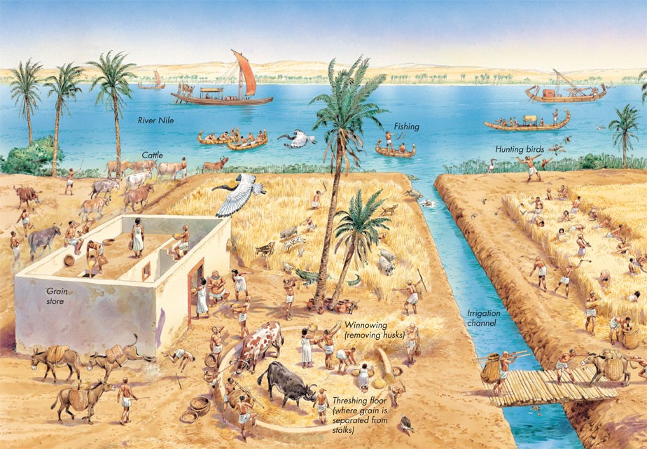
The civilization of Ancient Egypt was not merely "gifted" by the Nile; it was governed by it. Unlike the unpredictable and often destructive flooding of the Mesopotamian rivers, the Nile’s annual inundation—the Akhet—was remarkably consistent. Beginning in mid-summer, the river would crest, depositing a thick, nutrient-rich layer of black silt across the valley floor. This was the foundation of Egyptian survival, turning an otherwise arid desert into one of the most productive agricultural landscapes in the ancient world.

The agricultural year was divided into three distinct seasons based on this cycle:

  1. Akhet (Inundation): The flood season, during which fields were submerged, and farmers often took on state projects or maintenance.

  2. Peret (Emergence/Growth): The waters receded, leaving behind the fertile silt. Farmers plowed and sowed seeds in the damp earth.

  3. Shemu (Harvest/Drought): The final season when crops were harvested and the heat intensified, leading to the low-water period.

The Shaduf: Engineering the Landscape

While the flood provided the soil, it could not reach the higher terraces or sustain crops during the long, arid months of Shemu. To overcome this, Egyptian farmers mastered the use of the shaduf—a simple yet brilliant mechanical device that revolutionized irrigation.

The shaduf consisted of a long, pivoting pole balanced on a vertical support. At one end, a bucket (often made of leather or pottery) was attached to a rope; at the other, a heavy counterweight (usually a large lump of dried mud or stone) was secured.

How the Shaduf Transformed Production:

  • Vertical Efficiency: By using the counterweight, a single farmer could lift significant volumes of water from a canal or the riverbank and pour it into elevated irrigation channels or onto high-lying gardens with minimal physical exertion.

  • Garden Expansion: Before the shaduf, irrigation was limited to the areas naturally reached by the flood. With this device, farmers could cultivate "high ground" crops, allowing for the year-round production of vegetables, herbs, and fruit trees, even when the river level was at its lowest.

  • Water Management: The device allowed for the fine-tuning of water distribution. Farmers could systematically fill a network of small, interconnected trenches, ensuring that water reached specific plots of land precisely when the crops needed it most.

Agricultural Resilience

The combination of the predictable flood and the manual efficiency of the shaduf allowed Egypt to generate massive agricultural surpluses. This surplus was the backbone of the state: it supported the pharaoh’s bureaucracy, fed the skilled laborers who built the pyramids, and provided the wealth required for extensive trade.

By treating the Nile not just as a water source, but as a dynamic system to be managed and engineered, the Egyptians turned a harsh, desert environment into a sustainable agricultural machine that remained stable for over 3,000 years.

The Roman Circus Maximus: The Home of Chariot Racing

May 20, 2026

Introduction: The Epicenter of Mass Entertainment

Nestled in the natural valley between the Palatine and Aventine hills in Rome sits the Circus Maximus (Circus Maximus). While the Colosseum is often celebrated as the definitive arena of Roman spectacle, it was dwarfed in both physical scale and cultural popularity by the Circus. Measuring over 2,000 feet (600 meters) in length and nearly 400 feet (118 meters) in width, it was the largest stadium in the entire Roman Empire, capable of accommodating over 150,000 seated spectators—with some historical estimates pushing that number closer to 250,000.

Chariot racing (ludi circenses) was Rome’s true national obsession, cutting across lines of gender, class, and political status. In the Circus Maximus, common plebeians sat directly alongside aristocratic senators to witness high-velocity, lethal spectacles. The stadium was a triumph of engineering and a complex economic micro-city, functioning as a high-stakes arena where driving factions vied for imperial favor, drivers achieved unimaginable wealth, and emperors controlled the volatile passions of the Roman masses through the calculated policy of "bread and circuses" (panem et circenses).

1. Architectural Anatomy: The Anatomy of the Track

The design of the Circus Maximus evolved over centuries, transforming from an open-air dirt track into a monumental, multi-tiered stone masterpiece under Julius Caesar and the Emperor Trajan. Its structural layout was highly specialized to optimize both athletic competition and spectator safety.

  • The Carceres (Starting Gates): Located at the open, wide end of the stadium was a curved row of 12 vaulted starting gates known as carceres (literally "prisons"). The gates were arranged in a precise geometric arc to ensure that every chariot, regardless of its lane assignment, stood at an mathematically equal distance from the starting line.

  • The Spina (The Central Backbone): Running down the center of the track at a slight diagonal was a massive stone barrier called the spina (spine). The spina divided the track into distinct inbound and outbound lanes. It was decorated with lavish trophies of empire, including fountains, shrines, and towering Egyptian obelisks imported by emperors like Augustus and Constantius II.

  • The Metae (Turning Posts): At either end of the spina stood the metae—three colossal, conical bronze or stone pillars mounted on heavy stone bases. These turning posts marked the most dangerous zones on the track, where drivers had to execute tight, high-speed 180-degree turns while closely packed together.

  • The Cavea (The Seating Tiers): The stadium seating was divided into three distinct vertical zones based on social class. The lowest tiers were made of solid marble and reserved for senators and knights. Above them rose the stone tiers for the ordinary citizens, topped by a wooden upper gallery for the poorest plebeians and women.

2. The Mechanics of the Race

A standard race day at the Circus Maximus featured 24 individual races, each conducted with ritualistic, military precision.

  • The Procession (Pompa Circensis): Before the horses stepped onto the track, a grand religious parade marched through the city gates into the Circus. Led by the emperor or a high magistrate, the procession included musicians, dancers, athletes, and priests carrying the statues of the gods, validating the sporting event as a holy festival.

  • The Mappa Drop: The race commenced when the presiding magistrate dropped a white cloth, known as a mappa, from his high viewing box above the starting gates. This visual signal triggered a system of spring-loaded mechanics that caused the wooden doors of all 12 carceres to snap open simultaneously.

  • The Lap Counters: A standard race consisted of seven consecutive laps around the spina, totaling roughly 3.5 miles (5.6 kilometers). To track the progress of the race for the massive crowd, the spina featured two unique mechanical counting systems: seven large bronze eggs (ova) that were lowered one by one, and seven bronze dolphins that were rotated forward to honor Neptune, the patron god of horses.

3. The Chariot Factions: The Big Four

Chariot racing was completely dominated by four massive, state-regulated enterprises known as factions (factiones). Each faction was defined by a specific color, and fans wore these colors with an intensity that frequently boiled over into violent, urban street riots.

  • The Reds (Russata) and Whites (Albata): The oldest, foundational factions of the republic, traditionally representing summer (red) and winter (white).

  • The Blues (Veneta) and Greens (Prasina): The economic and political titans of the Imperial Era. The Greens were fiercely supported by the common working classes and several emperors (like Caligula and Nero), while the Blues tended to align with the conservative aristocracy.

  • The Corporate Ecosystem: Factions were not merely sports teams; they were massive corporate conglomerates. They owned sprawling breeding farms across North Africa and Spain, employed armies of veterinary surgeons, horse trainers, leather smiths, and talent scouts, and systematically managed the immense betting economies that ran rampant throughout the city.

4. The Driver's Trade: Lethal Professionalism

The men who drove the chariots, known as aurigae or agitatores, were almost exclusively slaves or freedmen. Despite their low legal status, successful drivers became the most celebrated celebrities in the Roman world, their names inscribed on monuments and their faces painted on public murals.

  • The Weaponry and Rigging: Unlike Greek drivers who held the reins loosely in their hands, a Roman driver wrapped the thick leather reins tightly around his own waist to leverage his entire body weight for steering. While this gave the driver immense control, it carried a catastrophic risk: if the chariot flipped, the driver would be dragged to death by his own horses. To prevent this, Roman drivers always carried a sharp, curved knife (falx) tucked into their chest bandages to cut themselves free in an emergency.

  • The Naufragia (Shipwrecks): The catastrophic crashes that occurred around the metae turning posts were known as naufragia (literally "shipwrecks"). Drivers would intentionally crowd their rivals against the stone pillars, attempting to smash their wheels and cause pile-ups, much to the bloodthirsty delight of the crowd.

  • The Scorpus and Diocles Legacies: The rewards for surviving these shipwrecks were astronomical. The famous 2nd-century driver Gaius Appuleius Diocles competed for 24 years, winning 1,462 of his 4,257 races. Upon retirement, his accumulated prize winnings totaled over 35 million sesterces—a sum large enough to personally feed the entire city of Rome for a year, making him the wealthiest athlete in human history.

5. The Structural Evolution: Engineering Challenges

Managing a stadium of such immense proportions required sophisticated structural engineering, particularly regarding crowd control, emergency evacuation, and hydraulic management.

  • Vomitoria (Exits): Like the Colosseum, the Circus Maximus utilized a complex matrix of internal vaulted staircases and exit tunnels called vomitoria. The geometry of these tunnels allowed the stadium to be emptied entirely of its 150,000+ spectators in less than 30 minutes, preventing deadly human stampedes.

  • The Cloaca Maxima Integration: The Circus sat in a low-lying valley that naturally collected rainwater from the surrounding hills. To keep the track dry and firm, Roman engineers routed branches of the Cloaca Maxima (the great sewer line) directly beneath the stadium floor. This network of subterranean stone vaults continuously drained excess groundwater away into the Tiber River.

  • The Safety Moat: To protect the elite senators sitting in the front rows from runaway horses or loose animals during the hunting spectacles (venationes) that were occasionally held on the track, Julius Caesar excavated a 10-foot-wide, 10-foot-deep water canal (euripus) between the track and the stone seats. This moat acted as an impenetrable psychological and physical barrier for the beasts.

6. The Circus as a Social Microcosm

The Circus Maximus was unique because it was the only public venue in Rome where men and women were permitted to sit together without segregation. This turned the stadium into the premier social hub of the capital.

The poet Ovid wrote extensive advice on how to use the crowded benches of the Circus to pick up lovers, noting that the tight seating forced people close together, and that brushing dust off a neighbor's cloak or adjusting their cushion was an ideal way to strike up a conversation.

Beyond romance, the exterior of the stadium was framed by a massive, two-story arcade packed with commercial businesses. When the races were happening, the outside arches functioned as a bustling bazaar filled with taverns, cookshops, astrology booths, brothels, and money-lenders, making the Circus Maximus the continuous, throbbing engine of Roman street life.

Ancient Greek Mythology: Archaeological Sites Connected to the Gods

May 20, 2026

Introduction: The Topography of the Divine

To the ancient Greeks, myths were not abstract fables confined to scrolls; they were historical realities anchored directly into the physical landscape. The gods were thought to inhabit the very valleys, mountains, and springs that the Greeks passed every day. Wherever a strange geological anomaly occurred—a deep cave, a jagged peak, or a sulfuric spring—the Greeks recognized a portal to the divine and built a sanctuary to mark it.

Through the lens of classical archaeology, excavating these sacred sites reveals how deeply myth and architecture were intertwined. Sanctuaries like Delphi, Olympia, and Eleusis were meticulously engineered to amplify the mythical identity of the landscape. By studying the physical ruins, votive offerings, and temple layouts, historians can trace how the Greeks translated their cosmic pantheon into stone, transforming the natural topography of Greece into a physical map of the divine.

1. The Oracle of Apollo at Delphi: The Center of the Universe

Perched precariously on the dramatic, rocky slopes of Mount Parnassus sits Delphi, the panhellenic sanctuary of Apollo. In Greek mythology, this was the Omphalos—the literal navel of the earth—discovered by Zeus when he released two eagles from opposite ends of the cosmos and they crossed paths over this exact spot.

  • The Myth of the Python: Long before Apollo claimed the site, the mountain fissure was guarded by Python, a monstrous serpent child of Gaia (the Earth Mother). Apollo descended from Mount Olympus, slew the beast with his golden arrows, and buried its body beneath the temple floor. The site was renamed Delphi (from delphys, meaning womb), and Apollo established his oracle there to purge his blood-guilt.

  • The Sacred Fissure: The core of the archaeological site is the Adyton—the inner, subterranean chamber beneath the Temple of Apollo. Here sat the Pythia, the high priestess, suspended over a natural chasm on a bronze tripod. Excavations by geologists and archaeologists have revealed that the temple sits directly atop the intersection of two major geological fault lines (the Delphi and Kernaria faults). This cross-faulting caused bituminous limestone to frictionally heat, releasing low concentrations of ethylene and methane gas into the chasm, which likely induced the trance-like, prophetic states of the priestess.

  • The Treasury Route: As consultants walked up the Sacred Way toward the oracle, they passed an architectural gauntlet of civic treasuries built by competing city-states. These structures were packed with spoils of war, serving as a material reminder that every political move in the Greek world was validated by Apollo's divine voice.

2. The Sanctuary of Zeus at Olympia: The Cosmic Throne

Located in the fertile, green valley of Elis in the western Peloponnese, Olympia was the supreme religious sanctuary dedicated to Zeus, the king of the gods.

  • The Pelopion and the Chariot Race: While the site is famous for the Olympic Games, its oldest archaeological core is the Pelopion, a small, enclosure tomb dedicated to the hero Pelops. According to myth, Pelops won the local kingdom—and the hand of Princess Hippodamia—by defeating her murderous father, King Oenomaus, in a high-stakes chariot race by replacing the king's bronze axle pins with beeswax. The Olympic Games were established to honor Pelops' victory and Zeus' oversight of oaths.

  • The Temple of Zeus: Constructed in the 5th century BC, this monumental Doric temple was designed to reflect cosmic order. The east pediment sculptures froze the moment right before Pelops' mythical chariot race, warning athletes against cheating under the eyes of Zeus.

  • The Phidian Workshop: Excavators discovered the literal workshop of the master sculptor Phidias just outside the temple core. Inside the ruins, archaeologists found terra-cotta molds, ivory scraps, tools, and a small black cup inscribed with the words "I belong to Phidias." This workshop was where Phidias engineered one of the Seven Wonders of the Ancient World: the 40-foot-tall Chryselephantine Statue of Zeus. Crafted from sheets of pure gold and ivory over a wooden core, the statue sat enthroned inside the temple, scaled so large that the writer Strabo noted that if Zeus were to stand up, he would unroof the temple.

3. The Cave of Psychro (Dictean Cave): The Birth of a King

High in the Lasithi Plateau of Crete sits the Dictean Cave (or Psychro Cave), a deep, dramatic limestone cavern packed with stalactites and subterranean pools.

  • The Myth of the Infanticide: According to Hesiod's Theogony, the Titan Cronus, terrified of a prophecy that he would be overthrown by one of his children, swallowed his newborn offspring whole. When Rhea gave birth to her sixth child, Zeus, she tricked Cronus by handing him a stone wrapped in swaddling clothes. She then hid the infant Zeus deep inside this Cretan cave.

  • The Kouretes Warriors: To drown out the cries of the baby god, local mythological warriors known as the Kouretes performed a frenzied, loud dance outside the cave entrance, clashing their bronze shields and spears together whenever the infant wept.

  • The Bronze Votive Horde: Excavations inside the dark, watery depths of the cave validated its status as a premier Bronze Age pilgrimage site. Archaeologists recovered thousands of votive offerings dating back to the Minoan era, including bronze double-axes (labrys), miniature shields, bronze statuettes of bulls, and intricately carved libation tables trapped within the stalagmite formations, proving that the cave had been revered as a womb of divine power for over a thousand years before classical Greece emerged.

4. The Telesterion at Eleusis: The Portals of Demeter and Hades

Located just 11 miles northwest of Athens along the Sacred Way sat Eleusis, the home of the Eleusinian Mysteries—the most secretive, profound religious cult of the ancient Mediterranean.

  • The Abduction of Persephone: Myth tells us that Hades, god of the underworld, tore open the earth at Eleusis to abduct Demeter’s daughter, Persephone. Grieving and desperate, Demeter (the goddess of agriculture) wandered the earth in the guise of an old woman, eventually resting at Eleusis by the "Maiden's Well." Out of despair, she withheld her agricultural blessings, plunging the earth into the first barren winter.

  • The Telesterion Chamber: Unlike traditional Greek temples designed to be viewed from the outside, the Telesterion was a massive, square initiation hall engineered from the inside out. It featured a forest of internal columns supporting a roof that could hold thousands of initiates huddled together in absolute, windowless darkness.

  • The Plutonion Cave: Directly adjacent to the Telesterion sits the Plutonion—a shallow, triangular limestone cave that the Greeks identified as the physical gate of Hades through which Persephone ascended and descended every year. During the secret night-time initiation rituals, high priests would emerge from this dark cave into a blazing wall of torchlight to reveal a single ear of reaped wheat, a visual guarantee to the initiates that life could blossom directly out of the dark soils of death.

5. The Sanctuary of Poseidon at Sounion: The Maritime Sentinel

Jutting dramatically into the Aegean Sea at the absolute southernmost tip of the Attic peninsula sits Cape Sounion, dominated by the gleaming white marble ruins of the Temple of Poseidon.

  • The Contest for Athens: Sounion marked the territorial boundary of Athens' maritime empire. In myth, Poseidon was fiercely competitive with Athena for control of Attica. While Athena won the capital city by planting the first olive tree, Poseidon maintained his fierce grip on the jagged coastal headlands, striking the rock with his trident to create a saltwater spring.

  • The Tragedy of Aegeus: Sounion is the tragic geographic anchor of the myth of Theseus and the Minotaur. King Aegeus of Athens stood on the cliffs of Sounion, scanning the horizon for his son’s returning ship from Crete. Theseus had forgotten his promise to swap his ship's black sails for white ones to signal his survival. Seeing the black sails, Aegeus despaired and threw himself off the Sounion cliff into the water below, giving the Aegean Sea its permanent name.

  • The Agri-Marble Engineering: The 5th-century BC temple was constructed out of local Agrileza marble. Unlike Athenian marble packed with iron that turns golden over time, Sounion marble lacks iron, meaning it remains a stark, brilliant white. The architects cut fewer flutes into the columns to prevent erosion from the constant, corrosive sea spray, ensuring the temple stood as a permanent, bright beacon visible to sailors miles out at sea, signaling that they were entering the protected waters

The Roman Catacombs: Early Christian Art and Burial Practices

May 20, 2026

Introduction: The Subterranean Church

Beneath the bustling streets, suburban villas, and ancient highways of Rome lies a vast, silent labyrinth of volcanic tuffs. Stretching for hundreds of miles across multiple tiers, the Roman Catacombs serve as the premier archaeological repository of early Christian society. Constructed primarily between the 2nd and 5th centuries AD, these subterranean cemeteries were excavated out of absolute necessity, driven by a profound cultural clash over how to treat the dead.

For centuries, a persistent popular myth maintained that the catacombs were secret, underground hideouts where Christians huddled to escape imperial persecution. Archaeological excavations have thoroughly debunked this narrative; the catacombs were public, legally recognized communal cemeteries well known to Roman authorities. What makes them an unparalleled cultural treasure is their dual role as the birthplace of Christian art. On these dark, damp volcanic walls, a marginalized, developing community transitioned away from classical pagan iconography, inventing a brand-new visual language of hope, resurrection, and spiritual salvation that ultimately reshaped the artistic trajectory of Western civilization.

1. The Geological and Cultural Catalyst

The creation of the catacombs was born from a convergence of Rome’s unique geology and a radical shift in religious theology.

  • The Tuff Advantage: The landscape surrounding Rome is dominated by tufo, a soft, porous volcanic rock formed by ancient eruptions. When freshly exposed to air, tuff is remarkably soft and can be easily carved out using basic iron pickaxes. However, once exposed to the atmosphere over time, it undergoes a chemical dehydration process that hardens it, allowing engineers to cut deep, vertical shafts and multi-tiered galleries without the structure collapsing.

  • The Clash of Burial Practices: Traditional Roman society practiced cremation, viewing the burning of the body as a clean, standard method of releasing the soul. Christians, however, fiercely rejected cremation. Influenced by Jewish tradition and the literal belief in the future bodily resurrection of the dead at the Second Coming, they mandated inhumation (burial of the intact body).

  • The Real Estate Crisis: As the Christian population of Rome swelled in the 2nd century, the community faced a severe crisis. Roman law strictly forbade burials within the city walls (pomerium) for sanitary reasons. Surface land along the major consular roads like the Via Appia was tightly controlled and prohibitively expensive. To bury thousands of bodies intact without purchasing massive tracts of surface land, Christian communities began digging straight down into the volcanic bedrock.

2. Subterranean Engineering: The Anatomy of a Catacomb

The catacombs were planned, engineered, and managed by a highly specialized guild of Christian laborers known as fossors (fossores). These subterranean miners acted as a combination of cemetery architects, gravediggers, and low-ranking clergy.

  • The Ambulacra (Galleries): Fossors began by sinking a vertical staircase down into the earth. From the base, they tunneled out long, narrow corridors called ambulacra, typically measuring just 3 to 4 feet wide. As space ran out, they dug deeper into the floor, creating multiple vertical levels of galleries connected by steep stairs, sometimes reaching up to five tiers deep.

  • The Loculi (Slot Graves): The walls of the ambulacra were packed with rows of rectangular, shelf-like slots called loculi. Bodies were wrapped in simple linen shrouds dusted with preservatives like Myrrh and tucked into these slots. The opening was then sealed shut with terra-cotta tiles or marble slabs, bound tightly with lime mortar to prevent the spread of odors.

  • The Cubicula (Chambers): For wealthy families or prominent martyrs, fossors cut out private, square burial chambers called cubicula off the main corridors. These rooms functioned as private family chapels.

  • The Arcosolium (Arched Tombs): Within the cubicula, the elite were buried in arcosolia—luxurious tombs featuring a recessed, semi-circular arch carved directly into the wall above a sarcophagus-like chest, providing an ideal canvas for high-quality fresco paintings.

3. The Birth of Christian Iconography: Cryptic Coding

Because Christianity remained an illicit religion (religio illicita) until the Edict of Milan in 313 AD, early Christian art in the catacombs had to operate on two levels. It used a system of cryptic, symbolic coding that looked completely innocent to pagan Roman inspectors but carried deep, theological meaning to baptized believers.

  • The Good Shepherd: The most ubiquitous figure in early catacomb art, such as those found in the Catacomb of Priscilla, is a young, clean-shaven man carrying a sheep across his shoulders. To a pagan, this was a familiar, pastoral artistic motif representing humanitas or seasonal harmony. To a Christian, it was a direct visual citation of the Gospel of John: "I am the good shepherd; the good shepherd lays down his life for the sheep."

  • The Ichthys (The Fish): Because the Greek word for fish, $\text{I-X-Θ-Y-Σ}$, formed an acronym for "Jesus Christ, Son of God, Savior" ($\text{I}\eta\sigma o\tilde{\upsilon}\varsigma$ $\text{X}\rho\iota\sigma\tau\text{ó}\varsigma$ $\text{Θ}\epsilon o\tilde{\upsilon}$ $\text{Y}\iota\text{ó}\varsigma$ $\Sigma\omega\tau\dot{\eta}\rho$), drawing a simple fish silhouette on a tomb marker was a shorthand confession of faith.

  • The Anchor: Outwardly resembling a standard maritime symbol, the anchor was used in the catacombs as a disguised cross, symbolizing the hidden hope of salvation holding the soul steady through the storms of life and death.

  • The Orant Position: Frescoes frequently depict figures standing with their arms extended out wide, palms facing upward in prayer. This ancient gesture, known as the orant stance, represented the soul of the deceased experiencing the peace of paradise, praying for the living family members left behind on earth.

4. Biblical Narratives of Salvation

As the art evolved, full narrative scenes began appearing on the ceilings of the cubicula. Rather than focusing on the suffering or death of Christ—crucifixion scenes are notably absent in early catacomb art—the artists focused exclusively on stories of miraculous deliverance from death, pulling themes from both the Old and New Testaments.

  • Jonah and the Whale: Typically depicted in a multi-paneled cycle, Jonah is shown being thrown overboard, swallowed by a great sea monster (rendered as a classical mythological sea dragon or ketos), vomited out after three days, and resting under a gourd vine. This narrative was heavily utilized because Christ himself had cited Jonah as the definitive prefiguration of his own resurrection.

  • The Three Hebrews in the Fiery Furnace: Taken from the Book of Daniel, this scene shows three young men standing in the middle of raging flames, unhurt, with their arms raised in the orant position. It served as a powerful metaphor for the Christian community's survival through the fires of imperial persecution.

  • The Raising of Lazarus: The premier New Testament motif shows Jesus tapping a swaddled, mummy-like Lazarus with a magic-like wand, commanding him to step out of his tomb. It was placed directly adjacent to burial slots as an absolute visual guarantee to the grieving family that the person buried within would experience the exact same resurrection.

5. Ritual and Remembrance: The Refrigerium

The catacombs were not gloomy places of abandonment; they were active spaces of ritual remembrance where the living and the dead remained in continuous contact.

  • The Funerary Banquet: On the anniversary of a loved one's death, or on the feasts of prominent martyrs, families descended into the catacombs to hold a commemorative ritual meal known as the refrigerium (refreshment).

  • The Infrastructure of Feasting: Many cubicula were excavated with stone benches (triclinia) built right into the walls, allowing family members to recline and dine directly alongside the tombs of their ancestors.

  • The Libation Tubes: Some marble slabs sealing the loculi were engineered with small, vertical lead pipes or holes. During the refrigerium, family members would literally pour wine, milk, and honey down into the pipe, symbolically feeding the deceased loved one below and sharing the meal across the barrier of death.

6. The Post-Constantinian Shift and Ruin

Following the legalization of Christianity under Emperor Constantine, the functional role of the catacombs underwent a dramatic transformation.

  • The Cult of the Martyrs: Christians grew obsessed with being buried as close as possible to the tombs of celebrated martyrs (tumulum sanctorum), believing their proximity would grant them spiritual protection on Judgment Day. This led to massive structural alterations, as fossors violently cut new loculi into existing, priceless frescoes to squeeze in new bodies near holy sites.

  • The Above-Ground Migration: Constantine and his successors began building massive, open-air basilicas directly over the entryways of the most famous catacombs (such as San Sebastiano and Sant'Agnese). Over time, the elite abandoned underground burial entirely, preferring to be buried inside the prestigious floorboards of these new above-ground churches.

  • The Relic Evacuations: By the 8th and 9th centuries AD, as the Roman Empire collapsed and the unguarded suburban catacombs were repeatedly plundered by invading Lombards and Goths, successive Popes ordered a total evacuation. Armies of workers dug up the bones of thousands of anonymous Christians and packed them into carts, transferring them inside the safety of the city walls to be distributed among Rome's urban churches. The entries to the catacombs were sealed, forgotten, and swallowed by overgrowth for centuries, effectively freezing this pristine archaeological archive of early Christian life until its accidental rediscovery during the Renaissance.

← Newer Posts Older Posts →
Featured
image_2026-05-25_222749447.png
May 27, 2026
Roman Lamps: Lighting the Houses and Streets of Antiquity
May 27, 2026
Read more →
May 27, 2026
image_2026-05-25_222704325.png
May 27, 2026
The Viking Grave of the Birka Female Warrior: DNA and Identity
May 27, 2026
Read more →
May 27, 2026
image_2026-05-25_145539974.png
May 27, 2026
Ancient Greek Sculpture: The Transition from Kouros to Classical
May 27, 2026
Read more →
May 27, 2026
image_2026-05-25_222441047.png
May 27, 2026
Ancient Egyptian Mummification: The Chemistry of Natron and Resin
May 27, 2026
Read more →
May 27, 2026
image_2026-05-25_222324084.png
May 27, 2026
The Roman Port of Caesarea: Herod’s Masterpiece of Engineering
May 27, 2026
Read more →
May 27, 2026
image_2026-05-25_145946507.png
May 27, 2026
Roman Wall Painting: The Four Styles of Pompeian Decoration
May 27, 2026
Read more →
May 27, 2026
read more

Powered by The archaeologist