• MAIN PAGE
  • LATEST NEWS
    • Lost Cities
    • Archaeology's Greatest Finds
    • Underwater Discoveries
    • Greatest Inventions
    • Studies
    • Blog
  • PHILOSOPHY
  • HISTORY
  • RELIGIONS
    • Africa
    • Anatolia
    • Arabian Peninsula
    • Balkan Region
    • China - East Asia
    • Europe
    • Eurasian Steppe
    • Levant
    • Mesopotamia
    • Oceania - SE Asia
    • Pre-Columbian Civilizations of America
    • Iranian Plateau - Central Asia
    • Indus Valley - South Asia
    • Japan
    • The Archaeologist Editor Group
    • Scientific Studies
    • Aegean Prehistory
    • Historical Period
    • Byzantine Middle Ages
    • Predynastic Period
    • Dynastic Period
    • Greco-Roman Egypt
  • Rome
  • PALEONTOLOGY
  • About us
Menu

The Archaeologist

  • MAIN PAGE
  • LATEST NEWS
  • DISCOVERIES
    • Lost Cities
    • Archaeology's Greatest Finds
    • Underwater Discoveries
    • Greatest Inventions
    • Studies
    • Blog
  • PHILOSOPHY
  • HISTORY
  • RELIGIONS
  • World Civilizations
    • Africa
    • Anatolia
    • Arabian Peninsula
    • Balkan Region
    • China - East Asia
    • Europe
    • Eurasian Steppe
    • Levant
    • Mesopotamia
    • Oceania - SE Asia
    • Pre-Columbian Civilizations of America
    • Iranian Plateau - Central Asia
    • Indus Valley - South Asia
    • Japan
    • The Archaeologist Editor Group
    • Scientific Studies
  • GREECE
    • Aegean Prehistory
    • Historical Period
    • Byzantine Middle Ages
  • Egypt
    • Predynastic Period
    • Dynastic Period
    • Greco-Roman Egypt
  • Rome
  • PALEONTOLOGY
  • About us
No results found

Chiribiquete: Colombia's Painted Cave Labyrinth

August 2, 2026

Introduction

Located deep within the remote rainforests of southeastern Colombia, Chiribiquete National Park is one of the most extraordinary archaeological and ecological landscapes in the world. Covering more than 4.3 million hectares, it is Colombia's largest national park and a UNESCO World Heritage Site, renowned for its towering sandstone mesas, dense tropical forests, winding rivers, and vast networks of caves and rock shelters. Often referred to as the "Sistine Chapel of the Amazon," Chiribiquete preserves one of the largest and oldest collections of prehistoric rock art ever discovered. Thousands of paintings adorn the walls of cliffs, caves, and rock shelters, with some artworks dating back more than 12,000 years to the end of the last Ice Age. These remarkable paintings provide invaluable evidence of the beliefs, daily life, and environmental knowledge of the Indigenous peoples who inhabited the Amazon for millennia, making Chiribiquete one of South America's most significant archaeological treasures.

The Painted Cave Labyrinth

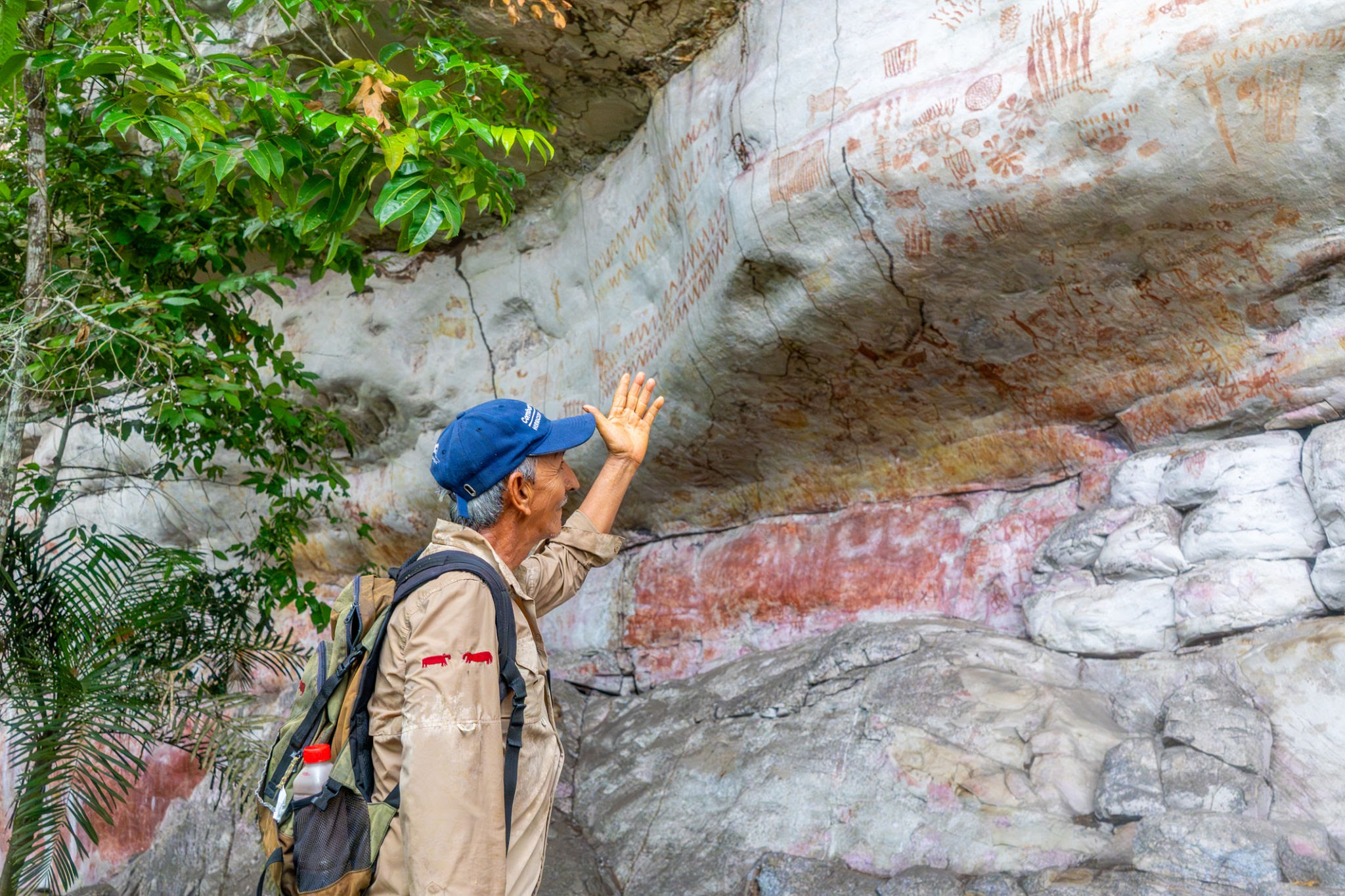
The immense sandstone formations of Chiribiquete, known as tepuis, contain an extensive labyrinth of caves, overhangs, and sheltered rock walls that served as ideal canvases for prehistoric artists. Archaeologists have documented tens of thousands of individual paintings, many of which remain remarkably well preserved because the rock shelters protect them from rain, wind, and direct sunlight. Created using natural red ochre pigments derived from iron-rich minerals, the paintings display an extraordinary variety of subjects that reflect both everyday life and spiritual beliefs.

The artwork depicts humans, jaguars, deer, tapirs, monkeys, birds, fish, turtles, snakes, crocodiles, and countless other animals native to the Amazon rainforest. Hunting scenes show groups of people using bows, spears, and other weapons to pursue game, while ceremonial dances and ritual gatherings reveal the importance of community life and religious practices. Other paintings portray geometric designs, handprints, mythical beings, and symbolic figures that may represent ancestral spirits, cosmological beliefs, or sacred ceremonies. Many images are layered over one another, suggesting that successive generations continued to use the same sacred locations for thousands of years.

Artistic Techniques and Cultural Significance

The artists of Chiribiquete created their paintings primarily with red ochre, a natural pigment rich in iron oxide that has remarkable durability. The pigment was finely ground and mixed with water, plant sap, or animal fats before being carefully applied to the rock surfaces using fingers, brushes made from plant fibers, or simple painting tools. The resulting images have survived for millennia, providing an unparalleled visual record of prehistoric Amazonian culture.

The repeated depiction of the jaguar is especially significant. Throughout many Indigenous Amazonian traditions, the jaguar symbolizes strength, spiritual power, transformation, and the connection between the human and supernatural worlds. Its frequent appearance suggests that Chiribiquete served not only as a habitation area but also as a sacred ceremonial landscape where rituals honoring powerful animal spirits were performed. The paintings therefore represent much more than artistic expression—they preserve religious beliefs, oral traditions, and cosmological knowledge passed down across countless generations.

Archaeological Discoveries

Archaeological investigations have uncovered stone tools, charcoal, hearths, food remains, and other evidence indicating that humans occupied Chiribiquete continuously for thousands of years. Radiocarbon dating suggests that some of the earliest occupations occurred shortly after the first people entered South America, making the site one of the oldest records of human settlement in the Amazon Basin. The abundance of animal imagery has also helped researchers reconstruct ancient ecosystems, showing that many of the species painted on the cave walls continue to inhabit the region today.

Because of its remote location and the presence of isolated Indigenous communities who continue to live without sustained contact with modern society, much of Chiribiquete remains unexplored. Large sections of the park are protected from tourism and development, ensuring the preservation of both its archaeological heritage and its exceptional biodiversity.

Environmental Importance

In addition to its archaeological significance, Chiribiquete is one of the world's most biologically diverse protected areas. Its forests support thousands of species of plants, mammals, birds, reptiles, amphibians, and insects, including many that are endangered or found nowhere else on Earth. The park's dramatic sandstone plateaus create isolated ecosystems where unique species have evolved over millions of years. This combination of outstanding cultural and natural heritage makes Chiribiquete one of the most important conservation areas in the Amazon.

The close relationship between the prehistoric paintings and the surrounding landscape demonstrates that the ancient inhabitants possessed an intimate understanding of their environment. Rather than exploiting the rainforest, they developed sustainable ways of living that respected the balance between humans, animals, rivers, and forests. Their artwork reflects a worldview in which nature and spirituality were deeply interconnected.

Conclusion

Chiribiquete National Park stands as one of the greatest archaeological discoveries in the Amazon, preserving an immense labyrinth of painted caves that documents more than 12,000 years of human history. Its thousands of red ochre paintings depict wildlife, hunting scenes, ceremonies, mythical beings, and sacred symbols that offer unparalleled insight into the lives, beliefs, and artistic traditions of the region's earliest inhabitants. Combined with its extraordinary biodiversity and largely untouched rainforest ecosystems, Chiribiquete represents a rare fusion of cultural and natural heritage. Often called the "Sistine Chapel of the Ancient Amazon," the site has fundamentally expanded our understanding of prehistoric South America, demonstrating that the Amazon was home to sophisticated Indigenous cultures whose artistic achievements, environmental knowledge, and spiritual traditions continue to inspire archaeologists and historians around the world.

2026 LiDAR: Amazon's 10,000 Geoglyphs Revealed

August 2, 2026

Introduction

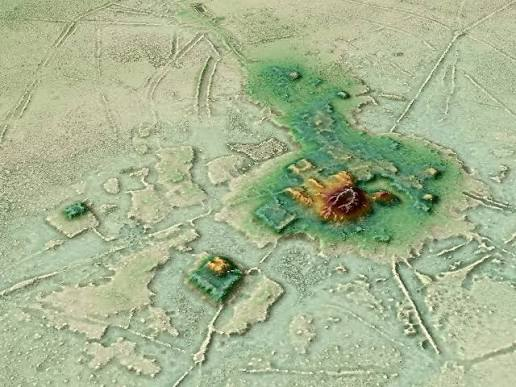
Revolutionary archaeological research conducted in 2026 using advanced satellite imaging and airborne LiDAR (Light Detection and Ranging) technology dramatically transformed the world's understanding of the ancient Amazon Basin. For centuries, archaeologists believed that the dense tropical rainforest had supported only small, scattered communities because the nutrient-poor soils and thick vegetation appeared unsuitable for large permanent settlements. However, the 2026 LiDAR surveys challenged this long-held assumption by revealing an astonishing network of more than 10,000 previously hidden pre-Columbian geoglyphs, earthworks, roads, canals, and settlements concealed beneath the forest canopy. Unlike conventional aerial photography, LiDAR emits millions of laser pulses that penetrate gaps in the vegetation and reflect off the ground surface, allowing researchers to generate highly accurate three-dimensional maps of the landscape even in areas completely covered by rainforest. These discoveries demonstrated that the Amazon was not an untouched wilderness before European contact but instead contained extensive, well-organized societies that reshaped their environment through sophisticated engineering, agriculture, and urban planning.

Earthwork Systems and Agroforestry

The LiDAR surveys mapped an enormous interconnected landscape extending across Acre in western Brazil, northern Bolivia, and other regions of the upper Amazon Basin. Rather than isolated villages, researchers identified networks of settlements connected by carefully engineered infrastructure that reflected long-term planning and regional cooperation. These findings revealed that ancient Amazonian societies invested significant labor in constructing monumental earthworks, transportation routes, and agricultural landscapes while preserving the surrounding forest ecosystem.

One of the most remarkable discoveries was the presence of geometric enclosures, consisting of perfectly shaped circles, squares, rectangles, and octagons measuring approximately 100 to 300 meters in diameter. These impressive earthworks were created by excavating large ditches and using the removed soil to build surrounding embankments. Archaeologists believe these enclosures functioned as ceremonial plazas, locations for public gatherings, religious rituals, political assemblies, and important community events. Some structures also display alignments corresponding with astronomical phenomena such as the sunrise during solstices and equinoxes, suggesting that they may have served as observational markers for seasonal calendars used in agriculture and religious ceremonies.

Connecting many of these settlements were extensive raised causeways, broad elevated earthen roads that stretched for more than 10 kilometers across flood-prone landscapes. These causeways provided reliable transportation routes during the rainy season when much of the surrounding terrain became inundated. By linking villages, ceremonial centers, agricultural fields, and resource areas, the roads facilitated trade, communication, migration, and political interaction between neighboring communities. Their straight alignments and standardized construction indicate careful planning and coordinated labor on a regional scale, demonstrating that these societies possessed advanced organizational abilities comparable to those of other ancient civilizations.

Equally significant was the widespread identification of terra preta, or Amazonian Dark Earth, one of the clearest indicators of long-term environmental management. Unlike the naturally nutrient-poor soils common throughout much of the Amazon, terra preta consists of deep black, highly fertile earth enriched through centuries of human activity. Ancient inhabitants intentionally created these productive soils by combining biochar (charcoal) with organic waste such as food scraps, animal bones, plant remains, ash, pottery fragments, and other biodegradable materials. This process greatly increased the soil's ability to retain nutrients, moisture, and beneficial microorganisms, allowing intensive agriculture to be sustained over many generations. The presence of extensive terra preta deposits demonstrates that pre-Columbian Amazonians actively engineered their environment rather than merely adapting to it, creating productive agricultural systems capable of supporting dense populations while maintaining the surrounding forest.

LiDAR Mapping Process

The success of the 2026 discoveries relied on the remarkable capabilities of LiDAR technology. Mounted on aircraft, sophisticated LiDAR laser arrays emitted millions of laser pulses toward the forest below. While many of these pulses reflected off leaves and branches, a significant number penetrated gaps in the canopy and reached the ground surface. By measuring the time required for each laser pulse to return, researchers generated highly detailed Digital Elevation Models (DEMs) that digitally removed the vegetation and revealed subtle landscape features previously invisible from the ground. These models exposed thousands of geometric earthworks, ancient roads, ditches, embankments, canals, reservoirs, and settlement patterns that had remained hidden beneath the rainforest for centuries. The application of LiDAR has therefore revolutionized Amazonian archaeology by making it possible to study entire regional landscapes rather than isolated excavation sites.

Significance of the Discoveries

The 2026 LiDAR findings fundamentally changed scholarly understanding of the Amazon's ancient past. Instead of being sparsely populated by small nomadic groups, the evidence indicates that much of the region supported large, interconnected populations living in organized settlements linked through transportation networks and cooperative systems of land management. These communities demonstrated sophisticated knowledge of engineering, urban planning, astronomy, and sustainable agriculture while carefully managing forests instead of clearing them completely. Their ability to enrich soils through terra preta, construct monumental ceremonial centers, and maintain extensive infrastructure illustrates that environmental sustainability and urban development were not mutually exclusive in the ancient Amazon.

The discoveries also highlight the importance of Indigenous knowledge and long-term ecological stewardship. Many modern forest landscapes once considered entirely "natural" are now understood to have been shaped by centuries of careful human management. This realization has significant implications for archaeology, ecology, conservation, and climate research, as ancient Amazonian practices may provide valuable insights into sustainable land use and soil restoration in the present day.

Conclusion

The 2026 LiDAR surveys represent one of the most significant archaeological breakthroughs in recent decades, revealing that the pre-Columbian Amazon Basin was home to dense, highly organized societies connected by thousands of monumental earthworks, ceremonial centers, raised causeways, and engineered agricultural landscapes. The discovery of more than 10,000 geoglyphs, together with extensive terra preta deposits and regional transportation networks, demonstrates that ancient Amazonians actively transformed and enriched their environment through advanced engineering and sustainable land management rather than simply living within an untouched rainforest. These findings have fundamentally reshaped our understanding of Amazonian civilization, confirming that the world's largest tropical forest once supported complex urban networks whose technological ingenuity and environmental stewardship rivaled those of many other great civilizations of the ancient world.

Go Thap: Vietnam's Funan-Era Hindu Shrines

August 2, 2026

Introduction

Situated on a series of naturally elevated earth mounds, locally known as "gò," within the seasonally flooded wetlands of Đồng Tháp Province in southern Vietnam, Gò Tháp is one of the most significant archaeological sites associated with the ancient Funan Empire. Flourishing between the 2nd and 7th centuries CE, the site served as an important religious, ceremonial, and settlement center in the Mekong Delta. Its strategic location allowed the inhabitants to benefit from the region's extensive network of rivers and canals while minimizing the risks posed by annual flooding. Archaeological excavations have uncovered the remains of temples, shrines, canals, residential structures, brick tombs, gold ornaments, stone sculptures, inscriptions, ceramics, and ritual objects, revealing that Gò Tháp was both a thriving spiritual center and a hub of economic activity. The site illustrates how the people of Funan successfully combined sophisticated engineering with Hindu religious traditions to create permanent sacred architecture within one of Southeast Asia's most challenging wetland environments.

Phase 1: Wetland Pile Foundations (2nd–4th Century CE)

The earliest phase of construction at Gò Tháp demonstrates the remarkable adaptability of Funanese engineers to the Mekong Delta's flood-prone landscape. Because much of the surrounding terrain was submerged during the rainy season, builders first created raised earthen mounds that elevated important structures above the floodwaters. To strengthen these artificial platforms, they drove massive ironwood (sao) posts deep into the soft ground, forming stable pile foundations capable of supporting heavy timber buildings. Ironwood was selected because of its exceptional strength, durability, and natural resistance to decay in constantly wet conditions. Timber platforms constructed on these foundations provided secure spaces for religious ceremonies, residential buildings, and administrative activities while protecting them from seasonal inundation. This innovative engineering approach allowed permanent settlements to flourish in an environment where conventional construction methods would have been impractical.

Phase 2: Stone and Brick Shrines (5th–6th Century CE)

As the Funan Empire became increasingly prosperous and Hinduism spread throughout the Mekong Delta, Gò Tháp developed into an important religious center marked by the construction of more permanent stone and brick temples. During the 5th and 6th centuries CE, builders erected substantial brick temple foundations using carefully fired bricks arranged with remarkable precision. These shrines housed beautifully carved Vishnu statues, often distinguished by their characteristic mitred crowns, reflecting the growing influence of Indian religious traditions within Funanese society. Alongside these sculptures were sacred linga-yoni altars, symbolic representations of the divine union of Shiva and Shakti, which played a central role in Hindu worship. Devotees performed ritual lustration, pouring water over the linga so that it flowed through the yoni, symbolizing purification, fertility, prosperity, and the continuous cycle of creation. The presence of these shrines demonstrates that Gò Tháp was not only an architectural center but also an important destination for religious ceremonies and pilgrimage.

Phase 3: Mortuary Vaults (Late Funan Era)

During the later period of the Funan civilization, Gò Tháp expanded its religious significance through the construction of elaborate subterranean brick-lined mortuary vaults. These underground tombs reflected increasingly sophisticated funerary practices and beliefs concerning death and the afterlife. Archaeologists have discovered numerous burial chambers containing valuable grave goods, including jewelry, ceramics, beads, and finely crafted gold-leaf sheets engraved with sacred motifs. Many of these delicate gold ornaments depict lotus flowers, revered throughout Indian religions as symbols of purity, spiritual enlightenment, and rebirth, while others portray sacred animals associated with divine protection and prosperity. The careful placement of these symbolic objects within the tombs suggests that they were intended to guide, protect, and bless the deceased during their journey into the next life. These discoveries provide important evidence for the religious beliefs, artistic traditions, and wealth of the Funanese elite.

Key Funan Takeaway

Gò Tháp demonstrates the extraordinary ability of early Funanese architects and engineers to adapt sophisticated Hindu religious architecture to the unique environmental conditions of the Mekong Delta. Rather than attempting to overcome the natural landscape, they worked in harmony with it by constructing buildings on elevated earthen mounds, reinforcing foundations with durable water-resistant ironwood piles, and designing permanent brick shrines capable of withstanding seasonal flooding. This combination of practical engineering and religious architecture illustrates the ingenuity of the Funan civilization and its successful integration of Indian cultural influences into local environmental conditions.

Conclusion

Today, Gò Tháp stands as one of the most important archaeological sites for understanding the history of the Funan Empire and the early development of civilization in the Mekong Delta. Its preserved remains reveal the evolution of settlement planning, hydraulic adaptation, religious architecture, and funerary traditions over several centuries. From the innovative pile-supported foundations that enabled construction in flood-prone wetlands, to the impressive brick Hindu shrines dedicated to Vishnu and Shiva, and finally to the carefully constructed brick-lined mortuary vaults containing beautifully engraved gold artifacts, Gò Tháp offers a comprehensive picture of Funanese engineering, spirituality, and material culture. The site not only highlights the remarkable resilience and creativity of its builders but also demonstrates how one of Southeast Asia's earliest civilizations successfully blended advanced construction techniques with enduring religious traditions, leaving behind a legacy that continues to enrich our understanding of the ancient Mekong world.

Shiloh Mounds: Tennessee's Mississippian Village

August 2, 2026

Introduction

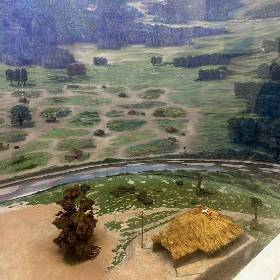
Located within present-day Shiloh National Military Park in southwestern Tennessee, the Shiloh Mounds preserve the remains of a thriving Mississippian village occupied between approximately 1000 and 1450 CE. Long before the famous Civil War battle took place on the same landscape, Native American communities established a prosperous settlement overlooking the Tennessee River, taking advantage of fertile floodplains, abundant wildlife, and strategic river transportation. The site consisted of several platform mounds surrounding a central plaza and served as a regional political, ceremonial, and trading center for neighboring farming villages.

Village Layout and Platform Mounds

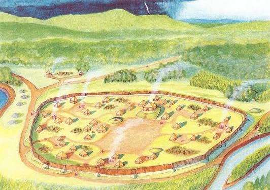
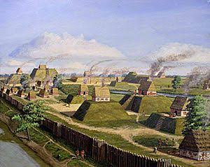
The settlement was organized around a spacious rectangular plaza bordered by six earthen platform mounds. These mounds were constructed through repeated deposits of compacted earth and clay carried in woven baskets. Wooden temples, council houses, and elite residences stood atop the elevated platforms, while ordinary homes surrounded the ceremonial center.

The open plaza functioned as the heart of community life, hosting religious ceremonies, political meetings, athletic competitions, seasonal festivals, and communal feasts. The carefully planned arrangement reflects the organized urban planning typical of Mississippian settlements.

Agriculture and Daily Life

The people of Shiloh practiced intensive farming centered on maize cultivation, supplemented by beans, squash, and sunflower production. The nearby Tennessee River provided fish, freshwater mussels, turtles, and transportation routes, while surrounding forests supplied deer, turkey, and other game.

Residents built rectangular houses using wooden poles, woven cane walls, and clay plaster. Storage pits beneath house floors preserved harvested crops, allowing the community to maintain a stable food supply throughout the year.

Trade and Religious Activities

Shiloh participated in extensive Mississippian trade networks linking communities throughout the Southeast. Archaeologists have recovered shell ornaments, copper objects, decorated pottery, and finely crafted stone tools imported from distant regions.

Religion centered on temples atop the platform mounds, where priests conducted ceremonies honoring ancestors, agricultural spirits, and celestial forces. Public rituals, dances, and seasonal festivals strengthened community identity while reinforcing the authority of hereditary leaders.

Archaeological Importance

Excavations have revealed mound construction phases, domestic structures, storage facilities, pottery workshops, food remains, and ceremonial artifacts that document centuries of occupation before the settlement was eventually abandoned. The site's preservation within a national military park has allowed archaeologists to study one of Tennessee's best-preserved Mississippian communities.

Conclusion

The Shiloh Mounds stand as an important example of a Mississippian river village, illustrating the successful combination of agriculture, trade, ceremonial architecture, and political organization along the Tennessee River. Its platform mounds, central plaza, and rich archaeological remains provide valuable insight into the daily life, engineering achievements, and cultural traditions of the Indigenous societies that flourished in the region centuries before European contact.

Sellars Mounds: Tennessee's Middle Cumberland Site

August 2, 2026

Introduction

Located near Lebanon, Tennessee, within the fertile Middle Cumberland River Valley, the Sellars Mounds represent one of the most significant archaeological sites of the Middle Cumberland Mississippian culture. Occupied between approximately 1000 and 1450 CE, the settlement served as a regional political, religious, and economic center that linked smaller farming communities throughout central Tennessee. The site contained several platform mounds, a central ceremonial plaza, residential villages, storage facilities, and burial areas, reflecting a highly organized society influenced by the broader Mississippian tradition while maintaining distinctive local customs. Its strategic position along the Cumberland River allowed the inhabitants to participate in regional trade networks extending across the southeastern United States.

Settlement Layout and Platform Mounds

Sellars Mounds was organized around a spacious central plaza, surrounded by earthen platform mounds that supported temples, council houses, and the residences of hereditary chiefs. These mounds were built by transporting thousands of basket loads of compacted clay and soil over multiple generations. Their elevated summits provided protection from seasonal flooding while symbolizing political and spiritual authority.

Residential neighborhoods surrounded the ceremonial precinct. Families lived in rectangular wooden houses constructed with timber frames, woven cane walls, and clay plaster. Storage pits, hearths, and workshops indicate that the community maintained a permanent agricultural settlement capable of supporting a sizable population.

Economy and Daily Life

The people of Sellars Mounds relied primarily on the cultivation of maize, beans, squash, and sunflowers, taking advantage of the fertile river terraces of the Cumberland Valley. Hunting deer, wild turkey, rabbits, and fishing in nearby rivers supplemented their agricultural production.

Craft specialists manufactured shell-tempered pottery, stone projectile points, bone tools, shell ornaments, and woven textiles. Long-distance trade brought marine shells from the Gulf Coast, copper from the Great Lakes region, and high-quality chert for toolmaking, demonstrating the community's participation in extensive Mississippian exchange networks.

Religion and Ceremonial Life

Religion formed the center of community life. Temples atop the platform mounds hosted ceremonies honoring ancestors, agricultural spirits, and celestial forces believed to influence fertility and prosperity. The central plaza accommodated seasonal festivals, ritual dances, communal feasts, athletic contests, and political assemblies that reinforced social unity and the authority of local leaders.

Many ceremonial artifacts recovered from the site reflect participation in the Southeastern Ceremonial Complex, indicating strong cultural connections with other Mississippian centers throughout the Southeast.

Archaeological Importance

Excavations have uncovered platform mound construction phases, house foundations, pottery, stone tools, shell ornaments, food remains, and burial features that provide valuable information about the Middle Cumberland culture. Sellars Mounds remains one of Tennessee's most important archaeological sites for understanding the regional development of Mississippian civilization.

Conclusion

Sellars Mounds stands as an important ceremonial and political center of the Middle Cumberland Mississippian culture, demonstrating advanced mound construction, organized agriculture, extensive trade, and sophisticated religious traditions. Its well-preserved earthworks continue to provide valuable insight into the Indigenous societies that flourished in central Tennessee before European contact.

Castalian Springs: Tennessee's Mound and Village

August 2, 2026

Introduction

Located near Castalian Springs in Sumner County, Tennessee, the Castalian Springs Mound Site was one of the largest Mississippian settlements in the Middle Cumberland region. Occupied from approximately 1100 to 1450 CE, the site served as a major political, religious, and residential center surrounded by fertile farmland and natural springs. The settlement included a large platform mound, a central ceremonial plaza, extensive residential neighborhoods, defensive palisades, and burial grounds. Archaeological evidence suggests that Castalian Springs functioned as the capital of a powerful local chiefdom that governed nearby farming communities throughout the Cumberland River Valley.

Settlement Planning

The community was carefully organized around a broad rectangular plaza dominated by a massive platform mound supporting the residence of the chief or an important temple. Residential houses were arranged in organized clusters surrounding the ceremonial center, while storage pits and workshops supported everyday economic activities.

The settlement was enclosed by a substantial wooden palisade constructed from closely spaced upright logs. Defensive gateways controlled movement into the village and protected both the population and the ceremonial precinct from potential attacks.

Agriculture and Trade

Castalian Springs flourished because of its location near fertile floodplains and reliable freshwater springs. Residents cultivated maize, beans, squash, and sunflowers while supplementing their diet through hunting, fishing, and gathering wild plants.

Trade routes connected the settlement with other Mississippian communities throughout Tennessee, Alabama, Mississippi, and the Ohio Valley. Archaeologists have recovered shell ornaments, copper objects, exotic stone materials, and finely crafted ceramics that illustrate the community's participation in long-distance exchange networks.

Ceremonial Activities

Religious ceremonies were conducted atop the platform mound, where priests performed rituals connected to agriculture, ancestor worship, and seasonal cycles. The central plaza hosted communal feasts, public gatherings, diplomatic meetings, ritual dances, and athletic competitions that reinforced political alliances and community identity.

Artifacts associated with the Southeastern Ceremonial Complex demonstrate that Castalian Springs shared many religious beliefs and artistic traditions with other Mississippian centers across the Southeast.

Archaeological Importance

Excavations have revealed house floors, storage pits, defensive palisades, pottery workshops, burial features, and ceremonial objects that provide detailed information about social organization and daily life. Castalian Springs remains one of Tennessee's best-preserved Middle Cumberland archaeological sites.

Conclusion

Castalian Springs represents one of the most important Mississippian chiefdom centers in Tennessee. Its monumental platform mound, organized village layout, defensive fortifications, and extensive trade connections demonstrate the remarkable political organization and engineering achievements of the Middle Cumberland people.

Link Farm: Tennessee's Duck River Temple Mound

August 2, 2026

Introduction

Situated along the Duck River near Columbia, Tennessee, the Link Farm Site was a prominent Mississippian ceremonial center occupied between approximately 1200 and 1450 CE. The settlement served as an important religious and political hub for surrounding farming communities in central Tennessee. Archaeological investigations have revealed a large platform mound, ceremonial plaza, residential structures, storage facilities, and burial areas, making Link Farm one of the most significant prehistoric sites within the Duck River Valley.

Temple Mound Construction

The centerpiece of the settlement was a substantial earthen platform mound, constructed through repeated deposits of compacted clay carried in woven baskets. The flat summit supported a wooden temple or council house overlooking the central plaza below. Elevated architecture protected important buildings from flooding while emphasizing the authority of political and religious leaders.

The mound underwent several construction phases as successive generations enlarged and remodeled the ceremonial center, demonstrating long-term occupation and continued community investment.

Community Life

Families lived in rectangular houses built from wooden posts, woven cane walls, and clay plaster. Agriculture formed the foundation of the economy, with maize, beans, squash, and sunflower cultivation supporting a permanent population. Hunting deer, turkey, and fishing in the Duck River supplemented food production.

Craft specialists produced shell-tempered pottery, chipped stone tools, bone implements, and shell ornaments. Regional trade networks connected Link Farm with neighboring Mississippian communities, facilitating the exchange of raw materials and ceremonial goods.

Religion and Ceremony

The central plaza hosted seasonal festivals, public ceremonies, ritual dances, and communal feasts. Priests conducted religious observances within the temple atop the platform mound, honoring ancestors and agricultural spirits while maintaining the spiritual well-being of the community.

The settlement's ceremonial architecture reflects the widespread Mississippian belief that elevated mounds served as sacred places linking the earthly and spiritual worlds.

Conclusion

Link Farm illustrates the importance of river-based Mississippian ceremonial centers in central Tennessee. Its platform mound, organized settlement, agricultural economy, and religious traditions demonstrate the sophisticated social organization and architectural achievements of prehistoric Indigenous societies along the Duck River.

Hall of the Dead Mounds: Tennessee's Burial Site

August 2, 2026

Introduction

The Hall of the Dead Mounds, located within Tennessee's Middle Cumberland archaeological region, represent an important Mississippian burial complex dating between approximately 1000 and 1450 CE. Rather than serving as a major residential settlement, the site functioned primarily as a sacred mortuary center where elite individuals and respected community members were buried beneath carefully constructed earthen mounds. These burial monuments provide valuable evidence of Mississippian beliefs concerning death, ancestry, and the afterlife.

Burial Mound Construction

The burial mounds were built by depositing successive layers of earth over prepared graves. Wooden mortuary structures were often erected before the final earthen covering was added. Some individuals were interred with elaborate grave offerings, including shell ornaments, decorated pottery, stone tools, copper artifacts, ceremonial pipes, and personal adornments that reflected their social status.

Repeated mound enlargement over time created impressive earthworks that commemorated generations of community leaders and reinforced ancestral traditions.

Mortuary Rituals

Archaeological evidence indicates that funeral ceremonies involved communal gatherings, ritual feasting, prayers, and offerings to honor the deceased. Elite individuals received particularly elaborate burials, demonstrating the existence of hereditary leadership and social ranking within Middle Cumberland society.

Many grave goods contain symbols associated with the Southeastern Ceremonial Complex, reflecting widespread beliefs concerning rebirth, sacred animals, and the journey of the soul after death.

Archaeological Importance

Excavations have uncovered burial pits, ceremonial objects, pottery, shell ornaments, copper decorations, and skeletal remains that allow researchers to study health, diet, social organization, and religious beliefs. These discoveries have greatly expanded understanding of Mississippian mortuary practices throughout Tennessee.

Conclusion

The Hall of the Dead Mounds preserve one of Tennessee's most important examples of Mississippian ceremonial burial traditions. Their carefully constructed earthworks and richly furnished graves reveal the deep spiritual beliefs, social organization, and ancestral reverence that characterized Middle Cumberland societies before European contact.

Bledsoe Creek: Tennessee's Mississippian Hamlet

August 2, 2026

Introduction

Located near Gallatin, Tennessee, along the shores of Bledsoe Creek, this Mississippian hamlet was occupied between approximately 1100 and 1450 CE. Although much smaller than the great ceremonial capitals of the Southeast, Bledsoe Creek provides valuable insight into everyday life in a rural Mississippian farming community. The settlement consisted of residential houses, storage pits, small ceremonial areas, workshops, and nearby agricultural fields that supported families living within the fertile Cumberland River Valley.

Village Organization

Bledsoe Creek was composed of clusters of rectangular wooden houses arranged around open communal spaces rather than large ceremonial plazas. Houses were built using timber frames covered with woven cane and clay plaster, with central hearths providing warmth and cooking facilities.

Storage pits beneath or beside houses preserved maize and other crops, ensuring a reliable food supply throughout the year. Small refuse areas and workshop spaces indicate that families produced many of their own tools, pottery, and household goods.

Agriculture and Craft Production

Residents cultivated maize, beans, squash, and sunflowers while hunting deer, turkey, rabbits, and fishing in nearby streams and rivers. Seasonal gathering of nuts, berries, and wild plants supplemented agricultural production.

Potters manufactured durable shell-tempered ceramics used for cooking, storage, and food preparation. Stone tools, bone needles, shell ornaments, and woven textiles illustrate the diverse household industries that supported daily life.

Regional Connections

Although relatively small, Bledsoe Creek maintained strong ties with larger Mississippian ceremonial centers through trade and cultural exchange. Imported shell ornaments, exotic stone materials, and shared pottery styles demonstrate participation in the wider Mississippian world while preserving local Middle Cumberland traditions.

Archaeological Importance

Excavations have uncovered house remains, storage pits, pottery fragments, food remains, stone tools, and household artifacts that provide an exceptionally detailed picture of rural Mississippian life. Unlike the monumental mound centers, Bledsoe Creek helps archaeologists understand the daily activities of ordinary farming families who formed the foundation of Mississippian society.

Conclusion

Bledsoe Creek represents an excellent example of a Mississippian farming hamlet, illustrating how agriculture, craft production, and community cooperation sustained larger ceremonial centers throughout Tennessee. Its well-preserved archaeological remains offer valuable insight into the everyday lives, economic practices, and cultural traditions of Indigenous families who lived in the Cumberland River Valley centuries before European settlement.

Mound Bottom: Tennessee's Central Palisade Village

August 2, 2026

Introduction

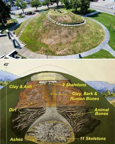
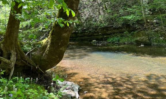
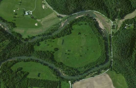
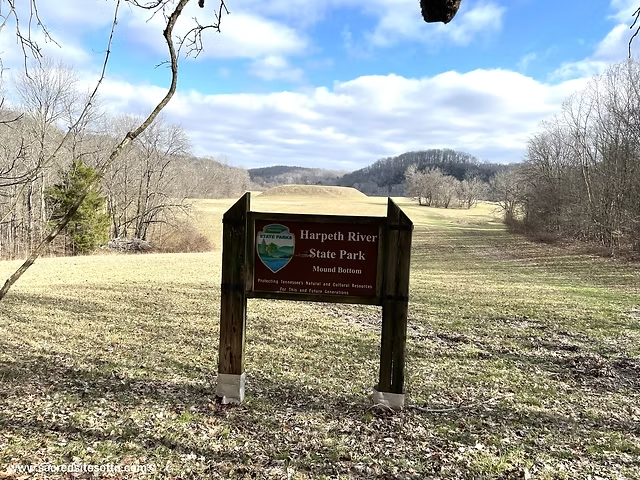
Located along the Harpeth River in present-day Cheatham County, Tennessee, Mound Bottom is one of the largest and most significant Mississippian archaeological sites in the Central Basin region. Occupied between approximately 1000 and 1300 CE, the settlement served as a major political, ceremonial, and economic center for numerous farming communities throughout central Tennessee. Covering nearly 100 acres (40 hectares), the site featured a large central plaza, multiple platform mounds, residential neighborhoods, and an extensive wooden palisade that enclosed the ceremonial precinct. Mound Bottom is considered one of the earliest major Mississippian centers in Tennessee and likely influenced the development of later mound-building communities across the Middle Cumberland region.

Settlement Layout and Monumental Architecture

The heart of Mound Bottom consisted of a large rectangular central plaza surrounded by at least twelve earthen platform mounds. These mounds were carefully constructed by transporting thousands of basket loads of clay and soil from nearby river terraces. Builders deposited the earth in compact layers to create stable, flat-topped platforms capable of supporting substantial wooden buildings.

The largest mound likely housed the residence of the chief or an important temple where priests conducted religious ceremonies. Smaller platform mounds supported council houses, elite residences, ceremonial buildings, and administrative structures. Residential neighborhoods surrounded the ceremonial center, with clusters of rectangular houses connected by well-defined pathways leading toward the plaza.

The Defensive Palisade

One of Mound Bottom's defining features was its massive wooden palisade, constructed from closely spaced upright timber posts surrounding much of the ceremonial center. Archaeological evidence indicates that the wall was reinforced with defensive gateways and may have included projecting bastions or watch stations that allowed defenders to monitor approaching visitors.

Beyond military protection, the palisade established a clear boundary separating sacred ceremonial spaces from the surrounding countryside. Its construction required coordinated labor from hundreds of workers, demonstrating the strong political leadership and organizational capacity of the community.

Agriculture, Trade, and Daily Life

The inhabitants practiced intensive agriculture centered on maize, beans, squash, and sunflowers, taking advantage of the fertile floodplain soils of the Harpeth River Valley. Hunting white-tailed deer, wild turkey, rabbits, and fishing in nearby rivers supplemented their diet throughout the year.

Craft specialists produced shell-tempered pottery, stone tools, bone implements, shell ornaments, and woven textiles. Trade routes connected Mound Bottom with major Mississippian centers such as Cahokia and Moundville, bringing marine shells, copper, exotic stone, and ceremonial objects from distant regions.

Religion and Ceremonial Activities

The large central plaza served as the location for seasonal festivals, religious ceremonies, athletic contests, diplomatic meetings, and communal feasts. Priests performed rituals atop the platform mounds honoring agricultural spirits, celestial forces, and revered ancestors. Ceremonial objects recovered from the site reflect participation in the Southeastern Ceremonial Complex, demonstrating strong cultural ties with Mississippian societies throughout the Southeast.

Archaeological Importance

Excavations have uncovered mound construction stages, house foundations, storage pits, defensive palisades, pottery workshops, food remains, and ceremonial artifacts. These discoveries have provided archaeologists with valuable information about the emergence of Mississippian political organization in central Tennessee and the evolution of complex chiefdoms.

Conclusion

Mound Bottom stands as one of Tennessee's earliest and most influential Mississippian ceremonial capitals, showcasing sophisticated urban planning, monumental earthwork construction, defensive architecture, and thriving agricultural communities. Its platform mounds, palisaded enclosure, and ceremonial plazas demonstrate the remarkable engineering and political achievements of prehistoric Indigenous societies in the Cumberland River Valley.

Pack: Tennessee's Central Basin Mound Site

August 2, 2026

Introduction

The Pack Site, located within Tennessee's Central Basin, is an important Mississippian archaeological settlement occupied between approximately 1100 and 1450 CE. Although smaller than major ceremonial capitals such as Mound Bottom, the Pack Site served as a significant local political and religious center that governed surrounding farming communities. The settlement included one or more platform mounds, residential neighborhoods, storage facilities, and ceremonial spaces, illustrating the widespread adoption of Mississippian cultural traditions throughout central Tennessee.

Settlement Organization

The Pack Site was organized around a modest ceremonial plaza bordered by earthen platform mounds. These mounds supported temples, council houses, and the residences of local chiefs. The surrounding residential district consisted of rectangular houses built from wooden posts, woven cane, and clay plaster.

Storage pits beneath house floors preserved harvested maize and other crops, while workshops produced pottery, stone tools, and household goods. Footpaths connected residential areas with the ceremonial center, reflecting organized settlement planning.

Agriculture and Economy

Residents cultivated maize, beans, squash, and sunflowers using the fertile soils of Tennessee's Central Basin. Hunting deer, turkey, rabbits, and fishing in nearby streams supplemented agricultural production.

The community also participated in regional trade, exchanging shell-tempered pottery, stone tools, shell ornaments, and exotic materials with neighboring Mississippian settlements. These commercial relationships helped spread technological innovations and ceremonial traditions throughout the region.

Ceremonial Life

Religious activities centered on the platform mound and adjacent plaza. Priests conducted seasonal ceremonies celebrating planting and harvest cycles, while community festivals included ritual dances, feasting, and public gatherings. Ancestor veneration and sacred symbolism associated with the Southeastern Ceremonial Complex reinforced the authority of hereditary leaders.

Archaeological Importance

Excavations have revealed house remains, pottery fragments, storage pits, hearths, stone tools, and ceremonial artifacts that provide valuable evidence for understanding the daily lives of Mississippian communities in central Tennessee. The site illustrates how smaller regional centers supported larger political networks while maintaining local cultural traditions.

Conclusion

The Pack Site demonstrates the successful spread of Mississippian culture throughout Tennessee's Central Basin. Its platform mound, organized village, agricultural economy, and ceremonial activities reveal a well-structured Indigenous community that contributed to the broader political and religious landscape of the prehistoric Southeast.

Lindsley Park Mounds: Tennessee's Woodland Burials

August 2, 2026

Introduction

Located in present-day Nashville, Tennessee, the Lindsley Park Mounds represent one of the most important Woodland Period archaeological sites in the Middle Cumberland region. Constructed between approximately 200 BCE and 500 CE, these earthen burial mounds predate the Mississippian civilization by several centuries and are associated primarily with the Middle Woodland and Hopewell Interaction Sphere. The site served as a ceremonial cemetery where communities gathered to honor their dead through elaborate funerary rituals, demonstrating the growing social complexity of prehistoric societies long before the construction of Mississippian platform mounds.

Burial Mound Construction

The mounds were built by carefully placing prepared burials on the ground before covering them with successive layers of soil carried in woven baskets. Over time, repeated ceremonies and additional burials enlarged the mounds into prominent earthworks visible across the surrounding landscape.

Some graves contained log tombs or stone-lined burial chambers, while others were accompanied by carefully arranged grave offerings that reflected the social status and spiritual beliefs of the deceased.

Artifacts and Trade

Excavations have uncovered finely crafted pottery, polished stone tools, copper ornaments, shell beads, mica sheets, ceremonial pipes, and exotic materials imported from distant regions. Many of these items originated through the extensive Hopewell Interaction Sphere, a vast trade network connecting communities throughout eastern North America.

The presence of imported materials demonstrates that Middle Cumberland societies participated in long-distance exchange centuries before the rise of Mississippian civilization.

Religion and Mortuary Practices

The Lindsley Park Mounds functioned primarily as sacred burial grounds rather than permanent settlements. Funeral ceremonies included ritual offerings, communal feasts, and ancestor veneration. The careful placement of grave goods suggests widespread beliefs concerning the afterlife and the continued importance of ancestral spirits within community life.

Archaeological Importance

The Lindsley Park Mounds have provided archaeologists with important evidence regarding Woodland social organization, trade networks, burial customs, and ceremonial traditions. The site bridges the transition between earlier Archaic cultures and the later Mississippian civilizations that would dominate Tennessee centuries afterward.

Conclusion

The Lindsley Park Mounds preserve one of Tennessee's finest examples of Woodland Period ceremonial burial architecture. Their carefully constructed earthworks, elaborate grave goods, and participation in long-distance trade illustrate the remarkable cultural achievements of prehistoric communities long before the emergence of Mississippian chiefdoms.

Old Stone Fort: Tennessee's Prehistoric Hilltop Enclosure

August 2, 2026

Introduction

Situated near Manchester, Tennessee, at the junction of the Duck River and Little Duck River, the Old Stone Fort is one of the most remarkable prehistoric ceremonial enclosures in North America. Constructed during the Middle Woodland Period between approximately 80 and 550 CE, the site occupies a naturally defended peninsula surrounded on three sides by steep river gorges. Despite its name, the structure was not a military fortification but rather a large ceremonial complex used for religious gatherings, trade, and social interaction. Massive earthen embankments reinforced with stone walls enclosed approximately 50 acres (20 hectares), making Old Stone Fort one of Tennessee's most impressive prehistoric monuments.

Engineering and Construction

Builders took advantage of the natural landscape by constructing earthen embankments across the narrow neck of the peninsula while using limestone slabs to stabilize portions of the walls. These embankments reached several meters in height and were carefully engineered to control access to the enclosed ceremonial space.

The strategic placement of gateways suggests that movement into the enclosure followed organized ceremonial routes rather than defensive military purposes. The site's construction demonstrates advanced knowledge of landscape engineering and communal labor organization.

Ceremonial Functions

Archaeological evidence indicates that Old Stone Fort served as a regional gathering place where Woodland communities assembled for seasonal festivals, religious ceremonies, trade fairs, and social events. Rituals likely involved ancestor worship, feasting, exchange of goods, and astronomical observations associated with seasonal cycles.

Unlike Mississippian mound centers dominated by hereditary chiefs, Old Stone Fort appears to have functioned as a communal ceremonial landscape serving multiple surrounding communities.

Artifacts and Archaeological Discoveries

Excavations have uncovered pottery, projectile points, ceremonial pipes, stone tools, shell ornaments, and food remains that reveal repeated seasonal occupation. The variety of artifacts suggests that people traveled considerable distances to participate in gatherings held within the enclosure.

Conclusion

Old Stone Fort represents one of the finest examples of Woodland ceremonial architecture in eastern North America. Its unique hilltop enclosure, sophisticated engineering, and carefully planned ceremonial landscape demonstrate the remarkable social organization and religious traditions of prehistoric Tennessee communities centuries before the rise of the Mississippian civilization.

Seven Mile Island: Tennessee's Mississippian Village

August 2, 2026

Introduction

Located along the Tennessee River near present-day Seven Mile Island in eastern Tennessee, this archaeological site preserves the remains of a thriving Mississippian village occupied between approximately 1000 and 1450 CE. The settlement served as a regional farming community connected to larger ceremonial centers throughout the Tennessee River Valley. Its strategic riverside location provided fertile agricultural land, abundant aquatic resources, and access to major transportation routes that linked communities across the Southeast.

Village Layout

Seven Mile Island consisted of residential neighborhoods arranged around open communal spaces, with one or more platform mounds serving as ceremonial and political centers. Houses were rectangular structures built from timber frames, woven cane walls, and clay plaster, each containing central hearths and underground storage pits.

The platform mound supported a temple or council house overlooking the surrounding settlement, while nearby workshops produced pottery, stone tools, and bone implements used in everyday life.

Agriculture and Subsistence

Residents cultivated maize, beans, squash, and sunflowers on the fertile floodplains of the Tennessee River. Fishing supplied freshwater mussels, catfish, and other river species, while hunting deer, turkey, and small mammals supplemented agricultural production.

Seasonal harvesting of nuts, berries, and wild plants provided additional food resources, creating a balanced subsistence economy capable of supporting permanent village life.

Trade and Cultural Connections

Seven Mile Island participated in regional Mississippian trade networks that distributed shell ornaments, copper artifacts, pottery, and high-quality stone tools throughout the Southeast. Shared ceramic styles and ceremonial objects indicate close cultural relationships with larger Mississippian centers in Tennessee, Alabama, and Georgia.

These connections allowed the community to exchange not only goods but also religious beliefs, artistic traditions, and technological innovations.

Archaeological Importance

Excavations have uncovered house remains, storage pits, pottery fragments, shell-tempered ceramics, food remains, and stone tools that provide valuable information about everyday Mississippian life in the Tennessee River Valley. The site contributes significantly to understanding how smaller farming villages supported the larger ceremonial chiefdoms of the prehistoric Southeast.

Conclusion

Seven Mile Island illustrates the importance of river-based Mississippian villages in sustaining the economic and political foundations of prehistoric Tennessee. Its agricultural prosperity, organized settlement layout, participation in regional trade, and ceremonial traditions demonstrate the adaptability and sophistication of Indigenous communities that flourished along the Tennessee River centuries before European arrival.

Spiro Mounds: Oklahoma's Caddoan Ceremonial Center

August 2, 2026

Introduction

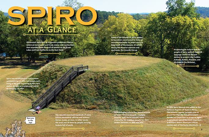
Located along the Arkansas River near present-day Spiro, Oklahoma, the Spiro Mounds represent one of the most important archaeological sites of the Caddoan Mississippian culture. Occupied from approximately 850 to 1450 CE, the site served as a major political, religious, and commercial center connecting the Great Plains, the Mississippi Valley, and the American Southwest. Covering nearly 150 acres (61 hectares), the complex originally consisted of twelve earthen mounds surrounding a large central plaza. Unlike many Mississippian centers, Spiro became renowned for its extraordinary ceremonial wealth, long-distance trade, and elaborate mortuary practices. Although salt production existed in parts of the Caddoan region, Spiro's primary importance was as a ceremonial and trade center rather than a salt-production site.

Settlement Layout and Monumental Architecture

The settlement was organized around a broad rectangular central plaza bordered by twelve platform and burial mounds. The largest platform mound supported the residence of the ruling chief or an important temple where political and religious ceremonies were conducted. Smaller mounds housed council buildings, elite residences, and sacred structures used during seasonal festivals.

The plaza functioned as the center of civic life, accommodating public ceremonies, ritual dances, athletic competitions, diplomatic meetings, and communal feasts. Residential neighborhoods surrounded the ceremonial precinct, with houses constructed from wooden posts covered by woven cane and clay plaster.

The Craig Mound and Sacred Burials

Spiro is particularly famous for the Craig Mound, one of the richest prehistoric burial mounds ever discovered in North America. Over several centuries, priests and elites placed ceremonial offerings within a sacred mortuary chamber constructed from cedar logs.

Archaeologists uncovered thousands of remarkable artifacts, including engraved marine shell cups, copper plates, carved wooden sculptures, woven textiles, pearl beads, stone pipes, and ceremonial masks. Many of these objects originated hundreds or even thousands of kilometers away, demonstrating Spiro's participation in one of North America's largest prehistoric trade networks.

Trade Networks and Economy

The inhabitants cultivated maize, beans, squash, and sunflowers, while hunting bison, deer, turkey, and fishing in the Arkansas River. Agriculture provided the surplus necessary to support priests, artisans, merchants, and political leaders.

Trade connected Spiro with communities throughout the Mississippi Valley, the Great Lakes, the Gulf Coast, the Rocky Mountains, and the American Southwest. Marine shells arrived from the Gulf of Mexico, copper from the Great Lakes, obsidian from the western United States, and turquoise from the Southwest. These imported materials were transformed into elaborate ceremonial objects by highly skilled artisans.

Religion and Ceremonial Life

Religion dominated life at Spiro. Priests conducted rituals atop the platform mounds while sacred ceremonies took place within the central plaza. Many artifacts display imagery associated with the Southeastern Ceremonial Complex, including falcons, serpents, sun symbols, and mythological beings that represented warfare, fertility, and the supernatural world.

The Craig Mound functioned as both a burial monument and a sacred repository for ritual objects, emphasizing the close relationship between ancestor worship, political authority, and religious belief.

Archaeological Importance

Excavations have revealed temples, houses, workshops, storage pits, plazas, burial chambers, and one of the richest collections of Mississippian ceremonial artifacts ever discovered. These findings have made Spiro indispensable for understanding Caddoan civilization, long-distance trade, and prehistoric religious traditions throughout eastern North America.

Conclusion

Spiro Mounds stands as the greatest ceremonial center of the Caddoan Mississippian culture, demonstrating advanced mound construction, extensive trade networks, remarkable artistic achievements, and sophisticated religious practices. Its monumental earthworks and extraordinary archaeological discoveries continue to provide invaluable insight into one of North America's most influential Indigenous civilizations.

Hughes Mound: Missouri's Mississippian Site

August 2, 2026

Introduction

Located in southeastern Missouri, Hughes Mound is an important archaeological site associated with the Mississippian culture, dating between approximately 1000 and 1400 CE. Situated within the fertile floodplains of the Mississippi River, the settlement served as a regional ceremonial and political center connected to larger Mississippian communities such as Cahokia. The site included platform mounds, residential villages, storage facilities, and ceremonial spaces that illustrate the expansion of Mississippian culture throughout the central Mississippi Valley.

Settlement Layout

Hughes Mound was organized around a central ceremonial plaza bordered by one or more platform mounds. These earthen structures supported temples, council houses, and elite residences overlooking the surrounding village. Residential neighborhoods composed of rectangular wooden houses occupied the areas surrounding the ceremonial center.

Builders transported compacted clay and soil in woven baskets, gradually enlarging the platform mounds over multiple generations. Their elevated design protected important buildings from flooding while emphasizing political and religious authority.

Economy and Daily Life

Residents cultivated maize, beans, squash, and sunflowers while hunting deer, turkey, and fishing in nearby rivers. Storage pits preserved agricultural surpluses that supported specialized craftsmen and community leaders.

Potters manufactured shell-tempered ceramics, while artisans produced stone tools, bone implements, and shell ornaments. Long-distance trade brought marine shells, copper, and high-quality stone from distant regions, reflecting Hughes Mound's integration into the wider Mississippian exchange network.

Religion and Community Life

Religious ceremonies centered on temples built atop the platform mounds. Priests performed rituals honoring agricultural spirits, ancestors, and celestial forces, while the central plaza hosted public gatherings, seasonal festivals, communal feasts, and diplomatic meetings.

Artifacts recovered from the site display stylistic influences associated with the Southeastern Ceremonial Complex, demonstrating the community's participation in widespread religious traditions.

Archaeological Importance

Excavations have uncovered pottery, house remains, food remains, ceremonial objects, and construction phases of the platform mounds. These discoveries contribute significantly to understanding the spread of Mississippian culture into southeastern Missouri.

Conclusion

Hughes Mound illustrates the successful expansion of Mississippian civilization throughout the central Mississippi Valley. Its ceremonial architecture, organized settlement, thriving agriculture, and regional trade networks highlight the cultural sophistication of prehistoric communities in southeastern Missouri.

Towosahgy: Missouri's 10-Mound Complex

August 2, 2026

Introduction

Located near East Prairie, Missouri, Towosahgy State Historic Site preserves one of Missouri's finest examples of a Mississippian mound center. Occupied between approximately 1200 and 1400 CE, the settlement served as a regional political, ceremonial, and residential community connected to the broader Mississippian world. The name Towosahgy, meaning "old village" in the Osage language, reflects the site's ancient origins. Archaeologists have identified ten earthen mounds surrounding a large rectangular plaza enclosed by defensive walls, making Towosahgy one of Missouri's most significant prehistoric settlements.

Urban Planning and Earthworks

Towosahgy was carefully planned around a spacious central plaza bordered by ten platform mounds of varying sizes. The largest mound supported a temple or the residence of the ruling chief, while smaller mounds housed ceremonial structures, council houses, and elite residences.

The settlement was protected by a wooden palisade with guarded gateways that enclosed the ceremonial center and nearby residential areas. Builders transported thousands of basket loads of earth to create the platform mounds, which were repeatedly enlarged as the community developed.

Agriculture and Economy

Residents cultivated maize, beans, squash, and sunflowers in the fertile Mississippi River floodplain. Hunting deer, turkey, and waterfowl, along with fishing, supplemented the agricultural economy.

Craft specialists produced shell-tempered pottery, chipped stone tools, shell ornaments, and bone implements. Trade connected Towosahgy with Cahokia and other Mississippian centers, facilitating the exchange of copper, marine shell, stone, and ceremonial goods.

Religion and Society

Temples atop the platform mounds served as sacred spaces where priests conducted ceremonies honoring ancestors and agricultural deities. The central plaza hosted religious festivals, athletic competitions, public assemblies, and communal feasts that strengthened social cohesion.

The site's architecture and ceremonial artifacts demonstrate participation in the broader Mississippian religious tradition shared across much of the southeastern United States.

Archaeological Importance

Excavations have revealed house foundations, defensive palisades, pottery workshops, storage pits, ceremonial buildings, and numerous artifacts that illustrate everyday life in a Mississippian town. Towosahgy remains one of Missouri's best-preserved prehistoric archaeological sites.

Conclusion

Towosahgy represents one of Missouri's most important Mississippian ceremonial centers, showcasing advanced urban planning, defensive engineering, monumental earthwork construction, and thriving agricultural communities. Its ten platform mounds and fortified layout demonstrate the remarkable political and religious organization of prehistoric Indigenous societies.

Kincaid's Fortified Village: Illinois' Palisade Site

August 2, 2026

Introduction

Located along the Ohio River in southern Illinois, Kincaid Mounds included one of the most impressive fortified villages of the Mississippian period. Occupied between approximately 1050 and 1450 CE, the settlement functioned as a regional political and ceremonial center protected by substantial defensive works. Its fortified village illustrates the importance of security, territorial control, and organized leadership within Mississippian chiefdoms while complementing the site's monumental platform mounds and ceremonial plazas.

The Palisade System

The village was enclosed by a massive wooden palisade constructed from closely spaced upright logs deeply embedded in the ground. Controlled gateways regulated access into the settlement, while projecting bastions allowed defenders to observe approaching visitors and monitor vulnerable sections of the wall.

The palisade likely served multiple purposes beyond defense. It clearly defined the sacred and political boundaries of the community while protecting important temples, elite residences, storage facilities, and the central plaza.

Village Organization

Inside the enclosure, rectangular houses surrounded a large ceremonial plaza bordered by platform mounds supporting temples and administrative buildings. Organized pathways connected residential districts with public spaces, reflecting careful urban planning.

Residents cultivated maize, beans, squash, and sunflowers while participating in extensive trade networks that connected Kincaid with Cahokia and other Mississippian centers.

Archaeological Discoveries

Excavations have uncovered postholes from the palisade, house foundations, storage pits, pottery, shell ornaments, copper objects, and ceremonial artifacts. These discoveries demonstrate repeated rebuilding of the defensive wall, suggesting that the fortifications remained an essential feature throughout the settlement's occupation.

Conclusion

Kincaid's Fortified Village highlights the advanced defensive engineering of the Mississippian Civilization. Its impressive palisade, organized settlement, monumental mounds, and ceremonial architecture reveal a highly structured society capable of coordinating large-scale public construction while protecting one of southern Illinois' most important prehistoric communities

Mill Creek Chert Mines: Illinois' Quarry Complex

July 30, 2026

Introduction

Located in southern Illinois near present-day Mill Creek, the Mill Creek Chert Mines formed one of the most important prehistoric quarry complexes in eastern North America. Beginning as early as 700 CE and reaching peak production during the Mississippian Period (1000–1400 CE), Indigenous miners extracted high-quality Mill Creek chert, a durable fine-grained stone prized for manufacturing hoes, axes, knives, spear points, scrapers, and other essential tools. The quarry became a major industrial center supplying stone implements to farming communities throughout the Mississippi Valley.

Mining Operations

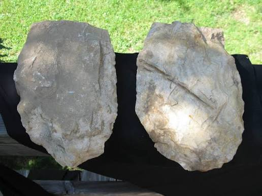
Miners identified exposed chert deposits within limestone bedrock and excavated shallow pits and trenches using stone hammers, antler picks, and wooden digging tools. Large chert nodules were removed, split into workable pieces, and roughly shaped near the quarry before transport.

Specialized craftsmen produced standardized blanks that could later be refined into finished agricultural tools and weapons. This efficient production system allowed large quantities of stone implements to be distributed across extensive trade networks.

Manufacturing and Trade

Mill Creek chert was especially valued for producing hoe blades, which were essential for cultivating large maize fields. Thousands of finished tools traveled hundreds of kilometers through Mississippian exchange networks, reaching communities across Illinois, Missouri, Kentucky, Tennessee, Arkansas, and beyond.

Archaeological evidence shows that Mill Creek chert became one of the most widely distributed stone materials in prehistoric eastern North America, reflecting the economic importance of specialized quarry industries.

Archaeological Importance

Excavations have uncovered quarry pits, manufacturing debris, hammerstones, unfinished tool blanks, and evidence of large-scale stone production. These discoveries reveal one of North America's earliest examples of specialized industrial resource extraction and regional distribution.

The quarry provides crucial evidence for understanding Mississippian technology, labor organization, agricultural expansion, and long-distance trade.

Conclusion

The Mill Creek Chert Mines represent one of the most significant prehistoric quarry and manufacturing complexes in North America. Their large-scale extraction of high-quality chert supplied countless Mississippian communities with essential agricultural and hunting tools, demonstrating the technological innovation, economic specialization, and extensive trade networks that characterized Indigenous civilizations of the Mississippi Valley.

Cave-in-Rock: Illinois' Saltpeter Mining Cave

July 30, 2026

Introduction

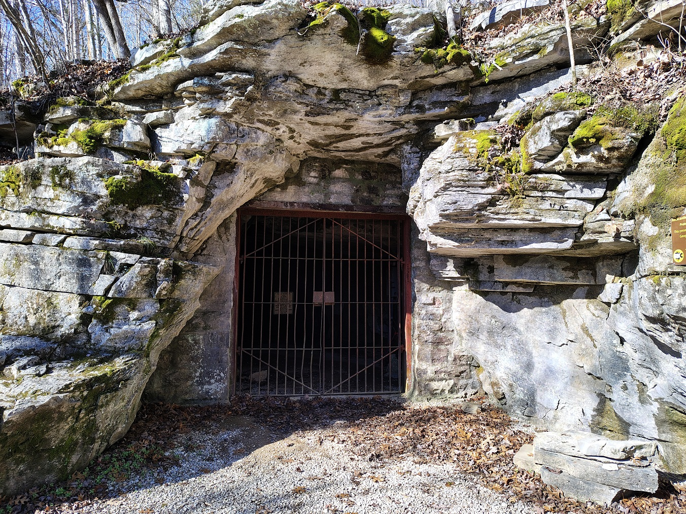
Located along the towering limestone bluffs of the Ohio River in Hardin County, Illinois, Cave-in-Rock is one of the largest natural cave systems in the American Midwest. Formed through thousands of years of erosion within Mississippian limestone, the cave features a massive entrance measuring nearly 55 feet (17 m) wide and extending more than 120 feet (37 m) into the bluff. Long before European settlement, Indigenous peoples visited the cave for shelter, ceremonies, and resource gathering. During the late eighteenth and nineteenth centuries, Cave-in-Rock gained additional importance as a source of saltpeter (potassium nitrate), an essential ingredient in gunpowder. Its strategic river location later made it famous as a refuge for traders, river travelers, and, at times, notorious river pirates.

Geology and Saltpeter Formation

Saltpeter formed naturally inside the cave through the slow decomposition of bat guano mixed with moisture-rich limestone sediments. Over many years, mineral-rich deposits accumulated along the cave floor, producing nitrate-bearing earth suitable for extraction.

During the early nineteenth century, miners excavated these deposits and processed the nitrate-rich soil by soaking it in water, filtering the solution, and evaporating it to produce potassium nitrate crystals. These crystals were then transported to nearby gunpowder mills, where they were combined with sulfur and charcoal to manufacture black powder.

Indigenous Use

Archaeological evidence indicates that Native American communities visited Cave-in-Rock for thousands of years before European arrival. Stone tools, pottery fragments, charcoal, and food remains suggest that the cave functioned as a temporary shelter, hunting camp, storage location, and ceremonial gathering place.

Its prominent location overlooking the Ohio River also made it a recognizable landmark along one of eastern North America's most important prehistoric transportation corridors.

Historical Importance

Beyond its geological significance, Cave-in-Rock became a well-known stop for flatboats and keelboats traveling the Ohio River during the late eighteenth century. Its protected interior offered temporary shelter for travelers, although it also became associated with outlaw gangs and river pirates who exploited the cave's strategic location.

Today, the cave is preserved within Cave-In-Rock State Park, where visitors can explore one of Illinois' most remarkable natural and historical landmarks.

Conclusion

Cave-in-Rock combines remarkable geological formation, prehistoric Indigenous occupation, valuable saltpeter resources, and colorful frontier history. Its limestone cavern, mineral deposits, and strategic river setting make it one of Illinois' most significant natural and archaeological sites.

← Newer Posts Older Posts →
Featured
image_2026-07-26_232306564.png
August 2, 2026
Chucalissa: Tennessee's Shell-Tempered Pottery Site
August 2, 2026
Read more →
August 2, 2026
image_2026-07-26_232234845.png
August 2, 2026
Renfrew Mounds: Mississippi's Moundville Satellite
August 2, 2026
Read more →
August 2, 2026
image_2026-07-26_232049483.png
August 2, 2026
Carson Mounds: Mississippi's Mound Group Metropolis
August 2, 2026
Read more →
August 2, 2026
image_2026-07-26_232020672.png
August 2, 2026
Feltus Mounds: Mississippi's Plaquemine Culture
August 2, 2026
Read more →
August 2, 2026
image_2026-07-26_231915672.png
August 2, 2026
Grand Village of the Natchez: Mississippi's 17th-Century Site
August 2, 2026
Read more →
August 2, 2026
image_2026-07-26_231627735.png
August 2, 2026
Winterville Mounds: Mississippi's Temple Complex
August 2, 2026
Read more →
August 2, 2026
read more

Powered by The archaeologist