• MAIN PAGE
  • LATEST NEWS
    • Lost Cities
    • Archaeology's Greatest Finds
    • Underwater Discoveries
    • Greatest Inventions
    • Studies
    • Blog
  • PHILOSOPHY
  • HISTORY
  • RELIGIONS
    • Africa
    • Anatolia
    • Arabian Peninsula
    • Balkan Region
    • China - East Asia
    • Europe
    • Eurasian Steppe
    • Levant
    • Mesopotamia
    • Oceania - SE Asia
    • Pre-Columbian Civilizations of America
    • Iranian Plateau - Central Asia
    • Indus Valley - South Asia
    • Japan
    • The Archaeologist Editor Group
    • Scientific Studies
    • Aegean Prehistory
    • Historical Period
    • Byzantine Middle Ages
    • Predynastic Period
    • Dynastic Period
    • Greco-Roman Egypt
  • Rome
  • PALEONTOLOGY
  • About us
Menu

The Archaeologist

  • MAIN PAGE
  • LATEST NEWS
  • DISCOVERIES
    • Lost Cities
    • Archaeology's Greatest Finds
    • Underwater Discoveries
    • Greatest Inventions
    • Studies
    • Blog
  • PHILOSOPHY
  • HISTORY
  • RELIGIONS
  • World Civilizations
    • Africa
    • Anatolia
    • Arabian Peninsula
    • Balkan Region
    • China - East Asia
    • Europe
    • Eurasian Steppe
    • Levant
    • Mesopotamia
    • Oceania - SE Asia
    • Pre-Columbian Civilizations of America
    • Iranian Plateau - Central Asia
    • Indus Valley - South Asia
    • Japan
    • The Archaeologist Editor Group
    • Scientific Studies
  • GREECE
    • Aegean Prehistory
    • Historical Period
    • Byzantine Middle Ages
  • Egypt
    • Predynastic Period
    • Dynastic Period
    • Greco-Roman Egypt
  • Rome
  • PALEONTOLOGY
  • About us
No results found

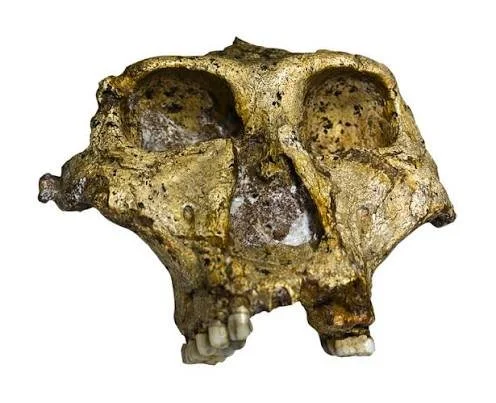
Florisbad: South Africa's 259,000-Year-Old Skull

September 27, 2026

Introduction

Florisbad, located in South Africa's Free State Province, is famous for a remarkably important human fossil discovered in association with a Middle Pleistocene archaeological and environmental record.

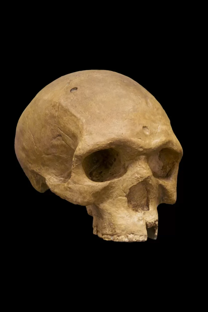
The Florisbad skull is generally dated to roughly 259,000 years ago and has played a major role in discussions about the evolution of Homo sapiens.

Its significance comes from its unusual anatomy.

The specimen appears neither completely archaic nor identical to later anatomically modern humans.

Instead, it represents a population during a period of major evolutionary change.

The Florisbad Site

Florisbad is associated with an ancient spring and lake environment.

Water attracted animals and provided opportunities for human occupation.

Over time, sediments accumulated around the ancient wetland.

These sediments preserved animal remains and archaeological material.

The Skull

The human fossil was discovered in the twentieth century.

It consists primarily of a partial skull.

Its anatomy displays a mixture of characteristics.

Some features resemble earlier Middle Pleistocene humans.

Others are compatible with populations approaching anatomically modern Homo sapiens.

Evolutionary Mosaic

Florisbad is important precisely because it does not fit neatly into one category.

Evolution often produces transitional populations whose anatomy combines multiple characteristics.

This does not mean that Florisbad represents a single "missing link."

The concept of a missing link is misleading because human evolution involved branching populations rather than one straight chain.

Dating

The fossil is commonly associated with an age around 259,000 years.

This places it within the Middle Pleistocene, a period when African populations were undergoing major evolutionary changes.

The date is particularly important because it falls relatively close to the period when early forms of Homo sapiens appear in the African fossil record.

Archaeological Evidence

Florisbad also contains stone tools and animal remains.

These materials provide environmental context.

The human fossil is therefore not an isolated anatomical specimen.

It belongs to a broader archaeological landscape.

Climate

The ancient spring environment changed with climate.

Wet and dry periods altered the lake and surrounding vegetation.

Animals responded to these changes.

Humans exploited the landscape according to available resources.

Human Evolution in Africa

Florisbad supports the broader view that modern human evolution was geographically complex.

Populations in different regions may have exchanged genes.

Anatomical characteristics could spread gradually.

Different populations could maintain distinctive traits while contributing to later Homo sapiens populations.

Relationship to Modern Humans

Researchers have debated exactly how Florisbad relates to later Homo sapiens.

Some classifications have placed the specimen within or near the evolutionary history of early Homo sapiens.

Others emphasize its distinct morphology.

The uncertainty is scientifically valuable.

It demonstrates that the evolutionary history of our species remains an active field of research.

Archaeological Context

The association between fossil, stone tools, fauna, and ancient environmental deposits allows researchers to study both biology and behavior.

The site demonstrates that human evolution cannot be separated from environmental history.

Conclusion

Florisbad provides one of the most important human fossils from Middle Pleistocene Africa.

Its approximately 259,000-year-old skull preserves a mosaic of anatomical features relevant to the emergence of Homo sapiens.

Rather than providing a simple missing link, Florisbad reveals a complex stage in a branching evolutionary history.
Elandsfontein: South Africa's Acheulean Site

September 27, 2026

Introduction

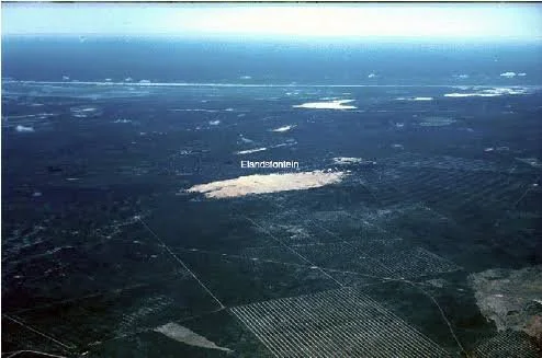
Elandsfontein, near the western coast of South Africa, is one of the most important open-air Acheulean archaeological sites in the country.

Unlike cave sites such as Sterkfontein or Blombos, Elandsfontein preserves archaeological evidence in an open landscape.

This is especially valuable because open-air sites reveal how hominins interacted with broader landscapes rather than concentrating activity inside shelters.

The Acheulean

The Acheulean is an archaeological tradition famous for large cutting tools such as handaxes and cleavers.

These tools required more complex production than simple flakes.

A toolmaker had to select an appropriate stone.

The core then had to be shaped through controlled removals.

The resulting object could have a sharp cutting edge and carefully shaped form.

Elandsfontein's Fauna

Elandsfontein is particularly important because stone artifacts occur alongside large mammal remains.

A Cambridge study describes the Cutting 10 locality as one of the rare southern African sites where Acheulean artifacts and animal bones occur together in primary or near-primary context.

The fauna includes numerous mammal species.

Butchery

Some evidence suggests that people processed animals at the site.

Cut marks and the distribution of skeletal elements can help archaeologists reconstruct carcass processing.

However, not every bone at an archaeological site was necessarily killed or butchered by humans.

Carnivores and natural processes can also accumulate bones.

This is why taphonomic analysis is essential.

Landscape

The environment around Elandsfontein was different from the modern landscape.

The fauna suggests a setting in which grasses played a substantial role.

Large herbivores were abundant.

Water sources supported animal populations.

These conditions created opportunities for hominin hunters and scavengers.

Acheulean Technology

Handaxes are among the most recognizable archaeological objects in human history.

Their repeated forms demonstrate learned technological traditions.

However, their function was probably not limited to one task.

They could have been used for cutting, butchering, woodworking, digging, and other activities.

Skill

Producing a symmetrical handaxe requires considerable motor control.

The maker must predict how a blow will travel through stone.

Too much force can fracture the wrong portion.

Too little force may fail to remove the desired flake.

The final form therefore reflects planning.

Hominin Identity

As with many early Stone Age sites, it is difficult to identify the exact species responsible for the artifacts.

Middle Pleistocene Africa contained multiple hominin populations.

Stone tools are cultural evidence rather than biological fossils.

Unless directly associated with human remains, they should not automatically be assigned to one species.

Open-Air Archaeology

Elandsfontein's open-air context is important because it provides a different perspective from cave archaeology.

Caves can preserve materials unusually well.

Open landscapes are more vulnerable to erosion.

However, open-air sites may preserve activity areas, butchery locations, raw-material sources, and landscape-use patterns that caves cannot.

Research History

Elandsfontein has been studied for decades.

Early collections were sometimes made before modern archaeological recording methods were available.

Later controlled excavations improved understanding of stratigraphy and spatial relationships.

This illustrates how archaeological interpretations can change as methods improve.

Conclusion

Elandsfontein is an important Acheulean landscape because it combines stone technology, large-mammal remains, and open-air archaeological context.

The site provides evidence for hominin interaction with animals and landscapes during the Pleistocene.

Its greatest value lies in demonstrating that early human technological behavior was not confined to caves but occurred across extensive African environments.

Canteen Kopje: South Africa's 2.9M-Year-Old Tools

September 27, 2026

Introduction

Canteen Kopje, located near the Vaal River in South Africa's Northern Cape, is one of the country's most important Earlier Stone Age archaeological sites.

The site is famous for its stone artifacts, particularly Acheulean handaxes and unusual prepared-core technologies.

Its importance is enhanced by the extraordinary chronological depth of the deposits.

The title's reference to "2.9M-Year-Old Tools" should be treated cautiously, however. Controlled excavations have established a very long Early and Middle Pleistocene sequence, but the exact age of individual artifact-bearing levels is more complicated than the title suggests.

The Vaal River

The Vaal River has been a major source of stone artifacts.

Ancient river gravels transported and deposited stones.

Hominins later selected some of these stones as raw materials.

This created an archaeological landscape where geological and human processes overlap.

Diamond Mining

Canteen Kopje is historically significant for another reason: diamond mining.

Industrial mining disturbed many ancient river sediments.

Unfortunately, much archaeological material was collected without controlled excavation.

This damaged archaeological context.

Controlled Excavation

Later researchers conducted controlled excavations.

These investigations revealed stratified archaeological deposits.

This was extremely important because the position of an artifact within a sediment layer provides chronological information.

Without stratigraphy, artifacts become much harder to interpret.

Acheulean Handaxes

Canteen Kopje is famous for handaxes.

These tools demonstrate sophisticated stone reduction.

The maker shaped a stone through repeated controlled strikes.

The final object could have a pointed end and cutting edges.

Victoria West Technology

One of the site's most interesting technological traditions is known as Victoria West.

This involves large prepared cores from which substantial flakes were removed.

Researchers have debated how Victoria West relates to later prepared-core technologies such as Levallois.

A Cambridge study of Canteen Kopje argues that Levallois and Victoria West technologies are rooted in Acheulean technological traditions at the site.

Why Prepared Cores Matter

Prepared-core technology requires planning.

The knapper must shape the core before producing the desired flake.

This means the final flake is not simply an accidental byproduct.

The maker anticipates its shape.

Such technological planning is important evidence for cognitive complexity.

Chronology

Canteen Kopje contains deposits extending across a very long period.

The Cambridge excavation report describes the sequence as extending through the Early and Middle Pleistocene and characterizes it as exceptionally long for South Africa.

This long sequence allows researchers to observe technological change.

Environmental Change

The Vaal River landscape changed over time.

River channels shifted.

Sediments accumulated.

Climate affected vegetation.

Animal communities changed.

Hominins repeatedly returned to the region.

The site therefore preserves interaction between environmental change and technological adaptation.

Raw Material

Stone selection was central.

Hominins selected quartzite and other suitable materials from river gravels.

The ability to identify good stone sources was itself a form of environmental knowledge.

Archaeological Preservation

The site's history also demonstrates the damage that uncontrolled collecting can cause.

Removing artifacts without recording their position destroys information.

A handaxe in a museum is valuable.

A handaxe in a documented archaeological layer is much more valuable because researchers can interpret it within a chronological and behavioral context.

Conclusion

Canteen Kopje is one of South Africa's most important Earlier Stone Age sites.

Its long archaeological sequence, Acheulean handaxes, Victoria West technology, and evidence relevant to prepared-core production provide a detailed record of technological evolution.

The site's story also highlights the importance of archaeological context and the damage caused when artifacts are removed from their original geological setting.

Kromdraai: South Africa's Paranthropus robustus

September 27, 2026

Introduction

Kromdraai is one of the most important fossil-bearing sites in South Africa's Cradle of Humankind.

The site is historically significant because it produced the type specimen of Paranthropus robustus, a heavily built hominin characterized by powerful chewing anatomy.

Kromdraai is also important because its archaeological deposits contain stone tools and evidence of other hominins.

This makes it a particularly valuable site for understanding the diversity of early hominins in southern Africa.

Discovery of Paranthropus robustus

The first major discovery of Paranthropus robustus at Kromdraai occurred in the 1930s.

The specimen became the type specimen for the species.

A type specimen is especially important in biological classification because it establishes the reference point for identifying members of the species.

Robust Anatomy

Paranthropus robustus had powerful chewing adaptations.

Its skull was heavily built.

The teeth were relatively large.

The jaws were strong.

The anatomy has traditionally been interpreted as reflecting adaptation to demanding foods.

Diet

The exact diet of Paranthropus robustus has been debated.

For many years, researchers emphasized hard or tough foods.

Later dental microwear and isotopic studies complicated the picture.

The species may have consumed a broader range of foods than the classic "nut-crushing" model suggested.

This is an important example of scientific revision.

Brain

Despite its robust chewing apparatus, Paranthropus robustus had a relatively small brain compared with later Homo.

This demonstrates that brain expansion was not a universal feature of every hominin lineage.

Different evolutionary strategies existed simultaneously.

Kromdraai A and B

Kromdraai includes two major localities, commonly designated Kromdraai A and Kromdraai B.

Kromdraai B is especially associated with hominin fossils.

Kromdraai A has produced important faunal and archaeological material.

Modern research recognizes that these localities belong to the same broader cave complex.

A recent Cambridge synthesis notes that Kromdraai B produced the type specimen of Paranthropus robustus, while stone tools occur at both Kromdraai A and B.

Stone Tools

Kromdraai has produced Oldowan and early Acheulean-related artifacts.

This raises an important question:

Who made the tools?

The presence of Paranthropus robustus fossils and stone tools in the same broad archaeological landscape does not automatically prove that Paranthropus made them.

Early Homo has also been identified or proposed in the Kromdraai assemblage.

Multiple Hominins

This is one of Kromdraai's greatest scientific values.

The site demonstrates that multiple hominin populations could inhabit the same region.

Human evolution was therefore not a simple sequence in which one species replaced another instantly.

Different hominins overlapped.

They may have exploited different foods or habitats.

The Cradle of Humankind

Kromdraai belongs to the Cradle of Humankind World Heritage landscape.

UNESCO identifies the region as one of the world's most important concentrations of fossil evidence concerning human evolution.

The site's value is therefore both local and global.

Paleoenvironment

The landscape around Kromdraai changed through time.

Cave deposits preserve animal remains that help reconstruct ancient environments.

Predators, herbivores, and smaller mammals provide evidence of ecological conditions.

The hominins lived within these ecosystems rather than outside them.

Evolutionary Side Branch

Paranthropus robustus is generally understood as part of a robust australopithecine lineage rather than a direct ancestor of modern humans.

Its extinction illustrates that evolutionary success is not guaranteed by specialized adaptations.

A lineage can survive for hundreds of thousands of years and eventually disappear.

Scientific Importance

Kromdraai demonstrates why fossils must be interpreted together with geology and archaeology.

A skull reveals anatomy.

Animal fossils reveal ecology.

Stone tools reveal technology.

Sediments reveal geological history.

Only by combining these forms of evidence can researchers reconstruct the past.

Conclusion

Kromdraai is one of the defining sites in the study of Paranthropus robustus.

Its fossils reveal a distinctive hominin adapted to powerful chewing, while associated archaeological evidence demonstrates that the surrounding landscape was occupied by technologically capable hominins.

The site ultimately reinforces one of the central lessons of paleoanthropology: human evolution was a branching process involving multiple species, overlapping populations, experimentation, and extinction.

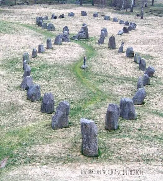
Vendel Cemetery: Sweden's Pre-Viking Elite Graves

September 20, 2026

Introduction

The cemetery at Vendel in central Sweden is one of the most important archaeological sites for understanding the society that existed immediately before the Viking Age.

Its boat burials, richly equipped graves, elaborate helmets, weapons, shields, riding equipment, and imported objects reveal an elite culture of extraordinary complexity.

The cemetery is particularly significant because it provides a bridge between the Migration Period and the Viking Age.

The people buried at Vendel lived in a society characterized by long-distance connections, warrior aristocracies, specialized craftsmanship, and increasingly sophisticated political organization.

The Vendel Period

The archaeological period known as the Vendel Period generally dates from approximately the sixth to eighth centuries CE.

It precedes the Viking Age.

The period witnessed major developments in Scandinavian political organization and material culture.

Warrior elites became increasingly prominent.

Long-distance trade expanded.

Animal-style art became highly sophisticated.

Weaponry and protective equipment became increasingly elaborate.

Vendel cemetery provides some of the clearest archaeological evidence for these developments.

Boat Burials

One of the cemetery's most famous features is its boat burials.

The deceased were placed in boats together with equipment representing their social identity.

Boats were more than transportation.

They were symbols of mobility, wealth, warfare, and status.

A boat burial could therefore communicate that the deceased belonged to a powerful maritime culture.

The practice also anticipated the famous Viking Age ship burials found elsewhere in Scandinavia.

Warrior Equipment

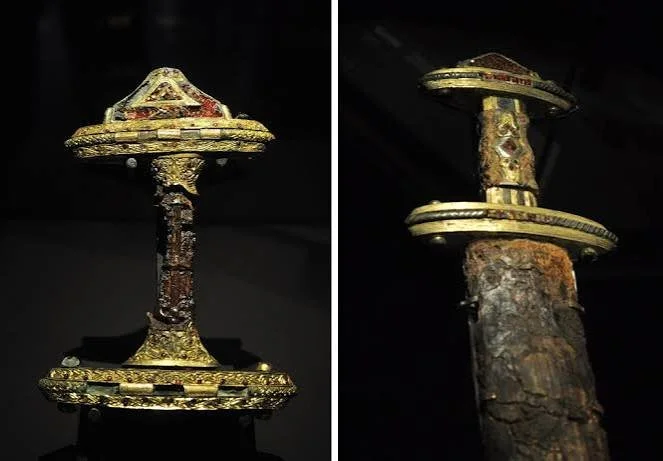
The graves contained extraordinary quantities of military equipment.

Among the objects were:

  • swords;

  • spears;

  • shields;

  • helmets;

  • axes;

  • riding equipment;

  • decorated fittings.

These objects demonstrate that warfare was central to elite identity.

However, the presence of weapons does not mean that every buried individual was simply a battlefield warrior.

Weapons could also function as symbols of rank.

They communicated social status, authority, and membership in an elite warrior culture.

The Famous Helmets

Vendel is particularly famous for its helmets.

These helmets were technologically sophisticated objects consisting of multiple components.

They offered protection while also serving as displays of prestige.

Some featured decorative elements associated with animals and mythological imagery.

The helmet therefore combined practical military technology with symbolic communication.

A warrior entering battle could be physically protected while simultaneously presenting an unmistakable statement of identity.

Shields and Defensive Equipment

Shields were another important element of the burials.

Shield boards were usually constructed from wood, while bosses and fittings were made of metal.

The metal components often survived archaeologically even when the wooden shield disappeared.

Decorated fittings reveal the importance of craftsmanship.

A shield was both a weapon of defense and a visible component of warrior identity.

Horses and Elite Mobility

Some burials included riding equipment.

Horses represented more than transportation.

In elite society, ownership of horses could symbolize wealth, mobility, and social status.

Mounted movement allowed elites to travel between settlements and political centers.

Horses could also play roles in warfare and ceremony.

The inclusion of riding equipment in graves therefore reinforces the impression of a socially powerful warrior aristocracy.

Animal-Style Art

Vendel's objects are famous for their intricate animal ornamentation.

Intertwined creatures, gripping beasts, serpentine bodies, and stylized animals cover many objects.

This artistic tradition is characteristic of Scandinavian elite culture during the period.

The imagery was not merely decorative.

Animals could have symbolic meanings connected with strength, supernatural protection, mythology, or elite identity.

Because written explanations are limited, archaeologists must reconstruct meaning through comparisons between artifacts and later Scandinavian traditions.

International Connections

Vendel's archaeological material demonstrates that Scandinavian elites participated in international exchange.

Some objects or materials show connections with regions beyond Sweden.

Trade routes crossed the Baltic Sea and connected Scandinavia with eastern and western Europe.

The presence of imported goods demonstrates that elite power depended partly upon access to international networks.

Luxury objects could be acquired through trade, diplomatic exchange, warfare, or gift giving.

Burial as Political Performance

A wealthy burial was a public statement.

Funerals allowed communities to display the status of the deceased.

The amount of labor required to construct a grave and prepare its equipment could reinforce the family's prestige.

The ceremony itself could include feasting, ritual activity, speeches, and displays of wealth.

The dead could therefore become instruments through which living elites negotiated social power.

What the Graves Tell Us About Society

Vendel demonstrates that Scandinavian society was highly stratified.

Some individuals possessed enormous quantities of valuable equipment.

Others must have lived far more modestly.

This inequality likely reflected differences in wealth, political authority, military influence, and access to trade.

The cemetery therefore provides archaeological evidence for the emergence of elite institutions that later became characteristic of Viking Age kingdoms.

The Connection to the Viking Age

The similarities between Vendel and Viking Age burials are striking.

Boat burials, warrior equipment, animal-style art, imported goods, and elaborate funerary displays all continued into the Viking Age.

The Viking world did not appear suddenly in the late eighth century.

Many of its cultural foundations were already developing during the Vendel Period.

Vendel therefore helps archaeologists understand the Viking Age as part of a longer process.

Conclusion

Vendel Cemetery is one of Scandinavia's great archaeological windows into the centuries before the Vikings.

Its boats, helmets, weapons, shields, horses, and ornamented objects reveal an elite society in which warfare, mobility, craftsmanship, religion, and political authority were closely interconnected.

The graves demonstrate that Viking Age culture had deep roots.

Long before Scandinavian raiders appeared in the chronicles of western Europe, elite communities in Sweden were already constructing sophisticated military identities, maintaining international connections, and expressing their status through extraordinary material culture.

Vendel is therefore not simply a cemetery.

It is evidence for the world that created the Vikings.

Valsgärde: Sweden's Ship Burials

September 20, 2026

Introduction

Valsgärde is one of the most remarkable burial sites in Sweden and one of the finest archaeological sources for understanding elite Scandinavian culture before and during the early Viking Age.

Located near the Fyris River in Uppland, Valsgärde contains numerous richly equipped graves, including several famous boat burials.

The site reveals a society in which elite identity was expressed through ships, weapons, horses, clothing, imported goods, craftsmanship, and elaborate funerary rituals.

Its archaeological importance lies partly in the exceptional preservation of objects.

Although much of the organic material decayed, many metal fittings, weapons, tools, and decorative objects survived.

Together they provide an extraordinary picture of elite life.

The Boat Graves

The most famous burials at Valsgärde involved boats.

The deceased were placed inside vessels accompanied by extensive grave goods.

These boats were not necessarily intended to function as literal transportation into another world in a simplistic sense.

Instead, they could symbolize mobility, status, military capability, and connection with maritime culture.

The vessel itself became part of the funeral monument.

Weapons of the Elite

The graves contained sophisticated weapons.

Swords were among the most prestigious possessions.

Their manufacture required advanced ironworking skills.

Spears and shields were also common.

The combination of weaponry suggests that the buried individuals belonged to a warrior elite.

However, these objects also served as social symbols.

A decorated weapon could communicate rank even when it was not being used in combat.

Helmets and Protection

Valsgärde is especially important because of its helmets.

Some are decorated with elaborate imagery and constructed using complex metalworking techniques.

Helmets were expensive and difficult to manufacture.

They required skilled specialists capable of forming metal plates, attaching fittings, and producing decorative components.

Their presence indicates access to significant resources.

Horses and Hunting

Several burials included equipment associated with horses and hunting.

Elite hunting was more than recreation.

It could demonstrate physical skill, access to land, control of animals, and aristocratic identity.

Horses similarly represented wealth and mobility.

The inclusion of these objects suggests that elite identity involved more than warfare.

It encompassed the broader lifestyle of an aristocratic warrior.

Clothing and Personal Equipment

Although textiles generally survive poorly, traces and metal fittings can provide information about clothing.

Brooches, buckles, mounts, and other objects indicate how garments were constructed and decorated.

Personal objects also provide clues about gender, status, occupation, and cultural connections.

The grave therefore becomes a partial inventory of an individual's social identity.

Imported Objects

Valsgärde's finds demonstrate long-distance connections.

Some objects and materials have parallels outside Sweden.

These connections show that Scandinavian elites participated in networks stretching across the Baltic and beyond.

Trade was only one mechanism.

Objects could also move through diplomatic gift exchange, marriage alliances, raiding, and migration.

The River and the Landscape

Valsgärde's location near the Fyris River was significant.

Waterways were essential transportation routes.

They connected settlements, agricultural regions, trading centers, and political sites.

The proximity of major elite centers in the wider Uppland landscape suggests that Valsgärde belonged to a politically important region.

Funerary Ritual

A boat burial required substantial preparation.

The community had to organize the construction or preparation of the grave, transport the deceased, assemble the grave goods, and conduct the ceremony.

The funeral could involve large gatherings.

Feasting and public displays of wealth may have accompanied burial.

The ceremony would have reinforced relationships among the living while commemorating the dead.

Religion and the Afterlife

The arrangement of grave goods provides clues about beliefs concerning death.

Weapons, horses, boats, food-related objects, and personal possessions may indicate ideas about continued identity after death.

However, archaeologists must avoid assuming that every grave object had a straightforward religious meaning.

Some objects may have been symbolic.

Others may have represented social status.

Others could simply have been personal possessions.

The meaning of a burial was likely complex.

Valsgärde and Viking Culture

Valsgärde demonstrates that many features associated with Viking Age culture had already developed before the Viking Age reached its traditional beginning.

Boat burial traditions, warrior aristocracies, elite craft production, international exchange, and animal-style art were already established.

The Viking Age was therefore an acceleration and expansion of earlier Scandinavian developments rather than an entirely new civilization.

Archaeological Preservation

Valsgärde is particularly valuable because archaeological excavations recovered large collections of objects.

Metal objects can survive for more than a millennium under favorable conditions.

Organic materials are more vulnerable.

Nevertheless, traces of wood, textiles, leather, and other materials can sometimes survive sufficiently to reveal details of construction.

Modern archaeological analysis can extract information from even tiny fragments.

Conclusion

Valsgärde provides a detailed portrait of Scandinavian elite society before and during the early Viking Age.

Its boats symbolize mobility.

Its weapons represent warrior status.

Its helmets reveal sophisticated craftsmanship.

Its horses demonstrate wealth and aristocratic identity.

Its imported objects demonstrate international connections.

Its graves demonstrate the enormous social importance of funerary ceremony.

The site reminds us that Viking civilization was built upon centuries of cultural development.

The ships and warriors later associated with Viking expansion did not emerge from nowhere.

Their roots can be seen in the elite communities represented by Valsgärde.

Boat Graves of Salme: Estonia's 8th-Century Warriors

September 20, 2026

Introduction

The boat graves at Salme in Estonia are among the most important archaeological discoveries for understanding the earliest stages of Viking-Age maritime warfare.

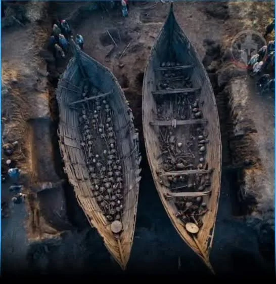
Discovered on the island of Saaremaa, the graves contained the remains of dozens of individuals buried in two boats along with weapons, gaming pieces, animal remains, and other objects.

Their significance is enormous.

The burials date to the eighth century, before the conventional beginning of the Viking Age in many historical narratives.

They therefore provide evidence for organized Scandinavian maritime activity at a surprisingly early date.

Discovery of the Boats

The archaeological discoveries revealed two boat burials.

The larger vessel contained numerous individuals and substantial quantities of military equipment.

The second boat was smaller and contained fewer individuals.

The arrangement indicates that the boats were used for funerary purposes after a violent event or military expedition.

The exact circumstances remain uncertain.

Archaeologists continue to debate whether the individuals died in battle, were killed after combat, or were deliberately buried following an expedition.

Scandinavian Origins

The artifacts strongly suggest that many of the buried individuals originated from Scandinavia.

Weapons, clothing elements, and other objects have parallels in Swedish and broader Scandinavian archaeological traditions.

Some researchers have proposed connections with central Sweden, although identifying exact geographic origins is difficult.

Scientific methods such as isotope analysis and ancient DNA research can provide additional evidence.

These methods allow researchers to investigate diet, mobility, ancestry, and biological relationships.

Weapons

The graves contained numerous weapons.

Swords were among the most significant.

Spears and shields were also represented.

The quantity of military equipment suggests that the group consisted largely of warriors.

This is particularly important because it demonstrates that organized Scandinavian seaborne expeditions existed before the famous Viking raids on places such as Lindisfarne.

The Evidence of Combat

Human remains from the graves preserve evidence relevant to violence.

Trauma patterns can sometimes reveal whether individuals experienced injuries before death.

However, the absence of visible wounds does not necessarily mean that people did not die violently.

Soft-tissue injuries leave no archaeological trace, and some forms of trauma may be difficult to detect.

The archaeological evidence therefore has to be combined with contextual analysis.

The Ships

The boats themselves provide important technological information.

They were constructed using Scandinavian boatbuilding traditions.

Their wooden components had been arranged in ways consistent with clinker-built construction.

Clinker construction involves overlapping planks attached along their edges.

This technique produced lightweight but flexible vessels capable of operating effectively in coastal waters.

The Salme boats therefore provide evidence for the maritime technology that later became central to Viking expansion.

Gaming Pieces

The presence of gaming equipment is particularly interesting.

Gaming pieces have been found in many Scandinavian elite burials.

Games could be associated with strategy, social interaction, and elite leisure.

Their presence in a warrior burial suggests that the individuals were not represented exclusively through violence.

They were members of a culture with complex social identities.

Burial and Status

The burial itself required significant organization.

Transporting bodies, constructing or preparing the burial vessels, assembling weapons, and arranging the grave goods required coordinated labor.

This suggests that the group belonged to a socially organized community.

The burial may also have been intended to preserve group identity.

The Meaning of the Mass Burial

Why were so many people buried together?

This remains one of the most fascinating questions.

One possibility is that they died during a military expedition.

Another is that they were defeated by local inhabitants and subsequently buried together.

The archaeological evidence does not allow researchers to reconstruct every event with certainty.

This uncertainty is scientifically valuable.

Archaeology provides evidence, but evidence does not always produce a single uncontested narrative.

Salme and the Viking Age

The Salme graves challenge traditional ideas about when Viking activity began.

The eighth century is often treated as the threshold of the Viking Age.

Yet Salme demonstrates that Scandinavian maritime warfare and long-distance expeditions were already occurring.

The famous raids of the late eighth and ninth centuries were therefore part of a longer development.

The Baltic Sea as a Zone of Interaction

The Baltic was not a barrier separating communities.

It was a transportation network.

Scandinavian sailors could cross between islands and coastlines.

Trade, migration, warfare, and cultural exchange occurred across the sea.

Salme illustrates the importance of these maritime connections.

Modern Scientific Research

Modern investigation of the Salme burials has employed multiple scientific techniques.

Bioarchaeology can reveal age, sex, trauma, and health.

Isotope analysis can provide clues about geographical mobility and diet.

Ancient DNA can investigate biological relationships and ancestry.

Artifact analysis can reveal technological traditions.

Together, these methods produce a much more detailed picture than traditional excavation alone.

Conclusion

The Salme boat graves provide extraordinary evidence for the early development of Viking maritime culture.

They demonstrate that Scandinavian warriors were traveling across the Baltic in organized groups before the Viking Age's most famous raids.

Their weapons reveal military organization.

Their boats demonstrate advanced maritime technology.

Their gaming pieces and personal equipment reveal elite culture.

Their burial demonstrates complex social and funerary practices.

Salme therefore occupies a crucial place in the history of the Viking world.

It shows that the Viking Age did not begin suddenly with a single raid.

Its foundations were already being laid across the Baltic generations earlier.

Rõuge: Estonia's Bronze Age Hillfort

September 20, 2026

Introduction

Rõuge is an important archaeological site in southeastern Estonia that provides evidence for prehistoric settlement, fortification, agriculture, and community organization.

The site belongs to a landscape shaped by lakes, forests, agricultural land, and natural elevations.

Hillforts were among the most distinctive settlement forms in prehistoric and early medieval northeastern Europe.

They could serve as defensive strongholds, communal gathering places, elite residences, or refuges during periods of conflict.

Rõuge helps archaeologists investigate how communities adapted to changing political and economic conditions in the Baltic region.

The Landscape

Rõuge's natural environment played an important role in settlement development.

Lakes provided fish and water.

Forests supplied timber, wild resources, and fuel.

Agricultural land supported cultivation and livestock.

Elevated terrain offered strategic advantages.

The relationship between settlement and environment was therefore fundamental.

Fortification

Hillforts were usually constructed in locations where natural slopes could supplement artificial defenses.

People could reinforce vulnerable approaches using earthworks, wooden structures, ditches, and palisades.

The labor required to construct these defenses suggests some degree of community organization.

A fortification was not simply a military structure.

It was also a statement that the inhabitants possessed the ability to organize collective labor.

Everyday Life

Archaeological evidence from settlements such as Rõuge can reveal ordinary activities.

People cultivated crops.

They raised animals.

They processed food.

They produced pottery.

They worked wood, bone, stone, and metal.

Homes would have contained hearths used for cooking and heating.

Waste accumulated around living areas, creating archaeological deposits that survive for centuries.

Agriculture

Agriculture was essential to the survival of settled communities.

Crops suitable for the regional climate could include barley, wheat, rye, oats, and other plants depending on the period.

Farmers also kept livestock.

Agricultural production created food surpluses that could support specialists and warriors.

The relationship between farming and fortification was therefore significant.

Communities with agricultural resources could invest more heavily in defensive structures.

Trade and Exchange

Rõuge existed within broader networks connecting Estonia with neighboring regions.

Objects and raw materials could move across local and long-distance routes.

Baltic communities participated in exchange networks involving metals, amber, furs, ceramics, and other goods.

The presence of non-local materials can reveal these connections.

Conflict and Defense

Fortifications imply the possibility of conflict.

However, archaeologists must be cautious.

A fortified site does not necessarily mean that warfare occurred continuously.

Communities may have constructed defensive structures because conflict was possible or because fortification communicated political authority.

The psychological effect of a stronghold could be as important as its military function.

Social Organization

The construction and maintenance of a hillfort required cooperation.

People had to gather materials, construct walls, maintain defensive features, and coordinate settlement activities.

This indicates a community capable of collective organization.

Leadership may have been exercised by local elites, chiefs, or communal institutions.

Archaeological Methods

Archaeologists reconstruct prehistoric settlements using multiple types of evidence.

Excavations reveal layers of occupation.

Pollen analysis can reconstruct vegetation and agricultural activity.

Animal bones reveal diet and livestock management.

Charcoal provides evidence about fuel and environmental conditions.

Artifact analysis reveals technology and trade.

Together, these methods reconstruct the environment as well as the human settlement.

The Broader Baltic Context

Rõuge should not be studied in isolation.

The Baltic region contained numerous communities connected through trade, migration, conflict, and cultural exchange.

Estonia occupied a strategic position between Scandinavian, eastern Baltic, and eastern European networks.

This location made the region an important crossroads.

Conclusion

Rõuge illustrates the complexity of prehistoric Estonian society.

Its settlement and fortification demonstrate organized communities capable of defending territory, producing food, manufacturing tools, and participating in wider networks.

The site reminds us that the Baltic was never a peripheral world.

It was a dynamic region where communities developed distinctive traditions while interacting with their neighbors.

Rõuge's archaeological remains provide an important window into this long and complicated history.

Asva: Saaremaa's Iron Age Fort

September 20, 2026

Introduction

Asva, located on the island of Saaremaa in Estonia, is one of the most important prehistoric fortified settlements in the eastern Baltic.

The site is particularly valuable because archaeological excavations have revealed evidence of settlement, metalworking, agriculture, animal husbandry, and long-distance connections.

Asva demonstrates that Iron Age communities in the Baltic were technologically sophisticated and economically interconnected.

Its fortifications also provide evidence for a society in which security and collective defense had become important concerns.

Saaremaa's Strategic Position

Saaremaa occupies a crucial position in the Baltic Sea.

Its location allowed inhabitants to interact with communities across the Baltic.

The island could function as a stopping point for maritime travelers.

Its natural resources also supported agriculture, fishing, livestock, and craft production.

Asva therefore benefited from both its local environment and its maritime location.

The Fortified Settlement

The settlement was protected by defensive structures.

Fortifications may have included walls, ditches, and wooden elements.

Such structures required considerable labor.

The existence of a fortified settlement indicates that residents anticipated threats or wanted to demonstrate control over the surrounding territory.

Metalworking

One of Asva's most important archaeological characteristics is evidence for metalworking.

Iron and bronze technologies transformed prehistoric society.

Metal tools were stronger and more durable than many earlier materials.

Weapons could be manufactured with increasing sophistication.

Bronze ornaments also served as markers of status.

A community capable of working metals possessed valuable technical knowledge.

Bronze Casting

Bronze objects could be produced using casting techniques.

Metal had to be heated until molten and poured into prepared molds.

After cooling, the object could be finished through hammering, grinding, and polishing.

This process required specialized knowledge of temperature, materials, and tool use.

The presence of metallurgical production at Asva therefore indicates craft specialization.

Agriculture and Food Production

Despite its maritime connections, Asva depended upon agriculture.

Crops and livestock provided the foundation of daily life.

Farmers grew cereals and maintained animals such as cattle, sheep, pigs, and horses.

Fishing supplemented agricultural production.

The combination of farming and marine resources created a diversified economy.

Trade Networks

Objects found at Asva demonstrate that the settlement participated in wider exchange systems.

The Baltic Sea facilitated movement.

Goods could travel between Estonia, Scandinavia, Finland, the eastern Baltic, and continental Europe.

Exchange networks carried not only objects but also ideas and technologies.

Social Organization

The existence of specialized craft production suggests economic differentiation.

Not everyone could devote their time to metalworking.

Some individuals likely specialized in particular crafts while others concentrated on agriculture, fishing, construction, or warfare.

Such specialization is a characteristic of increasingly complex societies.

Warfare and Community Defense

The fortified character of Asva indicates the importance of defense.

Weapons and fortifications together suggest that warfare was part of the social environment.

Yet military organization should not be understood separately from economics.

Control over agricultural land, livestock, trade routes, and craft production could generate conflict.

Archaeological Significance

Asva has contributed significantly to archaeological understanding of Iron Age Estonia.

The site's layers preserve evidence from different periods.

This allows archaeologists to examine changes in technology, settlement organization, and economic activity over time.

Rather than presenting a single moment, the settlement preserves a long process of transformation.

Conclusion

Asva was far more than an Iron Age fort.

It was a settlement where agriculture, metalworking, trade, maritime activity, and defense came together.

Its archaeological record demonstrates that communities in the eastern Baltic were deeply connected to wider European developments.

Asva provides a valuable reminder that Iron Age Estonia was a technologically capable and economically active society with its own complex political and cultural traditions.

Ridala: Estonia's Stone Cist Graves

September 20, 2026

Introduction

Ridala represents an important part of Estonia's prehistoric funerary landscape.

Stone cist graves are among the distinctive burial traditions found in the Baltic region, reflecting changing approaches to death, ancestry, and community identity.

A stone cist grave generally consists of a burial chamber constructed from stone slabs or carefully arranged stones.

These structures were not merely practical containers for human remains.

They were monuments.

They marked particular locations in the landscape and provided communities with physical places through which relationships with ancestors could be maintained.

The Construction of Stone Cists

Constructing a stone cist required careful selection and placement of stones.

Large slabs had to be transported and arranged to create a recognizable burial structure.

The process required cooperation.

Even relatively small monuments could therefore represent collective labor.

The construction itself may have been part of the funerary ritual.

Burial Practices

Prehistoric burial customs varied considerably.

Some individuals were buried intact.

Others were cremated before their remains were deposited.

Different communities and periods used different practices.

The archaeological study of Ridala helps researchers investigate these changing approaches.

Burial customs can reveal ideas about identity, family, status, and religious belief.

The Importance of Stone

Stone was an especially powerful material for monuments.

Unlike wood, stone survives for thousands of years.

A stone grave could therefore become a permanent feature of the landscape.

Its durability helped maintain memory.

Generations could recognize the same monument even after the original burial community had disappeared.

Ancestors and Landscape

Burial monuments connected the living with the dead.

Ancestors could become part of local identity.

A community occupying a landscape containing ancient graves could claim continuity with previous generations.

This may have strengthened territorial identity.

The grave was therefore both a religious monument and a statement about belonging.

Social Differences

Not every burial monument was necessarily equal.

Differences in size, construction, grave goods, and location may reflect differences in social status.

However, archaeologists must avoid assuming that every elaborate grave represents an individual ruler.

Burial traditions can also reflect family structures, collective identities, and ritual practices.

Grave Goods

Objects placed with the dead can include ornaments, tools, weapons, ceramics, and personal possessions.

These artifacts may have served symbolic or practical purposes.

They can also reveal technological traditions and trade connections.

Imported objects are especially valuable because they indicate interaction with distant communities.

The Broader Baltic Tradition

Stone cist graves occur across parts of northern and eastern Europe.

Their distribution allows archaeologists to compare funerary practices between communities.

Similar architectural traditions do not necessarily mean that groups shared exactly the same beliefs.

Cultural similarities may arise through contact, migration, or independent development.

Archaeological Interpretation

Modern archaeology approaches burial sites carefully.

Human remains can reveal age, sex, health, disease, trauma, and diet.

Isotope analysis can sometimes reveal geographic mobility.

Ancient DNA can provide information about biological relationships.

Artifact analysis can reconstruct trade and technology.

Together, these methods allow researchers to examine individuals as well as communities.

Conclusion

Ridala's stone cist graves provide a valuable window into prehistoric Estonian attitudes toward death and memory.

The graves demonstrate that communities invested considerable effort in creating durable monuments.

They transformed particular locations into places of remembrance.

Through stone, landscape, ritual, and burial, generations maintained connections with those who had died.

Ridala therefore represents more than an archaeological cemetery.

It is evidence of how prehistoric communities used the landscape to preserve identity and memory.

Proosa: Estonia's Viking Age Settlement

September 20, 2026

Introduction

Proosa provides important evidence for settlement and everyday life in Estonia during the Viking Age.

While famous Viking archaeological sites often emphasize spectacular weapons, ships, and treasure, settlements such as Proosa reveal another side of the period.

They show how ordinary communities lived.

People cultivated land, raised animals, manufactured tools, prepared food, built houses, traded with neighbors, and participated in the wider economic networks of the Baltic Sea.

Life in the Viking Age Baltic

The Viking Age was not simply an era of Scandinavian raids.

Across the Baltic, communities developed complex economies.

Estonia occupied an important geographical position between Scandinavia, Finland, the eastern Baltic, and eastern European regions.

This encouraged interaction.

Goods and ideas traveled along maritime and overland routes.

Houses and Settlement

Viking Age Estonian houses were generally constructed using locally available materials.

Wood was particularly important.

Buildings could include living spaces, storage areas, workshops, and animal-related structures.

Hearths served as sources of heat and cooking.

The archaeological remains of these structures are often fragmentary because organic materials decay.

Nevertheless, postholes, hearths, floors, and refuse deposits can reveal the organization of settlements.

Agriculture

Agriculture formed the economic foundation of most settled communities.

Farmers cultivated cereals and maintained livestock.

Cattle provided meat, milk, hides, and labor.

Sheep supplied wool.

Pigs provided meat.

Horses were important for transportation and status.

Agriculture was supplemented by fishing, hunting, gathering, and trade.

Craft Production

Settlement archaeology often reveals small-scale manufacturing.

People produced pottery, textiles, wooden objects, bone tools, leather goods, and metal items.

Some craftsmen may have specialized.

Others likely combined craft production with farming.

This flexible economy allowed households to survive changing conditions.

Trade

The Baltic Sea created a major transportation network.

Estonian settlements could participate in exchange with Scandinavian communities and other Baltic regions.

Goods could include:

  • furs;

  • amber;

  • iron;

  • textiles;

  • ceramics;

  • salt;

  • ornaments;

  • weapons.

Trade also transmitted cultural practices.

Religion and Belief

Viking Age communities practiced religious traditions that combined local beliefs with influences from neighboring cultures.

Burial practices, ornaments, symbols, and ritual objects can provide evidence for belief systems.

Christianity was beginning to spread through the Baltic during the later Viking Age, although conversion occurred gradually.

Warfare

The Viking Age was also an era of conflict.

Weapons found in settlements or nearby graves demonstrate the importance of military preparedness.

Yet most inhabitants were not professional warriors.

Farmers, craftsmen, and merchants could possess weapons for defense.

Military activity should therefore be understood within the broader social structure.

Archaeological Importance

Proosa contributes to understanding the ordinary foundations of Viking Age society.

A settlement provides different evidence from a royal burial.

Instead of focusing on one elite individual, archaeologists can investigate households and communities.

This helps correct the impression that the Viking Age was dominated exclusively by kings and warriors.

Conclusion

Proosa represents the everyday world behind the Viking Age.

Its significance lies not necessarily in spectacular monuments but in the evidence of ordinary human activity.

Agriculture, craft production, trade, domestic life, and regional interaction formed the foundation of the Baltic societies that existed during this period.

By studying settlements such as Proosa, archaeologists can reconstruct the lives of the people whose labor sustained the more famous warriors, merchants, and rulers of the Viking world.

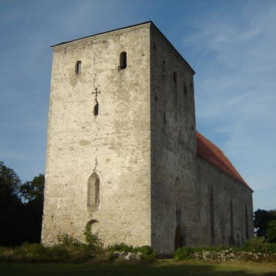
Pöide: Estonia's Medieval Castle Hill

September 20, 2026

Introduction

Pöide represents an important chapter in the medieval history of Saaremaa and Estonia.

The site's fortified landscape reflects the political transformations that reshaped the eastern Baltic during the medieval period.

Fortified centers were essential to medieval societies because they combined military defense with political administration.

A castle or fortified hill could protect territory, control movement, provide a residence for authorities, and serve as a visible symbol of power.

Pöide's history reflects the complicated interaction between local communities, Christian institutions, and expanding political powers.

Saaremaa in the Medieval Period

Saaremaa occupied an important position in the Baltic Sea.

Its inhabitants had long participated in maritime networks.

During the medieval period, the island became increasingly drawn into the political struggles involving Scandinavian kingdoms, German crusading powers, and local communities.

This transformed the strategic importance of fortified locations.

The Castle

The fortified center at Pöide developed as part of a wider medieval defensive system.

Stone became increasingly important in medieval fortification.

Unlike temporary wooden defenses, masonry structures could withstand fire and provide stronger protection.

Walls, towers, gates, and internal buildings could be combined into a carefully organized defensive complex.

Military Function

A castle had several military purposes.

It could protect soldiers.

It could store supplies.

It could serve as a refuge during conflict.

It could control roads, waterways, or surrounding territory.

Its psychological function was equally important.

A large stone fortress demonstrated that its builders possessed resources, labor, and political authority.

Christianity and Political Change

Medieval Saaremaa experienced major religious transformation.

Christian institutions became increasingly influential.

Churches and fortified centers sometimes developed together because political and religious authority were closely connected.

Conversion was not simply a matter of personal belief.

It was connected to changes in law, taxation, political allegiance, and international diplomacy.

Local Resistance and Conquest

The Baltic region experienced prolonged political conflict during the medieval period.

Local populations defended their autonomy against expanding powers.

Fortifications became central to these struggles.

Pöide must therefore be understood within a broader history of conquest, resistance, and political consolidation.

Architecture

Medieval defensive architecture was based on several principles.

Walls needed sufficient thickness.

Entrances were carefully controlled.

Elevated locations provided defensive advantages.

Stone construction required skilled masons.

Timber could supplement masonry structures.

The resulting fortress combined engineering with strategic planning.

Everyday Life Inside a Fortress

A medieval fortification was not occupied only by soldiers.

It could contain administrators, craftsmen, servants, religious personnel, and other residents.

Food had to be stored.

Weapons had to be maintained.

Buildings required constant repair.

Animals and supplies needed management.

A castle was therefore a functioning community.

Trade and Administration

Fortified centers could also function as administrative hubs.

Authorities could collect taxes, regulate trade, enforce laws, and manage surrounding territories.

Their strategic location made them useful for controlling economic activity.

This demonstrates why castles were instruments of government as well as military structures.

Archaeological Evidence

Archaeologists reconstruct medieval fortified sites through architectural remains, artifacts, and landscape analysis.

Stone walls reveal construction techniques.

Ceramics provide information about domestic activity.

Metal objects reveal tools and weapons.

Animal bones reveal diet and livestock.

Coins can indicate economic connections.

Together these materials create a picture of life within the fortress.

The Legacy of Pöide

Pöide's importance extends beyond its physical ruins.

The site represents the broader transformation of Estonia from prehistoric and Viking Age societies into medieval Christian political structures.

It illustrates how military architecture became a tool of state formation.

Conclusion

Pöide's medieval castle hill reflects a period when the eastern Baltic underwent profound political and religious transformation.

Its fortifications demonstrate the importance of military technology.

Its settlement history reveals changing systems of administration.

Its Christian context illustrates the transformation of religious and political authority.

Most importantly, Pöide demonstrates that medieval castles were not isolated military structures.

They were centers of power, administration, economy, religion, and community life.

The ruins that survive today are therefore fragments of a much larger medieval world—one shaped by warfare, commerce, conversion, and the struggle for control of the Baltic.

Kuressaare: Saaremaa's Episcopal Castle Site

September 20, 2026

Introduction

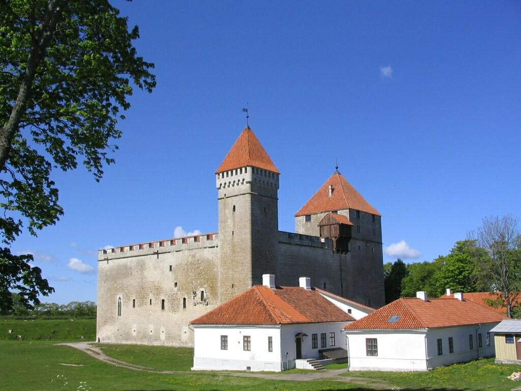
Rising from the shores of Saaremaa in western Estonia, Kuressaare Castle is one of the most impressive surviving medieval fortifications in the eastern Baltic. The castle developed as an important center of ecclesiastical and political authority under the bishops of Ösel-Wiek, whose territory encompassed Saaremaa and neighboring regions.

Today, the fortress is one of Estonia's best-preserved medieval castles. Its massive stone walls, towers, courtyard, and defensive architecture provide an unusually clear picture of how religious authority, military power, and territorial administration were combined during the Middle Ages.

Kuressaare is particularly fascinating because it was not simply a military fortress. It was also a residence, administrative center, religious institution, and symbol of episcopal authority.

Saaremaa in the Medieval Baltic

Saaremaa occupies a strategic position in the Baltic Sea.

The island lies close to important maritime routes connecting Estonia with Latvia, Sweden, Finland, and other parts of northern Europe. Long before the castle was constructed, Saaremaa communities participated in Baltic commerce and maritime activity.

During the medieval period, however, the island became increasingly incorporated into the political and religious structures of Christian Europe.

The conquest and Christianization of the eastern Baltic during the thirteenth century transformed Saaremaa's political landscape.

The Bishopric of Ösel-Wiek

Kuressaare's history is closely connected with the medieval Bishopric of Ösel-Wiek.

The bishop was both a religious leader and a territorial ruler. This combination of spiritual and secular authority was common in medieval Europe.

The bishop required fortified centers from which territory could be governed and defended.

Kuressaare eventually became one of the most important episcopal centers on Saaremaa.

Construction of the Castle

The stone fortress visible today developed over several stages.

Earlier defensive structures existed before the great stone complex reached its mature form. Construction and modification continued over generations as military technology and political circumstances changed.

The castle's design reflects the evolution of medieval fortress architecture.

Its thick walls were capable of resisting attacks using contemporary siege equipment, while towers provided elevated positions for defenders.

The Square Fortress

One of the most recognizable features of Kuressaare Castle is its strong geometric organization.

The central courtyard is surrounded by substantial defensive walls and buildings.

This arrangement created a protected internal space where residents could live and work while remaining inside the fortified complex.

The castle's architecture demonstrates the importance of controlled access.

A hostile force could not simply enter the central residential areas without first overcoming multiple defensive obstacles.

Religious and Secular Authority

Kuressaare illustrates an important characteristic of medieval political organization: religion and government were deeply interconnected.

The bishop's authority was religious, but he also exercised political and administrative power.

The castle therefore represented both:

  • ecclesiastical authority;

  • territorial government;

  • military power;

  • economic administration;

  • aristocratic residence.

Its architecture communicated this authority to the surrounding population.

Daily Life Inside the Castle

Life within a medieval castle was not exclusively military.

Residents would have included clergy, administrators, servants, guards, craftsmen, and other personnel.

The castle needed food storage, kitchens, water supplies, heating systems, workshops, and areas for religious activities.

During periods of peace, the fortress functioned as a working administrative center.

During periods of conflict, its defensive architecture became much more important.

Saaremaa and the Baltic Crusades

The establishment of Christian rule in Saaremaa occurred within the broader context of the Northern Crusades.

German, Danish, Scandinavian, and local powers competed for influence across the eastern Baltic.

The Christianization of the region was therefore not simply a religious process.

It involved conquest, political restructuring, economic change, and the establishment of new systems of landholding.

Kuressaare became part of this transformed political order.

Military Importance

The castle's defensive strength was particularly valuable because Saaremaa's position exposed it to maritime threats.

Control of the island could influence shipping routes across the Baltic.

A fortified episcopal residence could protect political officials while also serving as a base for military operations.

Its walls were designed to withstand attacks from weapons that were becoming increasingly sophisticated during the later Middle Ages.

Later Historical Development

Kuressaare Castle continued to be modified and reused after the medieval period.

As artillery transformed European warfare, traditional medieval fortifications became increasingly vulnerable.

Nevertheless, the castle remained politically and strategically important.

Its later history reflects the changing powers that controlled Saaremaa and the wider Baltic region.

Archaeological Significance

Archaeological and architectural research has revealed information about the castle's construction phases and changing functions.

Researchers can examine masonry techniques, architectural alterations, artifacts, and surviving structural elements to reconstruct how the fortress developed.

Such evidence helps historians understand not only military architecture but also medieval administration and everyday life.

Conclusion

Kuressaare Castle is one of the most significant medieval monuments in Estonia.

Its importance extends far beyond its impressive walls.

The fortress represents the intersection of Christianity, political authority, military technology, maritime geography, and medieval state formation.

Standing on Saaremaa's Baltic shores, Kuressaare preserves the physical remains of a period when religious institutions could also function as territorial governments and fortified castles served simultaneously as residences, administrative centers, and symbols of power.

For understanding medieval Estonia and the wider eastern Baltic world, Kuressaare is an essential archaeological landmark.

Haapsalu: Estonia's 13th-Century Fortress

September 20, 2026

Introduction

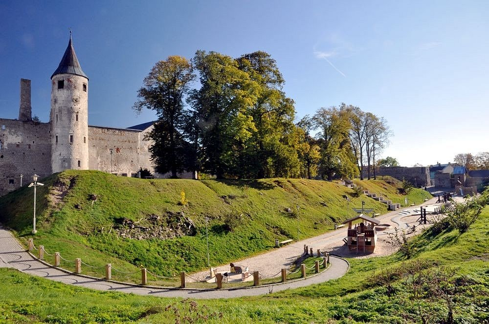
Haapsalu Castle is one of Estonia's most important medieval architectural complexes and a major reminder of the political transformation that occurred in the eastern Baltic during the thirteenth century.

The fortress developed as a major center of the Bishopric of Ösel-Wiek. Unlike a purely military stronghold, Haapsalu served as a religious center, episcopal residence, administrative headquarters, and defensive complex.

Its ruins preserve evidence of centuries of political competition, religious transformation, military development, and urban growth.

Medieval Haapsalu

Haapsalu developed during the medieval period in an area that offered access to the Baltic Sea and regional transportation routes.

Its location made it valuable for both administration and trade.

The establishment of Christian political authority created new centers of power, and Haapsalu became one of the most important of these.

The Bishopric of Ösel-Wiek

The bishopric controlled territory across western Estonia.

Its rulers required fortified residences from which they could administer lands, collect revenues, conduct religious activities, and organize military defense.

Haapsalu became a principal episcopal center.

The castle therefore functioned as part of a larger territorial system rather than as an isolated fortress.

Architectural Development

Construction began during the thirteenth century and continued over subsequent generations.

The complex incorporated religious and defensive structures.

Its walls enclosed substantial areas, while towers strengthened vulnerable points.

The cathedral church was especially important because it demonstrated the religious role of the site.

The combination of cathedral and fortress architecture is one of Haapsalu's defining characteristics.

The Cathedral

The cathedral was the spiritual heart of the complex.

Its presence demonstrates that Haapsalu was more than a military installation.

Religious ceremonies, ecclesiastical administration, and the activities of clergy all formed part of the site's daily life.

The cathedral's architecture also reflected the wealth and authority of the bishopric.

Defensive Functions

The surrounding walls provided protection against armed attack.

During periods of political instability, fortified episcopal centers could become essential refuges.

Medieval warfare in the Baltic involved raids, sieges, territorial disputes, and struggles between competing political powers.

A strong fortress therefore represented a substantial political advantage.

The Castle as a Residence

The bishop and his household required suitable accommodation.

The complex included spaces for administration, storage, domestic activities, and religious life.

High-status medieval residences were designed to communicate authority.

Visitors entering the castle would encounter architecture that demonstrated the resources and organizational capacity of the bishopric.

Political Context

Haapsalu existed within a complicated political environment.

The eastern Baltic was contested by local communities and external powers including Danish, German, Swedish, and later other regional authorities.

The establishment of castles helped these powers maintain control over strategically important territories.

Haapsalu consequently became part of the broader history of medieval Baltic state formation.

Urban Development

The fortress influenced the development of Haapsalu itself.

Settlements commonly grew around medieval castles and religious institutions because these sites generated demand for craftsmen, merchants, food suppliers, and services.

The castle therefore contributed to the development of a wider urban economy.

Archaeological Evidence

Archaeological investigation of Haapsalu has uncovered artifacts and structural evidence that reveal aspects of medieval life.

Objects recovered from the site can provide information about:

  • diet;

  • trade;

  • craftsmanship;

  • religious practice;

  • warfare;

  • domestic life.

Architectural analysis also helps identify different construction phases.

Later History

Haapsalu's importance continued after the Middle Ages, although changing political circumstances altered the castle's functions.

Military technology also transformed.

The introduction and increasing use of gunpowder artillery reduced the effectiveness of traditional medieval fortifications.

Parts of the complex eventually fell into ruin.

Yet the surviving remains preserve the medieval plan and architectural character of the site.

Conclusion

Haapsalu Castle represents the complex relationship between religion, government, and military power in medieval Estonia.

Its cathedral, walls, towers, and residential structures demonstrate how an episcopal center could serve several purposes simultaneously.

Today, the ruins provide an unusually valuable window into the medieval eastern Baltic and the centuries when Christian institutions became central to political organization.

Haapsalu is therefore not merely a picturesque ruin. It is a physical record of the transformation of Estonia.

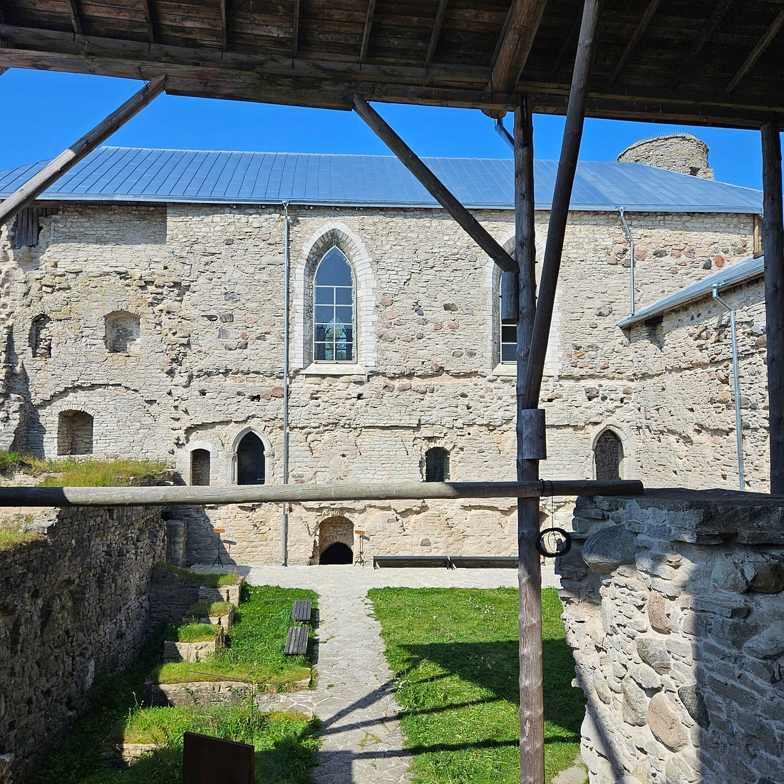
Padise: Estonia's Cistercian Monastery Ruins

September 20, 2026

Introduction

The ruins of Padise Monastery preserve the remains of one of medieval Estonia's most significant religious institutions. Founded by Cistercian monks, Padise became an important center of religious life, agriculture, landholding, and economic organization in western Estonia.

The monastery illustrates how medieval monasteries were far more than places where monks prayed.

They were agricultural enterprises, landowners, educational institutions, centers of manuscript culture, and important components of regional economies.

The Cistercian Tradition

The Cistercian Order emerged in western Europe during the late eleventh century as a reform movement within Western monasticism.

Cistercians emphasized disciplined religious life, manual labor, simplicity, and agricultural self-sufficiency.

Their monasteries often became major economic institutions.

Padise belonged to this wider European network.

Foundation of Padise

The monastery developed during the medieval period following the Christianization and political restructuring of Estonia.

Cistercian monks from another Baltic monastery established the religious community at Padise.

The location provided access to agricultural land and transportation routes.

This allowed the monastery to support itself while participating in regional economic networks.

Monastic Architecture

Padise's architecture reflected both religious requirements and practical necessities.

A medieval monastery typically required:

  • a church;

  • cloisters;

  • dormitories;

  • kitchens;

  • storage rooms;

  • workshops;

  • agricultural facilities;

  • administrative spaces.

At Padise, these functions were incorporated into a substantial stone complex.

A Monastery and Agricultural Enterprise

Agriculture was fundamental to monastic life.

Monks and lay workers cultivated crops, raised animals, managed forests, and maintained other resources.

The monastery's agricultural activities could support both the resident community and broader economic exchange.

The Cistercian approach emphasized productive landscapes.

Land management therefore became an important component of religious practice.

Economic Networks

Padise did not exist in isolation.

Monasteries exchanged goods with surrounding communities and participated in regional markets.

Surplus agricultural products could be traded.

Specialized crafts could also be performed within or around the monastery.

The monastery's economic power allowed it to acquire additional land and resources.

Political Relationships

Medieval monasteries often depended upon relationships with secular rulers.

Land grants, privileges, taxation arrangements, and legal protections affected their prosperity.

Padise's history therefore reflects the interaction between religious institutions and political authorities.

Defensive Architecture

One of Padise's most unusual characteristics is the substantial defensive character of its later architecture.

Political instability in the Baltic could threaten religious institutions.

The monastery was therefore fortified.

This transformation demonstrates that medieval religious communities sometimes had to adapt to military realities.

The boundary between monastery and fortress could become surprisingly thin.

Daily Life of the Monks

Monastic life followed a structured schedule.

The monks divided their day between:

  • prayer;

  • religious services;

  • work;

  • meals;

  • study;

  • rest.

The rhythm of life was regulated by the liturgical calendar.

Work was not regarded simply as economic necessity. Within the Cistercian tradition, labor could be considered an important component of disciplined religious life.

Archaeological Importance

The surviving ruins allow researchers to reconstruct aspects of monastic organization.

Architectural remains reveal the relationship between sacred and practical spaces.

Artifacts provide additional evidence for food consumption, trade, craft production, and domestic activity.

Together, these discoveries show how a medieval religious community functioned materially.

Destruction and Decline

Like many medieval institutions in the Baltic, Padise experienced periods of conflict and political disruption.

The Reformation and subsequent changes in religious and political organization fundamentally altered the monastery's role.

The monastic institution was eventually dissolved.

The buildings lost their original purpose and gradually deteriorated.

Conclusion

Padise Monastery provides a remarkable illustration of medieval religious life in Estonia.

Its history combines spirituality, agriculture, architecture, economics, politics, and warfare.

The ruins remind us that monasteries were major institutions capable of transforming landscapes and shaping regional economies.

Padise therefore represents much more than a ruined religious building. It is an archaeological record of the complex organization of medieval European society on the eastern Baltic frontier.

Tallinn's Toompea: Estonia's Danish Castle

September 20, 2026

Introduction

Toompea Hill dominates the historic skyline of Tallinn and has served as a center of political power for centuries. Its strategic elevation made it an ideal location for a fortress, while its position overlooking the surrounding city and Baltic approaches made it valuable to successive rulers.

The medieval history of Toompea is closely connected with Danish expansion into northern Estonia.

The castle represents an important stage in the formation of medieval Tallinn and illustrates how fortifications could become the foundations of political administration.

A Strategic Hill

Toompea's greatest advantage was its elevation.

A fortress located on a high hill could observe surrounding territory and provide defenders with a significant tactical advantage.

From the hill, authorities could oversee the settlement below and monitor important approaches.

This strategic geography helps explain why the location remained politically important for so long.

Danish Conquest

During the early thirteenth century, Danish forces became deeply involved in northern Estonia.

The conquest of Tallinn and surrounding territory brought the region into the Danish political sphere.

A fortified center was essential for maintaining authority.

Toompea consequently became a major seat of power.

The Danish Castle

The castle was developed and rebuilt repeatedly.

Medieval fortifications rarely remained unchanged because political requirements and military technology evolved.

Walls were strengthened, towers modified, and internal buildings reconstructed.

The result was a complex architectural palimpsest in which different periods of Estonian and Baltic history can be identified.

Tallinn and the Hanseatic World

Tallinn eventually became one of the major commercial cities of the eastern Baltic.

Its harbor connected the city to the wider Hanseatic trading system.

Toompea, however, represented a different form of power.

While the lower town became increasingly associated with merchants and urban commerce, Toompea was strongly connected with political and aristocratic authority.

The geographical division between the upper and lower town reflected social and institutional differences.

Nobility and Government

Throughout later medieval and early modern history, Toompea remained associated with governing elites.

Political institutions developed around the castle.

This made the hill a center from which territory could be administered.

The castle's importance consequently survived changes in ruling dynasties and political systems.

Architecture

Toompea's architecture combines defensive and residential elements.

Medieval castles required strong walls, controlled entrances, towers, storage areas, and accommodation for rulers and officials.

Later periods added new architectural styles and administrative buildings.

The modern appearance of Toompea therefore represents centuries of reconstruction rather than a single medieval building phase.

Archaeological Evidence

Archaeological research on Toompea has revealed evidence for earlier occupation beneath later structures.

Excavations and architectural studies can identify different phases of fortification and settlement.

Such evidence demonstrates that the hill was strategically significant before and after the Danish conquest.

The Symbolism of Toompea

Toompea became more than a physical fortress.

It became a symbol of authority.

Control of the hill represented control over the city and, more broadly, over northern Estonia.

The ability of the site to remain politically significant for centuries is one of its most remarkable characteristics.

Conclusion

Tallinn's Toompea demonstrates how geography can shape political history.

A naturally defensible hill became a fortified center, a seat of rulers, and eventually one of the most important political landscapes in Estonia.

Its Danish medieval origins form only one chapter in a much longer story.

Today, Toompea remains a powerful reminder that Tallinn's political importance was rooted in a strategic hill overlooking the Baltic world.

Narva Fortress: Estonia's 13th-Century Border Stronghold

September 20, 2026

Narva Fortress stands beside the Narva River at one of the most strategically important points in northeastern Estonia. For centuries, the river formed a major political and military boundary, and control of the crossing was crucial for states competing for influence in the eastern Baltic.

The fortress therefore represents much more than medieval military architecture.

It is a physical expression of centuries of competition between Scandinavian, Baltic, German, and Russian political powers.

The Narva River

Geography determined Narva's importance.

The Narva River connects Lake Peipus with the Baltic Sea.

This created a natural transportation corridor between inland territories and maritime routes.

A fortified crossing could therefore control movement through a large region.

Medieval Origins

Fortifications developed at Narva during the medieval period as external powers expanded their influence across northeastern Europe.

The Danish rulers of northern Estonia played an important role in establishing a fortified presence.

The site subsequently underwent repeated reconstruction.

Hermann Castle

The most famous surviving fortress structure is Hermann Castle.

Its massive stone walls and tower dominate the riverbank.

Across the river stands the fortress of Ivangorod, creating one of Europe's most dramatic fortified landscapes.

The two castles face each other across the water, reflecting centuries of political competition.

A Frontier Fortress

Narva's importance came from its frontier position.

Border regions were often unstable because political authority could change rapidly.

Fortresses helped rulers:

  • control roads;

  • supervise river crossings;

  • collect customs;

  • protect settlements;

  • project military power;

  • deter hostile forces.

Narva performed many of these functions.

Trade and Customs

Military power was not the only reason to control Narva.

Merchants traveling between the Baltic and inland regions could pass through the area.

Authorities could regulate commercial movement and collect taxes.

The fortress therefore had an economic function as well as a military one.

Russian Expansion

During the late medieval and early modern periods, Russian political power expanded toward the Baltic.

Narva became increasingly important in conflicts involving Muscovite Russia, Sweden, Denmark, and other powers.

The fortress was repeatedly attacked, captured, modified, and incorporated into different defensive systems.

Gunpowder Warfare

The development of firearms transformed fortress design.

Traditional medieval walls were increasingly vulnerable to artillery.

Narva's defenses therefore evolved in response to changing military technology.

This illustrates a broader transformation in European warfare from medieval siege methods toward artillery-dominated warfare.

The Great Northern War

Narva became particularly famous during the Great Northern War.

The Battle of Narva in 1700 resulted in a major Swedish victory over Russian forces.

Although the battle itself occurred outside the immediate medieval period, it demonstrates how the strategic importance of the fortress continued long after its original construction.

Archaeological Research

Archaeologists can examine layers of construction, destruction, and rebuilding to reconstruct Narva's complicated history.

Artifacts from different periods reveal changing military technologies, commercial relationships, and patterns of everyday life.

The fortress therefore serves as a historical archive constructed from stone, soil, and material culture.

Conclusion

Narva Fortress represents the long history of the eastern Baltic frontier.

Its position beside the Narva River made it strategically important for medieval rulers and later European states.

From its medieval origins through centuries of warfare, Narva remained a critical military and commercial gateway.

Its surviving architecture provides a powerful reminder that geography, trade, and warfare were inseparable in the political history of the baltic.

Izborsk: Russia's 9th-Century Hillfort

September 20, 2026

Introduction

Izborsk is one of the most historically significant fortified settlements in the northwestern Russian lands. Its origins reach back to the early medieval period, when fortified hilltop settlements served as centers of political authority, defense, trade, and community organization.

Located west of Pskov, near the modern Estonian border, Izborsk occupied an important position between the eastern Baltic and the emerging political centers of medieval Rus'.

Its history provides valuable insight into the development of fortified communities before the rise of the great medieval Russian principalities.

Early Origins

Izborsk is traditionally associated with the early medieval period and appears in historical traditions connected with the early rulers of Rus'.

Its elevated location offered natural defensive advantages.

A settlement built on a hill could observe surrounding territory while making direct assault more difficult.

Fortified Settlement

Early hillforts were not simply military bases.

They were communities.

Residents could include:

  • farmers;

  • craftsmen;

  • merchants;

  • warriors;

  • political leaders;

  • religious figures.

The fortification protected both people and valuable resources.

Strategic Location

Izborsk's location placed it near important routes connecting the Baltic region with the interior of eastern Europe.

This made it strategically important to rulers seeking control over regional trade and transportation.

The settlement could serve as a defensive outpost as well as a commercial center.

The Development of Stone Fortifications

Over time, the earlier settlement was transformed into a much stronger stone fortress.

The later medieval walls demonstrate sophisticated defensive engineering.

Towers projected from the walls, allowing defenders to attack enemies approaching from different directions.

Medieval Warfare

The western frontier of medieval Rus' was politically contested.

Izborsk experienced military pressure from neighboring powers, particularly from forces associated with the German and Livonian spheres.

Repeated attacks encouraged continued investment in the fortress.

Its survival depended on the ability of its defenders and rulers to adapt to changing forms of warfare.

Community Life

Even though the fortress had military functions, ordinary life continued within its walls.

Residents needed food, water, tools, clothing, and housing.

Craft production would have supported the settlement.

Agricultural communities in the surrounding landscape supplied food and raw materials.

Religious History

Christianity gradually became a major component of the region's cultural landscape.

Churches and religious institutions developed alongside fortified settlements.

Izborsk's later religious monuments reflect this transformation.

Archaeological Importance

Archaeology is particularly important for understanding Izborsk because written sources provide only partial information.

Excavations can reveal:

  • settlement layers;

  • pottery;

  • metal objects;

  • weapons;

  • agricultural tools;

  • building remains;

  • food remains.

These discoveries allow researchers to reconstruct daily life as well as political history.

Conclusion

Izborsk represents the evolution of a fortified community from an early medieval hillfort into a substantial stone fortress.

Its strategic position connected the Baltic frontier with the political world of Rus'.

The site demonstrates that medieval fortifications were not isolated military structures. They were living communities whose survival depended upon agriculture, craftsmanship, trade, political organization, and military defense.

Izborsk therefore provides an important archaeological window into the formative centuries of northwestern Rus'.

Pskov Krom: Russia's Medieval Citadel

September 20, 2026

Introduction

The Pskov Krom, commonly known as the Pskov Kremlin, is the historic fortified heart of Pskov. Rising above the confluence of the Velikaya and Pskova Rivers, the citadel became the center of political, religious, and military life in one of medieval Russia's most important frontier cities.

Its walls and towers reflect centuries of warfare, political development, religious authority, and commercial expansion.

Geography and Defense

Pskov's location was strategically exceptional.

The city developed around major waterways that connected inland territories with the Baltic region.

The Krom occupied a naturally defensible position.

Rivers provided additional protection, while fortified walls controlled access to the central settlement.

Early Fortifications

The earliest defenses were likely constructed from timber and earth.

Such fortifications were common in early medieval eastern Europe.

As political power and military threats increased, stone construction became increasingly important.

The later stone walls transformed the Krom into a formidable citadel.

Religious Center

The Krom was also the spiritual center of Pskov.

The Trinity Cathedral became one of the most important religious buildings in the city.

The close association between fortress and cathedral reflects the medieval belief that political and religious communities were interconnected.

Political Authority

Pskov developed a distinctive political tradition.

The city enjoyed considerable autonomy during parts of the medieval period and developed institutions of collective government.

The Krom therefore represented civic authority as well as military defense.

Warfare on the Western Frontier

Pskov was repeatedly involved in conflicts with neighboring powers.

The city faced military pressure from German crusading orders, Swedish forces, and other rivals.

The Krom's walls provided essential protection.

Its defensive importance increased as siege warfare became more sophisticated.

Towers and Walls

The fortress incorporated multiple towers and defensive lines.

Towers allowed defenders to observe attackers and launch attacks from protected positions.

Walls created controlled zones that could slow or repel invading armies.

The architectural complexity of Pskov's defenses demonstrates the importance of accumulated military experience.

Economic Importance

Pskov's strategic location also made it commercially significant.

Merchants traveled along routes linking Russia with the Baltic.

The city's economy depended on agriculture, craft production, fishing, trade, and taxation.

The Krom protected the political center that regulated this economic system.

Archaeological Research

Archaeological excavations in Pskov have produced enormous quantities of information.

Organic materials survive unusually well in some layers, allowing researchers to study wooden structures and everyday objects.

Artifacts can reveal details about food, clothing, trade, literacy, craft production, and domestic life.

Cultural Significance

Pskov developed distinctive architectural and artistic traditions.

Its churches became famous for their characteristic forms.

The Krom therefore belongs not only to military history but also to the history of Russian architecture and religious culture.

Conclusion

Pskov Krom is one of the most important medieval fortified complexes in Russia.

Its strategic location, political role, religious significance, and military architecture demonstrate the complexity of medieval urban life.

The fortress protected more than a city.

It protected a political community, a religious center, and a major regional economy.

For this reason, the Pskov Krom remains one of the clearest physical expressions of medieval Pskov's independence and strategic importance.

Novgorod Detinets: Russia's 9th-Century Kremlin

September 20, 2026

Introduction

Novgorod Detinets is the historic fortified center of Veliky Novgorod and one of the most important archaeological and architectural complexes in medieval Russia.

Situated beside the Volkhov River, the fortress developed at the heart of a city that became one of the most powerful commercial and political centers of medieval eastern Europe.

Although the title identifies the site with a ninth-century origin, the surviving fortress is the product of many centuries of rebuilding and expansion.

Novgorod's Strategic Location

The Volkhov River connected Lake Ilmen with Lake Ladoga and the Baltic Sea.

This waterway formed part of an extensive network connecting northern Europe with the lands of Rus'.

Novgorod's location allowed merchants and travelers to move between Scandinavia, the Baltic, and the interior.

The Birth of a Major City

Novgorod grew into a major urban center during the early medieval period.

Its economy depended heavily on trade.

Merchants exchanged:

  • furs;

  • wax;

  • honey;

  • timber;

  • metals;

  • textiles;

  • luxury goods.

The city became an important meeting point between different cultural and economic worlds.

The Detinets

The Detinets functioned as the city's fortified political and religious center.

The walls enclosed important buildings and provided protection during warfare.

The fortress's position beside the river gave it additional strategic value.

The Cathedral of Saint Sophia

One of the most important buildings within the Detinets is the Cathedral of Saint Sophia.

Constructed in the eleventh century, it became a major symbol of Novgorod.

The cathedral demonstrates the city's wealth and the importance of Christianity in its political culture.

Novgorod's Political Tradition

Novgorod developed a distinctive form of political organization.

The city was associated with the veche, a public assembly that played an important role in political decision-making.

Political authority was therefore distributed differently from the more centralized monarchies that later emerged elsewhere in Russia.

The Detinets stood at the center of this political landscape.

Trade and the Baltic World

Novgorod was deeply connected with northern European commerce.

Its merchants interacted with Scandinavian and German traders.

The city's economic influence extended across enormous distances.

Archaeological finds demonstrate connections reaching far beyond the immediate region.

Birch-Bark Documents

Perhaps the most remarkable evidence from Novgorod comes from birch-bark documents.

These writings preserved everyday communications, financial records, requests, complaints, and other messages.

They reveal that literacy was not restricted exclusively to religious elites.

The documents provide an unusually intimate view of medieval urban society.

Archaeological Importance

Novgorod's archaeological layers are exceptionally valuable.

Waterlogged soil can preserve organic materials that would normally disappear.

Researchers have recovered:

  • wooden structures;

  • tools;

  • leather;

  • seeds;

  • food remains;

  • household objects;

  • writing materials.

This makes Novgorod one of the world's most important medieval archaeological cities.

Conclusion

Novgorod Detinets represents the political and religious heart of one of medieval Europe's most influential cities.

Its walls protected institutions that controlled a vast commercial network.

The combination of fortress, cathedral, political assembly, and urban economy demonstrates the complexity of medieval Novgorod.

The archaeological evidence from the city makes its history especially valuable because it allows historians to move beyond the lives of rulers and examine the experiences of ordinary residents.

Novgorod was not simply a medieval Russian city.

It was a major bridge between the Baltic world and eastern Europe.

← Newer Posts Older Posts →
Featured
images - 2026-10-28T160148.000.jpeg
October 28, 2026
Invisible Field Boundaries: Detecting Ancient Hedgerows with LiDAR
October 28, 2026
Read more →
October 28, 2026
images - 2026-10-28T160035.775.jpeg
October 28, 2026
Paleo-lakeside Cemeteries: Burials at Vanished Shorelines
October 28, 2026
Read more →
October 28, 2026
images+-+2026-10-17T225136.482.webp
October 28, 2026
Submerged Neolithic Causeways in the English Channel
October 28, 2026
Read more →
October 28, 2026
nabta-aggregate.webp
October 28, 2026
The Archaeology of Nightwatch Posts: Small Guard Stations and Social Order
October 28, 2026
Read more →
October 28, 2026
images - 2026-10-28T155920.814.jpeg
October 28, 2026
Reconstructing Ancient Roadside Inns from Faunal and Ceramic Data
October 28, 2026
Read more →
October 28, 2026
mascaras-de-ceramica-3.webp
October 28, 2026
Small-Scale Brick Kilns: Household Ceramic Production in Hinterlands
October 28, 2026
Read more →
October 28, 2026
read more

Powered by The archaeologist