• MAIN PAGE
  • LATEST NEWS
    • Lost Cities
    • Archaeology's Greatest Finds
    • Underwater Discoveries
    • Greatest Inventions
    • Studies
    • Blog
  • PHILOSOPHY
  • HISTORY
  • RELIGIONS
    • Africa
    • Anatolia
    • Arabian Peninsula
    • Balkan Region
    • China - East Asia
    • Europe
    • Eurasian Steppe
    • Levant
    • Mesopotamia
    • Oceania - SE Asia
    • Pre-Columbian Civilizations of America
    • Iranian Plateau - Central Asia
    • Indus Valley - South Asia
    • Japan
    • The Archaeologist Editor Group
    • Scientific Studies
    • Aegean Prehistory
    • Historical Period
    • Byzantine Middle Ages
    • Predynastic Period
    • Dynastic Period
    • Greco-Roman Egypt
  • Rome
  • PALEONTOLOGY
  • About us
Menu

The Archaeologist

  • MAIN PAGE
  • LATEST NEWS
  • DISCOVERIES
    • Lost Cities
    • Archaeology's Greatest Finds
    • Underwater Discoveries
    • Greatest Inventions
    • Studies
    • Blog
  • PHILOSOPHY
  • HISTORY
  • RELIGIONS
  • World Civilizations
    • Africa
    • Anatolia
    • Arabian Peninsula
    • Balkan Region
    • China - East Asia
    • Europe
    • Eurasian Steppe
    • Levant
    • Mesopotamia
    • Oceania - SE Asia
    • Pre-Columbian Civilizations of America
    • Iranian Plateau - Central Asia
    • Indus Valley - South Asia
    • Japan
    • The Archaeologist Editor Group
    • Scientific Studies
  • GREECE
    • Aegean Prehistory
    • Historical Period
    • Byzantine Middle Ages
  • Egypt
    • Predynastic Period
    • Dynastic Period
    • Greco-Roman Egypt
  • Rome
  • PALEONTOLOGY
  • About us
No results found

Fort Union: New Mexico's Santa Fe Trail Fort

October 3, 2026

Introduction

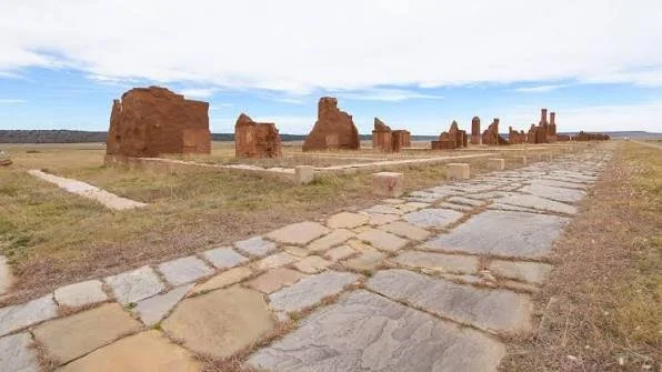
In the open grasslands of northeastern New Mexico, the ruins of Fort Union stretch across a broad valley beside the old Santa Fe Trail.

Today, visitors see adobe walls, foundations, earthworks, roads, wagon ruts, and scattered structural remains.

In the nineteenth century, however, this was one of the largest and most important military installations in the American Southwest.

Fort Union was established in 1851 and remained active until 1891. During those four decades, it functioned as a military post, supply depot, transportation center, arsenal, and instrument of federal expansion.

Its history is inseparable from the Santa Fe Trail.

The fort existed partly because the trail had become a major commercial corridor connecting the United States with New Mexico.

The Santa Fe Trail

The Santa Fe Trail developed into an international commercial highway during the early nineteenth century.

After Mexican independence from Spain in 1821, trade between Missouri and Santa Fe expanded rapidly.

Merchants transported manufactured goods westward.

New Mexican traders transported silver, livestock, furs, and other products eastward.

The trail crossed hundreds of miles of difficult terrain.

It also passed through lands occupied and used by Indigenous peoples.

The expansion of commerce therefore transformed relationships among merchants, governments, settlers, and Native nations.

Why Fort Union Was Built

By 1851, the United States had acquired extensive territories in the Southwest following the Mexican-American War.

The federal government wanted greater military control over these territories.

Lieutenant Colonel Edwin V. Sumner established Fort Union near the junction of the Mountain and Cimarron branches of the Santa Fe Trail.

The location was strategically chosen.

The fort could support traffic on multiple branches of the trail.

It could also serve as a base for military operations throughout the region.

Three Forts

Fort Union was not one structure.

Three successive forts occupied the area.

The first Fort Union operated from 1851 to 1861.

The second, often called the Star Fort, was constructed during 1861–1862.

The third and largest fort was developed beginning in 1862 and remained in operation until 1891.

This sequence reflects changing military requirements.

The fort expanded as the United States increased its military presence in the Southwest.

The First Fort

The first fort was relatively modest.

Its construction reflected the urgency of establishing a military presence near the trail.

Buildings were largely functional.

Soldiers needed:

  • barracks

  • officers' quarters

  • storage

  • workshops

  • stables

  • administrative spaces

The fort was also exposed to the region's climate.

Cold winters, wind, dust, and limited local resources made military life difficult.

The Civil War

The Civil War dramatically changed Fort Union's strategic role.

In 1862, Confederate forces invaded New Mexico Territory.

Their objective included capturing Fort Union and gaining control over the Santa Fe Trail and potentially the Colorado gold fields.

Fort Union became a major defensive target.

The Confederates never captured it.

Their defeat at Glorieta Pass and the destruction of their supply train prevented their advance.

The Star Fort

The second Fort Union was designed as a defensive fortification during this period of heightened threat.

Its star-shaped design reflected contemporary European and American military engineering.

The angular bastions allowed defenders to cover approaches with overlapping fields of fire.

The Star Fort was short-lived.

After the Confederate threat diminished, the military developed the larger third fort.

The Third Fort

The third Fort Union became the largest.

It included numerous buildings and specialized facilities.

The National Park Service's historic documentation identifies 56 structures associated with the Third Fort, occupying approximately 100 acres.

The complex included:

  • barracks

  • officers' quarters

  • warehouses

  • workshops

  • hospital facilities

  • administrative buildings

  • an arsenal

  • corrals

  • supply facilities

The depot itself became larger than the military post.

This is an important distinction.

Fort Union was not simply a place where soldiers lived.

It was an enormous logistical operation.

The Military Supply Depot

The Southwest was geographically enormous.

Military posts were scattered across New Mexico, Arizona, Colorado, Texas, and surrounding territories.

They required constant supplies.

Food, clothing, ammunition, weapons, tools, construction materials, and animal feed had to move through the region.

Fort Union became the central supply hub.

The National Park Service describes it as the largest military supply depot in the Southwest.

This made transportation central to the fort's existence.

Wagon Trains

Wagon trains arrived carrying supplies from the east.

The Santa Fe Trail could become crowded with freight traffic.

The National Park Service notes that wagon convoys commonly traveled in groups for protection and that military freight increased substantially during the Civil War.

The fort's wagon-related archaeology remains visible today.

Deep parallel depressions in the ground preserve portions of the Santa Fe Trail's historic ruts.

These ruts are physical evidence of thousands of wagon journeys.

Fort Union and Indigenous Peoples

The history of Fort Union cannot be separated from Indigenous history.

The region was used by Apache, Comanche, Kiowa, Ute, and other Native peoples.

The expansion of American military and commercial infrastructure altered existing territorial relationships.

The U.S. Army conducted campaigns against Indigenous nations and also attempted to protect commercial routes.

This history is complex.

The fort could be described from the perspective of military logistics, but Indigenous communities experienced the expansion of federal power in fundamentally different ways.

A Tool of Federal Expansion

Fort Union represented more than military defense.

It was part of the broader process through which the United States extended political and economic control across the Southwest.

Soldiers protected wagon trains.

Military escorts accompanied travelers.

Supplies moved through the region.

Federal institutions expanded.

The fort therefore became an instrument through which national power reached distant territories.

The National Park Service describes Fort Union as an "agent of change" in the New Mexico Territory and Southwest.

Architecture

The fort's architecture reflected local materials and regional construction traditions.

Adobe was extensively used.

Adobe walls could be constructed efficiently from locally available earth.

However, they required constant maintenance.

Water erosion and weather could damage walls.

The surviving ruins therefore represent only a fraction of the original structures.

The Third Fort's remains are particularly important because they preserve the layout of an enormous nineteenth-century military complex.

The Santa Fe Trail and Cultural Exchange

The trail connected communities.

People from different backgrounds encountered one another along its route.

Merchants from Missouri interacted with Hispanic New Mexican traders.

Military personnel encountered Indigenous communities.

Mexican and American commercial systems became increasingly interconnected.

The National Park Service notes that Anglo-American traders sometimes married into New Mexican families, demonstrating that the trail created social relationships as well as economic ones.

The Railroad Changes Everything

Fort Union's importance declined after the arrival of the railroad.

The Atchison, Topeka and Santa Fe Railway reached the region in the late nineteenth century.

The railroad bypassed the fort in 1879.

As rail transportation expanded, the Santa Fe Trail's role diminished.

The fort's supply function declined.

The military post remained for another decade, but its strategic importance was increasingly reduced.

Fort Union was abandoned in 1891.

Archaeology

Archaeologists can reconstruct Fort Union's history through:

  • building foundations

  • adobe fragments

  • ceramics

  • glass

  • military buttons

  • ammunition

  • animal bones

  • tools

  • architectural hardware

  • roads

  • wagon ruts

These materials reveal everyday life.

A military fort was not simply officers and soldiers.

It also included cooks, laborers, teamsters, merchants, craftsmen, medical personnel, families, and civilian employees.

Preservation

Adobe ruins are vulnerable.

Rain can dissolve exposed surfaces.

Wind can erode walls.

Plants can grow through foundations.

Temperature fluctuations contribute to cracking.

Preservation therefore requires stabilization and careful monitoring.

The goal is not to rebuild the fort into a modern-looking replica.

Instead, conservation seeks to preserve surviving historic material and archaeological information.

Conclusion

Fort Union was one of the most important military and logistical centers of the nineteenth-century American Southwest.

Its importance came from geography.

The fort stood where major branches of the Santa Fe Trail met.

It protected commerce.

It supplied distant military posts.

It participated in campaigns against Indigenous nations.

It became a key defensive installation during the Civil War.

And eventually, it declined because the railroad transformed transportation.

Today, its ruins and wagon ruts preserve a remarkably tangible record of that transformation.

Fort Union is therefore not simply an old military fort.

It is a physical record of how transportation, commerce, military power, Indigenous resistance, and American territorial expansion reshaped the Southwest.
Canyons of the Ancients: Colorado's 6,000 Sites

October 3, 2026

Introduction

In southwestern Colorado lies one of the densest archaeological landscapes in North America: Canyons of the Ancients National Monument.

The title of this article refers to the area's historically cited figure of approximately 6,000 recorded archaeological sites. That figure was used extensively in earlier descriptions of the monument. Today, however, the Bureau of Land Management reports more than 8,300 documented archaeological sites, while estimates suggest that tens of thousands of additional sites may remain unrecorded.

The difference illustrates an important fact about archaeology:

The archaeological record is not fixed.

New surveys, remote sensing, mapping, and fieldwork continually expand our knowledge.

Canyons of the Ancients covers approximately 176,000 acres and preserves evidence representing more than 12,000 years of human activity.

A Cultural Landscape Rather Than a Single Ruin

The name "Canyons of the Ancients" can give the impression of a single archaeological site.

It is not.

It is an enormous cultural landscape containing thousands of individual archaeological features.

These include:

  • pueblos

  • field houses

  • cliff dwellings

  • kivas

  • great kivas

  • check dams

  • reservoirs

  • agricultural fields

  • shrines

  • petroglyphs

  • roadways

  • storage structures

The distribution of these features allows archaeologists to investigate entire settlement systems rather than isolated buildings.

Twelve Thousand Years of Human History

The monument's archaeology begins long before the construction of Pueblo villages.

Evidence demonstrates human activity extending back more than 12,000 years.

This means the landscape contains traces of hunter-gatherers, early agricultural communities, ancestral Pueblo societies, and later Indigenous use.

The Ancestral Pueblo period represents only one portion of this enormous chronology.

The Four Corners

Canyons of the Ancients lies within the Four Corners region, where Colorado, Utah, Arizona, and New Mexico meet.

This area was not divided by modern state boundaries in ancient times.

People moved across the region.

Ideas spread.

Pottery styles changed.

Trade networks connected distant settlements.

Agricultural practices were adapted to local environments.

Archaeologists therefore study the monument as part of a broader Four Corners system.

Farming the High Desert

Agriculture was central to many ancestral Pueblo communities.

Maize, beans, and squash formed the foundation of agricultural production.

But the environment was challenging.

Rainfall was variable.

Growing seasons could be short.

Soils were not uniformly productive.

Farmers developed strategies for conserving water.

Check dams could slow runoff.

Terraces could reduce erosion.

Reservoirs could capture water.

Fields could be positioned where runoff accumulated.

These features demonstrate environmental engineering.

Check Dams

Check dams are particularly revealing.

A small wall placed across a drainage can slow flowing water.

When water loses speed, sediment accumulates.

Over time, this can create productive agricultural surfaces.

Such features demonstrate that ancient farmers understood water movement.

The landscape was therefore actively engineered.

The natural environment provided the materials and processes, while people modified them to support agriculture.

Pueblos and Community Centers

Some settlements developed into substantial villages.

Structures could include dozens or hundreds of rooms.

Kivas provided communal and ceremonial spaces.

Large settlements required organization.

Construction involved gathering stone, transporting timber, producing mortar, and coordinating labor.

Food production had to support the population.

The resulting architecture is evidence of social cooperation.

Lowry Pueblo

One of the best-known publicly accessible sites within the monument is Lowry Pueblo.

The site contains approximately 40 rooms, eight kivas, and a great kiva.

The great kiva is particularly significant.

Its scale suggests communal activities extending beyond individual households.

Such structures may have served ceremonial, social, and political purposes.

Architecture Across the Landscape

The archaeological record demonstrates enormous architectural diversity.

Some structures are large pueblos.

Others are tiny field houses.

Some are built along canyon walls.

Others stand on mesa tops.

This variation tells archaeologists that ancient communities did not have one standardized settlement pattern.

People used different structures for different purposes.

A small field house could be associated with agricultural production.

A large pueblo could serve as a residential and communal center.

A granary could store food.

A kiva could provide communal ceremonial space.

Rock Art

Petroglyphs form another major part of the monument's archaeological record.

Rock art can depict:

  • humans

  • animals

  • geometric designs

  • abstract symbols

  • weapons

  • hunting scenes

  • ceremonial imagery

However, interpreting rock art requires caution.

An image cannot automatically be translated into a specific meaning.

Some meanings may survive through Indigenous traditions, while others may no longer be recoverable.

Roads and Movement

Perhaps one of the most fascinating aspects of Canyons of the Ancients is evidence of ancient roads.

Roads demonstrate that archaeological sites were connected.

A settlement was not an isolated village.

It belonged to a network.

People moved between agricultural fields, households, ceremonial centers, water sources, and neighboring communities.

The road system therefore provides a different kind of archaeological evidence: evidence of social geography.

Climate

Climate influenced settlement decisions.

Periods of drought could place pressure on agricultural systems.

But climate alone does not explain population movement.

People could respond through:

  • crop diversification

  • water management

  • food storage

  • trade

  • migration

  • social reorganization

The archaeology of the Southwest demonstrates that human responses to climate were complex.

The Thirteenth-Century Transformation

By the late thirteenth century, many ancestral Pueblo communities in the Mesa Verde region experienced major population movements.

Large settlements were abandoned.

People migrated southward and toward the Rio Grande and other regions.

Archaeologists increasingly understand this as a period of social transformation rather than a simple disappearance.

The descendants of ancestral Pueblo communities remain part of the modern Indigenous landscape.

Descendant Communities

Canyons of the Ancients is therefore a living cultural landscape.

The Bureau of Land Management emphasizes that the area remains connected to traditional Indigenous uses.

Modern Pueblo peoples maintain cultural relationships with ancestral landscapes throughout the Southwest.

This matters when discussing archaeological sites.

A ruin is not necessarily culturally "dead."

It can remain meaningful to communities whose ancestors built and occupied it.

Modern Land Use

The monument is also a working landscape.

BLM reports that livestock grazing occurs across much of the monument and that oil and gas leases cover a substantial portion of the area.

This creates difficult management questions.

How can archaeological resources be protected while allowing other forms of land use?

How should roads, pipelines, grazing, recreation, and energy development be managed around fragile sites?

These questions make Canyons of the Ancients an important case study in modern cultural-resource management.

Archaeological Survey

The enormous number of sites creates a unique scientific opportunity.

Archaeologists can study settlement density at a regional scale.

Instead of examining only famous ruins, researchers can investigate relationships among thousands of sites.

Modern technologies include:

  • aerial photography

  • satellite imagery

  • LiDAR

  • GIS mapping

  • drone photography

  • magnetometry

  • electrical resistivity

  • pedestrian survey

These technologies can identify features without extensive excavation.

Why "6,000 Sites" Became Famous

The historical figure of approximately 6,000 recorded sites helped communicate the monument's extraordinary archaeological density.

But the newer count demonstrates why archaeological numbers must be understood as measurements made at particular points in research history.

As survey continues, the number changes.

The current BLM description lists more than 8,300 documented sites and estimates that more than 30,000 additional sites may remain to be recorded.

Preservation

The archaeological resources are fragile.

Visitors are asked to stay on established trails where appropriate, avoid touching structures, and leave artifacts where they are found.

This is particularly important because archaeological context is irreplaceable.

A pottery fragment removed from a site becomes less informative.

A projectile point separated from its original location loses information about how the site was used.

Archaeology depends on relationships among objects, structures, soil, and landscape.

Conclusion

Canyons of the Ancients is extraordinary because its archaeological significance does not depend on one spectacular ruin.

Its importance lies in its scale.

Thousands of archaeological sites form a connected cultural landscape.

Pueblos, field houses, farms, roads, kivas, reservoirs, rock art, and storage structures collectively reveal how people lived across the Southwest for thousands of years.

The famous "6,000 sites" figure captures only an earlier stage of discovery.

Today, more than 8,300 sites have been documented, and thousands more may remain unidentified.

The monument therefore represents not merely an archaeological collection but a vast archive.

Every field wall, trail, granary, petroglyph, and foundation contributes another fragment to the story of human adaptation in the American Southwest.

Crow Canyon: Colorado's Mesa Verde Outlier

October 3, 2026

Introduction

The archaeological landscapes surrounding Crow Canyon in southwestern Colorado offer an important window into the wider settlement world of the Mesa Verde region.

The term "outlier" can be useful when discussing archaeological communities that exist beyond a major regional center or display architectural and cultural connections with larger traditions. However, Crow Canyon should not be imagined as an isolated settlement detached from Mesa Verde.

Instead, it formed part of a densely interconnected landscape of villages, field houses, agricultural installations, ceremonial structures, and smaller settlements.

The broader Mesa Verde region was home to ancestral Pueblo communities whose architecture and material culture developed over centuries.

Crow Canyon's archaeology helps reveal how these communities organized themselves beyond the famous cliff dwellings of Mesa Verde National Park.

The Mesa Verde World

Mesa Verde is often associated with spectacular cliff dwellings.

But those structures represent only a portion of the archaeological record.

The surrounding region contained hundreds and thousands of additional sites.

People lived on mesa tops, in canyon rims, near agricultural fields, and in smaller hamlets.

This broader settlement system is essential to understanding ancestral Pueblo society.

Crow Canyon Archaeological Center has conducted extensive research in southwestern Colorado to investigate these communities. Its projects have included Sand Canyon Pueblo, Castle Rock Pueblo, Yellow Jacket Pueblo, Woods Canyon Pueblo, and other sites.

Crow Canyon Archaeological Research

The Crow Canyon Archaeological Center has played a major role in studying the region.

Its research has focused especially on the period between approximately A.D. 1000 and 1300.

Researchers combine excavation, survey, environmental reconstruction, artifact analysis, architectural mapping, and public archaeology.

This approach is important because the region cannot be understood through one site.

Settlement archaeology examines relationships among communities.

The Pueblo III Period

Many of the most dramatic Mesa Verde communities date to the Pueblo III period, approximately A.D. 1150–1300.

During this period, populations increasingly aggregated into larger settlements.

Villages sometimes contained:

  • multiple kivas

  • dense room blocks

  • towers

  • plazas

  • defensive walls

  • storage areas

  • agricultural features

The architecture suggests increasing social complexity.

But the precise causes remain debated.

Possible factors include:

  • population growth

  • environmental stress

  • conflict

  • social reorganization

  • changing trade relationships

  • migration

  • religious developments

No single explanation accounts for every settlement.

Sand Canyon Pueblo

Sand Canyon Pueblo provides an important comparison.

Crow Canyon Archaeological Center describes it as a late-thirteenth-century village that became a major focus of archaeological investigation. The Sand Canyon Archaeological Project examined settlement in the central Mesa Verde region between 1983 and 1993.

The research demonstrated the importance of studying entire settlements rather than only spectacular architectural features.

Excavations examined:

  • architecture

  • ceramics

  • animal remains

  • plant remains

  • human remains

  • tools

  • settlement organization

This multidisciplinary approach helps reconstruct daily life.

Castle Rock Pueblo

Castle Rock Pueblo provides particularly dramatic evidence.

Crow Canyon research indicates that the village was occupied from approximately the 1260s until the mid-1280s.

The site included at least:

  • 16 kivas

  • 40 surface rooms

  • nine possible towers

  • a D-shaped enclosure

  • possible plazas

  • retaining walls

  • village-enclosing walls

The settlement was built around a prominent sandstone butte.

Its location may have provided defensive advantages.

Archaeological evidence indicates that the settlement ended abruptly, possibly as the result of violent conflict.

This is important because it provides evidence that violence was one factor in the final centuries of occupation in the region.

Yellow Jacket Pueblo

Yellow Jacket Pueblo is another major site.

Crow Canyon identifies it as the largest known prehistoric site in the Mesa Verde region.

It appears to have functioned as a major community center surrounded by smaller settlements.

Its occupation extended from the mid-A.D. 1000s into the late 1200s.

The site's scale demonstrates that Mesa Verde society consisted of complex networks rather than isolated households.

Woods Canyon Pueblo

Woods Canyon provides another perspective.

The site contains structures along canyon rims and beneath cliff overhangs.

Crow Canyon's database describes multi-story rooms, kivas, towers, retaining walls, check dams, and other features. The site was occupied from the mid-1100s into the late 1200s.

Such architecture demonstrates the integration of domestic, ceremonial, agricultural, and defensive elements.

What Makes an "Outlier"?

The concept of an archaeological outlier is complicated.

In some Southwestern contexts, "outlier" refers to a community that shares architectural or cultural characteristics with a regional center while lying outside its immediate core area.

However, archaeological researchers increasingly emphasize networks rather than simple centers and peripheries.

A community outside a major center may have had considerable independence.

It could participate in regional exchange while maintaining its own political organization.

Therefore, calling a settlement an "outlier" does not necessarily mean it was subordinate.

Agriculture

Agriculture formed the economic foundation of these communities.

Maize was especially important.

Farmers also cultivated beans and squash.

Agricultural features included:

  • fields

  • check dams

  • terraces

  • reservoirs

  • soil-management structures

These systems demonstrate extensive environmental knowledge.

Food Storage

Food storage was critical.

Dry crops could be stored for months or longer.

Storage reduced vulnerability to poor harvests.

It also allowed communities to support people who performed non-agricultural activities such as construction, pottery production, tool manufacture, or ceremonial work.

Ceramics

Pottery provides some of the most valuable evidence for archaeological chronology.

Mesa Verde ceramics include distinctive decorated styles.

Sherds can reveal:

  • chronology

  • cooking

  • storage

  • trade

  • household activity

  • regional connections

A pottery fragment found in a specific archaeological layer can help date that context.

Human Remains

Human remains can provide evidence about:

  • age

  • sex

  • diet

  • disease

  • injury

  • physical activity

  • trauma

  • migration

However, archaeological work involving human remains requires particular ethical care.

Modern descendant communities have important interests in the treatment and interpretation of ancestral remains.

The End of the Mesa Verde Settlement

By the late thirteenth century, ancestral Pueblo populations in the Mesa Verde region underwent major relocation.

Many communities were abandoned.

Archaeologists debate the relative importance of drought, environmental change, conflict, population pressure, social transformation, and broader migration.

The evidence indicates that people moved rather than simply disappearing.

Many descendants of ancestral Pueblo communities live in Pueblo communities elsewhere in the Southwest.

Archaeological Methods

Crow Canyon research demonstrates how modern archaeology combines multiple methods.

Researchers may use:

  • systematic survey

  • excavation

  • ceramic analysis

  • faunal analysis

  • archaeobotany

  • dendrochronology

  • remote sensing

  • GIS

  • architectural analysis

The result is a much more detailed reconstruction than excavation alone could produce.

Conclusion

Crow Canyon's importance lies in its connection to the wider Mesa Verde world.

The archaeology demonstrates that ancestral Pueblo society consisted of extensive networks of communities rather than isolated cliff dwellings.

Villages such as Sand Canyon, Castle Rock, Yellow Jacket, and Woods Canyon reveal different aspects of settlement organization.

Some communities grew large.

Others remained smaller.

Some were heavily enclosed.

Others were more open.

Agriculture connected them.

Trade connected them.

Shared architectural traditions connected them.

And eventually, large-scale migration transformed the entire region.

Crow Canyon and the broader archaeological landscape therefore provide a valuable reminder that Mesa Verde was not simply a collection of spectacular ruins.

It was a living social world composed of thousands of people and hundreds of interconnected communities.

Hovenweep Castle: Utah's Square Tower Village

October 3, 2026

Introduction

On the Colorado-Utah border, where mesas meet narrow canyons and the desert appears almost empty, stand some of the most remarkable stone structures of the ancestral Pueblo world.

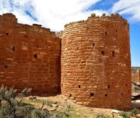
Among them is Hovenweep Castle, one of the most recognizable architectural complexes within Hovenweep National Monument.

The word "castle" is modern.

The structure was not a European-style castle.

Instead, Hovenweep Castle was part of an ancestral Pueblo settlement composed of masonry rooms, towers, kivas, agricultural features, and other structures.

The National Park Service identifies Hovenweep as a collection of six groups of Puebloan village ruins. At its height, the communities may have supported nearly 2,500 people across the broader landscape. Most standing structures visible today date to approximately A.D. 1200–1300.

The Meaning of Hovenweep

"Hovenweep" is a Ute word generally translated as something like "deserted valley."

The name reflects the appearance of the archaeological landscape today.

But abandonment does not mean that the region was meaningless after the ancestral Pueblo occupation.

Modern Pueblo communities maintain cultural relationships with ancestral places throughout the Four Corners.

The Square Tower Group

The Square Tower Unit is the most accessible part of Hovenweep National Monument.

It contains the largest concentration of standing structures within the monument.

Among them are:

  • Hovenweep Castle

  • Square Tower

  • Tower Point

  • Rim Rock House

  • Twin Towers

  • kivas

  • check dams

  • cliff dwellings

  • petroglyphs

The arrangement demonstrates that the buildings were part of a larger settlement system.

Hovenweep Castle

Hovenweep Castle sits directly along the canyon edge.

The National Park Service describes it as a structure containing several rooms and D-shaped towers.

Its dramatic appearance led later observers to describe it as a castle.

But the architecture belongs to the ancestral Pueblo tradition.

The builders constructed walls from carefully laid stone masonry.

The structure's unusual geometry reflects sophisticated construction.

The Square Tower

Nearby stands the Square Tower.

The National Park Service describes it as a three-story tower constructed on a boulder at the head of Little Ruin Canyon.

Its location is remarkable.

Rather than leveling the terrain, builders incorporated the natural boulder into the architecture.

This illustrates a broader Southwestern principle: architecture often worked with the landscape rather than attempting to erase it.

Why Build Towers?

The function of Hovenweep's towers has been debated.

Possible uses include:

  • domestic activity

  • storage

  • observation

  • ceremonial purposes

  • social gatherings

  • defense

No single interpretation necessarily applies to every tower.

Some structures may have had multiple functions.

Archaeology often reveals what a structure physically contains but cannot always determine exactly what every room meant to its inhabitants.

Defensive Architecture

The canyon-edge position of many structures has encouraged interpretations emphasizing defense.

During the late thirteenth century, evidence of conflict exists in parts of the Mesa Verde region.

Walls and restricted entrances could provide security.

But defensive interpretation should not automatically be applied to every elevated structure.

A cliff-edge location also provided architectural advantages, visibility, and access to natural stone foundations.

Water Management

Hovenweep's environment is dry.

Water was therefore one of the most important resources.

Ancestral Pueblo communities constructed check dams and other water-control features.

These structures could slow runoff and increase soil moisture.

They also reduced erosion.

Water management demonstrates that these communities were actively engineering the landscape.

Agriculture

The settlements relied on farming combined with hunting and gathering.

Maize, beans, and squash were important crops.

But agriculture at Hovenweep was risky.

Rainfall could be unpredictable.

The ability to capture runoff and conserve soil moisture therefore had significant economic value.

Kivas

Kivas appear throughout the Hovenweep landscape.

These circular structures were associated with communal and ceremonial activities.

Their presence demonstrates that the settlement included spaces that were not simply residential.

Architecture therefore reveals different categories of social life.

Households, ceremonies, food production, storage, and community activities occupied different spaces.

Petroglyphs

Rock imagery also appears in the monument.

Petroglyphs can preserve evidence of symbolic traditions.

Some imagery depicts humans and animals.

Other images are geometric or abstract.

The meanings of many images remain uncertain.

Interpretation requires comparison with archaeological context and, where appropriate, Indigenous knowledge.

Settlement Density

The broader Hovenweep region contained several communities.

The National Park Service estimates that nearly 2,500 people may have lived within the communities protected by the monument at one time.

This challenges the popular image of the desert as an empty wilderness.

The landscape was once densely inhabited.

People farmed.

They built villages.

They maintained roads and trails.

They constructed water-control systems.

They produced pottery.

They conducted ceremonies.

Masonry Technology

The masonry at Hovenweep is exceptionally impressive.

Builders selected stones carefully.

Walls could curve, angle, or form unusual geometric patterns.

Some structures incorporate D-shaped towers.

Others are circular, rectangular, or irregular.

Construction required understanding how stone courses could support upper walls.

The surviving structures demonstrate considerable architectural knowledge.

Climate and Abandonment

Hovenweep's occupation ended around the late thirteenth century.

This was part of a broader regional transformation.

Drought is frequently discussed as a factor.

Tree-ring evidence indicates periods of severe drought in the late thirteenth century.

But drought alone does not explain the migration.

Social conflict, population pressure, political reorganization, resource stress, and broader migration likely interacted.

The Great Migration

By approximately A.D. 1300, many ancestral Pueblo communities in the Mesa Verde region had been abandoned.

People migrated toward areas that would become the homelands of modern Pueblo communities.

The archaeological record therefore documents a movement of populations rather than a mysterious disappearance.

Preservation

The masonry structures are remarkably durable but still fragile.

Visitors are instructed to stay on designated trails, avoid touching or entering structures, and leave artifacts where they are found.

Touching masonry can loosen stones.

Climbing can destabilize walls.

Collecting artifacts destroys archaeological context.

Preservation therefore depends partly on visitor behavior.

Conclusion

Hovenweep Castle is one of the most visually dramatic ancestral Pueblo structures in the Southwest.

Its unusual towers and canyon-edge architecture invite comparison with European castles, but the comparison can obscure its true identity.

This was ancestral Pueblo architecture.

The settlement incorporated stone masonry, towers, kivas, agricultural fields, water-control systems, and symbolic landscapes.

Its builders adapted to a dry environment through engineering and careful settlement planning.

Today, Hovenweep's structures survive as evidence of a complex community whose people eventually migrated elsewhere.

The ruins are therefore not monuments to a vanished "mystery civilization."

They are the surviving architecture of ancestral Pueblo communities whose descendants remain part of the Southwest today.

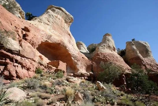
Anasazi Bridge: Utah's Natural Rock Arch Site

October 3, 2026

Introduction

The Utah landscape contains thousands of natural arches, bridges, cliffs, canyons, and rock formations that have been used and interpreted by people for thousands of years.

Among the lesser-known features associated with the archaeological landscape of southern Utah are natural bridges and arches located near archaeological areas and canyon systems.

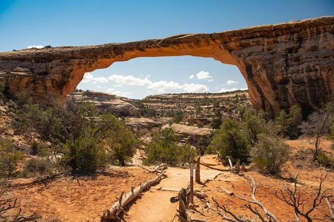
The title "Anasazi Bridge" reflects a popular geographic and archaeological association, but it is important to distinguish natural geological formations from archaeological structures. A natural bridge is created primarily through erosion, not constructed by people.

The distinction matters because the Four Corners landscape contains both extraordinary natural formations and extensive archaeological evidence from ancestral Pueblo communities.

Natural Bridges and Geological Processes

A natural bridge forms when erosion cuts through a landform, eventually creating an opening beneath a span of rock.

Water is often the primary agent.

In desert environments, flash floods can exploit weaknesses in sandstone.

Over long periods, channels deepen.

The rock above an opening becomes isolated.

Eventually, a bridge-like formation remains.

The sandstone landscapes of southern Utah are particularly favorable for such processes.

The Difference Between an Arch and a Bridge

Geologists distinguish between natural arches and natural bridges.

An arch may form through processes such as weathering, frost action, or erosion.

A natural bridge is more specifically associated with flowing water.

The distinction is scientific rather than cultural.

To an observer, both can look like enormous stone doorways.

The Anasazi Name

The term "Anasazi" is an older archaeological label that has largely been replaced by Ancestral Puebloan in professional and Indigenous-sensitive usage.

"Anasazi" derives from a Navajo term that has often been translated as "ancient enemies" or interpreted in related ways.

Many archaeologists and institutions now prefer "Ancestral Pueblo" because it emphasizes cultural continuity with modern Pueblo peoples.

Nevertheless, older place names remain embedded in maps, popular literature, and tourism.

Natural Bridges in Archaeological Landscapes

Natural bridges could have been important landmarks even when they were not modified by people.

A dramatic geological feature is easy to recognize.

It can become a waypoint.

It can define a travel route.

It can serve as a meeting place.

It can become part of oral traditions.

In an environment where navigation can be difficult, large rock formations provide natural reference points.

Water and Travel

The same processes that create natural bridges can create travel corridors.

Canyons provide routes through otherwise difficult terrain.

Seasonal streams can provide water.

Sheltered alcoves can offer protection from weather.

People moving through southern Utah would have encountered these geological formations as part of their daily environment.

Archaeological Landscapes Around Bridges

Archaeological surveys in southern Utah have identified extensive evidence of ancestral Pueblo occupation.

Sites can include:

  • rock shelters

  • pottery scatters

  • agricultural fields

  • storage structures

  • pithouses

  • masonry rooms

  • petroglyphs

The presence of an arch does not automatically mean that people built or lived within it.

Archaeological interpretation requires physical evidence.

Rock Art

Natural rock formations frequently occur near rock-art sites.

Petroglyphs were created by pecking or carving into rock surfaces.

Pictographs were painted.

Images may include humans, animals, geometric designs, and abstract forms.

Their meanings vary and cannot always be recovered.

The Archaeology of Movement

One of the most important concepts in Southwestern archaeology is movement.

People did not simply live inside houses.

They traveled between:

  • farms

  • water sources

  • hunting grounds

  • villages

  • ceremonial spaces

  • storage locations

  • neighboring communities

Natural bridges and canyon systems could form part of these travel networks.

Landscape Memory

Landscapes can preserve cultural memory.

A prominent arch may be associated with stories.

A canyon may be connected to a migration tradition.

A mountain may serve as a ceremonial landmark.

Archaeologists sometimes refer to these relationships as cultural landscapes.

The concept recognizes that places can have meaning beyond their physical resources.

Natural Architecture

There is an interesting relationship between natural and constructed architecture in the Southwest.

Ancestral Pueblo builders frequently incorporated cliffs, caves, boulders, and rock shelters into their buildings.

Natural bridges represent the extreme end of this geological architecture.

The rock itself creates the structure.

Humans may then use the surrounding landscape without substantially modifying it.

Archaeological Caution

Because popular archaeology often attaches dramatic stories to natural formations, careful evidence is essential.

A natural arch does not become an archaeological site merely because pottery is found nearby.

A rock shelter does not automatically represent a residence.

A petroglyph does not automatically explain why the landscape was used.

Archaeologists establish interpretations through multiple lines of evidence.

Modern Preservation

Natural arches are vulnerable to erosion.

Unlike buildings, they cannot simply be repaired.

The geological processes that created them continue to operate.

Human vandalism can also damage nearby archaeological resources.

Visitors should avoid touching rock art, climbing fragile formations, or collecting artifacts.

Why These Places Matter

The importance of a natural bridge lies partly in its ability to connect geology and archaeology.

The rock formation tells a geological story.

Nearby archaeological remains tell a human story.

Together they demonstrate how people interacted with the physical environment.

Conclusion

"Anasazi Bridge" should be approached as a landscape concept rather than assuming that the bridge itself was an ancient Pueblo construction.

Natural bridges are products of erosion.

Yet the surrounding landscapes can preserve remarkable archaeological evidence of ancestral Pueblo life.

People traveled through canyons.

They farmed near water sources.

They built shelters.

They created rock art.

They navigated using prominent geological landmarks.

The resulting cultural landscape demonstrates that archaeology is not confined to buildings.

Sometimes the most important archaeological setting is the natural world surrounding the ruins.

Range Creek Mummies: Utah's Fremont Wrapped Bodies

October 3, 2026

Introduction

Deep within Utah's rugged canyon country lies Range Creek, an archaeological landscape remarkable for the preservation of Fremont-period sites.

The Fremont tradition represents a diverse group of ancient communities that occupied portions of Utah and neighboring regions roughly between A.D. 400 and 1350.

Range Creek is particularly valuable because archaeological sites survived there in unusually good condition.

The phrase "Range Creek Mummies" evokes preserved human bodies, but it is important to approach the subject carefully. Archaeological preservation in the canyon includes human remains and other organic materials in some contexts, but the archaeological significance of Range Creek is much broader than a collection of "mummies."

The real story is one of Fremont settlement, agriculture, storage, burial practices, environmental adaptation, and exceptional site preservation.

The Fremont Tradition

The Fremont are named after the Fremont River in Utah.

They were not a single centralized civilization.

Rather, archaeologists use "Fremont" to describe a broad archaeological tradition characterized by shared material patterns across parts of Utah and neighboring regions.

Evidence includes:

  • distinctive pottery

  • basketry

  • moccasins

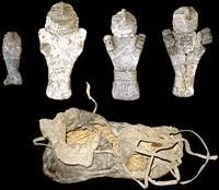
  • clay figurines

  • rock art

  • pithouses

  • agricultural systems

The National Park Service notes that Fremont communities differed in important ways from contemporary ancestral Pueblo communities farther south and east.

Range Creek Canyon

Range Creek contains more than 500 archaeological sites, according to the Natural History Museum of Utah.

Many are approximately 1,000 years old and are associated with Fremont communities.

The canyon remained relatively protected from modern development.

Restricted access helped preserve archaeological features that would have been vulnerable to looting, agriculture, construction, and recreational disturbance.

Fremont Agriculture

The people of Range Creek practiced agriculture despite the challenging environment.

Maize was particularly important.

Agriculture required water.

The canyon environment offered limited but usable resources.

Farmers cultivated suitable areas and took advantage of seasonal water availability.

This demonstrates that Fremont communities were not simply wandering hunter-gatherers.

They practiced a mixed economy.

Hunting and Gathering

Agriculture did not replace hunting and gathering.

Fremont communities continued to hunt deer and other animals.

They gathered wild plants, seeds, nuts, and other resources.

This diversified economy reduced dependence on any single food source.

The result was an adaptable subsistence system.

Pithouses

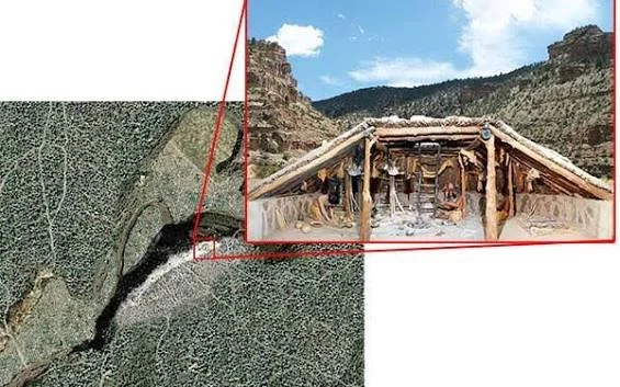
The primary Fremont dwelling was the pithouse.

Pithouses were excavated partially into the ground.

The lowered floor helped moderate temperature.

A roof supported by wooden posts covered the structure.

Utah historical sources describe Fremont pithouses as warm in winter and relatively cool in summer.

Pithouses could serve as living spaces, work areas, or communal structures.

Storage Structures

Storage was crucial.

Fremont communities built granaries and other storage facilities.

Some were deliberately placed in difficult-to-access locations.

This could protect food from animals and possibly from other people.

Storage also reflects economic planning.

A successful harvest could be preserved for later use.

Why Range Creek Is Archaeologically Important

Many archaeological sites elsewhere have been disturbed.

Looting removes artifacts.

Modern construction destroys deposits.

Agriculture can disturb floors and walls.

Range Creek escaped much of this damage.

As a result, archaeologists can study relationships among structures and artifacts.

This is extremely valuable.

Human Burials

Human remains provide evidence about Fremont life.

Archaeologists can study:

  • age

  • sex

  • disease

  • nutrition

  • injury

  • physical activity

  • burial practices

But human remains are not simply archaeological objects.

They are ancestors.

Modern ethical standards require careful treatment, consultation, and legal compliance.

The Meaning of "Mummy"

A mummy is generally a human or animal body preserved through natural or artificial processes.

In dry environments, bodies can sometimes become naturally desiccated.

Textiles, wrappings, and other materials can survive in exceptional conditions.

However, not every naturally preserved human burial should be described as a "mummy" in a sensational sense.

Archaeologists use more precise terminology based on the actual preservation process.

Wrapped Bodies and Textiles

Organic materials can be exceptionally valuable.

Basketry, woven fibers, cordage, and textiles can reveal technological traditions.

A preserved wrapping may demonstrate how people manufactured and used plant fibers.

The survival of such materials depends on environmental conditions.

Dry caves and sheltered areas can prevent rapid decomposition.

Archaeological Ethics

Human remains require special treatment.

Researchers must balance scientific investigation with cultural and ethical responsibilities.

Federal law, including the Native American Graves Protection and Repatriation Act, establishes important requirements concerning Native American human remains and cultural items.

Archaeology therefore cannot simply excavate every burial for scientific purposes.

Modern practice increasingly emphasizes descendant consultation and respectful treatment.

Range Creek and the Landscape

The most important lesson from Range Creek is that the Fremont people were deeply integrated into their environment.

They understood:

  • seasonal water

  • agricultural soils

  • animal migration

  • wild plants

  • canyon geography

  • storage locations

Their settlements reflect environmental knowledge accumulated over generations.

Dendrochronology and Dating

Wooden beams and other plant materials can provide chronological evidence.

Tree-ring dating can sometimes establish precise construction dates.

Researchers have also used radiocarbon dating.

Preliminary dates from maize remains have suggested Fremont occupation in Range Creek around A.D. 900–1150, although the canyon contains evidence for additional periods and the precise chronology varies by site.

Rock Art

Range Creek also contains rock art.

Some imagery may be associated with Fremont traditions.

Rock art provides evidence of symbolic behavior but is difficult to date precisely.

Researchers therefore combine imagery with archaeological context.

Why the Sites Remained Preserved

Range Creek's isolation was crucial.

Limited access reduced disturbance.

This created a rare archaeological situation.

Archaeologists can study entire landscapes rather than only fragments.

The Natural History Museum of Utah describes the canyon as containing hundreds of relatively pristine archaeological sites.

Modern Research

Research in Range Creek has involved archaeologists, dendrochronologists, anthropologists, students, and other specialists.

The landscape provides opportunities to study:

  • settlement organization

  • agriculture

  • food storage

  • chronology

  • architecture

  • environmental adaptation

  • social organization

It is effectively a large archaeological laboratory.

Preservation and Access

The same isolation that preserved Range Creek creates challenges.

Opening the area widely to tourism could increase damage.

Archaeological sites can be destroyed quickly by uncontrolled visitation.

For this reason, restricted access and carefully managed research remain important.

Conclusion

Range Creek's significance lies far beyond the sensational idea of "mummies."

Its real importance is archaeological.

The canyon preserves hundreds of Fremont sites in unusually good condition.

Pithouses reveal domestic life.

Granaries reveal food storage.

Agricultural features reveal environmental adaptation.

Rock art reveals symbolic traditions.

Burials reveal aspects of mortuary practice.

Organic materials provide rare information about technologies that usually disappear from the archaeological record.

Together, these remains demonstrate that Fremont communities were skilled farmers, hunters, craftspeople, and environmental specialists.

Range Creek is therefore one of the most valuable landscapes for understanding Fremont life in Utah.

Steinaker Reservoir: Utah's Fremont Pithouses

October 3, 2026

Introduction

Modern Steinaker Reservoir is known primarily as a water-storage and recreation facility in northeastern Utah.

Yet the surrounding Uinta Basin is also part of a much older human landscape.

Before the modern reservoir, roads, ranches, and irrigation infrastructure transformed the area, Indigenous communities occupied the valleys and foothills for thousands of years.

Among the most important archaeological traditions represented in the region is the Fremont tradition, known for its pithouses, agriculture, distinctive pottery, rock art, and mixed subsistence economy.

The title's emphasis on Fremont pithouses therefore directs attention toward an archaeological landscape that predates the modern reservoir.

Steinaker and the Ashley Valley

Steinaker Reservoir lies in the Ashley Valley of northeastern Utah.

The modern reservoir is supplied by Ashley Creek and provides water storage for irrigation. Utah State Parks describes the reservoir as part of the Central Utah Project system and notes that construction began in the early 1960s.

The modern landscape therefore overlays an ancient one.

Archaeological sites in the region can include structures, artifacts, rock art, and subsistence evidence associated with earlier Indigenous communities.

The Fremont Tradition

The Fremont occupied large portions of Utah between approximately A.D. 400 and 1350.

They were characterized by a combination of agriculture, hunting, gathering, and village life.

The National Park Service identifies distinctive Fremont artifacts including specialized basketry, moccasins, pottery, clay figurines, and trapezoidal human figures in rock art.

Pithouses

The pithouse was a major Fremont architectural form.

A pithouse was partially excavated into the ground.

Posts supported a roof.

The floor could be below the surrounding ground surface.

This design provided thermal advantages.

During winter, the partially underground structure retained warmth.

During summer, it could remain cooler than exposed surface structures.

Construction

Building a pithouse required several stages.

First, people excavated a depression.

They then prepared the floor.

Wooden posts were positioned to support the roof.

Smaller branches and other materials were added.

Earth, vegetation, and other materials could then complete the roof.

The final structure could appear relatively small from outside.

Inside, however, the lowered floor created a usable living area.

Household Life

Pithouses provide evidence about daily life.

Archaeologists may find:

  • pottery fragments

  • grinding stones

  • projectile points

  • animal bones

  • charcoal

  • plant remains

  • storage pits

These materials can reveal what people ate, how they prepared food, what tools they used, and how they organized their household.

Agriculture

Fremont communities cultivated maize.

Beans and squash were also important in many areas.

Agriculture required reliable access to water.

In the Uinta Basin, rivers and streams created opportunities for cultivation.

However, irrigation was not always necessary or uniform.

Different communities adapted their agricultural strategies to local conditions.

Hunting

Hunting remained important.

Deer, rabbits, and other animals contributed meat and raw materials.

Animal remains found in archaeological sites can reveal which species were hunted.

Cut marks on bones can indicate butchering.

Burning can provide evidence of cooking.

Age profiles can sometimes indicate hunting strategies.

Gathering

Wild plants remained part of the Fremont economy.

Seeds, berries, roots, nuts, and other plants provided carbohydrates, fats, vitamins, and other nutrients.

Gathering also reduced dependence on agriculture.

A household could supplement its harvest with wild resources.

Pottery

Fremont pottery is distinctive.

Much of it is gray and coil-built.

Pottery served multiple purposes.

Cooking vessels could withstand heating.

Storage jars could preserve food.

Smaller containers could be used for serving or other household tasks.

Decorative differences help archaeologists identify regional traditions.

Rock Art

The Uinta Basin contains important Fremont rock imagery.

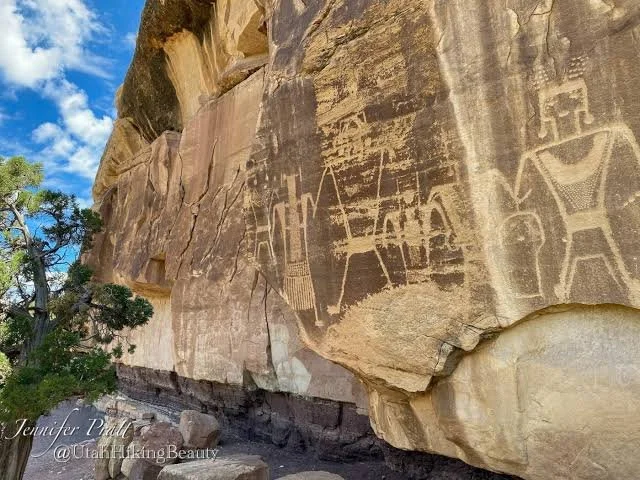
One of the most recognizable Fremont motifs is the trapezoidal-bodied anthropomorphic figure.

These figures sometimes have elaborate headdresses, necklaces, earrings, shields, or other features.

Their precise meaning remains uncertain.

They may have represented ritual beings, ancestors, important individuals, or symbolic concepts.

Archaeologists cannot confidently assign a single interpretation to every image.

The Modern Reservoir

The construction of a reservoir changes archaeological preservation.

Flooding can destroy or conceal archaeological sites.

Survey and mitigation archaeology are therefore often conducted before major construction projects.

Archaeologists may document sites, excavate selected contexts, recover artifacts, and preserve records.

This work creates a scientific archive even when the original landscape is transformed.

Cultural Resource Management

Modern archaeology includes a major field known as cultural resource management.

Before infrastructure projects proceed, archaeologists may evaluate whether cultural resources are present.

If significant sites are identified, agencies may:

  • redesign projects

  • avoid sites

  • document them

  • excavate selected areas

  • preserve artifacts

  • establish monitoring programs

The objective is to balance development with preservation requirements.

Water and Human History

Steinaker illustrates an important theme in archaeology.

Water attracts people across thousands of years.

Ancient farmers depended on streams.

Modern farmers depend on reservoirs.

The technologies are different, but the geographic logic remains similar.

People settle where water makes life and agriculture possible.

Climate

The Uinta Basin experiences seasonal climate variation.

Ancient communities needed to manage drought risk.

Food storage was therefore essential.

A household with stored maize could survive periods when crops failed or hunting opportunities declined.

Settlement Networks

A pithouse was not necessarily an isolated home.

Multiple pithouses could form villages.

Villages could connect with agricultural fields, storage facilities, trails, and resource areas.

This creates a settlement network.

Archaeologists study these spatial relationships to understand social organization.

Fremont Regional Diversity

One of the problems with the word "Fremont" is that it can imply greater cultural uniformity than actually existed.

Fremont communities occupied a huge area.

Their architecture and artifacts varied.

Some communities relied heavily on agriculture.

Others maintained stronger hunting and gathering traditions.

The Fremont should therefore be understood as a diverse archaeological tradition.

Conclusion

Steinaker Reservoir belongs to a modern water-management system, but its landscape has a much deeper human history.

The Fremont people occupied the region centuries before modern irrigation projects transformed the valley.

Their pithouses demonstrate architectural adaptation.

Their pottery reveals craft traditions.

Their agricultural remains reveal food production.

Their hunting and gathering practices demonstrate economic flexibility.

Their rock art reveals symbolic traditions.

The modern reservoir therefore sits within a landscape that has supported human adaptation for thousands of years.

Understanding the archaeology beneath and around such modern infrastructure helps demonstrate that Utah's landscapes are not empty spaces waiting to be developed.

They are cultural landscapes layered with generations of human history.

Moon Lake: Utah's Uinta Basin Fremont

October 3, 2026

Introduction

High in northeastern Utah, Moon Lake occupies a striking position near the Uinta Mountains and Uinta Basin.

Today, the lake is closely associated with modern water management. Moon Lake Dam was constructed during the 1930s as part of a major irrigation project. The Bureau of Reclamation notes that the original natural lake had an estimated capacity of approximately 13,900 acre-feet before the dam expanded the storage system.

But the human history of the region extends far beyond twentieth-century irrigation.

The Uinta Basin was occupied by Indigenous peoples for thousands of years, and archaeological evidence from the broader region includes Fremont-period sites.

The Uinta Basin

The Uinta Basin is a large geological basin surrounded by mountain ranges.

Its geography creates ecological diversity.

Mountain environments provide timber, game, water, and seasonal resources.

Lower elevations provide different plants and agricultural possibilities.

Ancient communities could move between these ecological zones.

This diversity was valuable because no single environment provided every resource needed for survival.

The Fremont

The Fremont archaeological tradition developed across much of Utah and neighboring areas during the first and second millennia A.D.

Fremont communities combined:

  • farming

  • hunting

  • gathering

  • craft production

  • storage

  • seasonal movement

They were not identical to the ancestral Pueblo communities of the Four Corners.

Their material culture is distinctive.

Agriculture in the Uinta Basin

Maize agriculture was important in portions of the Fremont world.

But farming at high elevations or in semi-arid environments was challenging.

Farmers needed to understand local precipitation.

They selected suitable soils.

They took advantage of river valleys and seasonal water.

They stored crops for later use.

This demonstrates a high degree of environmental knowledge.

Hunting

Hunting remained important.

Mountain environments supported deer and other game.

Hunting could provide meat, hides, bone, sinew, and other materials.

The combination of agriculture and hunting provided greater economic flexibility.

Gathering

Wild plant resources were also important.

Pine nuts, seeds, berries, roots, and other plants could supplement cultivated foods.

This mixed economy allowed communities to respond to seasonal changes.

Pithouses

Fremont communities frequently constructed pithouses.

These semi-subterranean structures were well suited to the regional climate.

The lowered floor moderated temperature.

A roof created shelter.

A central hearth could provide warmth and cooking.

The interior could support multiple household activities.

Storage

Food storage was crucial.

Dry maize could be stored for extended periods.

Storage facilities sometimes appear separately from residential areas.

This separation could reduce fire risk and protect food.

In some Fremont landscapes, storage structures were placed in elevated or difficult-to-access locations.

Rock Art

The Uinta Basin is particularly famous for rock imagery.

Fremont rock art includes distinctive anthropomorphic figures.

These figures often have trapezoidal bodies and elaborate headdresses.

Some are large enough to dominate rock panels.

The figures have been interpreted in many ways, but their exact meanings remain uncertain.

The Problem of Interpretation

Archaeologists must distinguish observation from interpretation.

Observation:

A figure has a trapezoidal body.

Interpretation:

The figure represents a supernatural being.

The first statement is directly observable.

The second requires an argument.

This distinction is essential in archaeology.

Moon Lake and Modern Water Infrastructure

The modern Moon Lake Project fundamentally changed the region's water system.

The Bureau of Reclamation states that construction began in 1935 and that the dam was substantially completed in 1938.

The project was designed to store water and supplement irrigation supplies in the Uinta Basin.

This demonstrates how modern communities also adapted to the same fundamental challenge faced by ancient farmers: water availability.

Ancient and Modern Water Management

The comparison between Fremont agriculture and modern reservoirs is revealing.

Ancient farmers used:

  • local streams

  • seasonal runoff

  • irrigation

  • soil management

  • small-scale water-control systems

Modern society uses:

  • dams

  • canals

  • reservoirs

  • diversion structures

  • large-scale irrigation networks

Both systems represent technological responses to environmental constraints.

Archaeological Surveys

Modern infrastructure projects often require cultural-resource surveys.

Before roads, pipelines, reservoirs, and other developments are constructed, archaeologists may investigate the affected landscape.

This helps identify prehistoric sites.

Some sites can be preserved in place.

Others may require archaeological documentation.

The resulting records allow researchers to reconstruct landscapes that have since changed.

The Importance of Context

An isolated artifact has limited meaning.

A projectile point can tell us about technology.

But a projectile point found beside a pithouse, grinding stone, hearth, and storage pit tells a much richer story.

It can reveal how people lived.

This is why archaeological context matters.

Regional Connections

The Fremont world was not isolated.

People interacted with neighboring communities.

Archaeologists have identified similarities and differences between Fremont and ancestral Pueblo traditions.

These connections may reflect:

  • migration

  • trade

  • cultural exchange

  • shared environmental adaptation

The evidence does not always allow researchers to distinguish among these possibilities.

Climate and Change

The Fremont period coincided with major climatic fluctuations.

Drought and changing precipitation could affect agricultural production.

Communities responded in different ways.

Some may have intensified farming.

Others may have increased hunting.

Some communities may have moved.

The end of the Fremont archaeological period was therefore likely caused by multiple interacting factors.

Modern Indigenous Connections

The Uinta Basin remains part of Indigenous homelands.

The history of the region did not end when Fremont villages changed or were abandoned.

Later Ute and other Indigenous communities continued using the landscape.

Modern archaeological interpretation should therefore recognize multiple layers of Indigenous history.

Conclusion

Moon Lake's modern history is dominated by dams, irrigation, and water storage.

But beneath that modern infrastructure lies a much older human story.

Fremont communities occupied the broader Uinta Basin through a combination of agriculture, hunting, gathering, storage, and seasonal adaptation.

Their pithouses reveal domestic architecture.

Their pottery reveals technology.

Their rock art reveals symbolic traditions.

Their agricultural practices reveal environmental knowledge.

The modern Moon Lake Project demonstrates that water remains one of the central challenges of life in the Uinta Basin.

The technology has changed dramatically, but the fundamental importance of water has remained constant.

Nine Mile Canyon: Utah's Barrier Canyon Art

September 27, 2026

Introduction

Stretching for approximately 46 miles through eastern Utah, Nine Mile Canyon is one of the most remarkable rock-art landscapes in the American West.

Despite its name, the canyon is far longer than nine miles.

Its modern name has been explained in connection with historic transportation routes and measurements, but the archaeological importance of the canyon has little to do with its name.

What makes Nine Mile Canyon exceptional is the extraordinary concentration of archaeological and historic resources found along its length.

The canyon contains evidence associated with Archaic, Fremont, and Ute peoples, as well as later ranching and transportation history. Carbon County describes more than 1,000 cataloged sites in the canyon and surrounding landscape.

A Canyon as an Archive

Nine Mile Canyon can be understood as an archaeological archive carved into sandstone.

Its cliffs preserve:

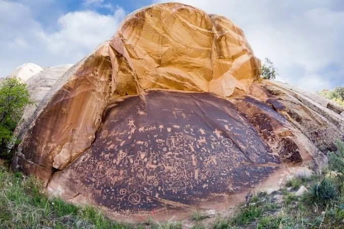
  • petroglyphs

  • pictographs

  • archaeological shelters

  • camps

  • Fremont remains

  • Ute imagery

  • historic inscriptions

  • ranching structures

The canyon therefore contains multiple periods of human history.

Barrier Canyon Style

The title emphasizes Barrier Canyon Art.

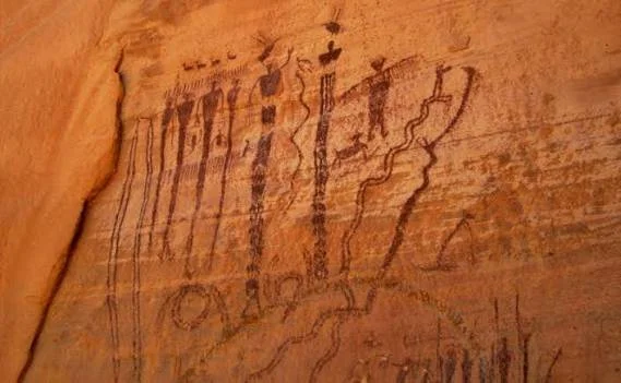
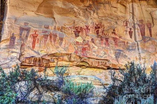
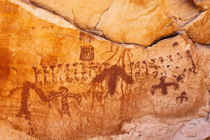
Barrier Canyon Style is an archaeological rock-art tradition associated particularly with Utah and surrounding regions.

Some of its most recognizable images are large anthropomorphic figures.

These figures can have:

  • elongated bodies

  • large heads

  • elaborate features

  • geometric designs

  • unusual proportions

They often appear visually different from later Fremont rock art.

Dating the Rock Art

Dating rock art is difficult.

A painted figure may not contain organic material suitable for conventional radiocarbon dating.

Researchers therefore use several methods:

  • superimposition

  • weathering

  • pigment analysis

  • archaeological association

  • stylistic comparison

  • varnish development

Each method has limitations.

A panel may contain images created centuries apart.

Later artists sometimes carved or painted over earlier imagery.

Fremont Rock Art

Nine Mile Canyon is particularly rich in Fremont imagery.

Fremont figures are often recognizable by their trapezoidal bodies and elaborate headdresses.

Some appear to carry shields or other objects.

Animals frequently occur alongside human figures.

The Utah State Historic Preservation Office identifies Nine Mile Canyon as one of the areas where Fremont rock imagery is especially well represented.

Hunting Scenes

Some panels appear to show hunting.

Animals may include deer, bighorn sheep, or other species.

Human figures can appear beside them.

However, archaeologists must be careful about interpreting such scenes literally.

An animal figure does not necessarily represent an actual hunting event.

It may instead have symbolic, ceremonial, mythological, or social meaning.

The Big Buffalo Panel

The Big Buffalo is one of the best-known rock-art locations in Nine Mile Canyon.

Large animal imagery is visually striking because it remains recognizable after centuries of weathering.

Such panels demonstrate the ability of ancient artists to manipulate the natural surface of sandstone.

The natural contours of rock could become part of the composition.

Technique

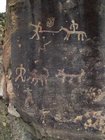
Petroglyphs were created by removing the dark weathered surface of sandstone.

The lighter stone underneath could then become visible.

The artist could peck away the surface point by point.

The resulting contrast produced an image.

Pictographs were created differently.

Pigments were applied to the rock surface.

Mineral pigments, charcoal, plant materials, and other substances could produce different colors.

Rock Varnish

Desert rock surfaces often develop a dark coating known as desert varnish.

This coating forms slowly.

When artists peck through it, lighter rock becomes visible.

Over time, weathering gradually changes the contrast.

This can help archaeologists assess relative age, although it cannot normally provide an exact calendar date by itself.

Fremont and Ute Heritage

Nine Mile Canyon is not exclusively a Fremont landscape.

Later Ute peoples also used the region.

The canyon therefore contains layers of Indigenous history.

This is important because archaeologists sometimes divide landscapes into periods for analytical convenience.

Real people did not experience the world as archaeological "periods."

The canyon remained a useful landscape across generations.

A Transportation Corridor

The canyon later became important for Euro-American transportation.

Historic roads followed portions of the canyon.

Ranching developed.

Cabins, corrals, and other structures were constructed.

These historic remains now coexist with prehistoric archaeological sites.

Ranching History

Historic ranches demonstrate how later settlers adapted to the same landscape.

Water availability remained crucial.

Canyon bottoms could provide grazing.

Sheltered areas offered locations for buildings.

The sandstone cliffs remained landmarks.

The cultural landscape therefore continued evolving.

Archaeological Density

Carbon County reports more than 1,000 cataloged sites in the canyon.

This density makes Nine Mile Canyon exceptionally valuable.

It allows researchers to study relationships among different site types.

A rock-art panel may be located near a habitation site.

A hunting area may be near a water source.

A historic ranch may occupy a location that had already been used by Indigenous people for centuries.

Preservation Challenges

Rock art is fragile.

Touching the surface can transfer oils and moisture.

Chalk, paint, or other attempts to make images more visible can permanently damage them.

Graffiti is especially destructive.

A modern inscription across an ancient petroglyph can obscure the original image.

Energy Development

Nine Mile Canyon has also been affected by modern energy development.

Oil and gas infrastructure exists in parts of the surrounding region.

This creates complex cultural-resource management challenges.

Road construction, vehicle traffic, dust, vibration, erosion, and industrial development can affect archaeological sites.

The challenge is to balance modern economic activity with preservation of irreplaceable cultural resources.

Digital Documentation

Modern technology has transformed rock-art research.

Researchers can use:

  • high-resolution photography

  • 3D scanning

  • photogrammetry

  • GIS

  • digital elevation models

  • multispectral imaging

Digital documentation can preserve detailed records of panels.

This becomes increasingly important as natural weathering continues.

Indigenous Perspectives

Modern archaeological interpretation should not treat the rock art simply as anonymous prehistoric artwork.

The people who created these images had their own identities, communities, traditions, and spiritual systems.

Their descendants remain part of the broader Indigenous world of Utah.

Respectful interpretation therefore requires acknowledging that rock art can have cultural significance beyond its value as archaeological evidence.

Why the Art Survived

The dry Utah climate contributes to preservation.

Low humidity can reduce biological deterioration.

Sheltered cliff faces protect some panels from direct precipitation.

But preservation is not guaranteed.

Wind, water, freeze-thaw cycles, lichen, mineral alteration, and human activity continue to affect the artwork.

Nine Mile Canyon as a Cultural Landscape

The canyon should not be understood simply as an outdoor art gallery.

It is an interconnected cultural landscape.

The rock art is one component.

Others include:

  • archaeological camps

  • farming areas

  • trails

  • water sources

  • hunting locations

  • historic ranches

  • transportation routes

The meaning of the art is partly connected to this wider landscape.

Conclusion

Nine Mile Canyon is one of Utah's richest archaeological landscapes because it preserves thousands of years of interaction between people and place.

Barrier Canyon imagery provides a window into ancient symbolic traditions.

Fremont rock art reveals later cultural developments.

Ute imagery demonstrates continuing Indigenous use.

Historic ranches and roads reveal another chapter.

Together, these layers show that the canyon was never simply an empty passage through the desert.

It was a place where people lived, traveled, hunted, farmed, gathered, created art, told stories, and maintained relationships with the landscape.

Its rock walls preserve only fragments of those histories, but the fragments are extraordinary.

Protecting Nine Mile Canyon therefore means protecting more than beautiful images.

It means preserving an archaeological record of human life across thousands of years.

Buckhorn Wash: Utah's Pictograph Panels

September 27, 2026

Introduction

In the rugged landscape of central Utah's San Rafael Swell, the sandstone walls of Buckhorn Wash preserve one of the region's most impressive concentrations of ancient rock imagery. The canyon is particularly famous for a large panel containing human and animal figures associated with ancient Indigenous traditions.

Buckhorn Wash demonstrates why rock art is so important to Southwestern archaeology. These images are not simply decorative paintings on canyon walls. They are archaeological evidence of how people represented themselves, animals, supernatural beings, social identities, and perhaps aspects of their cosmology.

The canyon also illustrates an important archaeological principle: rock art should be understood within its landscape.

The cliffs, water sources, travel routes, shelters, hunting grounds, and archaeological sites surrounding the images all contribute to their meaning.

The San Rafael Swell

Buckhorn Wash lies within the enormous geological formation known as the San Rafael Swell.

The Swell is characterized by dramatic sandstone cliffs, mesas, canyons, ridges, and natural formations created through millions of years of geological processes.

The exposed sandstone provided an ideal canvas for ancient artists.

Its surfaces could preserve both painted images and pecked or carved figures.

Pictographs and Petroglyphs

The distinction between pictographs and petroglyphs is fundamental.

A pictograph is an image applied to a rock surface using pigment.

A petroglyph is created by modifying the rock itself through pecking, carving, scraping, or related techniques.

Buckhorn Wash contains important examples of rock imagery, and the distinction helps archaeologists understand how different images were produced.

Pigments could contain mineral materials such as iron oxides, which produce reddish colors.

Other pigments could produce black, white, or yellow tones.

Organic binders may have helped pigments adhere to rock.

The Buckhorn Wash Panel

The most famous rock-art panel contains large anthropomorphic figures and animals.

The human figures are visually striking because of their unusual proportions.

Some appear to have elaborate head features.

Others appear alongside animals.

The figures belong to traditions that archaeologists associate with ancient Indigenous populations of the region, including the broader traditions often called Barrier Canyon Style.

Barrier Canyon Style

Barrier Canyon Style rock art is particularly associated with Utah.

Its most recognizable feature is the presence of large anthropomorphic figures with elongated or simplified bodies.

Some figures are nearly life-sized or larger.

They can appear ghostlike to modern observers.

However, the modern word "ghost" should not automatically be interpreted as an ancient meaning.

The figures may have represented supernatural beings, ancestors, ritual participants, or other culturally important concepts.

Their precise meanings remain uncertain.

Why Are the Figures So Large?

Scale may have been significant.

Creating an image several meters high requires substantial effort.

The size would make the image visible from a considerable distance.

This raises questions about audience.

Was the panel intended for people traveling through the canyon?

Was it associated with ceremonial gatherings?

Did the artists deliberately choose the location because of its visibility?

Archaeology cannot always provide definitive answers, but the location itself suggests that the images were meaningful within the landscape.

Dating Buckhorn Wash

Dating rock art is notoriously difficult.

Unlike pottery or wooden structures, rock art often lacks organic material that can be directly dated.

Researchers therefore use several approaches.

These include:

  • stylistic comparison

  • superimposition

  • weathering

  • pigment analysis

  • archaeological association

  • radiocarbon analysis of suitable organic pigment components where available

These methods can produce chronological estimates, but they rarely provide the simple certainty of a tree-ring date.

Fremont Connections

Later Fremont communities also occupied central Utah.

Their rock art is often recognizable by distinctive anthropomorphic figures with trapezoidal bodies and elaborate headdresses.

At Buckhorn Wash and elsewhere in Utah, researchers must therefore distinguish between different artistic traditions.

A single canyon can preserve imagery produced over hundreds or thousands of years.

The Landscape Around the Art

The canyon itself was an important resource.

Water could be found seasonally.

Wild plants grew in suitable locations.

Animals traveled through the surrounding terrain.

Shelters provided protection from weather.

Travelers could follow natural canyon routes.

The rock-art panels therefore existed within a living landscape rather than on an isolated wall.

Archaeological Context

Rock art becomes much more informative when studied alongside nearby archaeological evidence.

A nearby habitation site might reveal what people ate.

A tool scatter might reveal hunting or manufacturing.

A hearth might provide chronological evidence.

A pottery fragment might indicate later occupation.

Together, these materials help establish who used the landscape and when.

Preservation

Pictographs are particularly vulnerable to deterioration.

Water can wash pigment away.

Mineral deposits can obscure images.

Wind erosion can alter rock surfaces.

Biological growth can damage pigments.

Human contact is also a serious problem.

Touching painted surfaces can transfer oils and moisture from skin.

Modern graffiti can permanently destroy archaeological information.

Modern Indigenous Significance

Rock art should not be treated solely as an archaeological curiosity.

The descendants of ancient Indigenous populations continue to live throughout the Southwest.

Places containing ancestral imagery can have cultural significance beyond what archaeology alone can reconstruct.

This makes respectful preservation especially important.

Conclusion

Buckhorn Wash is an extraordinary archaeological landscape because its sandstone walls preserve visual evidence of ancient Indigenous traditions.

The large anthropomorphic figures are among the most striking examples of ancient rock art in Utah.

Yet their greatest importance lies not simply in their appearance.

They demonstrate that ancient people used landscapes as places of communication, memory, ceremony, and identity.

The meaning of the figures may never be fully recoverable.

But the fact that generations of people chose this canyon and these rock surfaces tells us that Buckhorn Wash was more than a route through the desert.

It was a meaningful cultural landscape.

Sego Canyon: Utah's Mixed Rock Art Styles

September 27, 2026

Introduction

Few places demonstrate the long history of rock art in Utah as clearly as Sego Canyon.

Located in Grand County, near the Book Cliffs, Sego Canyon contains panels representing multiple periods and artistic traditions. Anthropomorphic figures, geometric imagery, animal representations, and later inscriptions appear across the canyon walls.

The result is not one unified style.

It is a visual record created across thousands of years.

Sego Canyon therefore provides an important case study in the archaeological interpretation of rock art, cultural continuity, and landscape use.

A Long Human History

The archaeological record of the American Southwest extends deep into prehistory.

Hunter-gatherers occupied the region long before agriculture.

Later, Fremont communities developed agricultural settlements.

Still later, Ute peoples continued using the landscape.

Each population interacted with the canyon differently.

Rock art preserves fragments of those interactions.

Multiple Rock-Art Traditions

Sego Canyon is particularly famous because researchers have identified several different rock-art traditions.

These include imagery associated with:

  • Archaic traditions

  • Fremont traditions

  • later Indigenous use

  • historic inscriptions

The styles overlap in places.

This creates a chronological puzzle.

An image located beside another image is not necessarily contemporary.

One may have been produced centuries earlier.

Barrier Canyon Style

Some of the canyon's most dramatic figures belong to traditions associated with the Barrier Canyon Style.

These figures can have elongated bodies, large heads, and unusual proportions.

They may dominate entire panels.

Their visual impact has contributed to considerable speculation about their meaning.

Archaeologists generally avoid assigning a single interpretation.

The figures could have represented beings connected with ritual or cosmological traditions.

But without direct written explanations, certainty is impossible.

Fremont Imagery

Later Fremont artists created distinctive imagery.

Fremont anthropomorphic figures often have trapezoidal bodies.

Some display elaborate headdresses, earrings, necklaces, or other features.

Animals and hunting-related imagery also occur.

These differences allow archaeologists to distinguish broad artistic traditions.

Why Styles Changed

Changes in rock art may reflect cultural transformation.

Different populations may have had different artistic traditions.

Religious concepts may have changed.

New social identities may have emerged.

Artists may have deliberately preserved older imagery while adding new images.

The canyon thus became a visual archive.

Superimposition

One of the most useful archaeological clues is superimposition.

If one image is painted or carved over another, the lower image must be older.

This does not necessarily provide an exact date.

But it establishes relative chronology.

A sequence can therefore be reconstructed.

Older figures may lie beneath newer ones.

Later artists may have added their own imagery to an already meaningful location.

The Canyon as a Route

Sego Canyon is not simply an art gallery.

It is a natural corridor through the landscape.

Canyons provide relatively easy movement through rugged terrain.

They can lead toward water sources, hunting areas, and other valleys.

This may help explain why multiple generations repeatedly returned.

The Role of Water

Water is one of the most important factors in Utah archaeology.

The desert environment makes permanent water sources especially valuable.

A canyon containing springs or seasonal drainage could support people, animals, and vegetation.

Rock-art locations near water may therefore have been strategically important.

Archaeological Context

Archaeologists study more than the rock walls.

They examine:

  • nearby camps

  • hearths

  • stone tools

  • pottery

  • animal remains

  • plant remains

  • trails

These materials can reveal the people who used the canyon.

Fremont Agriculture

Fremont communities practiced agriculture in parts of Utah.

Maize was an important crop.

Farmers also hunted and gathered.

The mixed economy allowed communities to survive variable environmental conditions.

Sego Canyon's archaeological record therefore belongs to a broader landscape of agricultural adaptation.

Historic Inscriptions

Later travelers left inscriptions on some canyon walls.

Historic graffiti is archaeologically different from prehistoric rock art.

Nevertheless, historic inscriptions can themselves become evidence of later history.

The challenge is distinguishing legitimate historic documentation from modern vandalism.

Preservation Problems

Rock art is extremely fragile.

Weathering cannot be stopped.

But human damage can often be prevented.

Touching panels, scratching names, applying chalk, or adding new graffiti can permanently alter the archaeological record.

Modern visitors should therefore observe rock art without touching or modifying it.

Indigenous Heritage

The canyon's Indigenous history extends beyond the prehistoric periods.

Ute peoples continued to use the broader region.

This demonstrates why terms such as "prehistoric" can sometimes be misleading.

Indigenous history did not end with the appearance of European settlers.

Conclusion

Sego Canyon is important because it preserves a long sequence of human artistic expression.

Its panels demonstrate that Utah's deserts were repeatedly visited and inhabited.

Different generations created different visual traditions.

Some produced monumental anthropomorphic figures.

Others created Fremont imagery.

Later peoples continued using the landscape.

The canyon is therefore a chronological archive written directly onto stone.

Its importance lies not merely in the beauty of the images but in what their layering tells us about cultural continuity, change, and the enduring human relationship with the Utah landscape.

McConkie Ranch: Utah's Fremont Petroglyphs

September 27, 2026

Introduction

Along the sandstone walls of Nine Mile Canyon in eastern Utah, the McConkie Ranch area contains some of the most recognizable Fremont rock art in the region.

The images are famous for their human figures, animals, hunting scenes, and geometric forms.

At first glance, the panels may appear to tell simple stories.

A hunter seems to pursue an animal.

A human figure appears to hold a weapon.

A large anthropomorphic figure appears to stand over the canyon.

But archaeology requires a more careful approach.

Rock art is evidence of symbolic behavior, but the original meanings of many images cannot be recovered with certainty.

The Fremont Tradition

The Fremont tradition developed across much of Utah during the first and second millennia A.D.

Fremont communities practiced agriculture but also relied heavily on hunting and gathering.

Their material culture included distinctive pottery, basketry, moccasins, and rock art.

The McConkie Ranch Panels

The rock-art panels at McConkie Ranch are particularly notable for their relatively large and well-preserved figures.

Anthropomorphic images appear alongside animals.

Some figures have elaborate headgear.

Others appear to carry objects.

The combination creates a visually complex record.

The Fremont Anthropomorphic Figure

The Fremont anthropomorphic figure is one of the most recognizable forms of Utah rock art.

Many figures have:

  • trapezoidal bodies

  • narrow waists

  • large heads

  • elaborate headdresses

  • necklaces

  • earrings

  • shields or weapons

Their exact meaning remains uncertain.

They may represent people, supernatural beings, ancestors, or combinations of these concepts.

Hunting Scenes

Some panels appear to show hunters and animals.

Archaeologists can compare these images with physical evidence of hunting.

Projectile points found elsewhere demonstrate the use of bows, darts, and other hunting technologies.

Animal bones reveal what species people consumed.

But rock art cannot necessarily be treated as literal documentation.

An animal may be symbolic rather than prey.

The Importance of Headdresses

Elaborate headgear appears on some Fremont figures.

This has generated considerable interpretation.

Possible explanations include:

  • ceremonial identity

  • social status

  • supernatural representation

  • ritual costume

  • hunting disguise

None can be confirmed universally.

The headdresses are nevertheless significant because they suggest that visual representations carried social information.

Nine Mile Canyon

The canyon itself provides the setting.

Its sandstone walls created natural surfaces for carving.

Water and vegetation made parts of the canyon habitable.

Travel through the canyon connected different areas.

This combination of movement, resources, and dramatic rock surfaces may have contributed to its importance.

Petroglyph Technique

Artists created petroglyphs through direct modification of rock.

Pecking is one common technique.

The artist repeatedly struck the surface with a harder stone.

This removed small pieces of the weathered surface.

The resulting lighter image contrasted with the darker surrounding rock.

Over time, the exposed area gradually darkened again.

Archaeological Dating

Dating petroglyphs is difficult.

Researchers use:

  • superimposition

  • weathering

  • stylistic comparisons

  • archaeological association

  • pigment analysis where applicable

The absence of a precise date does not make the image scientifically useless.

It simply requires archaeologists to express conclusions in terms of probability and relative chronology.

Modern Preservation

McConkie Ranch is accessible to visitors.

This creates preservation challenges.

Foot traffic can cause erosion.

People sometimes touch or climb near panels.

Modern graffiti can damage ancient images.

Photography is generally harmless when done responsibly.

Touching is not.

Cultural Significance

Fremont rock art represents the cultural heritage of Indigenous peoples.

Modern interpretation should therefore avoid portraying the artists as an anonymous "mysterious race."

The people who made the images lived in organized communities.

They had languages, families, beliefs, technologies, and relationships with the landscape.

Conclusion

McConkie Ranch preserves some of the most recognizable examples of Fremont rock art in Utah.

The images provide evidence of artistic skill and symbolic behavior.

They also reveal the importance of animals, human identity, and the surrounding landscape.

But the greatest lesson is one of archaeological humility.

We can see what the artists created.

We can study how the images were made.

We can compare them with other archaeological evidence.

But we cannot automatically know what every figure meant.

The mystery is not a failure of archaeology.

It is a reminder that archaeological evidence often preserves fragments of human experience rather than complete explanations.

Newspaper Rock: Utah's 2,000-Year Pictograph

September 27, 2026

Introduction

Newspaper Rock is one of Utah's most famous rock-art panels.

Located near the Needles district of Canyonlands country, the panel contains a dense collection of petroglyphs created by multiple generations of Indigenous artists.

Its name is especially appropriate in a metaphorical sense.

The sandstone surface resembles a newspaper filled with symbols, figures, animals, and marks created at different times.

But the title "2,000-Year Pictograph" requires an important archaeological correction.

Newspaper Rock is primarily known as a petroglyph panel, not a pictograph. The images were carved or pecked into the rock rather than painted onto it.

The panel also contains imagery representing different periods, meaning that not every figure is necessarily 2,000 years old.

The Rock Surface

The panel is located beneath a sandstone overhang.

This provided some protection from weather.

The rock surface became a natural canvas.

Artists repeatedly modified it.

Older images were sometimes joined by newer ones.

The result is a dense accumulation of visual information.

Petroglyph vs. Pictograph

A petroglyph is created by modifying the rock.

A pictograph is painted.

Newspaper Rock's famous imagery is predominantly petroglyphic.

This distinction matters because the techniques produce different preservation patterns.

Petroglyphs depend on contrast between modified and unmodified rock.

Pictographs depend on the survival of pigment.

The Earliest Imagery

Some imagery at Newspaper Rock is associated with ancient Indigenous traditions dating back many centuries.

Researchers generally connect portions of the panel with Archaic, Fremont, and later Ute or historic periods.

The panel is therefore not the product of one artist or one community.

It is a cumulative record.

Why Did People Return?

The repeated addition of images suggests that the location remained meaningful.

Possible reasons include:

  • proximity to travel routes

  • water

  • hunting areas

  • ceremonial significance

  • cultural memory

  • territorial relationships

The exact reason remains uncertain.

But repeated use demonstrates that the place had continuing importance.

The Images

The panel includes:

  • human figures

  • animals

  • geometric designs

  • handprints or hand-like forms

  • abstract markings

  • later historic inscriptions

Some figures are clearly recognizable.

Others are difficult to interpret.

Animals

Animal imagery includes representations of species important to the region.

Bighorn sheep are particularly common in Southwestern rock art.

Their presence may reflect hunting.

But animals could also have symbolic significance.

An image cannot automatically be interpreted as a record of an actual hunt.

Fremont Figures

Some imagery reflects Fremont artistic traditions.

Fremont anthropomorphic figures often have distinctive body shapes and elaborate headgear.

These figures differ from the older abstract forms found in some Archaic traditions.

The panel therefore provides evidence of cultural change.

Historic Ute and Euro-American Marks

Newspaper Rock also contains later imagery.

Ute people continued to use the broader region.

Historic travelers eventually added inscriptions.

These later marks create another archaeological layer.

Some may be historically significant.

Others constitute vandalism.

The distinction depends on age, context, and cultural-resource assessment.

Superimposition

Superimposition is especially important at crowded rock-art sites.

If one image overlaps another, the underlying image is older.

By mapping these relationships, archaeologists can reconstruct relative sequences.

The technique turns what appears to be a chaotic collection of marks into a chronological record.

Preservation

Newspaper Rock is protected because of its archaeological significance.

Visitors are generally expected to stay on designated paths and avoid touching the rock surface.

Modern graffiti is especially damaging because it competes visually with the original imagery.

The Meaning of the Name

"Newspaper Rock" is a modern English name.

It describes the appearance of the panel rather than translating an Indigenous term.

The metaphor is powerful because the panel really does resemble a dense visual publication.

But unlike a newspaper, its symbols do not come with captions.

Archaeological Interpretation

Archaeologists can identify:

  • technique

  • relative chronology

  • artistic style

  • superimposition

  • environmental context

They cannot always determine:

  • exact meaning

  • language

  • individual identity

  • specific historical event

This distinction is crucial.

Why the Panel Matters

Newspaper Rock is valuable because it demonstrates continuity.

Different peoples used the same landscape.

Each generation inherited a place that already contained marks from earlier generations.

The panel therefore became a form of cumulative cultural memory.

Conclusion

Newspaper Rock is best understood as a multi-period petroglyph panel, rather than simply a 2,000-year-old pictograph.

Its significance lies in its layered history.

Archaic artists, Fremont communities, later Indigenous peoples, and historic travelers all contributed to the visual record.

The sandstone surface therefore preserves not one message but generations of interaction.

It is an extraordinary example of how a landscape can become a long-term archive of human expression.

Paria Rimrocks: Utah's Dinosaur Tracks and Art

September 27, 2026

Introduction

Southern Utah is famous for landscapes that seem almost otherworldly.

Red cliffs rise above desert valleys.

Sandstone formations create natural arches, fins, hoodoos, and canyons.

But beneath the beauty lies a deeper geological history—and in places such as the Paria Rimrocks, that history includes evidence of dinosaurs.

The landscape can therefore preserve two very different kinds of records.

Dinosaur tracks document life millions of years ago.

Later rock art documents human activity thousands of years ago.

Together, they create a remarkable chronological sequence extending from the Jurassic and Mesozoic worlds into Indigenous history and modern settlement.

The Paria Landscape

The Paria region contains extensive exposures of sedimentary rock.

These rocks formed from ancient environments including rivers, floodplains, deserts, and coastal systems.

As geological layers accumulated, organisms occasionally left traces.

Footprints were pressed into wet sediment.

If the sediment hardened and was later buried, those impressions could survive.

Millions of years later, erosion exposed them.

Dinosaur Tracks

Dinosaur tracks are called trace fossils.

They are different from body fossils.

A body fossil preserves part of the organism itself.

A trace fossil preserves evidence of behavior.

Tracks tell us that an animal walked across a surface.

They can reveal:

  • direction

  • speed

  • gait

  • group movement

  • approximate body size

  • interactions with sediment

Track Formation

A dinosaur walking across wet sediment could leave an impression.

If the sediment was buried quickly enough, the track could survive.

Later layers accumulated above it.

Pressure and geological processes hardened the sediments.

Millions of years of uplift and erosion eventually exposed the ancient surface.

This is why dinosaur tracks can appear today on exposed sandstone.

Why Utah Has So Many Tracks

Utah preserves extensive Mesozoic sedimentary formations.

During the Jurassic, parts of the region consisted of environments very different from today's desert.

There were rivers, floodplains, dunes, and other ecosystems.

Dinosaurs moved through these landscapes.

Their tracks became part of the sedimentary record.

Human Rock Art

Much later, Indigenous peoples used the same landscape.

They created petroglyphs and pictographs.

These images belong to an entirely different period of history.

The presence of both dinosaur traces and human rock art demonstrates how one landscape can preserve vastly different timescales.

Fremont and Other Indigenous Traditions

Southern Utah was occupied by different Indigenous communities over thousands of years.

The Fremont tradition is particularly important in central and eastern Utah.

Other rock-art traditions are also present throughout the Colorado Plateau.

Each tradition must be interpreted in its own cultural and chronological context.

The Importance of Landscape

Why would humans create rock art here?

The answer may involve multiple factors.

The region provided:

  • water

  • travel corridors

  • hunting grounds

  • shelter

  • elevated viewpoints

  • dramatic rock surfaces

The cliffs themselves may have carried symbolic significance.

Archaeology and Geology Together

Paria demonstrates the value of interdisciplinary research.

Geologists investigate:

  • sedimentary formations

  • erosion

  • stratigraphy

  • fossil traces

Archaeologists investigate:

  • rock art

  • camps

  • tools

  • ceramics

  • settlement

Paleontologists study dinosaur evidence.

Together, these disciplines reconstruct a much longer history than any one field could provide.

Preservation

Both dinosaur tracks and rock art are fragile.

Visitors walking directly across fossil surfaces can gradually damage them.

Rock art can be damaged by touching or scratching.

Modern graffiti can permanently obscure ancient imagery.

The best protection is careful visitation and site management.

The Problem of Misinterpretation

Popular descriptions can sometimes combine different kinds of evidence.

A site might contain dinosaur tracks nearby and rock art elsewhere.

That does not mean Indigenous artists carved images of dinosaurs.

The archaeological evidence must be examined separately.

Some Indigenous traditions may contain stories involving ancient animals, but connecting a specific petroglyph to dinosaurs requires evidence.

The Geological Timescale

The most striking feature of the landscape is its timescale.

Dinosaurs lived tens or hundreds of millions of years ago.

Human occupation occurred vastly later.

The two records are separated by an enormous span of geological time.

Yet erosion places them in the same modern landscape.

Conclusion

The Paria Rimrocks illustrate how southern Utah preserves multiple chapters of natural and human history.

Dinosaur tracks provide evidence of ancient animal behavior.

Rock art records much later Indigenous cultural activity.

The geology connects them by exposing the surfaces where both forms of evidence survive.

The result is a landscape that functions as a natural archive.

Its sandstone records movement by animals millions of years ago and human activity thousands of years later.

That extraordinary overlap of geological and archaeological history is what makes the Paria region so compelling.

Camelot Petroglyphs: Utah's Figure Panels

September 27, 2026

Introduction

Utah's archaeological landscape contains thousands of rock-art panels, many of which remain difficult to interpret.

The Camelot Petroglyphs belong to this broader tradition of sandstone imagery in the Colorado Plateau.

The site's importance comes from its figure panels and the wider archaeological landscape in which they occur.

Like other Utah rock-art sites, Camelot demonstrates that ancient Indigenous artists used exposed sandstone surfaces to create images that could communicate identity, animals, social relationships, and ideas that modern archaeology can only partially reconstruct.

Figure Panels

Human and anthropomorphic figures are among the most visually compelling forms of Southwestern rock art.

Some appear realistic.

Others are highly stylized.

Some have exaggerated heads or bodies.

Others are reduced to geometric outlines.

These differences reflect changing artistic traditions.

Fremont Influence

Many anthropomorphic figures in Utah are associated with the Fremont tradition.

The characteristic Fremont figure often has:

  • trapezoidal body

  • broad shoulders

  • narrow waist

  • large head

  • elaborate headdress

These features provide archaeologists with useful comparative evidence.

But not every anthropomorphic figure in Utah is necessarily Fremont.

Rock-art styles overlap geographically and chronologically.

Why Create Human Figures?

The answer is uncertain.

Possible interpretations include:

  • ancestral figures

  • supernatural beings

  • ceremonial participants

  • important individuals

  • symbolic representations

Archaeologists rarely claim certainty without supporting evidence.

Animals and Humans

When human figures appear alongside animals, interpretation becomes especially complex.

The combination may represent hunting.

It may represent ritual relationships between humans and animals.

It may depict mythology.

Or the images may have been created independently.

Spatial association alone does not prove a narrative connection.

Rock-Art Technology

Creating a petroglyph required physical labor.

Artists had to select an appropriate surface.

They then removed the weathered outer layer using pecking, carving, or abrasion.

The process could take considerable time.

The completed image could remain visible for centuries.

Landscape Selection

The location of a panel was probably important.

Artists had many rock surfaces available.

Choosing one suggests that the place had some significance.

Visibility may have mattered.

Accessibility may have mattered.

Proximity to water or trails may have mattered.

Cultural traditions may also have influenced location.

Dating

Exact dating is difficult.

Researchers rely on:

  • superimposition

  • weathering

  • archaeological association

  • stylistic comparison

This means dates should often be expressed as approximate ranges rather than precise years.

Preservation

Rock art cannot be replaced once destroyed.

Modern graffiti can erase ancient lines.

Chalk can penetrate porous rock.

Touching can alter surfaces.

Visitors therefore have an important role in preservation.

Conclusion

The Camelot Petroglyphs represent another chapter in Utah's extraordinary rock-art record.

Their figure panels preserve evidence of ancient symbolic activity.

Although archaeologists can study technique, style, chronology, and landscape context, the precise meaning of the figures often remains uncertain.

That uncertainty should not diminish their importance.

Instead, it reminds us that archaeology works with surviving evidence, not complete historical records.

The figures remain powerful precisely because they preserve traces of ideas from cultures whose symbolic systems were not recorded in writing.

Hole-in-the-Rock: Utah's Mormon Pioneer Trail

September 27, 2026

Introduction

Few transportation routes in the American West demonstrate human determination in such dramatic fashion as the Hole-in-the-Rock Trail.

In the late nineteenth century, Mormon settlers in southern Utah faced an enormous geographic challenge: establishing a route across rugged terrain between the settlements of the upper Virgin River region and the San Juan River country.

The route they selected crossed some of the most difficult terrain in the Colorado Plateau.

Steep sandstone cliffs, deep canyons, broken mesas, and the Colorado River all presented obstacles.

Between 1879 and 1880, the expedition spent months constructing and improving a road that would allow wagons to descend toward the Colorado River and continue eastward.

The San Juan Mission

The expedition was organized as part of a Mormon colonization effort.

Church leaders wanted to establish settlements in the San Juan region of southeastern Utah.

A large group of settlers was organized for the journey.

The goal was not simply migration.

They intended to transport families, livestock, tools, food, wagons, and agricultural equipment.

This created enormous logistical demands.

Choosing the Route

The Hole-in-the-Rock route followed an existing natural break in the cliffs toward the Colorado River.

The terrain was difficult enough that a wagon road did not simply exist.

The settlers had to construct one.

They widened passages.

They blasted or excavated rock.

They built switchbacks.

They reinforced steep slopes.

They created routes for wagons.

The Descent to the Colorado

The most famous section was the descent toward the Colorado River.

The sandstone cliffs were steep.

Wagons had to be lowered and guided carefully.

Animals required assistance.

People worked with ropes, timber, tools, and improvised engineering solutions.

The route became one of the most extraordinary examples of pioneer road construction in Utah.

Engineering the Trail

The road was a major engineering project.

Settlers had to transform terrain that was not naturally suitable for wagons.

They created:

  • ledges

  • switchbacks

  • retaining structures

  • widened passages

  • ramps

The work demonstrates the enormous amount of labor required for nineteenth-century overland migration.

The Colorado River

Crossing the Colorado created another major obstacle.

The expedition needed to transport people, animals, and wagons across the river.

The crossing was difficult because of the river's depth, current, and canyon environment.

After reaching the opposite side, the settlers continued toward the San Juan region.

Why the Trail Was So Difficult

The route was not chosen because it was easy.

It was chosen because alternatives were also extremely difficult.

The Colorado Plateau contains extensive areas of rugged terrain.

Natural routes are constrained by canyons and cliffs.

A route suitable for horseback riders may be impossible for wagons.

The settlers therefore had to construct infrastructure specifically for their technology.

Indigenous Landscapes

The Hole-in-the-Rock route crossed landscapes with long Indigenous histories.

Native peoples had traveled through the region for centuries.

The presence of ancient trails, rock art, agricultural sites, and archaeological remains demonstrates that the landscape was not empty.

The Mormon settlers entered a region already occupied and used by Indigenous communities.

Relations With Native Peoples

Relations between Mormon settlers and Indigenous peoples varied considerably across Utah.

There were interactions involving trade, cooperation, conflict, missionary efforts, and competition over land and resources.

The history of the Hole-in-the-Rock expedition should therefore be understood within this larger colonial context.

Arrival in San Juan

The expedition eventually reached the San Juan region.

The settlers established communities despite the difficult environment.

Agriculture required irrigation.

Water was essential.

The same landscape that had made the journey difficult also created challenges for permanent settlement.

The Trail's Limited Use

The Hole-in-the-Rock route was never a major commercial highway.

Its extreme difficulty limited long-term use.

Once alternative routes became available, the original road became less important.

But its archaeological and historical significance remained.

Archaeological Evidence

The trail preserves physical evidence of nineteenth-century engineering.

Researchers can identify:

  • wagon ruts

  • rock-cut roads

  • retaining walls

  • camps

  • inscriptions

  • historic debris

These features help reconstruct the journey.

Preservation

The trail is vulnerable to modern vehicle use.

Off-road driving can damage historic surfaces.

Erosion can destroy wagon ruts.

Modern graffiti can damage historic inscriptions.

Preserving the route requires balancing public access with protection of fragile evidence.

Historical Significance

The Hole-in-the-Rock Trail demonstrates the relationship between migration and engineering.

The settlers did not simply travel through the landscape.

They physically altered it.

They transformed cliffs into roads.

They created infrastructure where none existed.

This is an important feature of American western expansion.

Conclusion

The Hole-in-the-Rock Trail is one of Utah's most remarkable historic transportation routes.

It demonstrates the enormous effort required to move families, wagons, animals, and supplies across the Colorado Plateau.

The trail also reveals the complexity of western settlement.

It was part of Mormon colonization, but it crossed a landscape with much older Indigenous histories.

Today, the surviving road cuts, switchbacks, camps, and river crossing areas provide tangible evidence of nineteenth-century engineering and migration.

The trail remains a monument to both human determination and the extraordinary difficulty of transforming a rugged landscape into a transportation corridor.

Escalante Petrified Forest: Utah's Ancient Log

September 27, 2026

Introduction

In southern Utah, the Escalante Petrified Forest preserves the remains of ancient trees transformed into stone.

The forest is a geological record rather than a conventional archaeological site.

Its importance lies in the preservation of wood from ecosystems that existed millions of years ago.

The landscape therefore provides an extraordinary connection to deep geological time.

Visitors walk among what appear to be logs scattered across the desert floor.

But these are not recently fallen trees.

They are fossils.

What Is Petrified Wood?

Petrified wood forms when organic material is gradually replaced or preserved by minerals.

A fallen tree becomes buried in sediment.

Groundwater carrying dissolved minerals moves through the wood.

Silica and other minerals can enter the cellular structures.

Over long periods, the original organic material may be replaced while retaining the microscopic structure of the wood.

The result is stone that preserves the appearance of wood.

The Chinle Formation

Much of the petrified wood in southern Utah is associated with the Chinle Formation.

The Chinle records ancient environments from the Late Triassic period.

At that time, the region was not the modern desert.

It included river systems, floodplains, wetlands, and other environments.

Trees grew along waterways.

When they died or were uprooted, some became buried rapidly enough to fossilize.

Geological Time

The Triassic period ended more than 200 million years ago.

This means that the trees represented at Escalante are vastly older than human history.

Humans have occupied the Colorado Plateau for thousands of years.

The petrified trees predate human occupation by an enormous margin.

The Fossilization Process

Petrification requires specific conditions.

The tree must be buried before it decomposes completely.

Water must carry minerals into the wood.

The chemical environment must allow mineral replacement or preservation.

Over geological time, pressure and mineralization transform the material.

The final fossil may preserve growth rings and cellular structures.

Color

Petrified wood can be remarkably colorful.

Different minerals create different colors.

Iron can produce red or orange tones.

Manganese and other minerals can create darker shades.

Silica can contribute to translucent or pale sections.

The result is sometimes spectacular.

Scientific Value

Petrified wood provides information about ancient environments.

Scientists can study:

  • tree anatomy

  • growth patterns

  • fossil wood types

  • sedimentary context

  • paleoclimate

  • ancient ecosystems

It therefore contributes to paleobotany.

The Ancient Ecosystem

The trees were part of a larger ecosystem.

Other organisms lived alongside them.

Reptiles, amphibians, insects, and early dinosaurs occupied Triassic environments.

The fossil record provides fragments of these communities.

Petrified wood is therefore not an isolated object.

It belongs to an ecosystem preserved in geological strata.

Human History Around the Forest

Although the petrified wood itself is geological rather than archaeological, people later interacted with the landscape.

Indigenous communities traveled through the region.

Later Euro-American explorers and settlers mapped the area.

Modern tourism eventually transformed the forest into a public attraction.

This creates a layered landscape in which geological and human histories overlap.

Scientific Collection

Fossils are valuable scientific resources.

Removing specimens without authorization can destroy information.

The exact location of a fossil can matter.

A piece of petrified wood found in geological context tells scientists something about the layer in which it was deposited.

Unauthorized collection can therefore reduce scientific value.

Preservation

Petrified wood may appear indestructible because it is stone.

But the landscape surrounding it is fragile.

Erosion can expose new material.

Vehicle traffic can damage surfaces.

Unauthorized collecting can remove specimens permanently.

Petrified Wood and Archaeology

It is important to distinguish fossil material from archaeological artifacts.

A petrified log is not a human-made object.

However, ancient people sometimes used fossil wood as raw material.

If worked pieces of petrified wood are found in archaeological contexts, they can become evidence of human activity.

This illustrates how geology can intersect with archaeology.

Conclusion

The Escalante Petrified Forest is a geological archive of an ancient world.

Its stone logs preserve trees that lived more than 200 million years ago.

The wood became mineralized through burial, groundwater, and geological processes.

Today, these fossils provide evidence about ancient ecosystems long before human beings occupied the region.

The forest therefore expands our understanding of Utah's history beyond archaeology.

The landscape contains not only traces of people but traces of life from an unimaginably distant geological past.

Grosvenor Arch: Utah's Double Natural Bridge

September 27, 2026

Introduction

Rising above the desert landscape of southern Utah, Grosvenor Arch is one of the region's most recognizable natural formations.

Its two sandstone spans create a dramatic double-arched structure that appears almost architectural.

But unlike a human-built bridge, Grosvenor Arch was constructed by geological processes operating over millions of years.

Its existence demonstrates the power of erosion, weathering, uplift, and gravity.

Geological Formation

Southern Utah's landscape consists largely of layered sedimentary rocks.

Sandstone formations were deposited in ancient environments.

Over geological time, these layers were buried, compressed, uplifted, fractured, and exposed.

Once exposed, they became vulnerable to erosion.

Erosion

Wind and water gradually remove softer material.

Freeze-thaw cycles can widen cracks.

Rainwater can exploit weaknesses.

Gravity causes blocks to fall.

Over millions of years, these processes carve cliffs and arches.

Grosvenor Arch is the product of this continuing process.

A Double Arch

The formation contains two prominent sandstone spans.

Their shape results from differential erosion.

Some portions of the rock are more resistant than others.

The surrounding material erodes more quickly.

Eventually, an opening forms.

Natural Bridge or Arch?

The distinction between a natural bridge and natural arch is geological.

A natural bridge is generally associated with erosion by flowing water.

An arch can form through other processes.

Grosvenor Arch is commonly described as an arch despite the occasional use of "natural bridge" in popular descriptions.

The Colorado Plateau

Grosvenor Arch belongs to the broader Colorado Plateau landscape.

The plateau contains some of the world's most spectacular concentrations of exposed sedimentary geology.

National parks and monuments such as Bryce Canyon, Capitol Reef, Grand Staircase-Escalante, and Grand Canyon preserve related geological histories.

Human Use of the Landscape

People have occupied the surrounding region for thousands of years.

Indigenous communities traveled through the area.

They hunted.

They gathered plants.

They created rock art.

They established agricultural settlements in suitable locations.

A prominent formation such as Grosvenor Arch could have served as a landmark.

Landscape Navigation

Before modern maps and GPS, prominent geological features were important navigational references.

A distinctive arch could identify a location.

Canyons and mesas could guide travelers.

The geography therefore had practical value in addition to aesthetic value.

Tourism

Grosvenor Arch became increasingly known to modern travelers through improved roads and tourism.

Its dramatic appearance made it attractive to photographers.

The modern trail and viewing areas allow visitors to experience the formation without climbing it.

Preservation

Natural arches are inherently temporary.

The geological forces that created them continue to operate.

Eventually, erosion may cause sections to collapse.

This is a natural process.

Human visitors can accelerate damage indirectly through unauthorized climbing, erosion, and disturbance.

Scientific Importance

The surrounding rock layers preserve geological history.

Sedimentary structures can reveal ancient environments.

The color and grain of sandstone reflect mineral composition and depositional conditions.

Geologists can therefore read the landscape as a record of ancient environments.

Conclusion

Grosvenor Arch demonstrates the extraordinary power of geological time.

The formation looks like architecture, but no human builder created it.

Wind, water, gravity, weathering, and geological uplift shaped the sandstone across immense spans of time.

The arch also exists within a landscape used by Indigenous communities for thousands of years and later transformed by modern tourism.

Its importance therefore combines geology, landscape history, and human experience.

Kodachrome Basin: Utah's Spire Formations Site

September 27, 2026

Introduction

Utah's Kodachrome Basin is famous for its unusual sandstone spires rising from an enclosed basin surrounded by the larger landscapes of the Colorado Plateau.

These formations are known as sandstone chimneys or spires.

Their unusual shapes have fascinated geologists and visitors for generations.

But the importance of Kodachrome Basin extends beyond its scenery.

The basin preserves geological evidence of ancient sedimentary environments while also forming part of a broader landscape with a long history of Indigenous use.

A Basin of Spires

The most distinctive feature of Kodachrome Basin is its collection of tall, narrow sandstone formations.

Unlike conventional cliffs, the spires stand independently.

Some rise tens of meters above the basin floor.

They vary considerably in shape and size.

How Did the Spires Form?

The precise geological history of each formation is complex.

The sandstone surrounding the basin was deposited in ancient environments.

Later geological processes altered the layers.

One widely discussed explanation involves ancient sediment-filled conduits or pipes through which material once moved.

More resistant material remained while surrounding sandstone eroded.

The result was the formation of vertical pillars.

Differential Erosion

Differential erosion is central to understanding the landscape.

Not all rock erodes at the same rate.

Harder material survives longer.

Softer sandstone disappears.

Over time, resistant cores become exposed.

This process can create dramatic formations.

The Name Kodachrome

The name "Kodachrome Basin" was popularized in the twentieth century.

National Geographic photographers reportedly used the name because the landscape's colors resembled the vivid hues associated with Kodachrome photographic film.

The name became permanent.

Today, the landscape is preserved as Kodachrome Basin State Park.

Ancient Environments

The sandstone itself records ancient environments.

Different layers can represent:

  • dunes

  • river systems

  • floodplains

  • lakes

  • coastal environments

Sedimentary structures provide evidence of how wind and water moved across the ancient landscape.

Indigenous Use

The basin and surrounding region have long Indigenous histories.

People used nearby resources for hunting, gathering, travel, and other activities.

Archaeological evidence from the broader region demonstrates that the Colorado Plateau was repeatedly occupied.

Water

Modern visitors may underestimate how important water is in the desert.

Seasonal springs, streams, and waterholes can determine where people can travel and camp.

Ancient travelers would have planned routes around water availability.

Rock Art

Rock art occurs throughout the broader southern Utah region.

Petroglyphs and pictographs provide evidence of Indigenous symbolic activity.

Not every panel can be assigned to a single culture or date.

Modern Recreation

Kodachrome Basin is now a recreational landscape.

Visitors hike among the spires.

Photography is particularly popular.

Camping and scenic tourism have become major uses.

Preservation

The spires are fragile.

Climbing and unauthorized off-trail activity can accelerate erosion.

Archaeological sites in the region are equally vulnerable.

Responsible visitation helps preserve the landscape for future research.

Conclusion

Kodachrome Basin is a striking example of geological sculpture.

Its sandstone spires demonstrate the effects of erosion and the unequal resistance of different geological materials.

The basin also belongs to a much older human landscape.

Indigenous peoples traveled through and used the region long before modern tourism.

Today, the site allows visitors to experience both geological history and the continuing cultural landscape of southern Utah.

Bryce Canyon Ancestral Sites: Utah's Small Pueblos

September 27, 2026

Introduction

Bryce Canyon is famous around the world for its extraordinary hoodoos—tall columns of eroded sandstone arranged in amphitheater-like formations.

Yet the spectacular geology is only one part of the area's history.

People have lived in and traveled through the Bryce Canyon region for thousands of years.

Archaeological evidence demonstrates Indigenous use of the plateau and surrounding landscapes, including small settlements and agricultural sites associated with ancestral peoples.

The title "small pueblos" should be understood carefully because Bryce Canyon's archaeological remains do not represent one large Pueblo city comparable to major settlements elsewhere in the Southwest.

Instead, the region contains evidence of dispersed Indigenous occupation.

The High Plateau

Bryce Canyon sits at a relatively high elevation.

The climate is considerably cooler than the deserts of southern Utah.

Snowfall is substantial.

Summer temperatures are comparatively mild.

These conditions create a different ecological environment from the surrounding lowlands.

Indigenous Occupation

The area was used by different Indigenous communities over thousands of years.

Archaeological evidence includes:

  • stone tools

  • projectile points

  • ceramics

  • temporary camps

  • agricultural traces

The remains demonstrate that people understood the seasonal opportunities of the plateau.

Ancestral Pueblo Connections

Ancestral Pueblo communities occupied parts of the larger Colorado Plateau.

Their influence and interaction extended across broad regions.

However, archaeological evidence at Bryce Canyon should not automatically be interpreted as evidence of a large permanent Pueblo town.

The landscape was likely used in multiple ways depending on time and location.

Agriculture

Agriculture at high elevation presented challenges.

The growing season was shorter.

Frost could occur unexpectedly.

Water availability varied.

Yet maize agriculture was possible in suitable locations.

People could supplement crops with wild foods.

Hunting

The plateau supported deer and other wildlife.

Hunting provided meat and materials.

The surrounding forests also supplied fuel and construction resources.

Gathering

Wild plants could provide berries, seeds, roots, and other foods.

Medicinal and technological plants were also valuable.

Knowledge of seasonal plant availability would have been essential.

Archaeological Visibility

One challenge at Bryce Canyon is preservation.

Snow, erosion, vegetation, and natural weathering can obscure archaeological remains.

Small sites may be difficult to detect.

This means that the archaeological record is probably incomplete.

The Hoodoo Landscape

The famous hoodoos are geological formations created by erosion.

Their presence would have shaped human experience.

Large cliffs and amphitheaters provide landmarks.

Natural shelters may provide protection.

Water flows through particular channels.

Travel routes follow natural openings.

Modern Tourism

Bryce Canyon is one of Utah's most heavily visited landscapes.

Millions of people are attracted by the hoodoos and scenic viewpoints.

Tourism creates both economic benefits and preservation challenges.

Foot traffic can damage archaeological sites.

Off-trail travel can cause erosion.

Unauthorized artifact collecting destroys context.

Indigenous Interpretation

Modern archaeological interpretation increasingly recognizes Indigenous relationships to landscapes.

The Bryce region was not an empty wilderness before modern national parks.

People lived, traveled, hunted, gathered, and farmed there.

The landscape therefore has cultural history in addition to geological beauty.

Conclusion

Bryce Canyon is best known for its hoodoos, but the landscape also preserves evidence of thousands of years of human activity.

Small archaeological sites reveal how Indigenous communities adapted to a high-elevation environment.

They hunted.

They gathered.

They farmed where possible.

They traveled across the plateau.

The archaeological record is less dramatic visually than the hoodoos, but it is equally important for understanding the history of the region.

Bryce Canyon is therefore both a geological wonder and a cultural landscape.

← Newer Posts Older Posts →
Featured
images (91).jpeg
October 26, 2026
Reconstructing Pastoral Feasting Sites from Burn Patterns and Bones
October 26, 2026
Read more →
October 26, 2026
October 26, 2026
Ancient Sound Mirrors: Echo-Enhancing Structures in Ritual Sites
October 26, 2026
Read more →
October 26, 2026
images (89).jpeg
October 26, 2026
The Geochemistry of Bronze Corrosion in Wetland Burials
October 26, 2026
Read more →
October 26, 2026
images (88).jpeg
October 26, 2026
Early Harpoon Technology Outside the Arctic: Global Diffusion Cases
October 26, 2026
Read more →
October 26, 2026
images (87).jpeg
October 26, 2026
The Archaeology of Salt-Encrusted Caches: Preservation and Looting Risks
October 26, 2026
Read more →
October 26, 2026
images (86).jpeg
October 26, 2026
Micro-Residues of Tanning on Ceramic Surface Impressions
October 26, 2026
Read more →
October 26, 2026
read more

Powered by The archaeologist