• MAIN PAGE
  • LATEST NEWS
    • Lost Cities
    • Archaeology's Greatest Finds
    • Underwater Discoveries
    • Greatest Inventions
    • Studies
    • Blog
  • PHILOSOPHY
  • HISTORY
  • RELIGIONS
    • Africa
    • Anatolia
    • Arabian Peninsula
    • Balkan Region
    • China - East Asia
    • Europe
    • Eurasian Steppe
    • Levant
    • Mesopotamia
    • Oceania - SE Asia
    • Pre-Columbian Civilizations of America
    • Iranian Plateau - Central Asia
    • Indus Valley - South Asia
    • Japan
    • The Archaeologist Editor Group
    • Scientific Studies
    • Aegean Prehistory
    • Historical Period
    • Byzantine Middle Ages
    • Predynastic Period
    • Dynastic Period
    • Greco-Roman Egypt
  • Rome
  • PALEONTOLOGY
  • About us
Menu

The Archaeologist

  • MAIN PAGE
  • LATEST NEWS
  • DISCOVERIES
    • Lost Cities
    • Archaeology's Greatest Finds
    • Underwater Discoveries
    • Greatest Inventions
    • Studies
    • Blog
  • PHILOSOPHY
  • HISTORY
  • RELIGIONS
  • World Civilizations
    • Africa
    • Anatolia
    • Arabian Peninsula
    • Balkan Region
    • China - East Asia
    • Europe
    • Eurasian Steppe
    • Levant
    • Mesopotamia
    • Oceania - SE Asia
    • Pre-Columbian Civilizations of America
    • Iranian Plateau - Central Asia
    • Indus Valley - South Asia
    • Japan
    • The Archaeologist Editor Group
    • Scientific Studies
  • GREECE
    • Aegean Prehistory
    • Historical Period
    • Byzantine Middle Ages
  • Egypt
    • Predynastic Period
    • Dynastic Period
    • Greco-Roman Egypt
  • Rome
  • PALEONTOLOGY
  • About us
No results found

Taleh: Somaliland's Dervish Fortresses

August 23, 2026

Taleh is one of the most important historical landscapes associated with the Dervish movement of the early twentieth century.

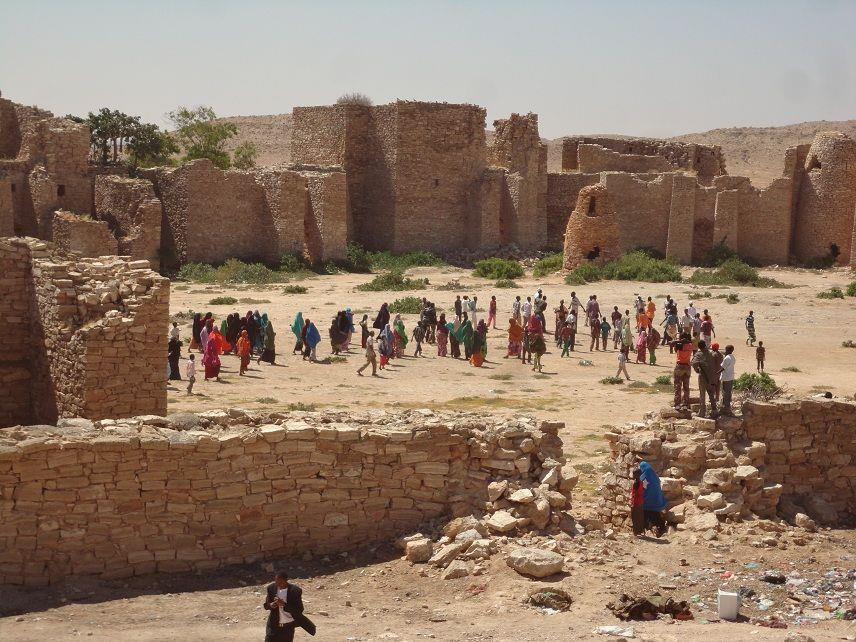
Located in the interior of Somaliland, Taleh became a major stronghold of Sayyid Mohammed Abdullah Hassan and his followers during their resistance to European and Ethiopian expansion.

The monumental stone structures at Taleh are among the most recognizable remnants of this period.

They demonstrate how military architecture, religious authority, and political resistance became intertwined in the Horn of Africa.

Sayyid Mohammed Abdullah Hassan

Sayyid Mohammed Abdullah Hassan was a Somali religious and political leader who became the central figure of the Dervish movement.

Beginning in the late nineteenth century, he mobilized supporters around opposition to foreign political and military influence.

The movement was shaped by:

  • Islamic religious ideas;

  • Somali political traditions;

  • anti-colonial resistance;

  • and alliances among different communities.

The Dervish State

The Dervish movement developed political and military institutions.

It established settlements, constructed fortifications, and controlled territories at different stages.

Taleh became one of its most important centers.

Why Taleh Was Important

The location of Taleh was strategically valuable.

It was situated in the interior, away from major coastal colonial centers.

Its location allowed Dervish forces to:

  • establish a protected headquarters;

  • store supplies;

  • organize military operations;

  • and maintain political authority.

The Fortifications

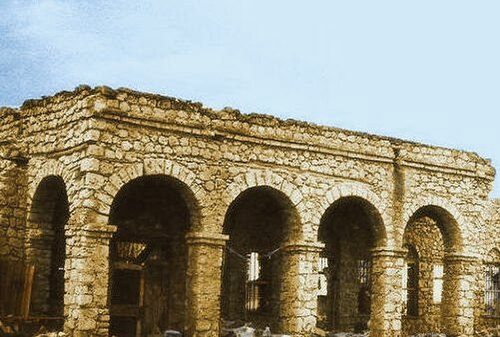
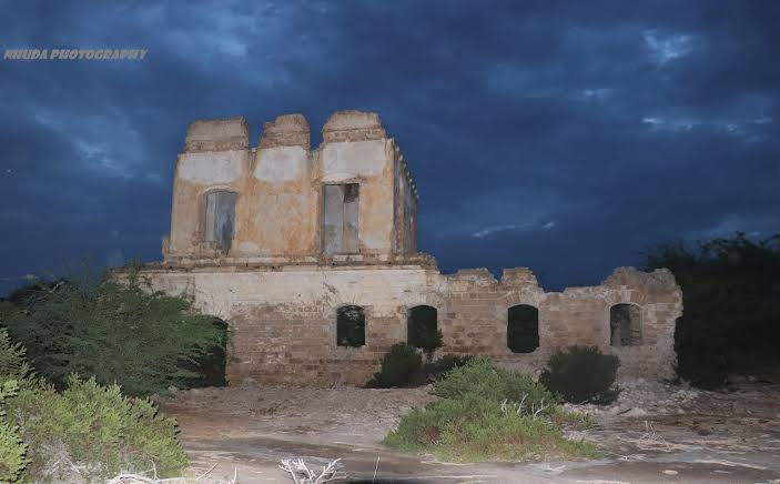
Taleh's most famous structures are its stone fortifications.

The architecture includes:

  • thick walls;

  • towers;

  • enclosed compounds;

  • and defensive structures.

These buildings were designed to withstand attacks and protect the people and resources inside.

Defensive Architecture

Fortifications served several functions.

They provided protection from:

  • firearms;

  • raiding parties;

  • rival political forces;

  • and colonial military expeditions.

High walls also communicated authority.

A large fortified settlement demonstrated that the Dervish movement possessed the organization and resources necessary to build permanent structures.

Religious and Political Power

The Dervish movement was not simply a military organization.

Its political authority was closely connected to Islamic religious identity.

Religious leadership helped mobilize followers and establish legitimacy.

This combination of religion and political resistance was a major feature of the movement.

Trade and Supply

A military settlement needed food and equipment.

Taleh therefore depended on regional networks supplying:

  • livestock;

  • grain;

  • water;

  • weapons;

  • ammunition;

  • and other necessities.

Control over movement through the interior was strategically important.

Conflict With Colonial Powers

The Dervishes fought British and Ethiopian forces for many years.

British military campaigns included:

  • ground operations;

  • naval support;

  • and eventually aerial bombardment.

The development of aircraft dramatically changed the balance of power.

The Fall of Taleh

In 1920, British forces launched a major campaign against the Dervish movement.

Aircraft were used to attack Dervish positions.

Taleh was eventually captured, contributing to the collapse of the Dervish state.

Preservation of the Fortresses

The surviving structures are important historical monuments.

They preserve physical evidence of a major anti-colonial movement.

The architecture also provides information about:

  • construction techniques;

  • defensive planning;

  • political organization;

  • and material resources.

Why Taleh Matters

Taleh is important not only to Somali history but to the broader history of anti-colonial resistance in Africa.

The site demonstrates how local political movements could develop sophisticated systems of:

  • administration;

  • military organization;

  • architecture;

  • and religious authority.

Conclusion

Taleh's fortresses are among the most powerful physical reminders of the Dervish movement.

Their thick walls and imposing towers represent a period when religious leadership and political resistance combined to challenge colonial expansion.

Today, the ruins stand as a major symbol of Somali historical memory and the struggle for political independence.
Hargeisa Rock Art: Somaliland's Hunter-Gatherers

August 23, 2026

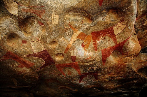
The rock-art landscapes around Hargeisa preserve some of the most important evidence for prehistoric human activity in Somaliland.

Before the development of states, cities, and written records, communities across the Horn of Africa created images on rock surfaces.

These paintings and engravings provide clues about:

  • animals;

  • people;

  • hunting;

  • pastoralism;

  • ritual;

  • and changing environments.

Rock Art Around Hargeisa

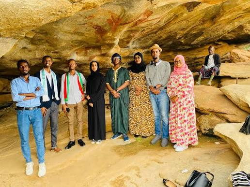
The Hargeisa region contains numerous rock shelters and exposed rock surfaces.

Some contain paintings of:

  • cattle;

  • wild animals;

  • human figures;

  • and symbolic forms.

The imagery belongs to different prehistoric periods.

Not every image was necessarily created by the same population.

Hunter-Gatherers and Pastoralists

The title identifies the art with hunter-gatherers, but chronology is important.

Some rock-art traditions in the Horn of Africa predate widespread pastoralism, while others are associated with later herding communities.

Researchers therefore examine the animals depicted and the archaeological context to determine the likely period.

Hunting Scenes

Wild animals represented in rock art can provide evidence about the environment.

Depictions may include:

  • antelope;

  • giraffes;

  • large mammals;

  • and other species.

If these animals no longer inhabit the region, their presence in ancient art may reflect past ecological conditions.

The Arrival of Livestock

Later rock-art traditions include domesticated animals.

Cattle became particularly prominent.

This suggests an economic transformation from primarily hunting and gathering toward pastoralism.

Human Figures

Human figures may represent:

  • hunters;

  • herders;

  • dancers;

  • ritual specialists;

  • or symbolic characters.

Some figures appear to carry objects.

However, identifying these objects can be difficult.

Ritual Interpretations

Rock art may have been associated with ritual activities.

Possible interpretations include:

  • hunting ceremonies;

  • fertility rituals;

  • initiation;

  • ancestral traditions;

  • or territorial identity.

No single explanation applies to every image.

Why Rock Shelters Were Chosen

Rock shelters provide natural protection.

They also create prominent landmarks within the landscape.

A painted shelter could become:

  • a meeting place;

  • a ritual location;

  • a navigation landmark;

  • or a place associated with ancestral memory.

Pigments

Prehistoric artists used naturally occurring pigments.

Red and yellow ochres were particularly common.

Other colors could be produced using:

  • charcoal;

  • mineral compounds;

  • or light-colored clays.

The pigments were applied using fingers, brushes, or other tools.

Environmental Change

The Hargeisa rock art provides evidence for landscapes that changed dramatically over time.

The Horn of Africa experienced fluctuations in:

  • rainfall;

  • vegetation;

  • wildlife;

  • and water availability.

Human communities adapted to these changes.

Why Hargeisa Rock Art Matters

The paintings provide a rare visual record of prehistoric life.

They reveal:

  • artistic ability;

  • human-animal relationships;

  • economic change;

  • environmental history;

  • and symbolic behavior.

Conclusion

Hargeisa's rock art preserves the memories of communities that lived in Somaliland thousands of years before written history.

Some images may reflect hunting traditions, while later artwork records the emergence of pastoral societies.

Together, they demonstrate how human relationships with animals and landscapes changed over time.

Berbera Tombs: Somaliland's Islamic Graves

August 23, 2026

Berbera, located on the Gulf of Aden, has been an important coastal settlement for centuries.

Its strategic location made it a center of maritime trade connecting Somaliland with Arabia, the Red Sea, and the wider Indian Ocean.

The town's Islamic cemeteries and tombs preserve evidence of the long history of Muslim communities in the region.

Islam on the Somaliland Coast

Islam became established along the Somali coast through centuries of contact with Muslim merchants and communities.

Trade played an important role.

Muslim merchants traveled between:

  • Arabia;

  • East Africa;

  • Persia;

  • India;

  • and the Red Sea.

Religious and commercial networks frequently overlapped.

Islamic Burial Traditions

Islamic burial practices generally emphasize:

  • burial of the deceased;

  • orientation toward Mecca;

  • modesty;

  • and communal remembrance.

However, tomb architecture varies considerably across regions.

Local traditions sometimes produced distinctive structures.

Tombs as Historical Evidence

Burial sites can preserve information about:

  • population;

  • religion;

  • social status;

  • artistic traditions;

  • and trade connections.

Inscriptions can be particularly valuable.

They may record:

  • names;

  • dates;

  • religious phrases;

  • genealogies;

  • and titles.

Coastal Trade and Islam

Berbera's importance as a port meant that religious traditions could spread alongside commercial relationships.

Merchants could establish long-term communities.

Mosques and cemeteries became permanent evidence of these networks.

Imported Materials

Objects associated with Islamic burials can sometimes reveal long-distance connections.

These may include:

  • ceramics;

  • beads;

  • textiles;

  • or architectural elements.

However, imported objects must be interpreted carefully because they may have passed through several trading communities.

Tomb Architecture

Some Islamic tombs are relatively simple.

Others may include:

  • stone markers;

  • domed structures;

  • decorated graves;

  • or enclosed burial spaces.

Architectural variation can reflect:

  • regional traditions;

  • social status;

  • religious practices;

  • and historical periods.

Berbera's Maritime Position

The Gulf of Aden made Berbera an important stopping point.

Ships could use the harbor while trading goods between Africa and Arabia.

The town therefore developed a cultural environment influenced by multiple regions.

The Colonial Period

During the nineteenth century, Berbera became increasingly important to European imperial interests.

British Somaliland established political control over the northern Somali coast.

Colonial administration altered the economic importance of the port.

Preservation

Historic Islamic cemeteries are vulnerable to:

  • urban development;

  • erosion;

  • vandalism;

  • and neglect.

Preserving graves is particularly important because burial sites contain cultural and religious significance beyond their archaeological value.

Why Berbera's Tombs Matter

The tombs preserve evidence of the long-term establishment of Islam in Somaliland.

They demonstrate how:

  • religion;

  • maritime trade;

  • migration;

  • and local traditions

became interconnected.

Conclusion

The Islamic tombs of Berbera are important historical witnesses to the transformation of Somaliland's coastal society.

They demonstrate that the Gulf of Aden was not simply a geographic boundary.

It was a corridor through which religion, commerce, people, and cultural traditions moved for centuries.

Oodweyne: Somaliland's Sultanate Palace

August 23, 2026

Oodweyne is an important settlement in the interior of Somaliland and forms part of the region's historical landscape of pastoral communities, local political authority, and trade.

The description “Sultanate Palace” should be treated carefully because specific claims about a surviving palace and its exact connection to a named sultanate require archaeological and historical verification.

Nevertheless, the concept provides an opportunity to explore the role of political residences in Somali sultanate society.

Political Authority in Somali Society

Traditional Somali political systems could include:

  • sultans;

  • clan leaders;

  • religious authorities;

  • elders;

  • and local chiefs.

Authority was often negotiated through relationships rather than imposed through a centralized bureaucracy.

What Was a Sultan's Residence?

A ruler's residence could serve several functions.

It could provide space for:

  • meetings;

  • diplomacy;

  • receiving visitors;

  • storing goods;

  • religious activities;

  • and administrative decisions.

A political residence was therefore more than a private home.

Architecture and Local Materials

Buildings in Somaliland traditionally used locally available materials.

Depending on the environment, construction could involve:

  • stone;

  • earth;

  • timber;

  • mud plaster;

  • and woven materials.

Architecture reflected climate and available resources.

The Pastoral Economy

Political authority was closely connected to pastoral wealth.

Livestock represented:

  • food;

  • transportation;

  • wealth;

  • marriage resources;

  • and social status.

A ruler's ability to mobilize livestock and followers could strengthen political influence.

Caravan Routes

Interior settlements such as Oodweyne were connected to wider networks through caravan routes.

Camel caravans could transport goods across difficult terrain.

They connected:

  • inland pastoral communities;

  • markets;

  • coastal ports;

  • and neighboring territories.

Islam and Political Authority

Islamic traditions provided another source of legitimacy.

Rulers could maintain relationships with:

  • religious scholars;

  • Sufi leaders;

  • and mosque communities.

Religious authority and political authority often interacted.

Diplomatic Meetings

A ruler's residence could become a place where disputes were resolved.

Elders and representatives from different groups could meet to negotiate:

  • grazing rights;

  • water access;

  • trade;

  • alliances;

  • and conflict.

Political architecture therefore supported social negotiation.

Colonial Transformation

European colonial expansion transformed local political systems.

British authorities increasingly imposed administrative structures that changed the role of traditional leaders.

Some rulers cooperated with colonial authorities.

Others resisted.

Traditional political institutions did not disappear immediately, but their authority changed.

Why Oodweyne Matters

Oodweyne represents the broader history of interior Somaliland, where pastoral economies and political institutions interacted with trade and religion.

Conclusion

The historical importance of Oodweyne lies in understanding how political authority functioned within Somali society.

Whether or not a specific surviving structure can securely be identified as a “sultanate palace,” the region illustrates how rulers, elders, religious authorities, and pastoral communities organized political life across the Somaliland interior.

Burao: Somaliland's 19th-Century Caravan Stop

August 23, 2026

Burao is one of Somaliland's major inland cities and historically developed within a landscape shaped by pastoralism, caravan trade, and regional markets.

During the nineteenth century, caravan networks were essential to the economy of the Horn of Africa.

Before modern roads and motor vehicles, camels provided one of the most effective means of transporting goods across dry landscapes.

Burao's position made it an important meeting point between inland pastoral communities and broader commercial networks.

The Camel Caravan

Camels were ideally suited to arid environments.

They could:

  • travel long distances;

  • carry heavy loads;

  • survive periods with limited water;

  • and consume vegetation unavailable to many other livestock.

This made them indispensable to long-distance trade.

What Did Caravans Carry?

Goods transported across Somaliland could include:

  • livestock;

  • hides;

  • skins;

  • ghee;

  • aromatic products;

  • salt;

  • textiles;

  • and imported manufactured goods.

The exact commodities varied according to location and period.

Burao as a Market

Markets were places where pastoralists and merchants exchanged goods.

A livestock market could bring together people from widely separated territories.

This created opportunities for:

  • trade;

  • social interaction;

  • political negotiation;

  • and information exchange.

The Importance of Water

A caravan stop needed reliable water.

Travelers and animals required substantial quantities.

Wells and seasonal water sources therefore influenced the location of settlements and routes.

Pastoral Communities

Burao's historical economy was closely connected to pastoralism.

People raised:

  • camels;

  • cattle;

  • sheep;

  • and goats.

Livestock were both economic resources and important social assets.

Coastal Connections

Goods could move from Burao toward coastal ports such as Berbera.

From there, products could enter maritime trade networks.

Conversely, imported goods could travel inland toward Burao.

This created a connection between:

pastoral interior → caravan route → coastal port → international trade.

Nineteenth-Century Trade

The nineteenth century was a period of significant change in the Horn of Africa.

European merchants and imperial powers increasingly became involved in regional commerce.

British influence over the Somaliland coast expanded.

Trade in livestock and other products became increasingly connected to international markets.

Colonial Rule

British Somaliland was established as a colonial territory.

Colonial authorities sought to regulate:

  • trade;

  • taxation;

  • movement;

  • and political relationships.

These changes affected caravan networks.

From Camels to Motor Transport

During the twentieth century, roads and motor vehicles gradually transformed transportation.

Caravan routes became less dominant.

Markets increasingly connected to modern urban infrastructure.

Nevertheless, livestock trading remained central to the economy.

Why Burao Matters

Burao represents the transformation of an inland caravan economy into a modern commercial center.

Its history demonstrates how:

  • pastoralism;

  • camel transport;

  • regional markets;

  • coastal trade;

  • and colonial economic systems

interacted.

Conclusion

Burao's history is closely connected to the caravan networks that once crossed Somaliland.

Camel traders carried goods between inland pastoral communities and coastal ports, linking local economies with the wider Red Sea and Indian Ocean world.

The rise of roads and motor transport eventually changed these networks, but the commercial importance of livestock and regional markets remains a major part of Burao's historical legacy.

Erigavo: Somaliland's Mountain Forts

August 23, 2026

Erigavo, also known as Ceerigaabo, lies in the mountainous Sanaag region of Somaliland near the Golis Mountains.

Its elevated location created strategic advantages for communities living in the region.

The surrounding mountains provided:

  • defensive positions;

  • access to different ecological zones;

  • grazing areas;

  • and views across extensive territory.

The title “Mountain Forts” reflects the broader defensive architecture of the region, although individual structures and their dates must be distinguished carefully.

The Golis Mountains

The mountains of northern Somaliland create one of the most distinctive landscapes in the Horn of Africa.

Higher elevations generally receive different rainfall patterns from the surrounding lowlands.

This can create diverse ecological zones within relatively short distances.

Why Mountains Were Valuable

Mountain locations could provide:

  • defensive advantages;

  • cooler conditions;

  • access to springs;

  • and strategic observation points.

A settlement positioned on elevated terrain could see approaching groups from considerable distances.

Fortification in Somali History

Fortifications in the region could be built for several reasons.

They might protect:

  • settlements;

  • rulers;

  • livestock;

  • water sources;

  • or trade routes.

The presence of a defensive structure does not necessarily indicate a large centralized state.

Local communities could construct fortifications in response to regional conflict.

Stone Construction

Stone was abundant in many mountainous parts of Somaliland.

Builders could construct:

  • walls;

  • towers;

  • enclosures;

  • and defensive compounds.

Stone structures were durable but required considerable labor.

Political Competition

The Horn of Africa experienced competition between:

  • local clans;

  • sultanates;

  • religious movements;

  • and colonial forces.

Control of mountain passes and water sources could provide strategic advantages.

Caravan Routes

Mountain routes connected different ecological zones.

Travelers could move:

  • livestock;

  • salt;

  • hides;

  • food;

  • and imported goods.

A fortified position near a route could potentially monitor movement.

Colonial Expansion

During the late nineteenth and early twentieth centuries, European powers expanded their political control over the Horn of Africa.

British Somaliland administration increasingly reached inland areas.

Mountain communities experienced new forms of taxation, administration, and military pressure.

The Dervish Period

The Dervish movement also affected northern Somaliland.

Its conflict with British and Ethiopian forces transformed regional military geography.

Fortifications and elevated positions became strategically important.

Archaeological Challenges

Mountain ruins can be difficult to date.

A stone wall may have been:

  • built in one period;

  • repaired later;

  • abandoned;

  • and reused by another community.

Archaeologists therefore need:

  • pottery;

  • inscriptions;

  • stratigraphy;

  • historical records;

  • and architectural comparisons

to establish chronology.

Why Erigavo Matters

Erigavo provides an important setting for studying:

  • mountain settlement;

  • defensive architecture;

  • pastoralism;

  • trade routes;

  • and political change.

The region demonstrates how geography shaped human history.

Conclusion

The mountain landscape around Erigavo illustrates how communities in Somaliland adapted their settlements to rugged terrain.

Elevated positions could provide protection, visibility, access to different ecological resources, and control over routes.

The surviving fortifications and historic structures form part of a broader record of Somali political organization, pastoral economies, regional conflict, and colonial transformation.

Together, these sites demonstrate that the mountains of Somaliland were not peripheral to history—they were strategic landscapes at the center of it.

Las Khorey: Somaliland's Salt Pans and Ruins

August 23, 2026

Las Khorey, also known as Laasqoray, is a historic coastal settlement in the Sanaag region of Somaliland. Situated along the Gulf of Aden, the town developed within a landscape where marine resources, salt production, pastoralism, and maritime trade intersected.

Its archaeological and historical importance comes from the combination of coastal ruins, traditional salt production, fishing, and its position within the wider trading network of the Horn of Africa.

The settlement demonstrates how communities adapted to one of the world's most challenging environments while taking advantage of the resources offered by the sea.

A Coastal Settlement in Sanaag

Las Khorey lies along a rugged section of Somaliland's northern coastline.

The region contains:

  • rocky shorelines;

  • beaches;

  • tidal areas;

  • marine resources;

  • and nearby desert and pastoral landscapes.

This combination created opportunities for both coastal and inland economic activities.

Salt Production

Salt has been one of the most important mineral resources available to coastal communities.

Sea water contains dissolved salts, primarily sodium chloride.

Traditional salt production generally depends on allowing seawater to evaporate.

As water disappears, salt crystals remain behind.

In suitable coastal environments, natural evaporation can make salt production relatively straightforward.

Why Salt Was Valuable

Before modern industrial salt production, salt was an important commodity.

It could be used for:

  • food preservation;

  • seasoning;

  • animal husbandry;

  • leather processing;

  • and certain industrial or craft activities.

Salt was particularly valuable in regions where natural sources were limited.

Salt and Caravan Trade

Salt could be transported inland through caravan networks.

Camel caravans were particularly useful because they could carry substantial loads across arid landscapes.

A coastal salt-producing settlement could therefore participate in a larger economic system connecting:

sea → coastal settlement → caravan route → inland market.

Fishing and Marine Resources

Salt was only one resource available at Las Khorey.

The Gulf of Aden provided:

  • fish;

  • shellfish;

  • and other marine resources.

Fishing could supplement pastoral economies and provide an additional source of food and trade.

The Coastal Trade Network

Las Khorey belonged to a coastline connected to the wider Red Sea and Indian Ocean world.

Ships moving through the Gulf of Aden could transport:

  • textiles;

  • ceramics;

  • metals;

  • food products;

  • and other manufactured goods.

Local products could travel in the opposite direction.

Ruins and Archaeological Evidence

Historic ruins along the Somaliland coast can include:

  • stone walls;

  • domestic structures;

  • religious buildings;

  • storage areas;

  • and graves.

Even apparently modest ruins can be valuable archaeological evidence.

Their distribution can reveal how large a settlement once was and how it was organized.

Islamic Heritage

Like many settlements along the Somali coast, Las Khorey developed within a region strongly influenced by Islam.

Islamic traditions affected:

  • burial;

  • architecture;

  • social organization;

  • education;

  • and commercial relationships.

Mosques and Islamic cemeteries became important features of coastal communities.

Inland-Coastal Relationships

The importance of Las Khorey cannot be understood only by looking at the sea.

The town depended on relationships with inland pastoral communities.

Livestock and other products could move toward the coast, while imported goods traveled inland.

This created a mutually dependent economic system.

Environmental Challenges

The arid climate has both preserved and damaged archaeological remains.

Dry conditions can protect:

  • stone structures;

  • ceramics;

  • and some organic remains.

At the same time, wind erosion and coastal processes can expose and destabilize ruins.

Why Las Khorey Matters

Las Khorey illustrates the relationship between:

  • salt production;

  • fishing;

  • pastoralism;

  • maritime trade;

  • and Islamic culture.

Its ruins represent a coastal economic system that existed long before modern transportation transformed regional commerce.

Conclusion

Las Khorey's salt pans and ruins preserve evidence of a community that made productive use of an exceptionally dry coastal environment.

Salt from the sea, fish from the Gulf of Aden, livestock from the interior, and imported goods from maritime traders all contributed to the settlement's economic importance.

The town therefore represents a broader historical pattern in which Somaliland's coast served as a bridge between inland African communities and the wider maritime world.

Bender Cassim: Somaliland's Portuguese Fort

August 23, 2026

The name Bender Cassim is historically associated with the port of Bosaso on the Gulf of Aden, in the broader Somali coastal region. The claim that the settlement contained a substantial Portuguese fort requires careful qualification.

Portuguese naval activity certainly affected the western Indian Ocean during the sixteenth century, but archaeological evidence for Portuguese fortifications must be distinguished from later local, Ottoman, or other structures.

The subject nevertheless provides an excellent opportunity to examine the dramatic changes that occurred along the Somali coast when Portuguese naval power entered the Indian Ocean.

Portuguese Expansion Into the Indian Ocean

Portugal entered the Indian Ocean at the end of the fifteenth century following Vasco da Gama's voyages.

The Portuguese sought to control maritime commerce by establishing:

  • fortified ports;

  • naval patrols;

  • trading agreements;

  • and strategic alliances.

Their objectives included gaining access to the lucrative trade in spices and other goods.

The Gulf of Aden

The Gulf of Aden was strategically crucial.

It provided access to:

  • the Red Sea;

  • Arabian ports;

  • East Africa;

  • and Indian Ocean routes.

Control of this region could influence trade between the Indian Ocean and Mediterranean markets.

Somali Coastal Communities

The Portuguese encountered established Muslim trading communities along the Somali coast.

These communities already possessed:

  • ships;

  • commercial networks;

  • Islamic institutions;

  • and connections with Arabia and the Red Sea.

Portuguese arrival therefore did not introduce maritime commerce to the region.

Instead, it inserted a new military power into an existing network.

Fortifications

Portuguese strategy often relied on fortified positions.

A fort could provide:

  • protection;

  • artillery platforms;

  • storage;

  • military headquarters;

  • and control over a harbor.

However, not every coastal ruin described as Portuguese can be securely attributed to Portugal.

Archaeological dating is essential.

The Adal-Portuguese Conflict

The Portuguese became involved in conflicts surrounding the Adal Sultanate and the Ethiopian Empire.

Portuguese forces supported the Ethiopian side at important moments.

These conflicts connected the Horn of Africa to the larger military competition of the Indian Ocean.

Firearms

Portuguese naval power depended heavily on artillery.

Their ships carried:

  • cannons;

  • firearms;

  • and other weapons.

This created a new military dimension in coastal politics.

Local Resistance

Portuguese control was never absolute.

Local rulers, merchants, and Muslim states resisted Portuguese attempts to dominate trade.

The Portuguese faced competition from:

  • Ottoman forces;

  • regional Muslim states;

  • Arab merchants;

  • and local coastal authorities.

Ottoman-Portuguese Rivalry

The Ottoman Empire also became involved in the Indian Ocean.

Ottoman support for Muslim powers in the Red Sea and Horn of Africa created a larger geopolitical struggle.

The Gulf of Aden therefore became part of a confrontation involving several major powers.

Why Bender Cassim Matters

Whether or not a specific surviving structure can securely be identified as a Portuguese fort, the Bender Cassim region belongs to a historically important coastal zone where European, Ottoman, Arabian, and African powers interacted.

Conclusion

The story associated with Bender Cassim illustrates the dramatic transformation of Indian Ocean politics after Portuguese expansion.

The Somali coast already possessed sophisticated maritime networks when the Portuguese arrived.

Rather than creating those networks, Portugal attempted to control them.

The resulting conflicts reshaped trade and military power throughout the Gulf of Aden and western Indian Ocean.

Zeila: Somaliland's Adal Sultanate Port

August 23, 2026

Zeila, also known as Zayla or Zeila, is one of the most historically important ports in the Horn of Africa.

Located on the Gulf of Aden in present-day Somaliland, Zeila participated in commercial networks connecting the Horn of Africa with Arabia, the Red Sea, Persia, and the Indian Ocean.

During the medieval period, the city became closely associated with the Adal Sultanate, an Islamic state whose political and military history played a major role in the Horn of Africa.

An Ancient Maritime Gateway

Zeila's importance came primarily from geography.

Its location placed it near the maritime routes linking:

  • East Africa;

  • Yemen;

  • the Red Sea;

  • Egypt;

  • and the Indian Ocean.

Ships could use the port as a stopping point and trading center.

Medieval Trade

Zeila participated in a large commercial network.

Merchants exchanged goods such as:

  • livestock;

  • hides;

  • ivory;

  • aromatic products;

  • salt;

  • textiles;

  • and imported manufactured goods.

The precise importance of each commodity changed over time.

The Islamic Character of Zeila

Islam became deeply established in Zeila.

Mosques, Islamic burial grounds, and Arabic inscriptions reflect the city's participation in the wider Muslim world.

Religious scholars and merchants helped connect Zeila to Islamic intellectual and commercial networks.

The Adal Sultanate

Adal emerged as an important Muslim political power in the Horn of Africa.

Its territory and influence changed over time.

The sultanate's political center was associated with several settlements, including Zeila as an important coastal hub.

Ahmad ibn Ibrahim al-Ghazi

The history of Adal is closely associated with Ahmad ibn Ibrahim al-Ghazi, often called Ahmad Gragn.

During the sixteenth century, he led major military campaigns against the Ethiopian Empire.

These conflicts dramatically transformed the political landscape of the Horn of Africa.

Firearms and Warfare

The Adal-Ethiopian conflicts also demonstrated the growing importance of firearms.

Adal forces obtained firearms and military support through connections with the wider Islamic world.

The introduction of firearms altered military strategy.

Zeila and International Commerce

Zeila's political importance was closely connected to commerce.

A successful port could generate wealth through:

  • taxation;

  • customs;

  • trade;

  • and control of goods moving inland.

The port also connected maritime traders with caravan routes.

Archaeological Remains

Today, archaeological remains around Zeila include:

  • ruined buildings;

  • mosque remains;

  • tombs;

  • walls;

  • and scattered ceramics.

These remains demonstrate the city's long occupation.

Imported Ceramics

Ceramic fragments are particularly important.

Archaeologists can sometimes identify pottery from:

  • Arabia;

  • Persia;

  • India;

  • China;

  • and other regions.

Imported ceramics demonstrate that Zeila participated in long-distance commerce.

Decline and Transformation

The importance of Zeila changed as political and commercial systems evolved.

Competition among regional powers, changes in trade routes, and the development of other ports affected the city's role.

The Portuguese presence in the western Indian Ocean also transformed regional maritime politics.

Why Zeila Matters

Zeila is one of the clearest examples of the Horn of Africa's integration into the medieval Islamic and Indian Ocean worlds.

It demonstrates that Somali coastal societies were not isolated.

They were active participants in international commerce and regional politics.

Conclusion

Zeila's history combines maritime trade, Islamic scholarship, political power, and military conflict.

As an important port associated with the Adal Sultanate, it became a gateway through which goods, people, religious ideas, technologies, and political influence moved between Africa and the wider Islamic world.

Its ruins preserve the physical evidence of a city that once stood at the crossroads of some of the most important commercial routes of the medieval Indian Ocean.

Bulhar: Somaliland's Abandoned Harbor

August 23, 2026

Bulhar, also known as Bulhar/Bulhar Harbor, is a historic coastal settlement in Somaliland that became an important port during the nineteenth century.

Its history illustrates how commercial importance can rise and fall as trade routes, political conditions, transportation technology, and competing ports change.

Today, Bulhar is remembered largely through its archaeological remains and its role in the history of Somaliland's coastal commerce.

A Port on the Gulf of Aden

Bulhar's location gave it access to maritime routes across the Gulf of Aden.

The port could connect inland trade networks with ships traveling toward:

  • Arabia;

  • the Red Sea;

  • East Africa;

  • and the wider Indian Ocean.

Nineteenth-Century Trade

During the nineteenth century, commerce along the Somali coast expanded.

European merchants became increasingly involved in regional trade.

Somali merchants and pastoral communities continued to control much of the local economic system.

Livestock

Livestock were particularly important.

The interior supplied:

  • camels;

  • cattle;

  • sheep;

  • and goats.

These could be traded or exported through coastal ports.

Hides and Other Goods

Other commodities included:

  • hides;

  • skins;

  • ghee;

  • salt;

  • and aromatic products.

Imported goods traveled inland in return.

Caravan Connections

Bulhar's success depended on inland caravan routes.

Camel caravans could transport goods between the port and interior markets.

This created an integrated economic network.

European Merchants

European merchants increasingly established commercial relationships along the Gulf of Aden.

British interests became particularly important as Britain developed its presence in the region.

Competition With Berbera

One reason for Bulhar's eventual decline was competition from nearby ports, particularly Berbera.

Berbera possessed advantages as a major regional market and became increasingly important under British administration.

Changing Transportation

The rise of steamships and modern transport changed maritime trade.

Ports needed suitable:

  • anchorages;

  • infrastructure;

  • warehouses;

  • roads;

  • and administrative systems.

A harbor that had once been commercially successful could decline if it could not adapt.

Abandonment

As commercial networks shifted, Bulhar gradually lost much of its former importance.

The settlement's decline created an archaeological landscape where ruins preserve evidence of its former prosperity.

Archaeological Importance

Abandoned ports are particularly valuable because archaeologists can examine:

  • warehouses;

  • houses;

  • wells;

  • walls;

  • cemeteries;

  • and imported ceramics.

These remains reveal the scale and character of historic commerce.

Why Bulhar Matters

Bulhar demonstrates that coastal economic systems are dynamic.

A port can become wealthy when:

  • trade routes favor it;

  • inland supply networks are strong;

  • and ships can access the harbor.

But the same port can decline when those conditions change.

Conclusion

Bulhar's abandoned harbor is a reminder that commercial geography is never permanent.

The port once connected inland Somaliland with the maritime world of the Gulf of Aden.

Competition, colonial economic changes, new transportation technologies, and shifting trade routes eventually reduced its importance.

Its ruins now provide a valuable archaeological record of a once-active nineteenth-century trading center.

Xiis: Somaliland's Ottoman Trading Post

August 23, 2026

Xiis, also known as Xiis/Xiisad, is a coastal settlement in Somaliland associated with the long history of trade along the Gulf of Aden.

The description “Ottoman Trading Post” requires careful historical qualification. Ottoman influence was strongest in the Red Sea and surrounding regions, and Ottoman involvement in the Horn of Africa was often indirect, military, diplomatic, or commercial rather than equivalent to a permanently administered Ottoman colony.

Nevertheless, Xiis lies within a coastal landscape affected by the wider Ottoman-Portuguese competition for control of Red Sea and Indian Ocean commerce.

The Ottoman Empire and the Red Sea

During the sixteenth century, the Ottoman Empire expanded its influence toward the Red Sea and western Indian Ocean.

The empire sought to:

  • protect Muslim trade routes;

  • challenge Portuguese expansion;

  • secure Red Sea commerce;

  • and strengthen relations with Muslim states.

Portuguese Competition

Portuguese naval power threatened established Muslim commercial networks.

Portuguese ships attempted to control strategic maritime routes and ports.

The Ottomans responded by expanding their own naval presence.

The Somali Coast

Somali coastal communities already possessed established trade systems.

They exchanged goods with:

  • Yemen;

  • Arabia;

  • Ethiopia;

  • Egypt;

  • India;

  • and other regions.

Ottoman involvement therefore occurred within an existing commercial environment.

What a Trading Post Could Do

A trading station could serve as:

  • a storage location;

  • a market;

  • a customs point;

  • a maritime stopping place;

  • or a diplomatic center.

Not all trading posts required large permanent buildings.

Archaeological Evidence

Researchers studying historic coastal settlements examine:

  • ceramics;

  • coins;

  • inscriptions;

  • architectural remains;

  • and imported objects.

Ottoman-period ceramics or other artifacts can provide evidence for connections with Ottoman-controlled regions.

Islamic Networks

Religion helped create commercial connections.

Muslim merchants could travel through the Red Sea and Gulf of Aden while sharing:

  • religious institutions;

  • legal traditions;

  • languages;

  • and commercial customs.

This made Islamic networks particularly important to long-distance trade.

Local Autonomy

The presence of foreign merchants or imported goods does not necessarily mean that local rulers lost control.

Somali coastal communities often retained considerable political autonomy.

Foreign traders depended on local authorities for:

  • security;

  • market access;

  • and permission to operate.

The Decline of Ottoman Influence

Ottoman influence in the western Indian Ocean faced continuing competition.

The Portuguese remained powerful at sea, while local states and merchants retained control over many commercial networks.

Over time, European imperial powers would become increasingly influential.

Why Xiis Matters

Xiis provides a useful lens through which to examine the interaction between:

  • Somali coastal communities;

  • Ottoman geopolitical interests;

  • Portuguese maritime expansion;

  • and Islamic trade networks.

Conclusion

The history associated with Xiis demonstrates that the Somali coast was deeply connected to the geopolitical struggles of the wider Indian Ocean.

Ottoman influence should not be understood as simple colonial control.

Instead, it formed part of a complex network of military alliances, commercial relationships, Islamic connections, and competition with Portuguese naval power.

Okavango Delta Mounds: Botswana's Iron Age Villages

August 23, 2026

The Okavango Delta is one of Africa's most remarkable environments: a vast inland wetland where seasonal floodwaters spread across the Kalahari landscape.

The region has supported human communities for thousands of years.

Archaeological mounds and settlement remains provide evidence for populations that adapted to the unusual combination of:

  • water;

  • wetlands;

  • seasonal flooding;

  • grasslands;

  • and dry surrounding landscapes.

Some archaeological sites in the broader Okavango region date to the Iron Age and later periods.

The Okavango Environment

Unlike most major deltas, the Okavango does not flow into the sea.

Its waters spread inland and gradually disappear through:

  • evaporation;

  • plant absorption;

  • and infiltration.

This creates an enormous seasonal wetland.

Why People Settled Here

The delta provided abundant resources.

These included:

  • fish;

  • reeds;

  • waterfowl;

  • wild plants;

  • and game.

The surrounding drylands provided additional resources.

This combination created a diverse ecological environment.

Archaeological Mounds

Some archaeological settlements appear as elevated mounds.

These may represent accumulated occupation debris or intentionally elevated living surfaces.

Mounds can contain:

  • pottery;

  • animal bones;

  • charcoal;

  • stone tools;

  • and architectural remains.

Why Build Above the Ground?

In a flood-prone environment, elevated settlement areas provide obvious advantages.

Higher ground can protect people and possessions from seasonal water.

However, not every mound was necessarily deliberately constructed as a platform.

Some developed gradually through repeated occupation.

Iron Age Communities

The Iron Age in southern Africa was characterized by expanding knowledge of:

  • ironworking;

  • farming;

  • livestock management;

  • and increasingly complex settlement systems.

Different communities adopted these technologies at different times.

Ironworking

Iron tools could improve agricultural productivity.

Iron could be used to produce:

  • hoes;

  • knives;

  • spearheads;

  • axes;

  • and other tools.

Ironworking also required specialized knowledge.

Agriculture and Wetlands

Agriculture in the Okavango required adaptation to unusual environmental conditions.

People could exploit:

  • seasonal floodplains;

  • fertile soils;

  • and nearby dryland areas.

The precise balance between farming, fishing, hunting, and herding varied between communities.

Fishing

Fish were an important resource.

Archaeological fish remains can provide evidence about:

  • species;

  • fishing intensity;

  • seasonal occupation;

  • and environmental change.

Fishing technologies could include:

  • nets;

  • traps;

  • spears;

  • and hooks.

Pottery

Pottery is one of the most important archaeological indicators of settlement.

Different vessel forms can reveal:

  • cooking;

  • storage;

  • serving;

  • and cultural traditions.

Ceramic styles can also help establish chronology.

Trade and Exchange

The Okavango was not isolated.

Communities could exchange goods across southern Africa.

Trade may have involved:

  • iron objects;

  • stone;

  • beads;

  • pottery;

  • salt;

  • and other resources.

Environmental Change

Wetland landscapes change over time.

Flood levels can shift.

Channels can move.

Vegetation can expand or contract.

Archaeological sites therefore provide important evidence for historical environmental change.

Why the Mounds Matter

The settlement mounds demonstrate that people developed strategies for living successfully in a complex wetland.

They reveal:

  • adaptation;

  • technology;

  • food production;

  • fishing;

  • settlement organization;

  • and regional exchange.

Conclusion

The archaeological mounds of the Okavango Delta preserve evidence of communities that understood how to exploit one of southern Africa's most unusual environments.

Their settlements demonstrate that wetlands were not barriers to human development.

Instead, they could provide abundant food and opportunities for trade when communities developed the knowledge necessary to manage seasonal flooding and diverse ecological resources.

Tsodilo Hills Engravings: Botswana's 2,000-Year Zoo Rock

August 23, 2026

Tsodilo Hills in northwestern Botswana is one of southern Africa's most extraordinary archaeological and sacred landscapes.

The hills contain:

  • rock paintings;

  • engravings;

  • archaeological sites;

  • shelters;

  • and evidence of long-term human occupation.

The area has been described as a major sacred landscape for local communities.

Its rock art includes representations of animals, humans, and abstract designs.

The title “Zoo Rock” captures the remarkable diversity of animals represented across the rock-art landscape, although the site's chronology extends well beyond a simple 2,000-year period.

The Hills

Tsodilo consists of several prominent rocky elevations rising dramatically from the surrounding landscape.

These include:

  • the Male Hill;

  • Female Hill;

  • Child Hill;

  • and other formations.

The landscape is visually distinctive and easily recognizable from a distance.

A Sacred Place

Tsodilo is deeply significant to local San communities.

Traditional beliefs associate the hills with spiritual beings and ancestral traditions.

The landscape therefore has both archaeological and living cultural significance.

Rock Art

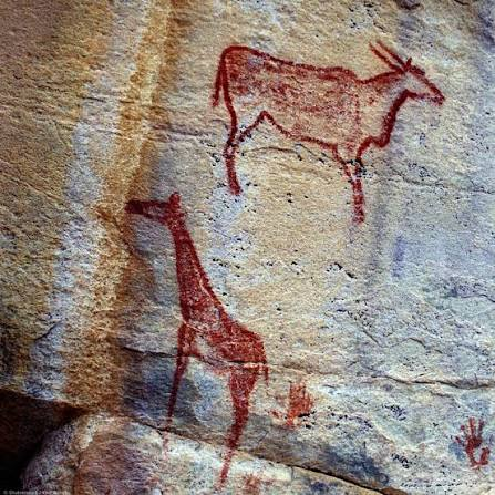
The hills contain thousands of painted and engraved images.

Artists represented:

  • giraffes;

  • eland;

  • antelope;

  • rhinoceros;

  • cattle;

  • humans;

  • and other animals.

The Animal “Zoo”

The diversity of animal imagery is one of Tsodilo's most striking characteristics.

Wild animals could provide information about:

  • hunting;

  • ecology;

  • ritual;

  • and symbolic beliefs.

The presence of animals that are rare or absent in the modern region may also provide clues about past environments.

Hunter-Gatherers

Some of the earliest artistic traditions are associated with hunter-gatherer communities.

These societies relied on:

  • wild game;

  • plants;

  • water;

  • and detailed knowledge of seasonal resources.

Rock art may have formed part of their symbolic and ritual world.

Later Pastoral Communities

Later images include domesticated animals.

Cattle representations demonstrate that the landscape was eventually incorporated into pastoral economies.

This makes Tsodilo valuable for studying economic change.

Engraving Techniques

Artists created engravings by:

  • pecking;

  • scraping;

  • incising;

  • and polishing rock surfaces.

Some images are deeply carved.

Others are faint and difficult to see.

Paint Pigments

Paintings used mineral pigments, especially:

  • red ochre;

  • yellow;

  • white;

  • and black.

Some colors have survived remarkably well because of the dry environment.

Archaeological Occupation

Excavations around the hills have produced:

  • stone tools;

  • pottery;

  • beads;

  • metal objects;

  • and other artifacts.

These materials demonstrate that people repeatedly returned to Tsodilo over thousands of years.

Climate and Landscape

Tsodilo's history is connected to changing environmental conditions.

The surrounding region has experienced fluctuations in:

  • rainfall;

  • vegetation;

  • wildlife;

  • and water availability.

People adapted their subsistence strategies accordingly.

UNESCO World Heritage Status

Tsodilo Hills was designated a UNESCO World Heritage Site because of its exceptional archaeological, cultural, and spiritual importance.

The designation recognizes the hills as one of the most significant cultural landscapes in southern Africa.

Why Tsodilo Matters

Tsodilo is important because it combines:

  • archaeology;

  • rock art;

  • living Indigenous traditions;

  • environmental history;

  • and long-term human occupation.

Conclusion

Tsodilo Hills is far more than a collection of prehistoric paintings.

It is a cultural landscape in which archaeology and living tradition overlap.

Its thousands of animal and human images preserve evidence of changing societies, while the hills themselves remain spiritually significant to local communities.

The result is one of Africa's most extraordinary examples of a landscape that has retained cultural meaning across thousands of years.

Divuyu Satellite Mound: Botswana's Prehistoric Trading Hub

August 23, 2026

Divuyu is an important archaeological site in northern Botswana associated with prehistoric and early historic settlement networks in the broader Okavango and Chobe region.

The description “Satellite Mound” reflects the use of modern remote-sensing and archaeological survey techniques to identify settlement structures and landscape features that can be difficult to recognize from ground level.

The site's importance lies in its potential to illuminate how communities in northern Botswana participated in regional networks of settlement, craft production, exchange, and movement.

Archaeology of Northern Botswana

Northern Botswana contains a rich archaeological record.

The region's rivers and wetlands created corridors through otherwise dry landscapes.

Important waterways include:

  • the Okavango;

  • the Chobe;

  • and associated seasonal channels.

These waterways provided transportation and resources.

Settlement Mounds

Archaeological mounds can develop through repeated occupation.

Layers may contain:

  • pottery;

  • charcoal;

  • animal bones;

  • shell;

  • stone tools;

  • and architectural debris.

Over centuries, these materials accumulate into raised deposits.

Why Mounds Matter

A mound can represent a long history of occupation.

Instead of one short-lived settlement, it may contain multiple phases of human activity.

Archaeologists can excavate these layers to reconstruct changes over time.

Trading Networks

Northern Botswana was connected to wider southern African networks.

Communities could exchange:

  • pottery;

  • metal;

  • beads;

  • stone;

  • animal products;

  • and other resources.

Trade did not necessarily involve professional merchants.

Exchange could occur through networks of neighboring communities.

Iron Age Technology

Ironworking transformed many communities in southern Africa.

Iron tools could improve:

  • agriculture;

  • hunting;

  • woodworking;

  • and construction.

Iron objects could also become valuable exchange items.

Beads and Long-Distance Connections

Glass beads are especially useful for identifying trade.

Imported beads can sometimes be traced to manufacturing traditions from distant regions.

Their presence demonstrates that local communities participated in extensive exchange networks.

The Role of Rivers

Rivers and wetlands were crucial transportation corridors.

They provided:

  • water;

  • fish;

  • reeds;

  • wildlife;

  • and routes through the landscape.

Communities could combine river transport with overland movement.

Remote Sensing

Modern satellite imagery can help researchers identify subtle archaeological mounds.

Researchers can compare:

  • vegetation differences;

  • soil patterns;

  • elevation;

  • and geometric features.

However, satellite detection must be confirmed through fieldwork.

Archaeological Dating

Dating a mound requires multiple lines of evidence.

Researchers may use:

  • radiocarbon dating;

  • ceramics;

  • stratigraphy;

  • metal technology;

  • and imported artifacts.

The phrase “prehistoric” encompasses thousands of years and should not be treated as a precise date.

Why Divuyu Matters

Divuyu contributes to the study of:

  • settlement organization;

  • trade;

  • Iron Age technology;

  • wetland adaptation;

  • and regional interaction.

It demonstrates that northern Botswana was part of a wider network of communities rather than an isolated region.

Conclusion

Divuyu's archaeological landscape illustrates how communities in northern Botswana adapted to waterways and participated in regional exchange.

Modern remote sensing adds a new dimension to the research by allowing archaeologists to identify settlement features that might otherwise remain hidden.

The combination of archaeological excavation and satellite mapping is helping reconstruct a prehistoric landscape in which rivers, villages, craft production, and trade were closely interconnected.

Matobo Hills: Zimbabwe's 2,000-Year Bushman Paintings

August 23, 2026

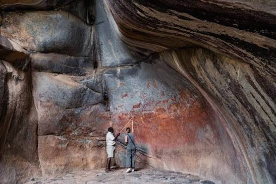
The Matobo Hills in southwestern Zimbabwe form one of Africa's most important prehistoric and historic cultural landscapes.

The region is famous for its dramatic granite formations and extensive collections of rock paintings associated with hunter-gatherer communities, particularly the San and related prehistoric populations.

The paintings include:

  • humans;

  • animals;

  • hunting scenes;

  • ritual figures;

  • and symbolic imagery.

Although some paintings can be approximately 2,000 years old or older, the rock-art tradition of Matobo spans a much broader period.

The Landscape of Matobo

Matobo consists of enormous granite outcrops shaped by erosion.

The rocks form:

  • caves;

  • shelters;

  • balancing formations;

  • cliffs;

  • and natural chambers.

These provided excellent locations for human occupation and rock art.

Why People Used Rock Shelters

Shelters protected people from:

  • sun;

  • wind;

  • rain;

  • and temperature extremes.

They also provided suitable surfaces for painting.

Some shelters contain layers of archaeological occupation beneath their painted walls.

Hunter-Gatherer Communities

Many of the paintings are associated with hunter-gatherer societies.

These communities possessed detailed knowledge of:

  • animal behavior;

  • plants;

  • water sources;

  • seasonal changes;

  • and landscape geography.

Their survival depended on understanding the environment at an extremely sophisticated level.

Animals in the Paintings

Artists represented numerous animals.

These could include:

  • eland;

  • antelope;

  • giraffe;

  • elephant;

  • rhinoceros;

  • and other species.

Animal imagery may reflect both everyday hunting and symbolic beliefs.

The Eland

The eland is particularly important in southern African San rock art.

It appears frequently in ritual contexts.

Ethnographic research among San communities has helped archaeologists understand how animals, especially eland, could be connected to:

  • trance;

  • healing;

  • rainmaking;

  • and spiritual transformation.

However, modern ethnography cannot automatically explain every prehistoric image.

Human Figures

Human figures appear in various forms.

Some may represent:

  • hunters;

  • dancers;

  • ritual specialists;

  • or supernatural beings.

Some images are highly realistic.

Others are abstract or elongated.

Ritual Interpretation

One of the most important interpretations of southern African rock art connects certain scenes to shamanic or trance experiences.

Researchers have proposed that images may represent:

  • altered states of consciousness;

  • healing rituals;

  • supernatural journeys;

  • and interactions with spiritual forces.

These interpretations remain debated but are supported by comparisons with historically documented San traditions.

Pigments

Artists used natural pigments.

Red ochre was especially important.

Other pigments produced:

  • yellow;

  • white;

  • black;

  • and occasionally other shades.

Pigments could be mixed with binding materials before application.

Fingerprints and Techniques

Some prehistoric paintings may have been applied using:

  • fingers;

  • brushes;

  • feathers;

  • or other organic tools.

Because organic tools rarely survive, archaeologists reconstruct techniques from the paintings themselves and experimental archaeology.

Dating the Art

Dating rock paintings is difficult.

Methods include:

  • direct dating of suitable pigment components;

  • radiocarbon analysis;

  • archaeological association;

  • stylistic comparison;

  • and mineral analysis.

Different images within the same shelter may have been created centuries apart.

Later Communities

Matobo was not abandoned after the earliest paintings.

Later communities continued using the landscape.

Archaeological evidence includes:

  • pottery;

  • metal objects;

  • stone tools;

  • and settlement remains.

The hills therefore represent thousands of years of continuous or repeated human interaction.

Sacred Landscape

Matobo also became an important sacred and political landscape in more recent history.

The hills are associated with traditional religious practices and ancestral beliefs.

The landscape later became connected with the history of the Ndebele kingdom and colonial Zimbabwe.

UNESCO World Heritage Site

The Matobo Hills were designated a UNESCO World Heritage Site because of their exceptional combination of:

  • natural scenery;

  • archaeological evidence;

  • rock art;

  • and living cultural traditions.

Why Matobo Matters

Matobo is important because it preserves a remarkable record of human interaction with the landscape across thousands of years.

The paintings reveal:

  • artistic skill;

  • hunting traditions;

  • ritual beliefs;

  • environmental knowledge;

  • and changing cultural practices.

Conclusion

The Matobo Hills are among the greatest repositories of prehistoric rock art in southern Africa.

Their paintings preserve the symbolic world of hunter-gatherer communities who understood animals, landscapes, weather, and spiritual forces through an intricate cultural system.

The hills are therefore not simply an archaeological site.

They are a living cultural landscape where geology, spirituality, history, and prehistoric art remain deeply connected.

Sangla: Baspa's 17th-Century Kinner Kailash Temple

August 21, 2026

The Himalayan Temple Hidden in Baspa Valley: Sangla's Sacred Link to Kinner Kailash

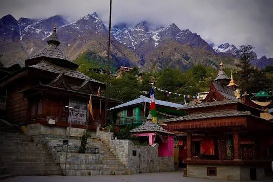
Sangla, located in the Baspa Valley of Kinnaur, is known today for dramatic scenery, traditional villages, and mountain tourism.

But the valley also preserves a deep religious history.

Temples and sacred spaces reflect the interaction of Hindu, Buddhist, and local Himalayan traditions.

Descriptions that assign a single seventeenth-century date to an entire “Kinner Kailash Temple” tradition should be treated carefully, because Himalayan temples often contain multiple construction phases, repairs, and layers of religious history.

The deeper story of Sangla is therefore not about a single building.

It is about an entire sacred landscape.

The Baspa Valley as a Cultural World

The valley provided:

  • Water.

  • Agricultural land.

  • Forest resources.

  • Routes through the mountains.

Settlements developed where these resources could be managed.

Communities built temples and houses using local stone and timber.

Kinnauri Architecture

Traditional architecture in the region is remarkable for its combination of practical engineering and decorative craftsmanship.

Timber and stone could be integrated to produce strong structures.

Wood carving added artistic and religious detail.

Temples became expressions of local identity.

Local Deities and Himalayan Religion

Religious life in Kinnaur cannot be reduced exclusively to either Hinduism or Buddhism.

Local deities and community traditions play important roles.

A village temple may therefore represent layers of belief accumulated over centuries.

Kinner Kailash as Sacred Geography

The presence of Kinner Kailash shapes the spiritual identity of the region.

Sacred mountains create relationships between people and landscape.

Pilgrimage routes, stories, and religious practices transform geography into heritage.

Temple Architecture as Historical Evidence

Studying a temple involves examining:

  • Construction materials.

  • Carving styles.

  • Structural techniques.

  • Renovation phases.

  • Religious imagery.

These features can help historians reconstruct changing cultural influences.

The Seventeenth-Century Himalayan World

The seventeenth century was a period of significant political and religious activity across the Himalayas.

However, assigning a temple entirely to one century can oversimplify its history.

Earlier traditions may survive.

Later communities may rebuild structures.

Therefore, a “seventeenth-century temple” often represents a longer cultural sequence.

Sangla Today

Modern tourism has brought Sangla into wider national and international awareness.

This provides economic opportunities but also creates pressure.

Traditional buildings may be replaced.

Land use can change.

Cultural practices can become commercialized.

Sustainable heritage management is therefore essential.

Why Sangla Matters

Sangla's greatest historical significance lies in its cultural continuity.

The valley is not simply beautiful.

It is inhabited.

Its communities continue to maintain traditions developed through generations of interaction with one of the world's most demanding environments.

The temples, mountains, rivers, and villages form one connected historical landscape.

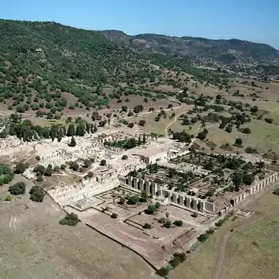
Medina Azahara: The Lost Palace City of the Caliph Who Wanted to Build Paradise

August 21, 2026

The Lost City Built by a Caliph: Inside Medina Azahara's Spectacular Rise and Sudden Destruction

In the tenth century, near Córdoba, one of the most powerful rulers in the Islamic world ordered the construction of an entirely new palace city.

Its name was Madinat al-Zahra.

Today, the ruins of Medina Azahara reveal the remains of an ambitious political project designed to demonstrate the power of the Umayyad Caliphate of Córdoba.

The city was more than a residence.

It was a statement.

The Rise of the Caliphate of Córdoba

In 929 CE, Abd al-Rahman III declared himself caliph.

This was a major political act.

A caliph claimed leadership of the Islamic community.

The declaration placed the Umayyad ruler of al-Andalus in direct ideological competition with other major Islamic powers.

Madinat al-Zahra became an architectural expression of this new authority.

Why Build a New City?

A palace could have been expanded within Córdoba.

Instead, a new complex was constructed outside the city.

This allowed the caliph to create a carefully organized environment.

The city included:

  • Palaces.

  • Administrative buildings.

  • Gardens.

  • Reception halls.

  • Residential areas.

  • Infrastructure.

  • Military elements.

Its location and design demonstrated hierarchy.

Architecture as Political Propaganda

Every major empire communicates power.

Some do it through monuments.

Others through ceremonies.

Madinat al-Zahra did both.

Foreign envoys arriving at the palace would encounter controlled sequences of architecture and ceremony.

The physical journey through the complex reinforced the ruler's authority.

The Terraced City

The palace complex was organized across terraces on the hillside.

This created visual hierarchy.

Higher levels were associated with elite and administrative functions.

Architecture shaped movement and visibility.

The landscape itself became part of political design.

The Reception Hall

One of the most spectacular elements of the site is the richly decorated ceremonial architecture associated with royal reception.

Carved stone, arches, decorative panels, and carefully arranged spaces created an environment intended to impress visitors.

Diplomacy became theater.

The visitor did not simply meet the ruler.

The visitor experienced the power of the caliphate.

The Myth of Zahra

Popular tradition sometimes claims that the city was named after a beloved woman named Zahra.

While the story is famous, the historical certainty surrounding such romantic explanations is limited.

The name may instead have broader symbolic or linguistic significance.

This illustrates a common problem in historical interpretation: beautiful stories are not automatically historical facts.

A Short Life

Despite its extraordinary scale, Medina Azahara did not survive for centuries as a functioning capital.

Political instability and civil conflict during the early eleventh century led to its destruction and abandonment.

The great palace city became a ruin.

How an Entire City Was Forgotten

Over time, stone from the abandoned complex could be reused elsewhere.

Sediment covered surviving structures.

The location gradually disappeared from ordinary public memory.

For centuries, the magnificent caliphal city existed largely beneath the landscape.

Archaeology eventually began revealing it again.

Why Medina Azahara Is Extraordinary

The site demonstrates both the power and fragility of political architecture.

A ruler could command enormous resources.

A city could be built to symbolize a new caliphate.

But political collapse could destroy that achievement within a relatively short period.

Today, the ruins reveal a paradox.

The city failed as a permanent political capital.

Yet its archaeological survival allows the modern world to understand the ambitions of one of medieval Europe's most powerful Islamic states.

Alcazaba de Almeria: Almeria's 10th-Century Fortress

August 21, 2026

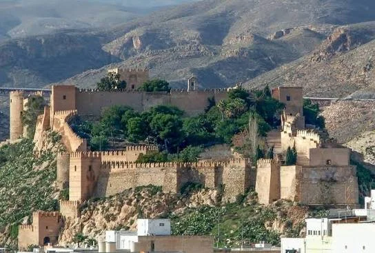
The 1,000-Year-Old Fortress Above Almería: Inside the Alcazaba Built to Control an Entire Coast

The Alcazaba of Almería dominates the city from its elevated position, reminding visitors that medieval Mediterranean history was shaped as much by fortifications as by palaces.

Built during the Islamic period of al-Andalus and later transformed under Christian rule, the fortress represents centuries of political change.

Its walls do not tell one story.

They preserve layers.

The Foundation of Almería

Almería became an important port and military center during the Umayyad period.

Its location provided access to Mediterranean trade routes.

A major fortress was therefore essential.

The Alcazaba developed as a defensive and administrative complex connected with the growth of the city.

The Meaning of Alcazaba

The word “alcazaba” derives from the Arabic al-qasaba, referring broadly to a fortified urban citadel.

Such structures were not merely military castles.

They could contain:

  • Administrative buildings.

  • Residences.

  • Storage areas.

  • Water systems.

  • Religious spaces.

  • Defensive towers.

The Alcazaba of Almería functioned as the fortified heart of the city.

Walls and Military Engineering

Medieval fortification required careful understanding of terrain.

The builders used elevation to increase defensive advantage.

Walls followed the contours of the landscape.

Towers allowed surveillance.

Gateways controlled access.

Defense was layered.

An attacker might breach one barrier only to encounter another.

Water and Survival

A fortress could not survive a long siege without water.

Therefore, water storage and management were essential.

Cisterns allowed communities to store water.

This was especially important in the dry climate of southeastern Spain.

Islamic Almería and Mediterranean Trade

Almería was not simply a military outpost.

It became an economically important Mediterranean city.

Trade networks connected the region with other parts of the Islamic world and the Mediterranean.

The fortress protected a prosperous urban center.

The Christian Conquest and Architectural Change

When political control changed, the fortress changed with it.

Christian rulers added and modified defensive structures.

This produced a layered monument.

Islamic architecture remained.

Later European military architecture was added.

The result reflects changing technologies of warfare.

Why the Alcazaba Survived

The survival of the complex reflects both its scale and its continued importance.

Because later rulers reused the site, it was not simply abandoned.

Reuse can destroy earlier structures, but it can also preserve them by keeping the location relevant.

A Fortress of Layers

Walking through the Alcazaba is effectively walking through political history.

One section may reflect Islamic rule.

Another may represent later Christian modifications.

The walls preserve the transition.

Why Almería's Alcazaba Matters

The fortress demonstrates that Mediterranean history cannot be reduced to simple narratives of conquest.

Every new ruler inherited an existing landscape.

They reused it.

Modified it.

Adapted it.

The Alcazaba therefore became a physical record of continuity through political change.

Castelo de São Jorge: The Lisbon Citadel Built on Thousands of Years of History

August 21, 2026

Before Portugal, Before Lisbon: The Ancient Secrets Hidden Beneath Castelo de São Jorge

Castelo de São Jorge stands on one of Lisbon's most strategically important hills.

The castle visible today is associated strongly with Portugal's medieval history, but the hill itself contains archaeological layers reaching much further into the past.

Phoenician-related activity, Iron Age communities, Roman occupation, Islamic Lisbon, and Christian Portugal all form part of the wider archaeological story.

The castle is therefore not simply a medieval monument.

It is an archaeological archive.

Why the Hill Was Important

Elevation provides advantages.

From the hill, inhabitants could observe surrounding territory and the Tagus River.

This made the location valuable for defense and settlement.

For thousands of years, communities recognized this strategic importance.

Roman Lisbon

Roman Olisipo developed into an important settlement connected with Atlantic and Mediterranean networks.

The region's relationship with trade, river transport, and imperial administration influenced its growth.

Archaeological remains demonstrate the long urban history beneath the modern city.

Islamic Lisbon

After the Islamic conquest of the Iberian Peninsula, Lisbon became known as al-Ushbuna.

The fortified hill formed an important part of the Islamic city.

Walls and defensive structures protected the settlement.

The later Portuguese castle therefore stands partly within a landscape shaped by Islamic military architecture.

The Christian Conquest

In 1147, Lisbon was captured by forces associated with Portugal's first king, Afonso I, with the assistance of crusading forces.

This event became a defining moment in Portuguese history.

The fortified hill was subsequently incorporated into the political world of the emerging Portuguese kingdom.

Why It Is Called São Jorge

The castle's association with Saint George reflects later Christian traditions.

Saint George was an important military and chivalric symbol in medieval Europe.

The naming demonstrates how monuments can acquire new identities after political change.

Archaeology Beneath the Castle

Modern archaeological investigation has demonstrated that the site contains remains from multiple periods.

This makes excavation especially complex.

Researchers must distinguish between:

  • Ancient occupation.

  • Roman material.

  • Islamic structures.

  • Medieval Portuguese construction.

  • Later modifications.

A wall is not automatically medieval simply because it is located beneath a castle.

Context matters.

Lisbon's Earthquake and the Transformation of the Castle

The devastating earthquake of 1755 transformed Lisbon.

The castle and surrounding city experienced major damage.

Later restoration and reconstruction changed the monument again.

The structure visible today therefore reflects both medieval history and modern conservation.

National Identity and Restoration

During the twentieth century, the castle underwent major restoration.

Such restoration raises important questions.

Should a monument be returned to an imagined medieval appearance?

Or should later historical layers remain visible?

Heritage conservation is often shaped by national identity.

The castle became an important symbol of Portuguese history.

Why São Jorge Matters

The monument tells a much larger story than the history of Portugal alone.

It reveals:

  • Ancient settlement.

  • Roman urban development.

  • Islamic Iberia.

  • Medieval conquest.

  • Portuguese monarchy.

  • Modern nationalism.

  • Archaeological conservation.

Few castles demonstrate so clearly how one location can remain strategically important across thousands of years.

Silves Castle: Algarve's Almohad Fortress

August 21, 2026

Portugal's Red Castle Was Once a Powerful Islamic Capital: The Forgotten Story of Silves

Silves Castle rises above the Algarve as one of Portugal's most impressive surviving fortifications.

Its distinctive reddish stone walls immediately separate it visually from many later European castles.

But Silves was not originally a Portuguese royal fortress.

During the Islamic period, the city—known as Shilb—became one of the most important urban centers in the western Iberian Peninsula.

The castle preserves the memory of this forgotten political and cultural world.

Silves Under Islamic Rule

Following the Islamic conquest of the Iberian Peninsula, the Algarve became integrated into the political and cultural world of al-Andalus.

Silves developed into a major urban center.

Its importance was connected with:

  • Agriculture.

  • River access.

  • Trade.

  • Political administration.

  • Strategic defense.

The castle protected the city.

The Red Sandstone Fortress

One of the most distinctive characteristics of Silves Castle is its use of local red sandstone.

The material gives the fortress its remarkable color.

But the stone was not chosen simply for beauty.

Builders used locally available materials.

The castle's appearance is therefore directly connected to the geology of the region.

Almohad Fortification

The fortress reached an important phase of development during the Almohad period.

The Almohads were a powerful North African and Iberian Islamic dynasty whose political influence extended across large parts of the western Islamic world.

Their period of control was marked by major defensive construction and architectural activity.

The surviving fortress reflects this wider military culture.

Towers, Walls, and Defense

The castle's defensive system included powerful walls and towers designed to control movement.

A medieval fortress depended on multiple defensive principles:

  • Height.

  • Thick walls.

  • Controlled entrances.

  • Towers for observation.

  • Interior storage.

  • Water access.

The design made use of the natural elevation of the site.

Water and the Great Cistern

Perhaps one of the most important features of any fortress is its water supply.

Silves Castle contains a major cistern system.

During a siege, access to water could determine whether a fortified city survived.

Rainwater and other sources had to be collected and stored.

The cistern was therefore not a secondary feature.

It was essential infrastructure.

Silves as a Cultural Center

Islamic cities were centers of more than military power.

Silves developed as an urban and cultural center.

The wider civilization of al-Andalus produced achievements in:

  • Literature.

  • Philosophy.

  • Agriculture.

  • Science.

  • Architecture.

  • Trade.

Silves participated in this broader world.

The Christian Conquest

Silves became a major target during the expansion of Christian kingdoms into southern Iberia.

The city changed hands during periods of conflict before eventually becoming incorporated into the Portuguese kingdom.

Political conquest transformed the fortress.

But, as at many Iberian monuments, new rulers did not erase everything that came before.

They inherited the city.

They reused its walls.

They adapted its structures.

The Archaeological Layers of Silves

The castle and surrounding city contain evidence from multiple historical periods.

Archaeological investigation can reveal:

  • Islamic occupation.

  • Later medieval Portuguese activity.

  • Domestic structures.

  • Defensive modifications.

  • Water infrastructure.

The monument is therefore not a single historical object.

It is a layered landscape.

Why Silves Castle Is So Important

Silves demonstrates the importance of remembering that Portugal's history did not begin with the Portuguese kingdom.

Before the medieval Christian monarchy, the region was part of the Roman world.

Before that, it was occupied by earlier communities.

And for centuries, southern Portugal was part of al-Andalus.

Silves Castle remains one of the most visible reminders of that Islamic past.

Its red walls have survived dynasties, conquests, religious transformations, and political revolutions.

Today, they stand above the Algarve as a reminder of a forgotten capital.

And perhaps that is the castle's greatest secret:

the fortress most visitors see as a Portuguese monument is also one of the most powerful surviving witnesses to Portugal's Islamic history.

← Newer Posts Older Posts →
Featured
images (85).jpeg
September 14, 2026
Birka: Sweden's Viking Trading Island
September 14, 2026
Read more →
September 14, 2026
images (84).jpeg
September 14, 2026
Uppåkra: Sweden's Iron Age Power Center
September 14, 2026
Read more →
September 14, 2026
images (83).jpeg
September 14, 2026
Tissø: Denmark's Viking Age Lake Village
September 14, 2026
Read more →
September 14, 2026
images (82).jpeg
September 14, 2026
Lejre: Denmark's Royal Iron Age Hal
September 14, 2026
Read more →
September 14, 2026
images (81).jpeg
September 14, 2026
Gudme: Denmark's Iron Age Gold Hoard Site
September 14, 2026
Read more →
September 14, 2026
images (80).jpeg
September 14, 2026
Nonnebakken: Odense's Viking Fort Remains
September 14, 2026
Read more →
September 14, 2026
read more

Powered by The archaeologist