• MAIN PAGE
  • LATEST NEWS
    • Lost Cities
    • Archaeology's Greatest Finds
    • Underwater Discoveries
    • Greatest Inventions
    • Studies
    • Blog
  • PHILOSOPHY
  • HISTORY
  • RELIGIONS
    • Africa
    • Anatolia
    • Arabian Peninsula
    • Balkan Region
    • China - East Asia
    • Europe
    • Eurasian Steppe
    • Levant
    • Mesopotamia
    • Oceania - SE Asia
    • Pre-Columbian Civilizations of America
    • Iranian Plateau - Central Asia
    • Indus Valley - South Asia
    • Japan
    • The Archaeologist Editor Group
    • Scientific Studies
    • Aegean Prehistory
    • Historical Period
    • Byzantine Middle Ages
    • Predynastic Period
    • Dynastic Period
    • Greco-Roman Egypt
  • Rome
  • PALEONTOLOGY
  • About us
Menu

The Archaeologist

  • MAIN PAGE
  • LATEST NEWS
  • DISCOVERIES
    • Lost Cities
    • Archaeology's Greatest Finds
    • Underwater Discoveries
    • Greatest Inventions
    • Studies
    • Blog
  • PHILOSOPHY
  • HISTORY
  • RELIGIONS
  • World Civilizations
    • Africa
    • Anatolia
    • Arabian Peninsula
    • Balkan Region
    • China - East Asia
    • Europe
    • Eurasian Steppe
    • Levant
    • Mesopotamia
    • Oceania - SE Asia
    • Pre-Columbian Civilizations of America
    • Iranian Plateau - Central Asia
    • Indus Valley - South Asia
    • Japan
    • The Archaeologist Editor Group
    • Scientific Studies
  • GREECE
    • Aegean Prehistory
    • Historical Period
    • Byzantine Middle Ages
  • Egypt
    • Predynastic Period
    • Dynastic Period
    • Greco-Roman Egypt
  • Rome
  • PALEONTOLOGY
  • About us
No results found

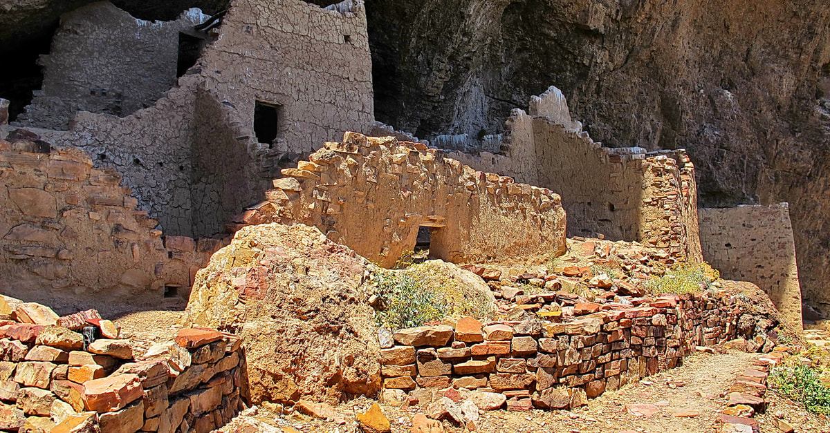
Tuzigoot: Arizona's Sinagua Hilltop Pueblo

September 18, 2026

Introduction

Tuzigoot is one of the best-known prehistoric pueblos in Arizona's Verde Valley.

Built approximately a thousand years ago, the hilltop settlement was occupied for several centuries and later abandoned before being rediscovered and excavated in the twentieth century. The National Park Service identifies its inhabitants archaeologically as Sinagua, a classification rather than the name of a known historical tribe.

The Sinagua

The Sinagua lived in central Arizona between approximately the sixth and fourteenth centuries.

They cultivated crops while also hunting and gathering.

They occupied diverse environments, from high-elevation forests to the warmer Verde Valley.

The name "Sinagua" comes from Spanish terminology meaning "without water," although the archaeological communities themselves clearly lived in landscapes containing important water sources.

Hilltop Construction

Tuzigoot occupies a prominent hill overlooking the Verde River region.

Its elevated position provided visibility across the surrounding landscape.

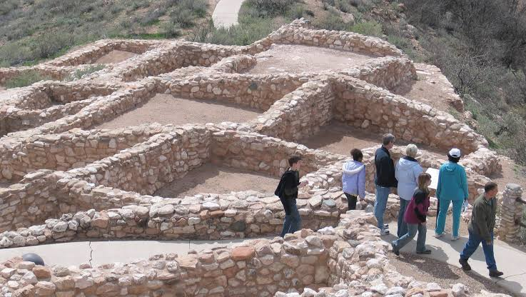
The pueblo contained numerous rooms constructed primarily from local stone and mortar.

The architecture developed over time, reflecting additions and modifications.

Daily Life

Residents lived in a community where domestic activities occurred in and around the rooms.

People prepared food, stored crops, manufactured tools, produced pottery, and cared for children.

The surrounding environment supplied wild plants, animals, wood, and other resources.

Agriculture provided the foundation of the economy.

Trade

Tuzigoot participated in regional exchange networks.

Artifacts found in Sinagua sites indicate contacts with distant communities.

Marine shell, exotic stones, pigments, and other materials could travel long distances.

Such objects demonstrate that prehistoric Arizona was integrated into broad exchange systems.

Architecture and Social Organization

The size of Tuzigoot suggests substantial community organization.

Constructing masonry rooms required labor and planning.

The hilltop location also suggests that the settlement had a strong relationship with the surrounding landscape.

Archaeologists continue to investigate how households were organized and how communal spaces functioned.

Excavation

Tuzigoot was excavated in 1933–1934 by Louis Caywood and Edward Spicer.

Their work established an important archaeological foundation for understanding the site.

Later research has continued to refine interpretations.

Modern archaeology is also more careful about acknowledging Indigenous perspectives and the limitations of older archaeological terminology.

Conclusion

Tuzigoot is more than a picturesque hilltop ruin.

It is evidence of a sophisticated agricultural community that adapted successfully to Arizona's environmental conditions.

Its masonry architecture, trade connections, agricultural economy, and long occupation make it an essential site for understanding the ancient Verde Valley.
Tonque Pueblo: Arizona's Salado Village

September 18, 2026

Introduction

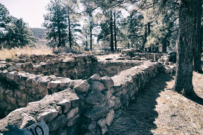
Tonque Pueblo, associated with the prehistoric Puebloan landscape of central New Mexico, represents the complexity of cultural classification in the American Southwest.

The label used in the title—"Salado Village"—requires some caution because Salado is an archaeological term most strongly associated with communities of central and eastern Arizona and adjoining regions, particularly during the thirteenth and fourteenth centuries.

Rather than assuming a simple ethnic identity, archaeologists examine architectural and material similarities to understand the connections between settlements.

Pueblo Architecture

Pueblo communities constructed substantial masonry buildings containing residential and communal spaces.

Rooms could be used for sleeping, storage, food preparation, craft production, and other domestic activities.

The organization of rooms around plazas or open spaces created a physical framework for community life.

Kivas and Ritual Space

Ceremonial structures known as kivas played important roles in many Pueblo communities.

Kivas could be circular or rectangular depending on region and period.

They often contained distinctive architectural elements such as benches, hearths, and central features.

Their exact uses varied, but they were associated with communal and ceremonial life.

Agriculture

The settlement economy depended heavily on farming.

Corn, beans, and squash were major crops.

Agriculture in the dry Southwest required careful management of rainfall and soil moisture.

Farmers also gathered wild plants and hunted animals.

This mixed economy helped communities survive environmental fluctuations.

Regional Interaction

The most important aspect of sites such as Tonque is the evidence for regional connections.

Pottery styles, architectural forms, tools, and other materials can reveal interaction between communities.

The prehistoric Southwest was a network of settlements rather than a collection of isolated villages.

Environmental Adaptation

Southwestern architecture was shaped by climate.

Thick masonry walls provided thermal mass.

Small openings reduced exposure to extreme temperatures.

Buildings could be positioned to take advantage of shade and prevailing environmental conditions.

Archaeological Interpretation

One of the challenges in Southwestern archaeology is the temptation to attach a modern tribal identity directly to an archaeological assemblage.

Archaeologists instead examine material evidence.

Modern Indigenous communities may have cultural relationships to ancestral sites, but those relationships cannot always be mapped perfectly onto archaeological categories.

Conclusion

Tonque Pueblo illustrates the complexity of Puebloan archaeology.

Its importance lies in architecture, agricultural adaptation, regional exchange, and the broader history of communities living in the Southwest.

The site reminds us that archaeological cultures were interconnected traditions rather than rigid political boundaries.

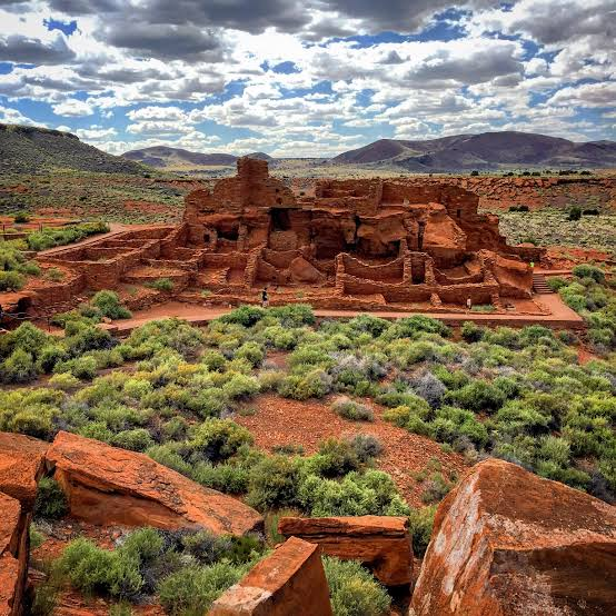
Wupatki Pueblo: Arizona's Lava Flow Villages

September 18, 2026

Introduction

Wupatki Pueblo occupies a remarkable position within the high desert of northern Arizona.

Surrounded by volcanic landscapes, the settlement became an important regional center during the centuries following the eruption of Sunset Crater.

Its architecture, agricultural adaptation, trade connections, and dramatic environmental setting make it one of the most significant archaeological landscapes in northern Arizona.

The Volcanic Landscape

The region around Wupatki was transformed by volcanic activity.

The eruption of Sunset Crater deposited volcanic material across the landscape.

Volcanic ash could alter soil conditions and, under some circumstances, improve moisture retention.

This created new agricultural possibilities.

Population Growth

Following the volcanic eruption, populations increased in the surrounding region.

Wupatki developed into a major settlement.

Its masonry structures demonstrate that the community became large and socially complex.

Architecture

Wupatki Pueblo contained numerous rooms constructed from local stone.

The buildings included residential areas, storage rooms, communal spaces, and other facilities.

The architecture demonstrates careful adaptation to the high-desert environment.

Trade

Wupatki became an important center for exchange.

Its location placed it between different ecological regions.

Communities from the Colorado Plateau, Little Colorado River Valley, and surrounding areas could interact here.

Archaeological evidence suggests the movement of pottery and other materials.

Climate and Agriculture

The environment was difficult.

Rainfall was unpredictable.

Farmers had to exploit seasonal precipitation efficiently.

The volcanic landscape could improve some agricultural conditions by allowing water to collect in soil.

But successful farming still required extensive environmental knowledge.

Archaeological Research

Wupatki attracted archaeological attention during the early twentieth century.

Jesse Walter Fewkes was among the researchers who documented the site.

Dendrochronology later became especially valuable because wooden beams preserved in the ruins could provide calendar dates.

The development of tree-ring dating transformed Southwestern archaeology by allowing researchers to establish much more precise chronologies.

Cultural Interaction

Wupatki should not be understood as belonging exclusively to one isolated cultural group.

Its location encouraged interaction among populations from several regions.

Architecture and pottery reveal these relationships.

Conclusion

Wupatki represents a remarkable example of human adaptation to volcanic desert landscapes.

Its growth demonstrates how environmental change could create new opportunities.

The site reveals a community that responded to climate, geology, agriculture, and regional trade through architectural and social innovation.

Elden Pueblo: Arizona's Sinagua Trade Center

September 18, 2026

Introduction

Elden Pueblo, located near Flagstaff, Arizona, was a major settlement associated with the Northern Sinagua tradition.

Its location near important travel routes and ecological zones made it particularly significant for regional exchange.

The site provides evidence for agriculture, craft production, trade, architecture, and social organization.

Location

Elden Pueblo lies near the San Francisco Peaks.

This landscape provided access to different ecological zones.

High-elevation forests supplied wood, game, and wild plants.

Lower elevations provided agricultural opportunities.

Such ecological diversity was economically valuable.

Architecture

The settlement contained masonry structures arranged into residential and communal spaces.

Construction required substantial quantities of stone, timber, and mortar.

The architecture demonstrates long-term investment in the settlement.

Agriculture

The inhabitants cultivated maize and other crops.

Farming was supplemented by hunting and gathering.

Because rainfall in northern Arizona can be highly variable, agricultural success required careful timing and landscape knowledge.

Trade

Elden Pueblo is particularly important because of evidence for regional interaction.

Objects found at the site demonstrate that residents participated in exchange networks extending beyond the immediate area.

Trade may have involved food, tools, pottery, stone, shell, and other materials.

Craft Production

Pottery was an important craft.

Ceramic vessels served cooking, storage, transport, and ceremonial functions.

Pottery styles can also help archaeologists reconstruct patterns of interaction between communities.

Social Organization

The size of Elden Pueblo indicates a community capable of organizing collective construction.

Shared spaces would have supported social interaction.

Ceremonial structures and communal areas could reinforce group identity.

Conclusion

Elden Pueblo demonstrates how Sinagua communities combined farming, trade, craft production, and architecture.

Its location near diverse ecological zones allowed residents to exploit multiple resources.

The site is therefore valuable for understanding not only local life but also the larger network of communities that connected northern Arizona.

Three Rivers Petroglyphs: New Mexico's 21,000 Images

September 18, 2026

Introduction

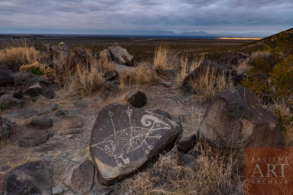
The Three Rivers Petroglyph Site in southern New Mexico contains one of the largest concentrations of prehistoric rock art in the American Southwest.

More than 21,000 petroglyphs are distributed across approximately 50 acres of basalt. The Bureau of Land Management identifies the artwork as primarily associated with the Jornada Mogollon tradition.

What Is a Petroglyph?

A petroglyph is an image created by modifying a rock surface.

At Three Rivers, ancient artists used stone tools to remove the darker weathered surface, exposing lighter rock underneath.

The resulting contrast made the designs visible.

What Was Depicted?

The site contains images of:

  • humans;

  • animals;

  • birds;

  • insects;

  • fish;

  • geometric designs;

  • masks;

  • handprints;

  • abstract forms;

  • possible supernatural or ceremonial imagery.

The enormous variety makes interpretation challenging.

Who Created Them?

The petroglyphs are associated with Jornada Mogollon communities.

Nearby archaeological remains include a prehistoric village, creating an important relationship between rock art and settlement.

Recent BLM interpretation emphasizes that the iconography found at the village and the rock art provides an important connection between the two archaeological contexts.

Why Make Thousands of Images?

There is no single answer.

Rock art may have served multiple purposes.

Some images could have been ceremonial.

Others may have communicated identity or social information.

Some may have marked places of importance.

Others may have represented animals, supernatural beings, or concepts that are no longer understandable to us.

Landscape and Meaning

The location of rock art is often as important as the image itself.

A petroglyph placed near a trail, water source, settlement, or distinctive geological feature may have had meanings connected to the landscape.

The rock itself became a medium through which people interacted with place.

Dating

The petroglyphs are broadly associated with a long prehistoric period.

Different sources give somewhat different chronological ranges because individual carvings are difficult to date precisely.

This is an important methodological issue.

Archaeologists often date rock art indirectly through style, associated artifacts, weathering, and nearby archaeological deposits.

Preservation

Rock art is extremely vulnerable.

Natural erosion can gradually damage images.

Human contact, graffiti, scratching, and vandalism can cause irreversible destruction.

Even touching the surface can contribute to deterioration.

Conclusion

Three Rivers is extraordinary because of the sheer scale of its artistic record.

More than 21,000 images transform a basalt landscape into an enormous prehistoric visual archive.

The site demonstrates that Jornada Mogollon communities expressed complex ideas through imagery and maintained meaningful relationships with particular landscapes.

Petroglyph National Monument: Albuquerque's Rock Art

September 18, 2026

Introduction

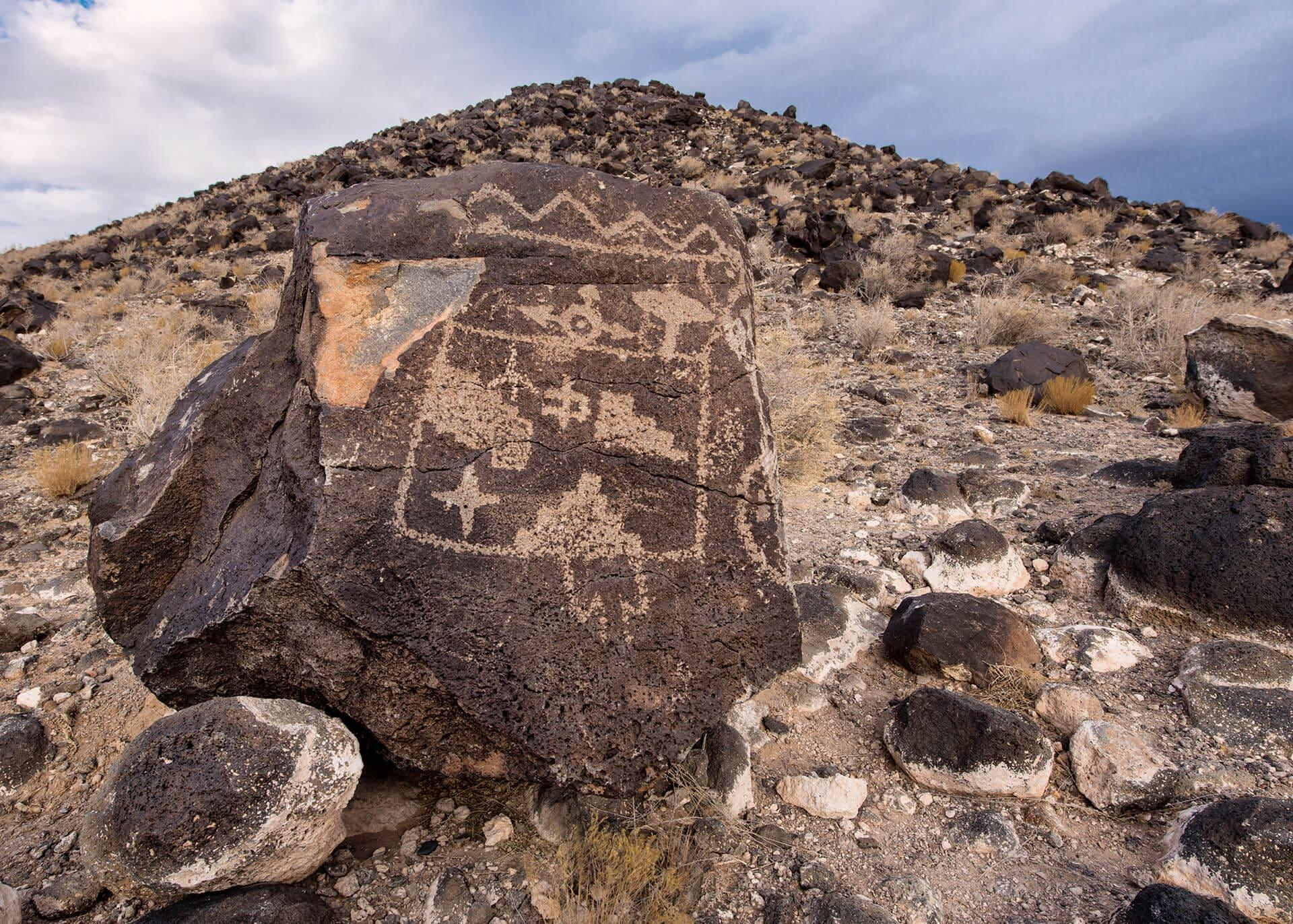
Petroglyph National Monument preserves one of the largest collections of volcanic rock art in North America.

Located on the western edge of modern Albuquerque, New Mexico, the monument contains thousands of petroglyphs created by Indigenous peoples over many centuries, together with later historic inscriptions.

A Volcanic Canvas

The monument's volcanic landscape contains dark basalt surfaces.

Weathering gradually creates a dark patina on exposed rock.

Ancient artists could remove this surface using stone tools, creating lighter images beneath.

The result was a natural contrast that made designs visible.

Indigenous Imagery

Petroglyphs include humans, animals, geometric forms, footprints, spirals, masks, and other designs.

Some images may represent religious or cosmological concepts.

Others may relate to identity, storytelling, ritual, or communication.

However, interpreting individual images is difficult without written explanations from the original creators.

The Importance of Context

Rock art should not be treated as a collection of isolated pictures.

Its location within a landscape matters.

Volcanic ridges, mountain views, water sources, pathways, and settlements could all contribute to the meaning of a place.

Long-Term Use

The monument represents a long period of human interaction with the landscape.

Different generations created images.

Some designs may have been deliberately placed near earlier carvings.

This means the landscape could function as a visual archive in which successive communities added their own marks.

European Contact

Later historic inscriptions demonstrate that the landscape continued to attract human activity after European arrival.

These later markings form a different historical layer and must be distinguished from Indigenous prehistoric art.

Archaeological Interpretation

Modern archaeology emphasizes caution.

Researchers cannot automatically assign a fixed meaning to a symbol simply because it resembles a modern image.

Meaning is culturally specific.

The strongest interpretations combine imagery with archaeological evidence, ethnographic information, Indigenous knowledge, and regional comparisons.

Preservation

The petroglyphs are fragile.

Weathering occurs naturally, but deliberate damage can accelerate deterioration.

Modern preservation therefore focuses on limiting physical contact and protecting the archaeological landscape.

Conclusion

Petroglyph National Monument demonstrates the importance of visual expression in Indigenous Southwestern societies.

The basalt rocks preserve thousands of moments of human creativity.

Together they form a cultural landscape that connects art, environment, identity, spirituality, and memory.

Galisteo Basin: New Mexico's Kiva Villages

September 18, 2026

Introduction

The Galisteo Basin of northern New Mexico contains an extraordinary concentration of archaeological sites representing centuries of Puebloan occupation.

The basin was not simply a collection of isolated villages.

It was a regional landscape in which communities interacted through agriculture, trade, migration, ritual, and social networks.

Pueblo Villages

Many settlements contained masonry structures, plazas, and ceremonial facilities.

The presence of kivas is particularly significant.

Kivas are ceremonial structures associated with Pueblo communities.

They often occupy central positions within settlements.

Agriculture

The basin's communities depended heavily on agriculture.

Corn, beans, and squash formed the foundation of the diet.

Farming was supplemented by hunting and gathering.

Because rainfall was variable, farmers needed detailed knowledge of soils, seasonal precipitation, and water availability.

Kivas

Kivas could function as important spaces for communal ceremonies.

Architectural features sometimes include benches, hearths, and central elements.

The exact practices performed within them varied through time and between communities.

Regional Interaction

Galisteo Basin communities participated in extensive exchange networks.

Pottery styles provide important evidence.

Ceramic similarities can indicate trade or shared cultural traditions.

Movement of people could also bring new architectural practices.

Migration

The basin experienced changing settlement patterns.

Some villages expanded.

Others were abandoned.

Population movement was a recurring feature of Southwestern history.

Abandonment therefore should not be interpreted as cultural disappearance.

People frequently relocated to other communities.

Archaeological Preservation

Many archaeological sites in the basin remain only partially excavated.

This is important because excavation itself is destructive.

Once archaeological layers are removed, their original spatial relationships are difficult to reconstruct.

Modern archaeology therefore increasingly emphasizes non-destructive methods and careful preservation.

Conclusion

Galisteo Basin demonstrates the complexity of Puebloan settlement systems.

Its villages, kivas, agricultural fields, and trade networks reveal a region shaped by cooperation, movement, environmental adaptation, and cultural continuity.

Abó Ruins: New Mexico's Salinas Pueblo

September 18, 2026

Introduction

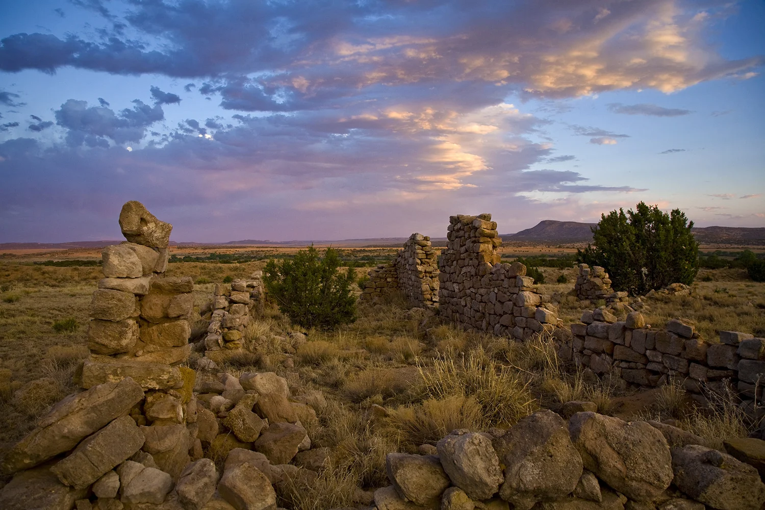
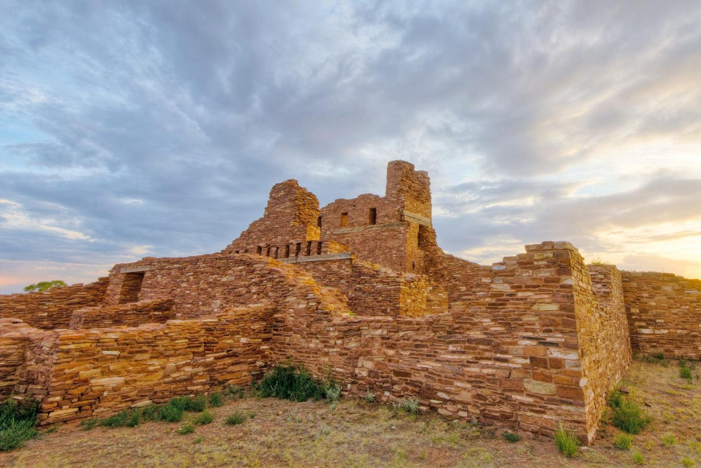
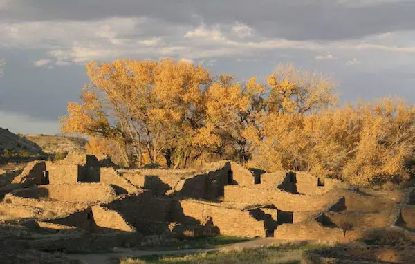
Abó is one of the three major sites preserved within Salinas Pueblo Missions National Monument in central New Mexico.

The site is particularly significant because it preserves both a large Pueblo settlement and the remains of a Spanish Franciscan mission.

The National Park Service identifies Pueblo occupation at Abó dating to approximately the thirteenth century, with evidence of interaction between Mogollon and Ancestral Pueblo traditions that contributed to the development of Tompiro culture.

The Pueblo

Abó was once a large and prosperous community.

Its inhabitants constructed substantial masonry buildings.

Agriculture, hunting, gathering, craft production, and trade supported the settlement.

Trade

The Salinas region occupied an important position between the Rio Grande and the Great Plains.

Trade routes brought communities into contact with peoples from different ecological and cultural zones.

Salt was particularly important.

The nearby saline environments provided a valuable resource that could be exchanged with neighboring communities.

Tompiro Culture

The people associated with Abó spoke a language identified by archaeologists as Tompiro.

Their culture reflected interaction between different Southwestern traditions.

This illustrates that cultural identity in the ancient Southwest could be complex and dynamic.

Spanish Arrival

Spanish colonization transformed the region.

Franciscan missionaries established a mission at Abó.

The mission church was constructed using local stone and Indigenous labor.

Its massive walls remain among the most impressive Spanish colonial ruins in New Mexico.

Cultural Interaction

The mission was not simply a European structure placed into an empty landscape.

It was built within an existing Pueblo community.

Indigenous people participated in construction and lived within a society increasingly shaped by Spanish colonial institutions.

This created both cultural exchange and profound conflict.

Abandonment

The Salinas communities experienced severe pressures during the seventeenth century.

Drought, famine, disease, Apache raids, and colonial pressures contributed to the eventual abandonment of the settlements.

The National Park Service notes that only a portion of the original Pueblo buildings at Abó remain visible today, while many remain unexcavated.

Archaeological Importance

Abó preserves multiple historical layers.

The Pueblo represents Indigenous history.

The mission represents Spanish colonial history.

The landscape preserves evidence of agricultural, economic, religious, and political change.

Conclusion

Abó is important precisely because it cannot be understood from a single perspective.

It is simultaneously a Pueblo archaeological site, a colonial mission landscape, and a record of Indigenous resilience.

Its ruins demonstrate how dramatically life changed in New Mexico after Spanish colonization.

Gran Quivira: New Mexico's Largest Salinas Site

September 17, 2026

Introduction

Gran Quivira is one of the most spectacular archaeological sites in central New Mexico.

Today part of Salinas Pueblo Missions National Monument, the site preserves the remains of a large Pueblo settlement and two Spanish mission complexes.

Before European colonization, Gran Quivira was a major regional center inhabited by Tompiro-speaking Pueblo people.

At its height, estimates place the population between approximately 1,500 and 3,000 people.

A Major Pueblo Center

Gran Quivira was not a small village.

It contained multiple pueblos, kivas, plazas, and associated structures.

Mound 7 alone contained 226 rooms and represents the largest fully excavated Pueblo structure at the site.

Regional Trade

Gran Quivira occupied a strategic location.

The settlement stood near the transition between the Pueblo world and the Great Plains.

Trade connected residents with communities from distant regions.

Goods could include food, stone, pottery, pigments, and other materials.

The site therefore functioned as a crossroads.

Salt

The Salinas Basin was economically important because of its salt resources.

Salt could be used for food preservation and dietary needs and could also function as an exchange commodity.

The relationship between settlement and salt resources contributed to the area's prosperity.

Spanish Colonization

Spanish colonization began to transform Gran Quivira during the late sixteenth and seventeenth centuries.

Franciscan missionaries established churches and convent structures.

The remains of these buildings stand alongside the Pueblo ruins.

Two Historical Landscapes

Gran Quivira therefore contains two architectural traditions.

The first is Indigenous Pueblo architecture.

The second is Spanish colonial mission architecture.

Their physical proximity provides a powerful record of cultural encounter.

Abandonment

By the late seventeenth century, Gran Quivira had been abandoned.

The National Park Service identifies a combination of disease, drought, famine, and Apache raiding among the factors involved.

This reminds us that historical events rarely have a single cause.

Environmental stress could intensify political conflict.

Disease could reduce populations.

Economic disruption could make settlements increasingly difficult to maintain.

Archaeological Preservation

Gran Quivira was designated a national monument in 1909 and later became part of Salinas Pueblo Missions National Monument.

Archaeological excavation and stabilization have revealed portions of the Pueblo and mission complexes.

Conclusion

Gran Quivira was one of the great Pueblo centers of the Salinas Basin.

Its size, architecture, trade networks, salt resources, and colonial history make it one of the most important archaeological landscapes in New Mexico.

The ruins preserve not only architecture but also the history of cultural interaction, conflict, resilience, and transformation.

Kuaua Pueblo: New Mexico's Kiva Murals

September 17, 2026

Introduction

Kuaua Pueblo, located near the Rio Grande north of Albuquerque, is particularly famous for its remarkable kiva murals.

The site provides evidence for Pueblo architecture, ceremonial life, artistic traditions, agriculture, and the cultural transformations that occurred during the period of Spanish colonization.

The Pueblo

Kuaua was a substantial Pueblo settlement.

Its architecture included residential rooms, communal spaces, plazas, and kivas.

The community depended heavily on agriculture.

Corn, beans, squash, and other crops formed the foundation of subsistence.

Kivas

Kivas were important ceremonial structures within Pueblo communities.

They could be partly underground and often contained specialized architectural features.

Their location within settlements indicates that ritual activity was integrated into community life.

The Murals

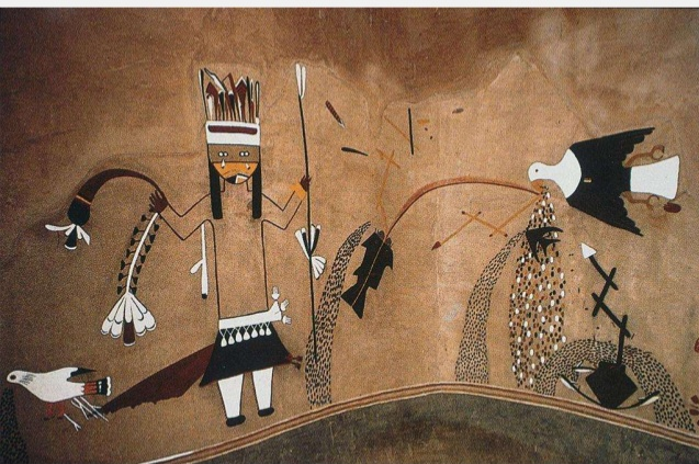
Kuaua's murals are among its most important archaeological discoveries.

Painted designs covered interior walls of kivas.

The images provide rare evidence for Pueblo visual culture.

Because pigments can survive in protected underground structures, kiva murals can preserve artistic information that would otherwise disappear.

What Did the Murals Mean?

Interpretation requires caution.

Some imagery appears to involve supernatural beings, ceremonial figures, masks, animals, and geometric patterns.

However, researchers cannot assume that every image has one fixed meaning.

Pueblo religious traditions are complex, and many ceremonial practices were not recorded by early European observers.

Art as Historical Evidence

The murals are valuable because they demonstrate that Pueblo societies had sophisticated artistic traditions.

Painting was not merely decorative.

Images could participate in ceremonial and social systems.

The creation of murals required pigments, tools, artistic skill, and coordinated labor.

Spanish Contact

Kuaua also preserves evidence of the transition brought by Spanish colonization.

The arrival of Spanish settlers and missionaries introduced new political, religious, and economic systems.

Pueblo communities responded in different ways.

Some incorporated new materials and practices.

Others resisted colonial authority.

The result was a complicated process of cultural interaction.

Preservation

Murals are exceptionally fragile.

Light, humidity, temperature changes, physical contact, and exposure can damage pigments.

Archaeological conservation therefore requires carefully controlled environments.

Why Kuaua Matters

Kuaua's murals provide a rare visual window into Pueblo ceremonial life.

They allow researchers to study imagery that complements archaeological evidence from architecture and artifacts.

Together, these sources provide a more complete picture of prehistoric and early historic Pueblo society.

Conclusion

Kuaua Pueblo is one of the most valuable archaeological sites in New Mexico for understanding Pueblo art and ceremonial traditions.

Its kiva murals demonstrate the sophistication of Indigenous artistic expression and provide evidence of a rich symbolic world that existed long before and during the earliest period of European colonization.

The site reminds us that archaeological ruins are not simply remnants of buildings.

They preserve ideas, beliefs, artistic traditions, and memories embedded within physical landscapes.

Birka: Sweden's Viking Trading Island

September 14, 2026

Introduction

Birka was one of the most important trading centers in Viking Age Scandinavia.

Located on the island of Björkö in Lake Mälaren, Sweden, Birka connected the Scandinavian world with extensive commercial networks extending across the Baltic, eastern Europe, the Islamic world, and western Europe.

The settlement became a major center of commerce, craftsmanship, cultural exchange, and political activity.

Its archaeological remains provide some of the richest evidence for Viking Age urban life.

The Island Location

Birka's position on an island within Lake Mälaren offered both advantages and challenges.

Waterways provided efficient transportation.

The surrounding islands created a protected maritime environment.

At the same time, controlling access to the settlement required ships and knowledge of local waterways.

International Trade

Birka's greatest importance came from trade.

Archaeologists have recovered objects originating from distant parts of the world.

These include:

  • Islamic silver coins;

  • beads;

  • textiles;

  • glass;

  • jewelry;

  • weapons;

  • ceramics;

  • exotic materials.

Such discoveries demonstrate that Viking Age Scandinavia was connected to enormous trade networks.

Islamic Silver

One of Birka's most famous archaeological characteristics is the large number of Islamic silver coins.

Many came from the Islamic world through eastern European trade routes.

Their presence demonstrates that Scandinavian merchants participated in long-distance exchange extending deep into Eurasia.

Craft Production

Birka was also a major manufacturing center.

Craftspeople produced jewelry, weapons, textiles, beads, and other objects.

The settlement therefore did not simply redistribute imported goods.

It transformed raw materials into new products.

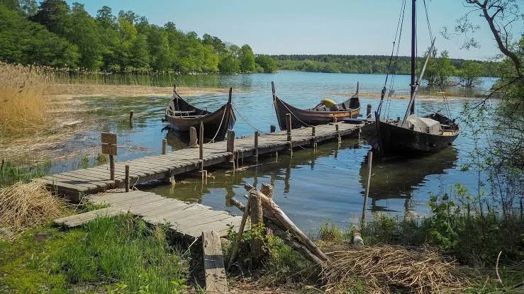
The Harbor

Ships were essential to Birka.

The harbor allowed merchants to unload cargo and transport goods throughout the Baltic region.

Maritime technology was therefore central to the settlement's economic success.

Defensive Structures

Birka was protected by defensive works.

Fortifications helped safeguard the settlement and its wealth.

They also demonstrate that trade centers required security.

A marketplace containing valuable goods would naturally become an important strategic target.

Burials

Birka is famous for its extensive cemeteries.

Thousands of graves provide evidence about the population.

Burials contain weapons, jewelry, tools, clothing accessories, and other objects.

These materials allow archaeologists to investigate social identity, gender roles, wealth, trade, and religious beliefs.

The Famous Warrior Burial

One burial at Birka became especially famous because it was originally interpreted as belonging to a male warrior.

Later osteological and DNA research demonstrated that the individual was biologically female.

This discovery stimulated major discussions about gender, identity, and warfare in Viking Age society.

It also demonstrates why archaeological interpretations must remain open to revision as scientific methods improve.

Christianity

Christian influence reached Birka relatively early.

Missionaries visited the settlement, including Ansgar in the ninth century.

Christianity initially existed alongside traditional Norse religious beliefs.

This makes Birka valuable for studying religious transition.

Social Diversity

Birka's international trade likely brought people from different regions.

Merchants, artisans, farmers, warriors, slaves, travelers, and political representatives could all participate in the settlement's economy.

This made Birka one of the most cosmopolitan environments in Viking Age Scandinavia.

Decline

Birka eventually lost its importance.

Changes in waterways, political organization, trade routes, and economic geography contributed to its decline.

Nearby Sigtuna later became a more important Scandinavian center.

Archaeological Importance

Birka is indispensable for understanding Viking Age commerce.

Its artifacts demonstrate connections between Scandinavia and regions separated by thousands of kilometers.

The settlement also provides evidence for urban life, craftsmanship, religion, burial practices, social organization, and political power.

Conclusion

Birka was one of the great commercial centers of the Viking Age.

Its island location, harbor, workshops, cemeteries, imported goods, and enormous collection of silver coins reveal a society deeply connected to the wider medieval world.

The settlement challenges the image of Viking Scandinavia as isolated and rural.

Birka was cosmopolitan, commercially sophisticated, technologically capable, and culturally diverse.

Its archaeological remains demonstrate that the Viking Age was fundamentally an age of movement—of ships, merchants, metals, technologies, beliefs, and people crossing the waterways of northern Europe and connecting Scandinavia to distant civilizations.

Uppåkra: Sweden's Iron Age Power Center

September 14, 2026

Introduction

Uppåkra was one of the most important settlements in Iron Age Scandinavia.

Located in southern Sweden near modern Lund, the site was occupied for many centuries and developed into a major political, economic, religious, and cultural center.

Its enormous archaeological record contains hundreds of thousands of artifacts.

This makes Uppåkra one of the richest archaeological sites for understanding the transformation of southern Scandinavia from the Iron Age into the Viking Age.

Long Occupation

Uppåkra was occupied for approximately a millennium.

This long sequence allows archaeologists to study social change over generations.

Rather than providing a snapshot of one moment, the site records continuous transformation.

Political Power

The settlement appears to have been an important elite center.

Large halls and high-status objects demonstrate concentrated wealth.

Political leaders could use the site to control surrounding communities and economic resources.

The Cult House

One of Uppåkra's most famous discoveries is a small but highly significant ritual building.

The structure is generally interpreted as a cult house.

Its architectural form and associated artifacts indicate that religious ceremonies took place there.

Religious Artifacts

Archaeologists have discovered numerous objects with religious significance.

These include figurines, decorated objects, and ritual deposits.

They provide evidence for pre-Christian Scandinavian beliefs.

Craft Production

Uppåkra was also a major manufacturing center.

Metalworking, jewelry production, and other specialized crafts occurred there.

Craftspeople required access to raw materials and elite patrons.

International Connections

Imported objects demonstrate that Uppåkra participated in long-distance trade.

Connections extended across Scandinavia and continental Europe.

Luxury objects provided elites with ways to demonstrate wealth and status.

The Gold Foils

Small decorative gold objects known as gold foils are among the site's most remarkable finds.

They often depict human figures.

Their exact meanings remain debated, but they are widely associated with elite or religious contexts.

Warfare

Weapons found at Uppåkra demonstrate that military power was part of elite society.

Weapons could function both practically and symbolically.

A warrior's equipment communicated social status as well as battlefield capability.

The Move to Lund

Around the end of the Viking Age, the center of settlement shifted toward Lund.

This transformation probably reflected changes in political organization and Christian urban development.

The transition demonstrates the emergence of medieval towns and new forms of royal administration.

Conclusion

Uppåkra was a major Iron Age center of power whose importance extended across centuries.

Its halls, ritual structures, gold objects, workshops, weapons, and imported goods reveal a society characterized by wealth, craftsmanship, political authority, and religious complexity.

The site's long history makes it particularly valuable because it demonstrates how Viking Age and medieval Scandinavian society emerged from earlier Iron Age traditions.

Uppåkra was not simply an ancient settlement.

It was a political and cultural heartland that helped shape the development of southern Scandinavia.

Tissø: Denmark's Viking Age Lake Village

September 14, 2026

Introduction

Tissø was an important Viking Age settlement and elite center located near a lake on the Danish island of Zealand.

The site is particularly valuable because it combines evidence for aristocratic residence, craft production, religious activity, agriculture, and long-distance trade.

Tissø demonstrates that Viking Age power was not concentrated exclusively in fortified towns.

Elite centers could also develop within rural landscapes.

The Lake Setting

The settlement was situated beside Lake Tissø.

Water provided transportation, food resources, and symbolic significance.

The lake could also serve as a natural boundary around which settlement and ritual activities developed.

The Elite Residence

Archaeological discoveries indicate the presence of a large elite hall.

The building was probably associated with a powerful local ruler or aristocratic family.

Such halls were centers of political and social life.

Craft Production

Tissø was an important manufacturing center.

Archaeologists have discovered evidence of:

  • metalworking;

  • jewelry production;

  • weapon manufacture;

  • textile production;

  • bone and antler working.

Craft specialization indicates that elite households could support skilled workers.

International Trade

Imported artifacts demonstrate contact with distant regions.

Luxury objects from continental Europe and other Scandinavian areas reached Tissø.

The site therefore participated in broader commercial networks.

Religion

Tissø is particularly important for understanding Viking religious practices.

Deposits of valuable objects in and around the lake have been interpreted in connection with ritual activity.

Water played a major role in many ancient religious traditions.

Objects deposited in lakes may have been offerings to supernatural powers.

Elite Power

The combination of a large hall, workshops, wealth, and ritual evidence suggests that Tissø was a major center of authority.

The ruler associated with the site could command labor and access to trade networks.

Rural Kingship

Tissø demonstrates that Viking Age political power did not require urban living.

An elite center could control surrounding agricultural communities while maintaining international connections.

The hall was the political heart of a wider landscape.

Archaeological Importance

Tissø helps archaeologists reconstruct the relationship between:

  • agriculture;

  • craft production;

  • trade;

  • religion;

  • political authority.

These systems were interconnected.

Conclusion

Tissø was an important Viking Age elite settlement where political authority, craftsmanship, commerce, and religion converged.

Its lakeside location and ritual deposits make it especially valuable for studying Viking belief systems, while its workshops and imported objects reveal extensive economic connections.

Tissø demonstrates that Viking Age Denmark consisted of a network of elite centers, farms, trading towns, religious sites, and military installations.

Its archaeological remains provide a detailed picture of how power operated within the Scandinavian countryside.

Lejre: Denmark's Royal Iron Age Hal

September 14, 2026

Introduction

Lejre is one of Denmark's most important archaeological sites associated with early royal power.

Located on Zealand, the site contains evidence of elite halls, ritual activity, settlement, and monumental architecture extending across several centuries.

Lejre has also been connected with medieval legends concerning Danish kings.

Although archaeology cannot simply confirm every legendary story, the extraordinary remains demonstrate that the region genuinely was an important center of power.

The Royal Hall

The most famous archaeological feature at Lejre is the sequence of large halls.

These structures were constructed from timber and required substantial resources.

Their size indicates that they were not ordinary houses.

They were probably used for elite gatherings, feasting, political meetings, and ceremonies.

Feasting and Kingship

Feasting was an essential component of early medieval political culture.

A powerful leader demonstrated generosity by distributing food and drink.

Guests developed relationships with the ruler.

Warriors could receive gifts.

Alliances could be strengthened.

The hall therefore functioned as a political institution.

Archaeological Finds

Lejre has produced numerous artifacts, including:

  • jewelry;

  • weapons;

  • glass vessels;

  • imported objects;

  • animal remains;

  • tools;

  • craft materials.

These discoveries indicate substantial wealth and international connections.

Myth and Archaeology

Lejre became associated with legendary Danish rulers, particularly figures preserved in medieval literature.

However, archaeological evidence must be interpreted independently from later stories.

The legends may preserve memories of powerful dynasties, but they were written centuries after the periods they describe.

Ritual Activity

Evidence suggests that religious activity occurred at Lejre.

Animal remains and unusual deposits may represent ritual practices.

The connection between political halls and religious ceremonies illustrates the close relationship between authority and belief.

Landscape

Lejre's significance extends beyond individual buildings.

The surrounding landscape contains archaeological features demonstrating long-term occupation and monument building.

The placement of elite structures within the landscape communicated status.

Political Center

Lejre may have functioned as a regional or dynastic center.

Its wealth and monumental architecture demonstrate the concentration of resources.

The ability to construct repeated large halls indicates that political authority persisted across generations.

Conclusion

Lejre offers a rare archaeological glimpse into the world of early Scandinavian kingship.

Its enormous halls, wealth, ritual evidence, and long occupation demonstrate that elite political centers existed before the fully developed Viking Age.

The site's association with Danish legend adds cultural significance, but its archaeological evidence is important in its own right.

Lejre stands as a powerful reminder that medieval kingship grew from centuries of Scandinavian traditions involving feasting, warfare, religion, wealth, and control of people and resources.

Gudme: Denmark's Iron Age Gold Hoard Site

September 14, 2026

Introduction

Gudme, located on the Danish island of Funen, was one of the most important centers of power in Iron Age Scandinavia.

Its archaeological remains reveal a wealthy and influential community involved in craft production, long-distance trade, elite culture, and religious activity.

The enormous quantities of precious metal discovered in the region have made Gudme especially famous.

A Wealthy Power Center

Gudme flourished particularly during the late Iron Age.

Archaeologists have uncovered evidence suggesting that the settlement was more than an ordinary farming community.

Large halls, workshops, imported objects, and precious metals indicate the presence of an elite political center.

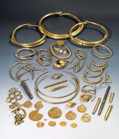
Gold and Silver

The discovery of gold objects is one of Gudme's defining features.

Gold was an elite material.

It required access to wealth and extensive exchange networks.

Gold jewelry, ornaments, and other objects demonstrate the concentration of resources at the site.

Trade Networks

Gudme was connected to wider European networks.

Imported objects demonstrate interaction with continental Europe and other parts of Scandinavia.

Trade may have brought luxury goods, raw materials, technologies, and cultural influences to the settlement.

Craft Production

Gudme was also a major center of craftsmanship.

Metalworking required specialist knowledge.

The presence of workshops indicates that elite communities could support highly skilled artisans.

Craft production reinforced the status of political leaders by allowing them to acquire and display exceptional objects.

The Great Halls

Large halls were central to elite life.

They could serve as residences, meeting places, ceremonial spaces, and locations for feasting.

Feasting was politically important because leaders strengthened alliances by providing food and hospitality.

The hall therefore represented both architecture and social power.

Religion

Gudme appears to have possessed significant religious importance.

The association between elite halls and ritual activity suggests that political and religious authority could overlap.

Religious ceremonies may have reinforced the legitimacy of local leaders.

Archaeological Significance

Gudme challenges simplistic ideas about Iron Age Scandinavia.

The region possessed sophisticated political economies before the Viking Age.

Long-distance trade, elite culture, craft specialization, and religious institutions were already well developed.

Transition to the Viking Age

The importance of Gudme declined as other centers rose.

Nearby Lundeborg became an important trading site.

This transition demonstrates how economic centers could shift as political and commercial networks changed.

Conclusion

Gudme represents one of the most important Iron Age power centers in Denmark.

Its gold, workshops, halls, imported objects, and religious evidence demonstrate the wealth and complexity of Scandinavian society before the Viking Age.

Rather than appearing suddenly in the eighth century, Viking Age culture emerged from earlier traditions of trade, craftsmanship, elite power, and international exchange.

Gudme provides an essential archaeological foundation for understanding that development.

Nonnebakken: Odense's Viking Fort Remains

September 14, 2026

Introduction

Nonnebakken was one of the Viking Age ring fortresses associated with Denmark's late tenth-century royal building program.

Located in modern Odense on the island of Funen, the fortress represents an important stage in the development of Danish royal authority.

Although much of the original structure has disappeared beneath later urban development, archaeological investigations have revealed evidence of its enormous circular design.

Location

Nonnebakken occupied an important position near Odense.

Its location gave it access to regional transportation routes and surrounding agricultural resources.

The fortress could therefore serve as a strategic center for controlling movement through Funen.

Architectural Design

Like other Danish ring fortresses, Nonnebakken was characterized by a circular defensive enclosure.

Its layout appears to have followed a carefully planned geometric design.

The similarities with other fortresses suggest that they were constructed as part of a coordinated royal program.

Harald Bluetooth

The fortress is generally associated with the reign of Harald Bluetooth.

During this period Denmark experienced increasing political centralization.

The king needed mechanisms for controlling territory and mobilizing military forces.

Nonnebakken was likely part of that system.

Military Function

A fortress could accommodate warriors and protect supplies.

It could also serve as a staging point for military operations.

Its location on Funen made it strategically valuable because the island occupied a central position between parts of Denmark.

Archaeological Evidence

Excavations and geophysical investigations have helped reconstruct the fortress despite later development.

Evidence of ramparts, ditches, and internal organization demonstrates the site's scale.

Archaeological methods are especially important at Nonnebakken because much of the monument is no longer visible above ground.

Urban Transformation

Modern Odense developed around and over parts of the ancient site.

This illustrates an important challenge in archaeology.

Historic settlements often remain beneath modern cities.

Archaeologists must therefore combine excavation with:

  • aerial photography;

  • geophysical surveys;

  • historical maps;

  • soil analysis;

  • digital reconstruction.

Political Significance

Nonnebakken demonstrates that royal power extended beyond Jutland.

The construction of major fortifications on Funen indicates that political integration involved strategic infrastructure across the Danish kingdom.

Conclusion

Nonnebakken is a reminder that Viking Age monuments do not always survive as spectacular ruins.

Much of the fortress is now hidden beneath later development, yet archaeological investigation continues to reveal its original form.

As one of the Danish ring fortresses, Nonnebakken provides evidence for Harald Bluetooth's efforts to organize territory, strengthen military authority, and consolidate the Danish kingdom.

Its buried remains represent an important chapter in the emergence of a more centralized Scandinavian state.

Aggersborg: Denmark's Largest Viking Fort

September 14, 2026

Introduction

Aggersborg is the largest and most spectacular of Denmark's Viking Age ring fortresses.

Located near the Limfjord in northern Jutland, Aggersborg occupied a strategically important position controlling one of Denmark's most significant waterways.

Its enormous circular enclosure and highly standardized internal layout demonstrate a level of military and architectural planning rarely associated with early medieval Scandinavia.

Scale

Aggersborg was substantially larger than the other known Danish ring fortresses.

Its enormous dimensions allowed it to accommodate large numbers of people.

The scale of the structure demonstrates that its construction required extraordinary resources.

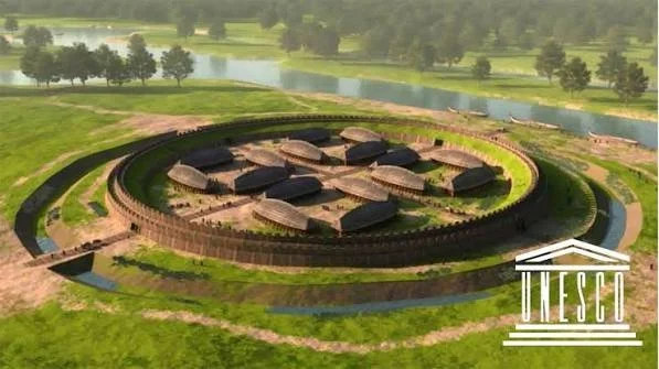
Circular Design

The fortress consisted of a massive circular rampart divided by major roads.

Four principal entrances were positioned according to a carefully planned geometric scheme.

Inside were groups of standardized longhouses.

The symmetry is one of Aggersborg's most remarkable characteristics.

Engineering

Building Aggersborg required:

  • surveying;

  • earthmoving;

  • timber construction;

  • road construction;

  • drainage;

  • logistical planning.

Workers needed food and equipment throughout the construction process.

The fortress therefore represents not only military technology but administrative capacity.

Strategic Geography

The Limfjord was a major transportation corridor.

Ships could use the waterway to move across northern Jutland.

Controlling this region allowed rulers to influence both commercial and military movement.

Aggersborg's position was therefore strategically valuable.

Royal Authority

Aggersborg is closely associated with the political ambitions of Harald Bluetooth.

The fortress formed part of a broader network of royal installations.

These sites likely helped the monarchy coordinate military forces and reinforce control over strategically important areas.

International Context

The construction of Aggersborg occurred during a period when Scandinavian kingdoms increasingly interacted with continental European powers.

Military organization was changing.

Kings were building stronger political institutions.

Christianity was expanding.

Trade networks were becoming increasingly integrated.

Aggersborg belongs to this broader transformation.

Daily Life

Despite its military appearance, people lived within the fortress.

Food preparation, craft production, animal keeping, and domestic activities all occurred.

Archaeological remains provide evidence of what inhabitants ate and how they worked.

The Meaning of the Fortresses

Scholars debate whether the ring fortresses were purely military.

Possible functions include:

  • royal residences;

  • military camps;

  • administrative centers;

  • training facilities;

  • logistical depots;

  • political symbols.

It is possible that they served several functions simultaneously.

Short Occupation

One striking feature of Aggersborg is that it appears to have been used for a relatively short period.

This raises important questions.

Why would a king invest enormous resources in a fortress that was not occupied continuously for centuries?

One possibility is that the fortress was designed for a particular political or military campaign.

Conclusion

Aggersborg represents the extraordinary organizational capacity of late Viking Age Denmark.

Its massive size, geometric design, strategic location, and standardized architecture reveal a centralized state capable of mobilizing enormous resources.

The fortress stands as a monument to a period when Scandinavian kingship was becoming more powerful and structured.

Aggersborg was therefore not merely a defensive wall.

It was an expression of royal strategy, military organization, engineering, and political ambition.

Trelleborg: Denmark's Massive Viking Fort

September 14, 2026

Introduction

Trelleborg is one of Denmark's most famous Viking Age fortresses and an important example of the highly organized military architecture associated with the reign of Harald Bluetooth.

The fortress was constructed according to a precise geometric plan.

Its circular enclosure, monumental ramparts, standardized houses, and strategic location demonstrate that Viking Age Denmark possessed sophisticated military and administrative capabilities.

Construction

Trelleborg required enormous quantities of labor.

Earth had to be excavated and moved to create defensive banks and ditches.

Timber was needed for buildings and fortifications.

The standardized design indicates that construction was planned before work began.

The Fortress Layout

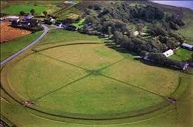
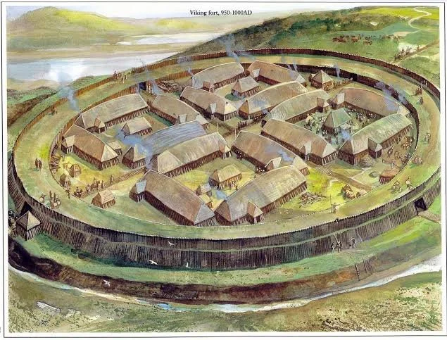
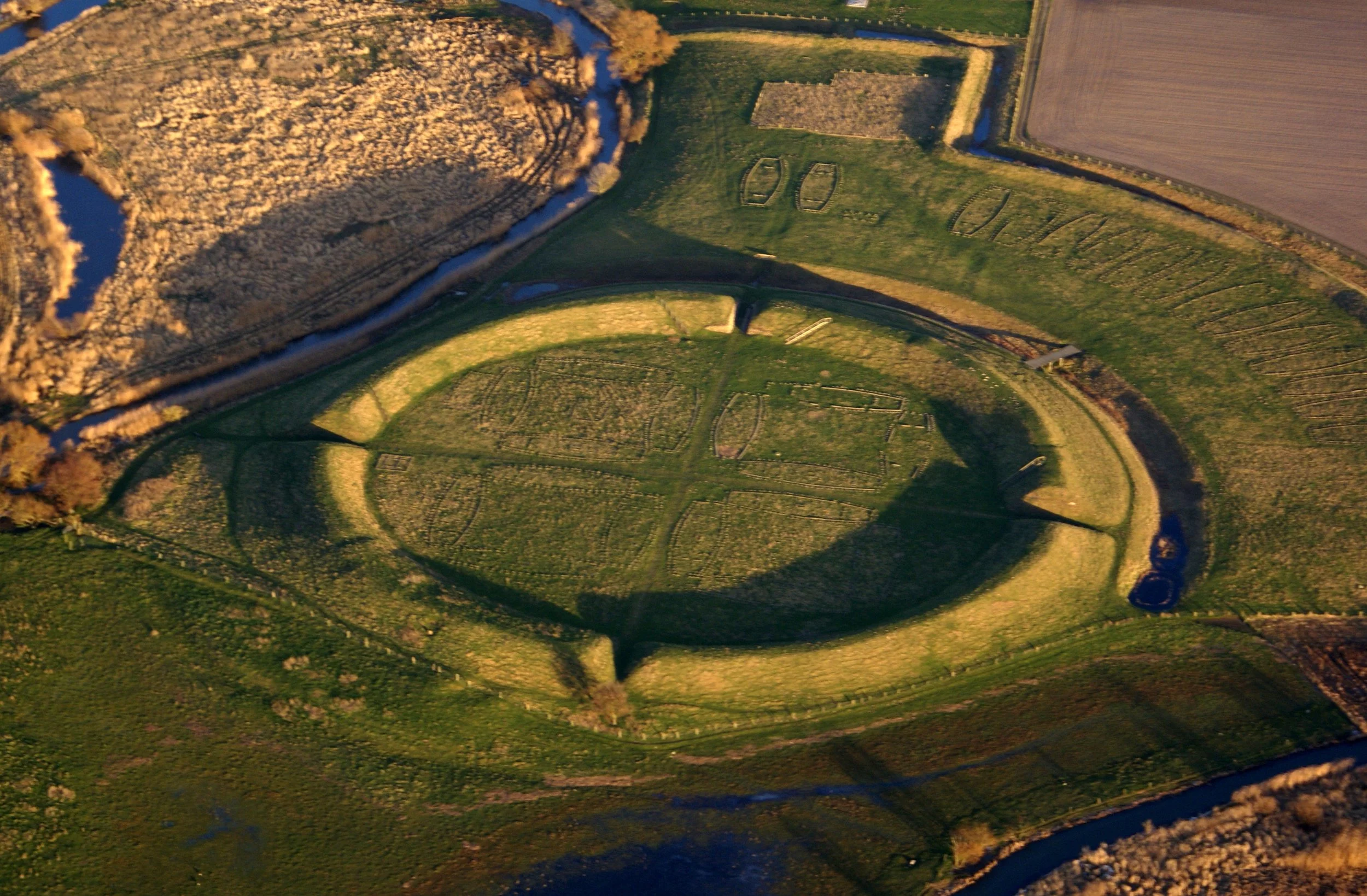
The main fortress was circular.

Inside were longhouses arranged in a carefully organized pattern.

Roads and entrances were systematically positioned.

This symmetry suggests the involvement of skilled planners and surveyors.

Military Organization

Trelleborg could accommodate substantial numbers of people.

Its military purpose probably included training, mobilization, storage, and strategic defense.

The fortress may have served as a temporary base for royal forces rather than simply a permanent city.

The Viking Army

The fortress provides evidence for a more organized form of warfare than the stereotype of independent raiders might suggest.

A centralized king needed warriors who could assemble rapidly.

They required food, weapons, horses, ships, and logistical support.

Fortresses such as Trelleborg could facilitate this organization.

The River and Strategic Position

Trelleborg was positioned near important waterways.

This allowed movement of troops and supplies.

Water transportation was essential to Scandinavian warfare.

A fortress controlling river and land routes could have significant strategic importance.

Archaeological Evidence

Artifacts discovered at the site include:

  • weapons;

  • tools;

  • jewelry;

  • agricultural equipment;

  • household objects;

  • craft materials.

These finds demonstrate that the fortress was a functioning settlement rather than a purely symbolic monument.

Burials

Nearby graves provide evidence for individuals associated with the community.

Human remains can help archaeologists investigate age, sex, health, diet, and injuries.

Such evidence can reveal the physical realities of Viking life.

Royal Power

Trelleborg is best understood within the political transformation of tenth-century Denmark.

Harald Bluetooth was attempting to strengthen royal control over a more unified kingdom.

Fortresses could serve as instruments of that process.

They provided military infrastructure while simultaneously demonstrating royal authority.

Christianization

Harald's reign also witnessed the growing influence of Christianity.

The construction of military fortresses and the promotion of Christianity occurred within the same period of political consolidation.

Both processes strengthened connections between Denmark and continental Europe.

Conclusion

Trelleborg demonstrates the sophisticated organizational capabilities of Viking Age Denmark.

Its geometry, standardized architecture, military function, and archaeological remains reveal a society capable of large-scale planning.

Rather than depicting Vikings simply as independent warriors, Trelleborg reveals the administrative machinery behind royal armies and territorial control.

It was a fortress, military base, logistical center, and powerful symbol of centralized kingship.

Fyrkat: Denmark's Viking Ring Fortress

September 14, 2026

Introduction

Fyrkat is one of the remarkable circular fortresses constructed in Denmark during the reign of King Harald Bluetooth in the late tenth century.

Its highly organized geometry distinguishes it from ordinary fortified settlements.

The fortress consisted of a circular defensive enclosure divided into carefully planned sections, with houses arranged according to a remarkably regular design.

Fyrkat provides important evidence for the organizational capabilities of Viking Age royal power.

The Ring Fortress Design

Fyrkat's most distinctive feature is its circular plan.

The fortress was surrounded by an earthwork rampart and defensive ditch.

Inside, buildings were organized according to a symmetrical layout.

This level of planning required surveying, engineering, labor coordination, and centralized authority.

Royal Construction

The construction of Fyrkat was probably beyond the capacity of a small local community acting independently.

Large quantities of earth and timber had to be moved.

Workers needed food, tools, supervision, and logistical support.

The fortress therefore represents the ability of the Danish monarchy to mobilize substantial resources.

The Longhouses

Inside Fyrkat stood large timber longhouses.

Their standardized form suggests that the buildings were constructed according to a planned architectural design.

Such standardization is important evidence for centralized planning.

The fortress was not a randomly developed village.

Military Function

Fyrkat's defensive character suggests a military purpose.

The fort could accommodate warriors and provide a strategic position from which the surrounding region could be controlled.

However, historians continue to debate exactly how these fortresses functioned.

They may have served military, administrative, political, and logistical purposes simultaneously.

Harald Bluetooth

Fyrkat belongs to a group of circular fortresses associated with Harald Bluetooth.

These include Aggersborg, Trelleborg, and other fortifications.

Their construction occurred during a period when Denmark was becoming more politically centralized.

The fortresses therefore form part of a broader transformation in royal authority.

Archaeological Finds

Excavations at Fyrkat have produced weapons, tools, jewelry, household objects, and other artifacts.

These finds provide evidence about the people who occupied the fortress.

Burials near the site also contribute information about the community.

The Fyrkat Woman

One particularly interesting burial is associated with a richly equipped woman.

Her grave contained objects that have sometimes been interpreted in connection with magic or ritual practices.

Such finds demonstrate the complexity of Viking Age belief and identity.

Fortification Technology

The fortress demonstrates sophisticated defensive engineering.

Earth ramparts provided elevated defensive positions.

Timber structures could reinforce entrances and walls.

Ditches made direct assault more difficult.

The circular layout allowed defenders to monitor the surrounding area.

Political Symbolism

Fyrkat was not only a military structure.

Its geometric precision would itself have communicated royal authority.

The ability to impose such a design upon the landscape demonstrated power.

The fortress essentially announced that the king possessed the organizational capacity to control people, resources, and territory.

Conclusion

Fyrkat represents one of the clearest archaeological expressions of centralized Viking Age kingship.

Its circular architecture, standardized longhouses, defensive earthworks, and archaeological remains reveal an unusually organized settlement.

The fortress illustrates the growing ability of Danish rulers to mobilize large populations and construct monumental infrastructure.

Fyrkat therefore stands as both a military installation and a symbol of political transformation during the late Viking Age.

Jelling Stones: Denmark's 10th-Century Runestones

September 14, 2026

Introduction

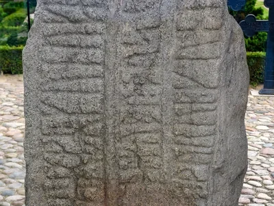
The Jelling Stones are among the most important monuments in Danish history.

Standing at Jelling in central Jutland, the two famous runestones are closely associated with King Gorm and King Harald Bluetooth.

The larger stone erected by Harald is particularly significant because its inscription refers to Harald's rule over Denmark and Norway and his conversion of the Danes to Christianity.

The monument therefore combines political authority, dynastic memory, religion, writing, and monumental art.

King Gorm's Stone

The older stone is associated with King Gorm.

Its inscription commemorates his wife, Thyra.

This demonstrates that runestones served as monuments to individuals and families.

They could preserve memory in a public and highly visible form.

Harald Bluetooth's Stone

The larger Jelling Stone was erected by Harald Bluetooth.

Its inscription presents Harald as a powerful ruler and emphasizes his achievements.

Among these was his claim to have unified Denmark and made the Danes Christian.

This is one of the clearest statements of royal ideology from Viking Age Scandinavia.

Christianity and Political Power

Harald's Christian conversion was not simply a religious event.

Christianity offered rulers new political and ideological tools.

Kings could present themselves as divinely sanctioned authorities.

Church institutions could strengthen royal administration.

Christianity also connected Denmark more closely to the wider European Christian world.

The Images

The larger Jelling Stone contains both runic writing and elaborate imagery.

One famous figure is interpreted as Christ.

The monument therefore represents the merging of Scandinavian artistic traditions with Christian symbolism.

Runic Writing

Runes were more than decorative symbols.

They were a practical writing system used for names, memorial inscriptions, ownership statements, magical formulas, and other purposes.

At Jelling, writing became a tool of royal propaganda.

The king's achievements were publicly displayed in durable stone.

The Jelling Monument Complex

The stones were part of a much larger monumental landscape.

The site included burial mounds, a church, and other structures.

Together they formed a carefully organized royal complex.

The arrangement demonstrates that architecture and landscape were used to communicate political authority.

Dynastic Memory

The Jelling monuments linked Harald to his parents and royal ancestors.

This strengthened dynastic legitimacy.

A ruler did not simply govern because he possessed military power.

He also needed to establish a convincing historical connection with earlier rulers.

Historical Significance

The Jelling Stones are frequently described as a kind of national monument because of their connection with the formation of Denmark.

However, historians must be careful not to project modern nationalism backward.

The tenth-century political world was structured around kingship, dynasties, alliances, territories, and personal loyalties rather than modern nation-states.

Conclusion

The Jelling Stones represent one of the most important surviving expressions of Viking Age royal ideology.

Through their inscriptions, imagery, and monumental setting, they communicate ideas about family, kingship, conquest, Christianity, and political legitimacy.

They demonstrate how Viking rulers used both traditional Scandinavian forms and new Christian symbolism to construct powerful statements about their authority.

Jelling is therefore not simply a collection of ancient stones.

It is a carefully constructed political landscape that captures Denmark during one of the most transformative periods in its history.

← Newer Posts Older Posts →
Featured
image_2026-09-15_213233600.png
September 18, 2026
Kaloko-Honokohau: Hawaii's Ancient Salt Pans
September 18, 2026
Read more →
September 18, 2026
image_2026-09-15_213313883.png
September 18, 2026
Anasazi Chacoan Outliers: New Mexico's Road Network
September 18, 2026
Read more →
September 18, 2026
image_2026-09-15_213356305.png
September 18, 2026
Salmon Ruins: New Mexico's Chaco Colony
September 18, 2026
Read more →
September 18, 2026
image_2026-09-15_213433098.png
September 18, 2026
Aztec West: New Mexico's Great House Community
September 18, 2026
Read more →
September 18, 2026
image_2026-09-15_213526907.png
September 18, 2026
Casamero Pueblo: New Mexico's Chaco Outlier
September 18, 2026
Read more →
September 18, 2026
image_2026-09-15_214058824.png
September 18, 2026
Chimney Rock: Colorado's Astronomical Great House
September 18, 2026
Read more →
September 18, 2026
read more

Powered by The archaeologist