• MAIN PAGE
  • LATEST NEWS
    • Lost Cities
    • Archaeology's Greatest Finds
    • Underwater Discoveries
    • Greatest Inventions
    • Studies
    • Blog
  • PHILOSOPHY
  • HISTORY
  • RELIGIONS
    • Africa
    • Anatolia
    • Arabian Peninsula
    • Balkan Region
    • China - East Asia
    • Europe
    • Eurasian Steppe
    • Levant
    • Mesopotamia
    • Oceania - SE Asia
    • Pre-Columbian Civilizations of America
    • Iranian Plateau - Central Asia
    • Indus Valley - South Asia
    • Japan
    • The Archaeologist Editor Group
    • Scientific Studies
    • Aegean Prehistory
    • Historical Period
    • Byzantine Middle Ages
    • Predynastic Period
    • Dynastic Period
    • Greco-Roman Egypt
  • Rome
  • PALEONTOLOGY
  • About us
Menu

The Archaeologist

  • MAIN PAGE
  • LATEST NEWS
  • DISCOVERIES
    • Lost Cities
    • Archaeology's Greatest Finds
    • Underwater Discoveries
    • Greatest Inventions
    • Studies
    • Blog
  • PHILOSOPHY
  • HISTORY
  • RELIGIONS
  • World Civilizations
    • Africa
    • Anatolia
    • Arabian Peninsula
    • Balkan Region
    • China - East Asia
    • Europe
    • Eurasian Steppe
    • Levant
    • Mesopotamia
    • Oceania - SE Asia
    • Pre-Columbian Civilizations of America
    • Iranian Plateau - Central Asia
    • Indus Valley - South Asia
    • Japan
    • The Archaeologist Editor Group
    • Scientific Studies
  • GREECE
    • Aegean Prehistory
    • Historical Period
    • Byzantine Middle Ages
  • Egypt
    • Predynastic Period
    • Dynastic Period
    • Greco-Roman Egypt
  • Rome
  • PALEONTOLOGY
  • About us
No results found

Tintic Mining District: Utah's Underground Labyrinths

September 27, 2026

Introduction

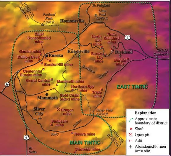
The Tintic Mining District is one of Utah's most important historic mining regions. Located in Juab and Utah counties, the district developed into a major nineteenth- and early twentieth-century center for the extraction of silver, lead, gold, copper, and other minerals.

The phrase "underground labyrinths" is especially appropriate for the physical complexity created by generations of mining.

Beneath the mountains, shafts, tunnels, stopes, drifts, raises, crosscuts, and other workings created an artificial subterranean landscape.

Geological Origins

The Tintic Mountains contain mineral deposits formed through complex geological processes.

Ore bodies occurred in different geological settings, requiring miners to adapt their extraction methods to local conditions.

This geological complexity influenced the shape of underground workings.

Mining was therefore an exercise in following mineralization through three-dimensional rock.

The Mining Boom

Tintic emerged as a major mining district during Utah's post-settlement mineral expansion.

Discoveries attracted prospectors and investors.

Settlements developed rapidly.

Eureka became the district's most famous community, while other camps developed around individual mines.

Railroads eventually transformed transportation and helped connect Tintic with national markets.

Underground Engineering

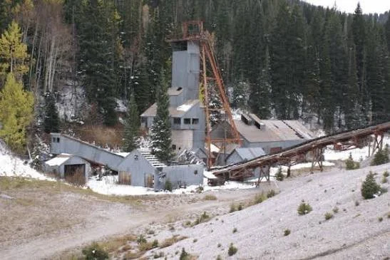
A nineteenth-century mine was effectively an underground city.

Shafts provided vertical access.

Drifts followed ore bodies horizontally.

Crosscuts connected workings.

Raises allowed miners to move upward.

Stopes were excavated where ore was removed.

Ventilation systems provided airflow.

Pumps removed groundwater.

Hoists transported people and materials.

The resulting network could extend for enormous distances.

Mining Technology

Early miners relied heavily on hand tools and black powder.

Later operations adopted increasingly powerful explosives, compressed-air drills, mechanical hoists, pumps, and improved ventilation systems.

Technological development changed the speed and scale of excavation.

However, deeper mining also introduced new dangers.

Rock pressure, flooding, poor ventilation, and structural failure became increasingly serious.

Labor and Risk

Mining was dangerous work.

Workers could be injured by explosions, rock falls, machinery, fires, and poisonous gases.

Long-term exposure to dust and metal-bearing materials could also produce serious health problems.

Despite these dangers, mining provided employment and wages that attracted workers from many backgrounds.

Eureka and the Tintic Economy

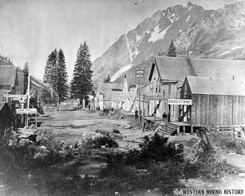
Eureka developed as one of Utah's major mining towns.

Its businesses, hotels, banks, newspapers, transportation infrastructure, and residential districts reflected the wealth generated by surrounding mines.

The town became a regional commercial center rather than merely a workers' camp.

Railroads

Rail transportation transformed Tintic mining.

Ore could be moved more efficiently to smelters and markets.

Coal, machinery, food, timber, and other supplies could enter the district more cheaply.

Rail access therefore changed the economics of mining.

Archaeology Beneath the Surface

Mining archaeology is unusual because much of the evidence is hidden underground.

Archaeologists and historians can study mine maps, engineering drawings, production records, machinery, surface structures, waste dumps, and underground features.

Mine maps are particularly valuable because they document how workers understood the subterranean environment.

They are historical maps of an artificial landscape.

Environmental Legacy

Tintic also demonstrates the environmental costs of extraction.

Mine waste can contain heavy metals.

Tailings can be transported by wind and water.

Smelters historically emitted pollutants.

Drainage from abandoned mines can alter water chemistry.

These impacts can continue long after mining ends.

Preservation

Historic mine openings can be extremely dangerous.

Unstable shafts and tunnels can collapse without warning.

Consequently, preservation does not necessarily mean allowing unrestricted public access underground.

Instead, historians and archaeologists can document sites through surveys, maps, photographs, engineering records, and carefully managed access.

Conclusion

The Tintic Mining District represents one of Utah's most complex industrial landscapes.

Its underground workings preserve evidence of generations of technological development and human labor.

Above ground, communities such as Eureka reveal how mining transformed Utah's economy and society.

Together, the surface settlements and subterranean workings demonstrate that nineteenth-century mining was a sophisticated industrial system whose physical footprint extended deep beneath the landscape.
Park City Mines: Utah's Silver Boom Relics

September 27, 2026

Introduction

Park City is one of Utah's best-known historic mining landscapes. Today it is internationally recognized as a mountain resort, but beneath and around the modern community lies the physical legacy of a major nineteenth- and twentieth-century silver-mining industry.

The mines surrounding Park City transformed a remote mountain settlement into an important industrial community. They also created a network of tunnels, shafts, mills, railroads, processing facilities, worker housing, and commercial institutions.

Modern Park City therefore exists within a much older mining landscape.

Discovery of Silver

Mining activity in the Park City region accelerated during the late nineteenth century after discoveries of valuable ore.

The Wasatch Mountains contain complex mineral deposits, and prospectors recognized opportunities for silver and associated metals.

Mining companies subsequently developed increasingly extensive underground workings.

The Growth of a Mining Town

Park City expanded rapidly as mines became productive.

The community developed hotels, stores, boardinghouses, restaurants, banks, schools, churches, newspapers, and entertainment establishments.

Mining wages supported local businesses.

Merchants depended upon miners.

Railroads depended upon mining freight.

The town therefore developed as a regional industrial economy.

Underground Park City

The most extensive historical remains are not necessarily visible from the modern streets.

Under the mountains are networks of shafts, tunnels, stopes, and connecting workings.

Mining followed ore bodies rather than neat geometric plans.

As different companies worked adjacent claims, underground workings sometimes created complicated relationships.

This is one reason historic mine maps are so valuable.

Silver Processing

Ore extracted from underground mines required processing.

Depending on the ore, operations could involve crushing, concentration, roasting, and smelting.

Waste material accumulated in tailings and dumps.

These industrial deposits provide archaeologists with evidence about changing mining technology.

Transportation

Railroads played a crucial role.

Before reliable rail connections, transporting heavy ore and industrial equipment over mountain terrain was expensive.

Railroads lowered costs and increased the scale of production.

They also connected Park City to Salt Lake City and wider national markets.

Labor and Immigration

Park City's mining workforce was diverse.

Immigrants and migrants from different regions contributed to the community.

Mining towns often contained ethnic neighborhoods, mutual-aid organizations, religious institutions, and social clubs.

These organizations provided support in environments where workers faced dangerous employment and economic uncertainty.

Labor Organization

Mining also produced labor disputes.

Questions concerning wages, working hours, safety, ownership, and management could generate conflict.

The history of mining labor demonstrates that industrialization involved negotiations over power as well as production.

Environmental Legacy

The mining industry left substantial environmental impacts.

Tailings, waste rock, mine drainage, and processing residues altered mountain landscapes.

Some contaminants remain significant environmental concerns today.

The modern community therefore exists alongside the physical consequences of historic extraction.

Preservation and Adaptive Reuse

Park City's historic buildings demonstrate how industrial heritage can be integrated into a modern city.

Former mining structures, worker residences, commercial buildings, and transportation features contribute to the community's historic identity.

Preservation also creates a challenge: tourism can generate economic value while simultaneously increasing pressure on historic landscapes.

Conclusion

Park City's silver mines were fundamental to the development of the community.

The visible historic district represents only the surface of a much larger industrial system.

The tunnels beneath the mountains, abandoned workings, processing sites, transportation routes, and surviving buildings together preserve the history of Utah's silver boom.

77. Mammoth: Utah's Lead-Zinc Ghost Town

Introduction

Mammoth, located in the Tintic Mining District, represents another chapter in Utah's long history of lead, zinc, silver, and gold extraction.

Like many western mining communities, Mammoth developed because mineral deposits justified the construction of an industrial settlement. Its later decline illustrates how communities dependent on extraction could shrink when mineral production became economically difficult.

The Tintic Context

Mammoth was part of the larger Tintic mining system.

The district contained multiple mineral deposits and numerous independent mining operations.

Rather than functioning as isolated mines, these operations shared transportation networks, labor markets, processing facilities, and commercial infrastructure.

Lead and Zinc

Lead and zinc were important industrial metals.

Lead had applications in ammunition, construction, batteries, pigments, and metallurgy.

Zinc became increasingly valuable for galvanizing iron and steel and for producing brass.

In western mining districts, these metals could occur alongside silver.

This made polymetallic deposits economically attractive.

Mining Technology

Extracting lead-zinc ore required underground mining techniques adapted to the geometry of the ore bodies.

Miners drilled into rock, used explosives, removed broken ore, and transported it toward shafts.

Surface facilities then processed the material.

The technological sophistication of such operations is often underestimated when viewing a ghost town today.

The Town

Mammoth developed the basic infrastructure of a mining settlement.

Housing accommodated workers.

Stores supplied goods.

Businesses provided services.

Industrial facilities processed mineral output.

Transportation routes connected the town with neighboring communities and markets.

The town's physical organization reflected the priorities of industrial production.

Boom and Population

Mining booms could produce rapid population growth.

But this growth was inherently unstable.

A mine could become unprofitable because of falling metal prices, declining ore quality, increasing extraction costs, or technological competition.

When employment declined, residents moved away.

Ghost-Town Archaeology

Mammoth's abandoned structures provide evidence of everyday life.

House foundations can reveal settlement patterns.

Discarded bottles and cans can reveal consumer behavior.

Industrial debris can indicate technological processes.

Mine dumps can preserve fragments of equipment and mineral-processing materials.

Archaeology therefore transforms a seemingly empty landscape into evidence of a once-active community.

Environmental History

Lead and zinc mining left significant environmental residues.

Heavy metals can persist in soil and sediment for long periods.

Historic smelting and milling further contributed to contamination.

Modern environmental investigations are therefore essential to understanding the complete legacy of Mammoth.

Preservation

Historic mining structures are vulnerable.

Wood deteriorates.

Masonry collapses.

Mine openings become unstable.

Weather gradually removes evidence.

Preservation efforts must balance public access, archaeological research, safety, and environmental concerns.

Conclusion

Mammoth is important because it demonstrates how lead-zinc mining shaped the social and industrial landscape of Utah.

Its ghost-town appearance should not obscure the complexity of the community that once existed there.

The remains preserve evidence of mining technology, labor, commerce, environmental transformation, and the economic forces that ultimately produced abandonment.

Eureka: Utah's Tintic Boomtown

September 27, 2026

Introduction

Eureka became one of the most important mining towns in Utah's Tintic Mining District. Established during the nineteenth-century mining boom, it grew from a settlement associated with nearby mineral deposits into a substantial commercial and transportation center.

Its historic buildings preserve an unusually rich record of western mining-town development.

The Tintic Discovery

Mining activity in the Tintic region expanded dramatically during the 1860s and 1870s.

Prospectors identified deposits containing valuable combinations of silver, lead, gold, copper, and other minerals.

Eureka emerged as one of the district's principal settlements.

A Mining City

Eureka was larger and more institutionally developed than many temporary mining camps.

It contained commercial buildings, hotels, banks, newspapers, schools, churches, saloons, and residences.

The town therefore became an urban center serving a broad mining region.

The Role of the Railroad

Rail transportation dramatically changed Eureka's economic position.

Mining towns were often constrained by the cost of transporting ore.

Railroads allowed heavy mineral products to reach processing facilities and markets more efficiently.

They also made imported machinery and supplies more affordable.

Eureka's growth therefore cannot be understood without considering transportation.

Mining Technology

The mines around Eureka contained extensive underground workings.

Miners used shafts, tunnels, explosives, hoisting equipment, pumps, and ventilation systems.

As mines became deeper, engineering demands increased.

Mining companies employed engineers and managers to organize increasingly complex operations.

The Commercial Economy

Mining generated demand for almost everything.

Workers needed food, clothing, tools, housing, entertainment, and transportation.

This created opportunities for merchants and entrepreneurs.

Banks provided financial services.

Newspapers reported mining developments.

Hotels accommodated visitors and traveling businessmen.

The town's economy thus multiplied the effects of mineral production.

Social Diversity

Eureka attracted workers and entrepreneurs from diverse backgrounds.

Mining communities frequently included immigrants and migrants with different languages, religions, and cultural traditions.

Mutual-aid organizations and ethnic associations could provide social security in an uncertain environment.

The resulting communities were socially complex.

Labor

Mining also produced labor relations shaped by the dangers and economics of industrial work.

Workers negotiated wages and conditions.

Mining companies sought productivity and profitability.

Safety became increasingly important as mines expanded.

The history of Eureka therefore belongs within the larger history of American industrial labor.

Decline and Transformation

As mineral production changed, Eureka's role evolved.

Some mines declined.

Others remained productive.

The town survived beyond the initial boom, demonstrating that not every mining community became a complete ghost town.

Its continued existence makes Eureka particularly valuable for historical study.

Preservation

Historic Eureka preserves a remarkable collection of buildings and streetscapes.

The town allows researchers to examine how western mining settlements developed into permanent communities.

Preservation also provides opportunities to interpret the relationship between mining and urban life.

Conclusion

Eureka represents the urban side of Utah's mining boom.

Its significance lies not only in its mines but in the institutions and communities that grew around them.

The town provides a detailed example of how mineral extraction could create a permanent commercial center connected to railroads, national markets, and industrial capitalism.

Alta: Utah's First Silver Discovery

September 27, 2026

Introduction

Alta occupies an important place in Utah's mining history and is closely associated with the early discovery and development of silver in the Wasatch Mountains.

Today, Alta is primarily associated with skiing and mountain recreation. Yet its landscape preserves evidence of an earlier industrial economy in which underground mining dominated the local environment.

Early Mining in the Wasatch

Mining expanded in Utah during the nineteenth century as settlers and prospectors increasingly investigated the mineral potential of mountain regions.

The Wasatch Mountains contain extensive mineralized zones.

Discoveries near Alta contributed to the development of Utah's early silver industry.

Silver and Economic Development

Silver was particularly valuable during the nineteenth century.

Its monetary role increased the importance of silver discoveries.

Mining companies could attract capital when deposits appeared sufficiently rich.

The resulting operations required substantial investment.

The Mining Community

Alta developed as a mining settlement.

Workers needed housing, food, tools, transportation, and services.

Businesses followed the workforce.

The town became an industrial community located at high elevation.

Mining at High Altitude

Alta's elevation created special challenges.

Snow could make transportation difficult.

Cold temperatures complicated outdoor work.

Avalanches posed hazards.

Building and maintaining roads and structures required adaptation to mountain conditions.

The physical environment therefore shaped industrial activity.

Underground Workings

The mines created networks beneath the mountains.

Shafts and tunnels followed mineralized zones.

Ore was transported to surface facilities for processing.

Some of the most significant evidence of historic Alta therefore exists in locations that are no longer obvious to visitors.

Silver Milling

Ore had to be processed before valuable metals could be recovered.

Mills crushed rock and separated valuable mineral material from waste.

Water was often important in milling operations.

The remains of historic processing facilities provide evidence of nineteenth-century engineering.

Mining Labor

Mining required workers willing to operate under dangerous conditions.

Drilling, blasting, timbering, ore removal, and transportation all involved hazards.

Workers also faced the difficulties of high-altitude living.

The community's history therefore includes both technological achievement and labor risk.

Decline

Alta's mining economy changed as ore deposits became less profitable and other industries developed.

The settlement eventually became much smaller.

The landscape later acquired a new economic identity through recreation and tourism.

From Mining to Skiing

The transformation from mining settlement to ski destination is particularly significant.

The same mountains that once constrained miners eventually became an economic resource for winter recreation.

This represents a striking example of landscape reuse.

Preservation

Mining remnants remain important historical resources.

They preserve evidence of the industrial origins of the community and help prevent modern visitors from seeing Alta solely through its contemporary recreational identity.

Conclusion

Alta's silver history illustrates the importance of early mining in Utah's economic development.

The settlement's transformation from a high-elevation mining community into a modern recreational destination demonstrates how landscapes can acquire entirely new economic meanings while retaining physical evidence of earlier periods.

Keystone: Utah's 1870s Mining Camp

September 27, 2026

Introduction

Keystone represents the transient character of many nineteenth-century western mining settlements.

Mining camps could emerge quickly following a mineral discovery, attract workers and investors, develop businesses and infrastructure, and then decline when expectations were not fulfilled.

The history of Keystone belongs to this larger pattern of boom-and-bust development.

The 1870s Mining Environment

The 1870s were a period of rapid mineral exploration throughout Utah.

Prospectors investigated mountain ranges searching for deposits of silver, gold, lead, copper, and other valuable minerals.

Mining camps formed around promising discoveries.

What Made a Mining Camp?

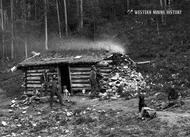
A mining camp generally began with claims and temporary shelters.

If the deposits appeared promising, more permanent structures followed.

These could include:

  • cabins;

  • boardinghouses;

  • stores;

  • blacksmith shops;

  • assay offices;

  • saloons;

  • warehouses;

  • mine structures.

The settlement expanded according to the fortunes of the mine.

The Assay Office

One particularly important institution in mining districts was the assay office.

Assayers analyzed ore samples to estimate their metal content.

Their work influenced investment decisions.

An apparently worthless rock could become valuable if analysis revealed significant metal content.

Conversely, disappointing assay results could cause investors to withdraw.

Mining and Speculation

Mining camps existed within speculative economies.

Investors frequently purchased claims or shares based on expectations of future production.

Promotional literature could exaggerate the potential of discoveries.

This created a volatile financial environment.

Transportation

Even rich ore could be economically useless if transportation costs were excessive.

Roads and trails connected camps with larger communities.

As railroads expanded, some mining districts became far more competitive.

Keystone's history must therefore be considered within this wider transportation system.

Everyday Life

Life in mining camps could be difficult.

Housing was often temporary.

Water and sanitation could be inadequate.

Food had to be transported into remote districts.

Winter conditions could isolate communities.

Yet mining camps could also develop surprisingly sophisticated social structures.

Decline

When mining expectations failed, residents moved.

Buildings were abandoned.

Some structures were relocated.

Others collapsed.

Eventually vegetation, erosion, and weather could obscure much of the settlement.

This process explains why many mining camps survive only as archaeological sites.

Archaeological Importance

Even a small camp can contain valuable evidence.

Artifacts can reveal what people ate, drank, purchased, wore, and used.

Building foundations reveal settlement organization.

Mine features reveal extraction techniques.

Together, these materials reconstruct everyday life in communities that may have left little written documentation.

Conclusion

Keystone represents the experimental and speculative character of Utah's nineteenth-century mining frontier.

Its importance lies not necessarily in its long-term size but in what it reveals about the mechanisms of boomtown development.

Mining camps were temporary experiments in geology, economics, technology, and human migration.

Heber Valley Forts: Utah's Ute War Defenses

September 27, 2026

Introduction

The forts and defensive settlements of Utah's Heber Valley reflect a period of profound tension between Indigenous communities and expanding Euro-American settlement during the nineteenth century.

The phrase "Ute War" encompasses conflicts involving Ute peoples, Mormon settlers, federal authorities, and military forces during the territorial period. These events cannot be understood simply as a sequence of military battles. They developed from competing claims over land, resources, political authority, mobility, and cultural survival.

Defensive settlements in the Heber Valley provide physical evidence of how settlers responded to perceived threats and how communities reorganized themselves during periods of conflict.

The Ute Homeland

Before Mormon settlement, Ute peoples had longstanding relationships with the lands of central and northern Utah.

The Heber Valley formed part of a larger landscape used for hunting, seasonal movement, trade, and social interaction.

Indigenous land use did not depend upon permanent agricultural villages in the European-American sense.

Consequently, the arrival of settlers transformed established patterns of land access.

Mormon Settlement

Mormon settlers expanded into Utah's valleys during the second half of the nineteenth century.

They established agricultural settlements and attempted to create permanent communities.

Farming required access to water and arable land.

As settlements expanded, competition over resources intensified.

The Walker War

One important episode was the Walker War of 1853–1854, associated with tensions between Mormon settlers and Ute leader Wakara, also known as Walker.

The conflict involved violence, livestock disputes, trade disagreements, and broader tensions surrounding settlement.

Although the conflict is often remembered as a "war," it consisted of raids, killings, military mobilization, negotiations, and localized confrontations rather than one continuous conventional campaign.

Defensive Architecture

Settlers sometimes responded to insecurity by constructing forts.

A fort could consist of houses arranged around a defensible perimeter, an enclosed block, stockade elements, or purpose-built defensive walls.

The architecture reflected the community's perception of danger.

However, fortification also served practical purposes such as organizing settlement and providing communal resources.

Heber Valley

As settlement expanded into the Heber Valley, communities developed agricultural systems and transportation routes.

The valley's geography influenced settlement organization.

Mountains surrounded the agricultural basin, while rivers and streams provided water.

This geography could also shape military movement and defensive strategy.

The Black Hawk War

Another major period of conflict was the Black Hawk War of 1865–1872.

The conflict involved Ute leader Antonga Black Hawk and other Indigenous groups resisting settlement pressures.

The causes included loss of hunting territory, competition over resources, livestock disputes, disease, and expanding settler occupation.

Again, the term "war" should not be interpreted as a conventional war between two modern states.

It consisted of localized attacks, raids, defensive mobilization, and military expeditions.

Federal Military Presence

The U.S. Army eventually became increasingly involved in maintaining order and supporting federal authority.

This reflected the growing integration of Utah into the political and military structure of the United States.

The federal presence also altered relationships between local settlers and Indigenous nations.

Archaeological Evidence

Fort sites can reveal settlement patterns through foundations, defensive walls, roads, wells, storage areas, and artifact concentrations.

Archaeology can sometimes challenge written narratives.

Documents often emphasize the perspective of settlers and military officials.

Material evidence can provide additional information about Indigenous interaction, economic exchange, and daily life.

Indigenous Perspectives

Modern interpretation increasingly recognizes that Indigenous communities were not merely obstacles to settlement.

Ute peoples actively negotiated, resisted, adapted, traded, migrated, and defended their interests.

The descendants of these communities remain part of Utah's cultural landscape.

Historical interpretation must therefore incorporate Indigenous perspectives rather than treating Ute history as a closed chapter.

Conclusion

The Heber Valley forts preserve evidence of a complicated period in Utah history.

They reflect settler fears and defensive strategies, but they also exist within a much older Indigenous landscape.

Understanding these sites requires examining settlement expansion, resource competition, Ute resistance, federal intervention, and the transformation of Indigenous land use.

Provo Tabernacle Site: Utah's Historic Fire Aftermath

September 27, 2026

Introduction

The Provo Tabernacle site provides an unusual example of how disaster can become part of architectural history.

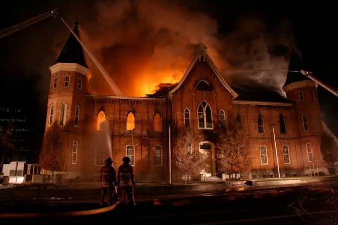
The Provo Tabernacle, constructed in the nineteenth century as a major religious and community building, was severely damaged by fire in 2010. Rather than being erased, the surviving structure became the foundation for a major preservation and adaptive-reuse project.

The site's history therefore spans construction, community use, destruction, preservation, and transformation.

Construction of the Tabernacle

The Provo Tabernacle was built during the nineteenth century as a major gathering place for the local Latter-day Saint community.

Large tabernacles served multiple purposes.

They hosted religious meetings but could also accommodate conferences, performances, lectures, civic events, and community gatherings.

Their architecture therefore reflected both religious and civic ambitions.

Architecture

The building was designed to accommodate large numbers of people.

Its construction required significant quantities of timber, masonry, and other materials.

The structure demonstrated the organizational capacity of the nineteenth-century community.

Large public buildings required planning, fundraising, skilled labor, and long-term maintenance.

Community Significance

The tabernacle became part of Provo's civic landscape.

Generations of residents encountered the building as a familiar landmark.

Its significance therefore extended beyond its architectural form.

It represented collective memory.

The 2010 Fire

A major fire severely damaged the building in December 2010.

The event dramatically altered the structure.

Roof and interior components were destroyed or weakened.

Yet substantial portions of the historic masonry remained.

The surviving ruins raised a fundamental preservation question:

Should the damaged building be stabilized as a ruin, restored, or adapted for another use?

Preservation Philosophy

Historic preservation often involves difficult decisions.

Authentic historic fabric has value.

At the same time, buildings can survive more effectively if they receive new functions.

The Provo Tabernacle became an example of adaptive preservation.

Rather than reconstructing the building as an exact nineteenth-century replica, preservationists retained significant historic elements while incorporating modern structural and functional requirements.

The Provo City Center

The restored structure eventually became the Provo City Center, demonstrating how historic buildings can acquire new public and commercial functions.

The project incorporated surviving historic masonry and architectural elements into a contemporary interior environment.

This approach preserved the building's physical identity while allowing continued use.

Archaeology and Historic Fabric

The fire revealed architectural information that might otherwise have remained hidden.

Exposed walls, construction layers, structural connections, and surviving materials provided opportunities to examine how the original building was constructed and modified.

Disaster can therefore unintentionally create archaeological opportunities.

Memory and Interpretation

The fire became part of the building's historical narrative.

The surviving structure is not simply a restored nineteenth-century building.

It is a building that passed through destruction and reconstruction.

That history contributes to its significance.

Preservation Lessons

The Provo Tabernacle demonstrates several principles of heritage conservation.

First, historic buildings can survive severe damage.

Second, preservation does not necessarily mean freezing a structure in its original condition.

Third, adaptive reuse can provide a practical means of ensuring continued stewardship.

Finally, community attachment can influence preservation decisions.

Conclusion

The Provo Tabernacle site demonstrates how historic architecture can survive disaster through preservation, adaptation, and continued community engagement.

Its history is now defined by multiple phases: construction, religious and civic use, fire, stabilization, restoration, and adaptive reuse.

The result is a powerful example of how historic places can remain meaningful even after major physical transformation.

Ogden Union Station: Utah's Railroad Museum Site

September 27, 2026

Introduction

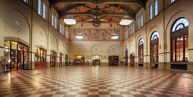
Ogden Union Station stands as one of Utah's most important railroad heritage sites.

Its significance derives from Ogden's strategic location at the intersection of major transportation routes and from the station's role in connecting Utah with national railroad networks.

Today, the historic station complex serves as a museum and cultural site, preserving the technological and social history of rail transportation.

Ogden and the Railroad

Before the railroad, transportation across Utah depended heavily on wagon roads, stage routes, and other overland systems.

Railroads transformed the geography of transportation.

Ogden became especially important because it developed as a major railroad junction.

The city became a gateway between the East and West.

The Transcontinental Railroad

The completion of the first transcontinental railroad in 1869 dramatically altered Utah's economy.

The Central Pacific and Union Pacific railroads met at Promontory Summit.

Ogden subsequently became a major connection point for western railroad transportation.

The city grew as rail traffic increased.

Union Station

The station complex served passengers and rail operations.

Large railroad stations were not simply buildings where people waited for trains.

They contained ticketing facilities, waiting rooms, restaurants, offices, baggage facilities, communication systems, and operational spaces.

They were transportation hubs.

Architecture

Ogden Union Station reflects the architectural ambition of major railroad companies.

The building's design communicated permanence and institutional importance.

Large public spaces accommodated passengers.

Decorative elements reinforced the idea that railroad stations were civic landmarks.

Railroads and Economic Transformation

Railroads transformed Utah's economy.

Agricultural products could reach distant markets.

Mining companies could ship ore more efficiently.

Manufactured goods could enter Utah more cheaply.

Tourism became more accessible.

Population movement accelerated.

Railroads therefore contributed to the integration of Utah into the national economy.

Workers

Railroads employed enormous numbers of workers.

Engineers, conductors, brakemen, maintenance crews, telegraph operators, station workers, mechanics, and laborers formed a specialized workforce.

Railroad employment required discipline and coordination.

Timetables were critical.

Communication systems had to function accurately.

A mistake could produce catastrophic consequences.

Immigrant Labor

Railroad construction relied heavily on immigrant workers, including large numbers of Chinese laborers who built the Central Pacific across the Sierra Nevada and Great Basin.

Irish, European, Mexican, and other workers also participated in railroad construction and operation at different times and locations.

The history of railroad expansion is therefore inseparable from labor migration.

Museum Preservation

Ogden Union Station now preserves artifacts associated with railroad history.

These can include locomotives, passenger cars, tools, photographs, uniforms, communication equipment, and historical documents.

Railroad museums are especially valuable because transportation technology is difficult to understand from photographs alone.

Visitors can see the scale of locomotives and equipment directly.

Social History

Stations were also places where people experienced migration, separation, reunion, tourism, commerce, and wartime transportation.

The social history of railroads therefore extends far beyond technology.

A station could be the location where families said goodbye, workers began new jobs, soldiers departed, or travelers entered a new region.

Conclusion

Ogden Union Station preserves the history of a transportation system that transformed Utah's relationship with the rest of the United States.

Its architecture, collections, railroad equipment, and location together demonstrate how railroads reshaped economic development, labor, migration, communication, and urban life.

Golden Spike: Utah's Transcontinental Join

September 27, 2026

Introduction

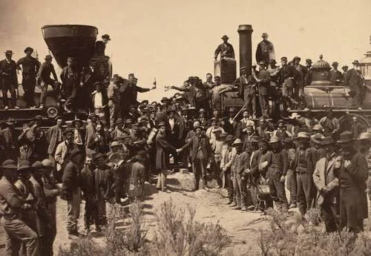
The Golden Spike symbolizes one of the most famous moments in American transportation history: the ceremonial joining of the Union Pacific and Central Pacific railroads at Promontory Summit, Utah, on May 10, 1869.

The event is often remembered through the famous photograph showing railroad executives and workers gathered around the final ceremonial connection.

Yet the completion of the railroad was more than a symbolic celebration. It represented the culmination of enormous engineering, financial, political, and labor efforts.

The Transcontinental Railroad Project

The idea of connecting the eastern and western United States by railroad had existed for decades.

The Pacific Railway Act of 1862 authorized federal support for railroad construction.

Two companies received major roles.

The Union Pacific built westward from the Missouri River.

The Central Pacific built eastward from Sacramento.

The two lines eventually met in Utah.

Engineering the West

Railroad construction across the American West required overcoming enormous geographical challenges.

Workers crossed deserts, mountains, rivers, and rugged terrain.

They built grades, bridges, tunnels, cuts, embankments, and drainage systems.

The work was physically demanding and frequently dangerous.

Chinese Railroad Workers

Chinese workers formed a crucial part of the Central Pacific workforce.

Thousands participated in constructing the railroad, particularly through the Sierra Nevada and across the Great Basin.

They performed demanding manual labor involving grading, blasting, track laying, and construction.

Their contributions were historically marginalized for many years but are now recognized as central to understanding the railroad's construction.

Mormon Labor

Mormon workers also participated substantially in railroad construction in Utah.

Many communities supplied laborers who worked for the railroads during the period surrounding completion.

Their participation reflects the complicated relationship between the railroad companies and Utah's predominantly Mormon population.

The Meeting Point

Promontory Summit was selected as the ceremonial meeting location.

The physical joining of rails represented the connection of two enormous construction projects.

A final ceremonial spike was driven into the track.

Although the famous golden spike was symbolic rather than an ordinary operational component, it became one of the most recognizable objects associated with American railroad history.

The Famous Photograph

The completion ceremony was documented photographically.

The image became a powerful representation of national technological progress.

Yet photographs also have limitations.

The famous image primarily presents railroad executives and dignitaries.

The thousands of laborers whose work made the project possible are largely absent from the central visual narrative.

Modern interpretation therefore seeks to broaden the story beyond the ceremony itself.

Economic Consequences

Railroad completion reduced travel times dramatically.

Goods could move across the continent much faster.

Markets became more integrated.

Mining, agriculture, manufacturing, tourism, and migration were transformed.

Utah became more directly connected to national economic systems.

Indigenous Consequences

The railroad also transformed Indigenous landscapes.

Construction crossed Native lands and contributed to increased settler migration, military movement, commercial development, and resource extraction.

Railroads therefore represent both technological achievement and a major force in the transformation of Indigenous territories.

The Golden Spike Today

The Golden Spike site is preserved as a major historic landmark.

Interpretation includes locomotives, reenactments, historic demonstrations, and educational programs.

The site helps visitors understand the technological scale of railroad construction.

Conclusion

The Golden Spike represents both a symbolic moment and a massive historical process.

The ceremony at Promontory Summit was only the visible culmination of years of engineering, investment, labor, migration, and political development.

Understanding the Golden Spike therefore requires looking beyond the ceremonial photograph to the thousands of people and enormous physical infrastructure that made continental rail connection possible.

Promontory Summit: Utah's 1869 Railroad Ceremony

September 27, 2026

Introduction

Promontory Summit is one of the most recognizable historical landscapes in Utah. On May 10, 1869, the Central Pacific and Union Pacific railroads were ceremonially joined there, creating the first continuous railroad connection across the United States.

The event became known as the "Golden Spike" ceremony.

Promontory Summit, however, is significant not only because of the ceremony itself. The location preserves evidence of a rapidly changing transportation system that reshaped the American West.

Why Promontory?

The railroad companies had to determine where the two construction lines would meet.

Promontory Summit provided a practical meeting location along the route through northern Utah.

The landscape contained difficult terrain but offered a workable railroad grade.

The location eventually became the site of the ceremonial connection.

May 10, 1869

The ceremony brought together executives, politicians, workers, journalists, photographers, and other observers.

A final ceremonial spike was driven into the railroad tie.

The event symbolized national technological integration.

Telegraph communication allowed news of the completion to travel rapidly across the country.

The Railroad as Infrastructure

The ceremony represented only a small fraction of the physical infrastructure required.

Railroads required:

  • tracks;

  • bridges;

  • culverts;

  • grades;

  • stations;

  • water facilities;

  • maintenance shops;

  • telegraph lines;

  • fuel stations;

  • rolling stock.

The railroad was therefore an enormous technological system rather than simply a line of rails.

The Human Workforce

Thousands of laborers constructed the railroad.

Chinese workers were particularly important to the Central Pacific.

Irish and other immigrant laborers were heavily represented on the Union Pacific.

Mormon workers also played a major role in Utah.

The workforce faced dangerous conditions, low wages in many cases, difficult weather, and exhausting physical labor.

Indigenous Landscapes

Promontory and the surrounding Great Basin were already Indigenous landscapes before railroad construction.

The railroad entered territories connected to Native communities and altered patterns of movement, hunting, trade, and settlement.

The expansion of rail transportation accelerated the arrival of settlers and commercial development.

This transformed the region permanently.

Railroad Towns

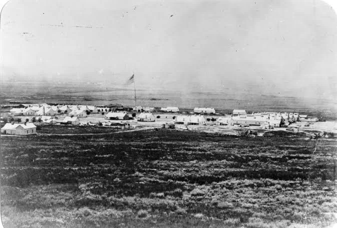
After the ceremonial completion, Promontory developed as a railroad community.

Stations, businesses, hotels, saloons, warehouses, and other facilities appeared.

Such towns could develop rapidly because railroad construction generated enormous economic activity.

But their fortunes were equally vulnerable to changes in railroad routing.

The Relocation of the Line

Promontory's long-term importance changed after the railroad route was altered.

A more efficient alignment through the Great Salt Lake region eventually bypassed the original summit route.

This is an important reminder that transportation infrastructure is dynamic.

A location that becomes strategically important can lose that importance when engineering solutions change.

Archaeological Evidence

The former railroad town left behind foundations, artifacts, grades, and other archaeological remains.

Archaeologists can use these materials to reconstruct the settlement.

Artifacts can reveal consumer behavior.

Building remains show the organization of businesses and residences.

Railroad features reveal technological practices.

Modern Interpretation

Today, Promontory Summit is preserved as a major historical site.

The site presents reconstructed locomotives and demonstrations that help visitors understand nineteenth-century railroad technology.

The ceremonial story is only one part of the interpretation.

Modern historical scholarship also emphasizes the laborers, Indigenous communities, businesses, engineers, and transportation systems involved in the railroad's development.

Legacy

The transcontinental railroad transformed the United States.

It shortened travel times.

It reduced transportation costs.

It accelerated migration.

It expanded commercial markets.

It encouraged industrial development.

It transformed western landscapes.

Its effects were therefore economic, technological, demographic, environmental, and political.

Conclusion

Promontory Summit represents a pivotal moment in American transportation history.

The 1869 ceremony became a national symbol of connection, but the deeper historical significance lies in the immense process behind it.

The summit preserves the memory of engineering achievement while also providing an opportunity to examine the labor, Indigenous history, economic transformation, and environmental consequences associated with the railroad.

For that reason, Promontory Summit is best understood not simply as the place where a golden spike was driven, but as a landscape where the American West entered a new technological and economic era.

Corinne: Utah's Gentile Boomtown

September 27, 2026

Introduction

Corinne occupies a distinctive place in Utah's nineteenth-century history because its development was closely connected to the arrival of the railroad and to the growth of a non-Mormon commercial community in a territory where Latter-day Saint settlers dominated many established settlements.

Founded in 1868 near the Bear River and shortly before the completion of the transcontinental railroad, Corinne rapidly became a center of commerce, transportation, warehousing, and freight distribution. Its population included merchants, railroad workers, freight operators, entrepreneurs, migrants, and others who were attracted by the opportunities created by the new transportation network.

The term "Gentile" was widely used in nineteenth-century Utah to refer to non-Latter-day Saints. It was a historical social category rather than a neutral modern demographic description. Corinne's reputation as a "Gentile boomtown" therefore reflects the city's role as an important non-Mormon commercial center during the territorial period.

The Railroad and the Birth of Corinne

Corinne's development was inseparable from the transcontinental railroad.

When the Union Pacific and Central Pacific railroads approached their meeting point in Utah, communities located along transportation corridors suddenly acquired new economic opportunities.

Corinne was strategically positioned near the Bear River and railroad lines.

Its founders recognized that the settlement could serve as a distribution point for goods moving into Utah's interior.

The timing was crucial.

The city was established in 1868, only months before the ceremonial completion of the transcontinental railroad in 1869.

That coincidence allowed Corinne to benefit from the dramatic expansion of transportation across the Great Basin.

A Commercial Alternative

Most established settlements in northern Utah were strongly associated with the Latter-day Saint community.

Corinne developed differently.

Merchants who were not members of the Church of Jesus Christ of Latter-day Saints established businesses there.

The city became associated with an economy based on trade rather than primarily on agricultural colonization.

Warehouses stored goods arriving by rail.

Freighters transported merchandise into surrounding communities.

Hotels accommodated travelers.

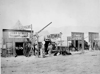
Saloons, restaurants, stores, and other businesses served workers and visitors.

Corinne thus became a commercial gateway.

Freight and the Interior

Railroads dramatically reduced the cost and time of moving goods across long distances, but rail access did not eliminate the need for local freight transportation.

Goods unloaded at railroad facilities still had to reach communities beyond the tracks.

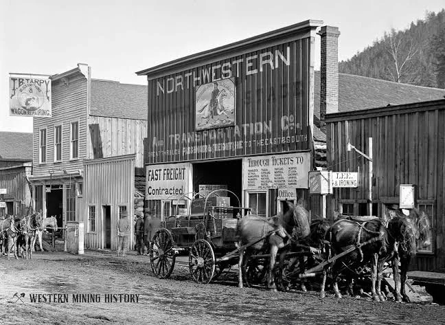
Wagon freight therefore remained important.

Teams of horses and oxen transported supplies into Utah's interior.

This created a transitional economy in which railroads and traditional overland freight systems operated together.

Competition with Salt Lake City

Corinne's commercial ambitions brought it into competition with Salt Lake City.

The new railroad created possibilities for merchants to bypass established distribution networks.

Corinne's boosters envisioned the settlement becoming a major commercial city.

Its location made this vision plausible.

Yet transportation routes, business networks, and political relationships ultimately favored other centers.

The city's rapid rise was therefore followed by a gradual decline in its regional economic dominance.

Social Diversity

Corinne's population was more diverse than many rural Mormon settlements of the period.

Railroad workers, merchants, immigrants, freight operators, and travelers created a cosmopolitan environment.

The city contained people from different religious and cultural backgrounds.

This diversity also produced social tensions.

The community was part of a larger territorial environment characterized by religious divisions and competing economic interests.

The End of the Boom

Corinne's decline demonstrates a central principle of transportation geography.

A town can prosper because of a particular route, but transportation systems are constantly changing.

As rail connections expanded and other communities developed better commercial relationships with the railroad, Corinne's strategic advantage diminished.

The city never became the enormous metropolis imagined by its boosters.

Nevertheless, it survived.

Archaeological and Architectural Evidence

Historic buildings, streets, commercial structures, transportation corridors, and archaeological deposits provide evidence of Corinne's boom period.

Domestic artifacts can reveal household consumption.

Commercial buildings demonstrate the organization of trade.

Transportation-related remains reveal how goods were moved between railroad and wagon networks.

The archaeological record therefore complements written accounts of the city's ambitions.

Corinne's Historical Significance

Corinne is important because it reveals that Utah's settlement history was not politically or culturally uniform.

The territory contained communities with different religious affiliations, economic strategies, and visions for the future.

Its emergence as a railroad-centered commercial town illustrates how transportation could challenge established economic systems.

Conclusion

Corinne's history is the story of a frontier boomtown created by the railroad.

Its identity as a "Gentile" community reflects its nineteenth-century position outside the dominant Latter-day Saint settlement network.

Its warehouses, freight operations, commercial institutions, and railroad connections reveal how the transcontinental railroad transformed Utah.

Although its commercial ambitions eventually diminished, Corinne remains an important historical example of the intersection of transportation, religion, migration, and western economic development.

Kelton: Utah's Freight Wagon Town

September 27, 2026

Introduction

Kelton was one of the important settlements associated with transportation across western Utah during the era when railroads and wagon freight worked together to move people and goods through the Great Basin.

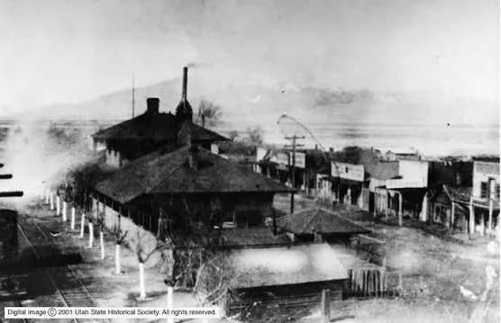
Located in a remote region near the Great Salt Lake Desert, Kelton developed as a railroad and freight community. Its history demonstrates that the completion of the transcontinental railroad did not immediately eliminate overland transportation.

Instead, railroads created new freight-transfer points where goods could be moved from trains to wagons and then transported into surrounding regions.

The Great Basin Transportation Problem

Western Utah presented enormous transportation challenges.

Distances were long.

Water was scarce.

Mountain ranges interrupted travel.

The Great Salt Lake Desert created a particularly difficult environment for travelers and livestock.

Before railroads, overland freight routes depended upon carefully spaced water sources.

The railroad dramatically changed this system but did not eliminate the importance of local freight.

The Railroad Station

Kelton became significant because of its position along the railroad.

Railroad stations in remote regions served multiple purposes.

They provided water, fuel, maintenance, communication, freight handling, and passenger services.

A station could become the nucleus of a settlement.

Kelton developed within this transportation environment.

Freight Transfer

One of Kelton's most important functions was associated with wagon freight.

Goods arriving by railroad could be loaded onto wagons and transported to destinations beyond the immediate railroad corridor.

This created a hybrid transportation economy.

Railroads handled long-distance movement.

Wagons handled regional distribution.

The two systems depended upon one another.

Teamsters

Freight transportation required experienced teamsters.

Driving a wagon across the Great Basin required knowledge of terrain, water sources, weather, livestock management, and route conditions.

Teamsters also faced economic pressures.

They had to maintain animals, equipment, and supplies while transporting heavy cargo over difficult terrain.

Community Life

Kelton developed the institutions typical of a transportation town.

Businesses served railroad employees and travelers.

Hotels and boardinghouses provided accommodation.

Restaurants and saloons served workers.

Warehouses stored goods.

Blacksmiths and mechanics maintained transportation equipment.

The settlement therefore had an economy larger than the railroad station itself.

The Desert Environment

Kelton's location made water especially important.

Water determined where animals could travel and where freight routes could operate.

Railroads solved some of the logistical problems by developing water infrastructure, but the broader desert environment remained demanding.

This relationship between infrastructure and natural resources is central to understanding western transportation history.

Decline

Transportation towns were vulnerable to changes in railroad logistics.

When railroads altered routes or developed alternative freight systems, communities dependent on transfer operations could decline quickly.

The automobile and improved highways later transformed freight transportation again.

As motor vehicles became more capable of crossing long distances, traditional wagon-based distribution declined.

Kelton gradually lost its earlier economic importance.

Archaeological Evidence

The remains of transportation towns can include foundations, roads, loading areas, wells, commercial structures, and discarded objects.

Such evidence can reveal how people interacted with transportation infrastructure.

A bottle discarded near a hotel may provide evidence of commercial life.

A building foundation can reveal the scale of a business.

A loading area can demonstrate how freight moved between transportation systems.

Historical Importance

Kelton illustrates the transitional character of western transportation.

It belongs to a period when railroads were transforming long-distance movement but wagons remained essential for local distribution.

This hybrid economy existed for decades.

Conclusion

Kelton's significance lies in its role as a freight and transportation community in the Great Basin.

Its history demonstrates that the railroad did not simply replace older transportation systems. Instead, rail and wagon freight initially worked together.

The eventual disappearance of the town reflects another transportation transformation: the replacement of wagon freight by more flexible highway and motor-vehicle systems.

Terrace: Utah's Railroad Section Houses

September 27, 2026

Introduction

Terrace was one of the many railroad settlements that emerged along the transcontinental route across Utah. Unlike major railroad cities such as Ogden, Terrace was shaped primarily by the operational requirements of the railway.

Its remains illustrate a less glamorous but essential part of railroad history: the workers and facilities responsible for maintaining the line.

Railroad Section Crews

A railroad could not function simply by laying tracks.

Tracks had to be inspected, repaired, cleared, and maintained continuously.

Railroad companies therefore divided routes into sections and assigned workers to each.

Section crews maintained stretches of track and associated infrastructure.

They repaired rails, replaced ties, cleared debris, maintained drainage, and responded to emergencies.

Section Houses

Railroad companies constructed section houses to provide accommodation for workers and their families.

These buildings were practical rather than monumental.

Their importance comes from what they reveal about railroad labor.

The section house placed workers close to the tracks they maintained.

This reduced response time and allowed crews to monitor the railroad.

Life Along the Railroad

Life in railroad section settlements could be isolated.

Workers and families lived far from major population centers.

Supplies arrived through railroad networks.

Social life developed within small communities.

Children might attend small schools or travel considerable distances for education.

The railroad was simultaneously workplace, transportation system, and connection to the outside world.

Maintenance as an Industrial System

Railroad maintenance required standardized procedures.

Workers used specialized tools.

Track geometry had to remain within acceptable tolerances.

Bridges and culverts required inspection.

Snow, flooding, erosion, and heat could damage infrastructure.

The seemingly simple railroad track therefore represented a constantly maintained industrial system.

Chinese and Other Railroad Workers

The construction of western railroads depended heavily on immigrant labor, especially Chinese workers on the Central Pacific.

After construction, railroad maintenance continued to involve workers from many backgrounds.

Understanding settlements such as Terrace helps broaden railroad history beyond the famous executives and ceremonial events.

The Landscape

Terrace's remote location demonstrates how railroads imposed a new geographic order on the Great Basin.

Before railroad construction, the region was characterized by Indigenous travel routes, natural resources, ranching, and overland transportation.

The railroad introduced an industrial corridor.

Stations, section houses, telegraph lines, water facilities, and maintenance areas appeared along it.

Abandonment

When railroad routes changed, the settlements supporting them could disappear.

A section house might be abandoned because the railroad consolidated maintenance operations elsewhere.

A station could close after a route was bypassed.

Once workers left, buildings deteriorated rapidly.

Archaeological Interpretation

Railroad archaeology can reveal the ordinary lives of workers.

Building foundations can establish settlement organization.

Household artifacts reveal what families purchased and consumed.

Railroad tools provide evidence of occupational activities.

Telegraph-related remains can reveal communication infrastructure.

Conclusion

Terrace is important because it represents the everyday infrastructure behind the transcontinental railroad.

Its section houses were not grand landmarks, but they supported one of the most important transportation systems in American history.

Studying such places shifts attention from famous ceremonies to the workers who maintained the tracks day after day.

Alazon: Utah's Abandoned Rail Stop

September 27, 2026

Introduction

Alazon represents the many small railroad stops that once punctuated Utah's western transportation corridor.

Such places could appear insignificant when compared with major railroad cities, but they formed essential components of the railway system.

A railroad required a network of stops, sidings, maintenance points, water facilities, communication stations, and worker settlements.

Alazon's abandoned landscape therefore preserves evidence of the infrastructure that made long-distance rail transportation possible.

Railroad Geography

Railroad construction created new geographic relationships.

Locations that had previously been remote became connected to national markets.

A railroad stop could provide access to freight, mail, passengers, and communication.

The importance of each stop depended upon its operational function.

Some became towns.

Others remained small maintenance or service points.

Why Stops Were Established

Railroads needed strategically placed facilities.

Trains required water and fuel.

Crews needed places to rest.

Tracks required maintenance.

Freight sometimes needed to be loaded or unloaded.

Telegraph systems required stations.

A small settlement could therefore exist because of one specific railroad function.

Everyday Railroad Life

Workers at small stops lived in environments very different from major cities.

They were surrounded by open desert and long stretches of track.

Their work schedules were determined by trains.

A delay or mechanical problem could change the rhythm of the settlement.

Families adapted their lives around railroad timetables.

Communication

The telegraph was essential.

Before modern telecommunications, railroad operators relied on telegraph messages to coordinate train movements.

Small stations could therefore become nodes in a national communication network.

This was one of the railroad's most transformative effects.

The physical tracks moved people and goods, while telegraph wires moved information.

Abandonment

Railroad landscapes are particularly vulnerable to technological change.

When locomotives became more efficient, watering stations could become unnecessary.

Dieselization eliminated many steam-era facilities.

Improved signaling reduced the need for some staffed locations.

Changes in routes could bypass older stops.

Alazon's abandonment should therefore be understood as part of technological modernization.

Archaeological Remains

An abandoned railroad stop can preserve foundations, railroad grades, loading areas, debris, and household artifacts.

These remains allow archaeologists to reconstruct settlement organization.

Even fragments of glass and ceramics can help establish periods of occupation.

Industrial remains can reveal the functions of the station.

Cultural Landscape

Alazon also demonstrates how railroad infrastructure created cultural landscapes.

Railroads were not merely transportation corridors.

They were communities.

They shaped employment, migration, commerce, communication, and settlement patterns.

Conclusion

Alazon's significance lies in its representation of the small-scale infrastructure behind the great railroad system.

Its abandonment reminds us that transportation technology is constantly changing.

The railroad stops that once seemed permanent could disappear when the technology supporting them changed.

Matlin: Utah's Chinese Railroad Labor Camp

September 27, 2026

Introduction

The history of the transcontinental railroad cannot be understood without examining Chinese railroad workers.

Matlin is associated with the broader landscape of Chinese labor camps and railroad construction in Utah and the Great Basin. Such places are important because they preserve evidence of workers whose contributions were essential but whose stories were frequently minimized in older accounts of railroad history.

Chinese Immigration and Railroad Labor

Large numbers of Chinese immigrants came to the United States during the nineteenth century.

Many settled in the American West.

Railroad companies recruited Chinese workers because they had established reputations for disciplined and highly organized labor.

The Central Pacific became particularly dependent upon Chinese workers during construction across the Sierra Nevada and Great Basin.

The Work

Railroad construction was physically demanding.

Workers cleared vegetation.

They graded the ground.

They moved enormous quantities of earth and rock.

They drilled holes for explosives.

They laid ties and rails.

They constructed bridges, culverts, and other infrastructure.

Much of the work was performed manually.

Labor Camps

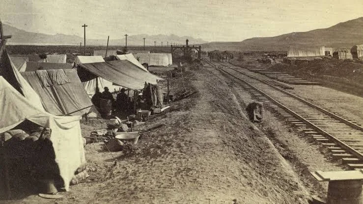
Construction camps were temporary communities.

Workers required sleeping quarters, cooking areas, food storage, water supplies, and work equipment.

Some camps moved as construction advanced.

Others became associated with more permanent railroad infrastructure.

Archaeological remains can include ceramics, bottles, metal objects, food remains, and structural traces.

Chinese Material Culture

Archaeologists have sometimes identified Chinese-associated sites through distinctive ceramic forms, coins, gaming materials, food remains, and other artifacts.

However, interpretation requires caution.

Artifacts do not automatically reveal ethnicity.

Researchers combine multiple forms of evidence, including historical documents, spatial organization, artifact patterns, and oral histories.

Food and Community

Food was particularly important in railroad camps.

Chinese workers maintained culinary practices while adapting to locally available ingredients.

Food remains can therefore provide information about cultural adaptation and community organization.

Chinese workers did not simply abandon their cultural identities when they entered railroad employment.

Working Conditions

Railroad construction was dangerous.

Explosives could cause injuries.

Rockfalls and construction accidents occurred.

Workers endured extreme heat and cold.

The desert environment presented serious logistical challenges.

Chinese workers also faced discrimination and unequal treatment.

Their historical experience must therefore be understood within the broader context of nineteenth-century racial exclusion.

The Chinese Exclusion Act

In 1882, the United States enacted the Chinese Exclusion Act, severely restricting Chinese immigration.

This law reflected widespread anti-Chinese sentiment and had profound effects on Chinese American communities.

Railroad labor history therefore intersects directly with American immigration history.

Archaeological Importance

Chinese railroad camps are important because written records often emphasize company management and construction milestones.

Archaeology can provide evidence of the workers themselves.

Artifacts reveal what they ate, purchased, repaired, discarded, and carried.

This creates a more complete historical record.

Preservation

Many railroad camps were temporary.

Their structures disappeared soon after workers moved.

Weather and later development further damaged archaeological remains.

Consequently, even small artifact concentrations can have major historical value.

Conclusion

Matlin's significance lies in the broader story it represents: the Chinese workers whose labor helped construct and maintain the railroad system across the American West.

Railroad history becomes much richer when the famous golden spike is placed alongside the camps, tools, meals, hardships, and communities of the laborers who made the ceremony possible.

Shoshone: Utah's Pony Express Station

September 27, 2026

Introduction

The name Shoshone evokes one of the major Indigenous cultural traditions of the Great Basin and Intermountain West. In the context of nineteenth-century transportation history, however, it is important to distinguish between Indigenous geography and the later Euro-American transportation infrastructure that passed through it.

The Pony Express operated only from April 1860 to October 1861, but its brief existence has left a powerful historical legacy. Stations were established at carefully selected points along the route, particularly where travelers and riders could obtain water, horses, food, and shelter.

Sites associated with the name Shoshone should therefore be interpreted through both Indigenous geography and the short-lived transportation network imposed upon it.

The Pony Express

The Pony Express was established to move mail rapidly between Missouri and California.

Riders traveled through a chain of relay stations.

At each station, a rider could exchange horses and continue toward the next point.

This system allowed mail to travel much faster than conventional stagecoach service.

The Great Basin Route

The route crossed difficult terrain.

Riders encountered deserts, mountain passes, rivers, and long stretches without reliable water.

Stations therefore had to be carefully located.

Water sources were among the most valuable geographic features.

Indigenous Landscapes

The transportation route did not cross an empty wilderness.

Indigenous communities had used these landscapes for generations.

The Shoshone and other Great Basin peoples possessed detailed knowledge of springs, plants, animals, trails, and seasonal resources.

European-American transportation routes frequently followed corridors that Indigenous people already knew and used.

This is an important archaeological and historical principle.

Station Infrastructure

A Pony Express station could be simple.

Some consisted of ranch buildings adapted for mail service.

Others were purpose-built facilities.

A station needed horse-changing facilities and basic accommodations.

The apparent simplicity of these structures should not obscure their importance within the national communication system.

Riders

Pony Express riders developed a legendary reputation.

They traveled rapidly and faced difficult environmental conditions.

Riders needed horsemanship, endurance, route knowledge, and reliability.

The job was dangerous.

Yet the service itself existed for only a short period.

The Telegraph

The Pony Express became obsolete when the transcontinental telegraph was completed in 1861.

The telegraph could transmit messages almost instantaneously compared with physical transportation.

This demonstrates one of the central patterns of technological history:

A successful technology can disappear rapidly when a fundamentally different technology solves the same problem more efficiently.

Archaeological Evidence

Station archaeology can reveal how transportation systems functioned.

Foundations, wells, corrals, ceramics, bottles, horseshoes, and other artifacts can identify the activities carried out at a station.

Archaeological research is particularly important where buildings have disappeared.

Indigenous Continuity

Modern interpretation should avoid treating Indigenous history as merely a prelude to the Pony Express.

Shoshone communities survived the transportation transformation and remain culturally present.

The arrival of Euro-American transportation changed their environment, but it did not erase their history.

Conclusion

The history associated with Shoshone and the Pony Express belongs to a larger story of transportation crossing an already inhabited Indigenous landscape.

The Pony Express was short-lived, but its stations became important historical markers.

Their significance lies in the intersection of Indigenous geography, western migration, communication technology, and the rapid transformation of transportation in the nineteenth century.

Deep Creek: Utah's Stagecoach Stop

September 27, 2026

Introduction

Deep Creek Station was one of the most important transportation stops in western Utah during the nineteenth century.

Located in the homeland of the Goshute people, Deep Creek became a crucial point along the overland route connecting Salt Lake City with the settlements and transportation networks farther west.

The site is especially significant because it served multiple transportation systems: the Pony Express, Overland Stage, and telegraph.

The National Park Service notes that a ranch established there by Howard Egan became a Pony Express home station in 1860–1861 and also supported the Overland Stage.

The Deep Creek Environment

Water determined transportation geography in the Great Basin.

Deep Creek provided an important source of water in a region where reliable springs and streams were widely separated.

This made the location valuable long before the arrival of Euro-American transportation.

The Goshute people had longstanding knowledge of the area.

Howard Egan's Ranch

Howard Egan established a ranch on Deep Creek in the late 1850s.

The ranch became a transportation facility.

Its agricultural production also supported the larger transportation network.

Egan produced hay, grain, mutton, and beef.

The station was therefore not simply a stopping place.

It was an agricultural enterprise integrated into the overland transportation economy.

Pony Express

During 1860–1861, Deep Creek served as a Pony Express home station.

Riders could change horses and obtain supplies.

The station's location was strategically important because the Pony Express depended upon reliable intervals between stops.

Overland Stage

The site also supported stagecoach transportation.

Stage travelers required food, water, rest, and fresh animals.

The station therefore served multiple transportation networks simultaneously.

Richard Burton's Account

English traveler Richard Burton visited Deep Creek during his 1860s journey through the American West.

His observations provide an unusually detailed contemporary description of the station.

He described buildings, agricultural fields, waterways, and livestock.

Such firsthand accounts are valuable historical evidence because they provide information about the physical landscape that archaeology can later investigate.

Telegraph

The completion of the transcontinental telegraph in October 1861 transformed the station's role.

The Pony Express quickly became obsolete.

A telegraph repeater station replaced the Pony Express operation.

This technological transition demonstrates how rapidly communication systems could change.

Agriculture and Transportation

Deep Creek demonstrates the importance of agriculture to transportation.

Stage stations could not survive on transportation alone.

They required hay for horses, grain for livestock and people, meat, water, and other supplies.

Agricultural production therefore became part of the transportation infrastructure.

Goshute Homeland

The history of Deep Creek cannot be separated from the Goshute people.

The station was established within an Indigenous landscape.

The development of the ranch and transportation route altered patterns of land use and resource access.

Modern interpretation must therefore include both the Indigenous history of the region and the later overland transportation history.

Archaeology

The original station buildings are largely gone.

Archaeological remains and historical markers can nevertheless preserve evidence of the site's former importance.

The combination of documentary sources and archaeology makes Deep Creek an excellent case study in frontier transportation history.

Conclusion

Deep Creek was far more than a stagecoach stop.

It was an agricultural enterprise, Pony Express station, Overland Stage facility, telegraph site, and strategic water source.

Its history demonstrates how transportation networks depended upon environmental knowledge, agriculture, and Indigenous landscapes.

Ibapah: Utah's Western Shoshone Village

September 27, 2026

Introduction

Ibapah lies in western Utah near the Deep Creek Mountains and the Nevada border. The community occupies a landscape with a long Indigenous history and is strongly associated with Goshute people.

Although the title uses the term "Western Shoshone," the historical identity of the community must be handled carefully because Indigenous territorial, linguistic, and political boundaries do not always correspond neatly to modern state or county lines.

Ibapah is especially important as a place where Indigenous continuity can be studied alongside the transportation, ranching, and settlement history of western Utah.

Indigenous Geography

The Great Basin was home to numerous Indigenous communities whose economies depended upon detailed knowledge of an arid environment.

The region's peoples hunted, gathered, traveled seasonally, traded, and managed relationships with springs and other water sources.

Rather than being an empty desert, the Great Basin was a culturally organized landscape.

The Deep Creek Region

The Deep Creek Mountains provided water, elevation, plants, wildlife, and shelter.

Communities could move between ecological zones according to seasonal availability.

This flexibility was crucial in an environment where rainfall was unpredictable.

European-American Settlement

During the nineteenth century, ranchers, miners, travelers, and transportation companies entered the region.

New settlement patterns introduced fences, private property claims, agricultural fields, livestock, and roads.

These changes affected Indigenous access to traditional resources.

Deep Creek Station

The nearby Deep Creek transportation station became part of the Pony Express and Overland Stage network.

This increased the strategic importance of the region.

Transportation corridors encouraged additional settlement.

Ibapah as a Community

Ibapah survived beyond the temporary transportation era.

This is historically important.

Many western transportation settlements disappeared when railroads and highways replaced earlier routes.

Indigenous communities, however, cannot be understood simply as transportation settlements.

Their histories extend across much longer periods.

Cultural Continuity

Modern Indigenous communities preserve language, traditions, family relationships, religious practices, and cultural knowledge.

Historical interpretation should therefore avoid presenting Indigenous communities as remnants of a vanished past.

The existence of Ibapah demonstrates continuity through enormous economic and political changes.

Archaeological Evidence

Archaeological research in the Great Basin has documented long sequences of human occupation.

Stone tools, food remains, hearths, shelter sites, and other evidence reveal adaptations extending thousands of years.

The modern community belongs to this much larger cultural landscape.

Water

Water remains one of the central themes of western Utah history.

Springs and streams determined settlement patterns.

Deep Creek supported both Indigenous lifeways and later agricultural and transportation enterprises.

This continuity illustrates how the same environmental resources can support very different economic systems over time.

Transportation and Change

The arrival of stage routes, telegraph lines, railroads, and highways transformed the region.

Each new technology altered distances and accessibility.

Yet none completely replaced the importance of local environmental knowledge.

Conclusion

Ibapah is significant because it represents Indigenous continuity within a landscape dramatically transformed by nineteenth- and twentieth-century transportation.

Its history connects Goshute and neighboring Great Basin traditions with ranching, stage routes, and modern settlement.

Rather than viewing Indigenous history as something confined to the distant past, Ibapah demonstrates that Indigenous communities remain active participants in the cultural landscape of the American West.

Callao: Utah's Tintic Freight Hub

September 27, 2026

Introduction

The history of Callao requires some caution because the name is associated with western Utah transportation and settlement, while the better-known Tintic mining district lies much farther east.

Rather than treating the title as evidence of a major Tintic railroad center without qualification, it is more useful to examine Callao within the broader system of freight movement that connected Utah's mining districts, ranches, stage routes, railroad corridors, and desert settlements.

Freight in Western Utah

Freight was essential to frontier economies.

Mining camps required machinery, timber, food, fuel, clothing, and tools.

Ranches required agricultural equipment.

Stage stations required hay and grain.

Small settlements depended upon merchants who could obtain goods from larger cities.

This produced a complex web of wagon routes.

The Importance of Geography

Western Utah is characterized by broad desert basins separated by mountain ranges.

Travelers had to identify reliable routes through difficult terrain.

Water sources were particularly important.

Freight operators planned routes around springs, wells, and ranches.

Wagon Transportation

Before widespread motorization, freight depended heavily on wagons.

Large freight wagons could carry substantial loads, but their movement was slow.

Animals consumed food and water.

Roads could become impassable after storms.

Sand and mud created serious obstacles.

Freight and Mining

Mining districts created enormous demand.

A mine could not operate without supplies.

Machinery had to be transported.

Timber was required for underground supports.

Food had to reach workers.

Ore had to leave the district.

This created economic opportunities for freight operators.

Callao in the Regional Network

Callao's historical importance is best understood through this regional network rather than through a simplistic model of one town serving one mining district.

Western Utah settlements often changed roles as transportation systems evolved.

A location might function as a ranching center, freight stop, postal station, or transportation waypoint at different periods.

Decline of Wagon Freight

Railroads eventually reduced the importance of long-distance wagon transportation.

Later, automobiles and trucks transformed freight once again.

Roads could reach areas that railroads never served.

Motor transport became more flexible.

The old wagon network declined.

Archaeological Evidence

Historic freight routes can leave surprisingly subtle archaeological traces.

Wheel ruts may survive in dry environments.

Foundations can identify former stations.

Metal hardware can indicate wagon repair.

Bottles and cans reveal the presence of travelers and workers.

Water infrastructure may preserve evidence of transportation use.

Historical Interpretation

Sites such as Callao should not be evaluated only by the size of their surviving buildings.

A small settlement can be historically important because of its position within a larger transportation network.

Conclusion

Callao's historical value lies in understanding the interconnected freight economy of western Utah.

Its story illustrates how mining, ranching, stage transportation, water sources, and wagon freight created a regional system before the dominance of modern highways.

The landscape preserves the memory of an era when transportation depended upon animals, human endurance, environmental knowledge, and carefully spaced sources of water.

Fish Springs: Utah's Pony Express Relay

September 27, 2026

Introduction

Fish Springs was one of the most important water and transportation sites in the western Great Basin.

Located at the southern edge of the Great Salt Lake Desert, Fish Springs is today protected as a wildlife refuge. The springs form a significant wetland in an otherwise extremely arid environment.

For thousands of years, Indigenous people used the oasis.

In the nineteenth century, it became part of the overland transportation network.

The National Park Service notes that a mail station was established there in 1859 and that Fish Springs later served mail contractors, the Pony Express, the Overland Stage, and the transcontinental telegraph.

An Ancient Oasis

Fish Springs is fundamentally a water landscape.

The surrounding desert is extremely dry, making the springs exceptionally valuable.

Archaeological evidence indicates that Indigenous peoples used the area for at least 11,000 years.

This long history places the Pony Express episode within a much larger human landscape.

The 1859 Mail Station

In 1859, Captain J. H. Simpson and a U.S. Army Topographical Engineers expedition established a mail station at Fish Springs.

Its importance came from its water supply.

The springs were brackish and relatively warm, but they were among the most reliable sources between important transportation points.

Pony Express

When the Pony Express began operating in 1860, Fish Springs became part of its relay system.

Riders needed fresh horses and access to water.

The station's remote location made it particularly valuable.

Overland Stage

The site also supported the Overland Stage.

Stagecoaches needed places where horses could be rested and replaced.

Passengers needed food and water.

Drivers needed reliable routes.

Fish Springs therefore functioned within multiple transportation systems.

Telegraph

The arrival of the transcontinental telegraph transformed communications.

The physical movement of messages by horse became increasingly unnecessary.

Fish Springs subsequently supported telegraph operations.

This sequence illustrates the rapid evolution of nineteenth-century communications.

The Station Structure

Historical descriptions indicate that the original Fish Springs station was a simple stone structure with a brush-and-dirt roof.

Very little of the original building survives.

The absence of major ruins should not be interpreted as evidence that the site was unimportant.

Its historical value comes from its position within the transportation system and its extraordinary environmental setting.

Indigenous History

The springs were already part of Indigenous geography long before the arrival of the U.S. military or mail routes.

Great Basin peoples possessed extensive knowledge of water sources and desert ecology.

Transportation infrastructure often depended on places that Indigenous communities already understood as critical resources.

Environmental Importance

Today Fish Springs is a major wetland refuge.

Its biological significance is remarkable because the springs create habitat in an otherwise extremely arid region.

The contrast between historical transportation and modern wildlife conservation is especially interesting.

The same water source that once supported horses and stage travelers now supports fish, birds, and other wildlife.

Conclusion

Fish Springs demonstrates how environmental geography shaped transportation history.

The oasis supported Indigenous communities for thousands of years before becoming a military mail station, Pony Express relay, stage stop, and telegraph station.

Its story is therefore not simply about the Pony Express.

It is about the extraordinary historical importance of water in the Great Basin.

← Newer Posts Older Posts →
Featured
images (76).jpeg
September 27, 2026
Nine Mile Canyon: Utah's Barrier Canyon Art
September 27, 2026
Read more →
September 27, 2026
images (77).jpeg
September 27, 2026
Buckhorn Wash: Utah's Pictograph Panels
September 27, 2026
Read more →
September 27, 2026
images (78).jpeg
September 27, 2026
Sego Canyon: Utah's Mixed Rock Art Styles
September 27, 2026
Read more →
September 27, 2026
images (79).jpeg
September 27, 2026
McConkie Ranch: Utah's Fremont Petroglyphs
September 27, 2026
Read more →
September 27, 2026
images (80).jpeg
September 27, 2026
Newspaper Rock: Utah's 2,000-Year Pictograph
September 27, 2026
Read more →
September 27, 2026
images (81).jpeg
September 27, 2026
Paria Rimrocks: Utah's Dinosaur Tracks and Art
September 27, 2026
Read more →
September 27, 2026
read more

Powered by The archaeologist